
Grand Canyon National Park
Grand Canyon, Arizona
Disclaimer: backpacking to the Little Colorado Gorge and Confluence is an advanced route that should only be attempted by experienced canyon hikers between October and April. Those who have not hiked in the canyon before should look at hiking on the Corridor trails. Doing these as an overnight is a good intro option instead of the strenuous Beamer Trail. Please also refer to the Hike Smart material from the park to ensure that you are adequately prepared for the conditions you will encounter on your selected hiking trail at Grand Canyon National Park.)
Read on for inspiration for what awaits you at this Arizona gem with preparation nonetheless!Dating back to the time that I worked at Grand Canyon National Park, I have wanted to hike to the confluence of the Little Colorado and Colorado Rivers in the eastern canyon. With my return to Arizona this year, I applied for the requisite permit and received it in August, for a backpacking date in December.
I originally planned this for two people but none of my potential hiking partners were able to make it so it became a solo affair. I also decided to add one day to the itinerary to allow a bit additional flexibility. The trip ultimately includes two nights in the Palisades Zone bookended by two nights in the Tanner Zone.
Day 1: Lipan Point-Seventyfivemile Saddle
As the dates approached, a snowstorm hit the South Rim. When I arrived in mid December, snow still extended to around 4500 feet in the canyon. Temperatures were 10-20 degrees F below normal.
After some final scouting information acquired from a Grand Canyon hikers group on Facebook, I was running a bit behind on the day that I arrived, but managed to sneak in a scouting stop and chat with a friend at Desert View from my prior time working at the park. We stood at the window of the Desert View watchtower absorbing the view and looking at the route that I would soon be embarking on, before I proceeded to Lipan Point and finalized my packing.
I then find my way to the Tanner trailhead. The snow is probably roughly ankle-to-lower shin deep as I start down the trail. I’m wearing waterproof socks over my Darn Tough hiking socks, and vented trail runners, knowing that once I break the snow line, I won’t need waterproofing anymore. (I’m a big fan of waterproof socks instead of waterproof shoes due to the added flexibility offered by separating the two).

Grand Canyon National Park
Grand Canyon, Arizona

Grand Canyon National Park
Grand Canyon, Arizona
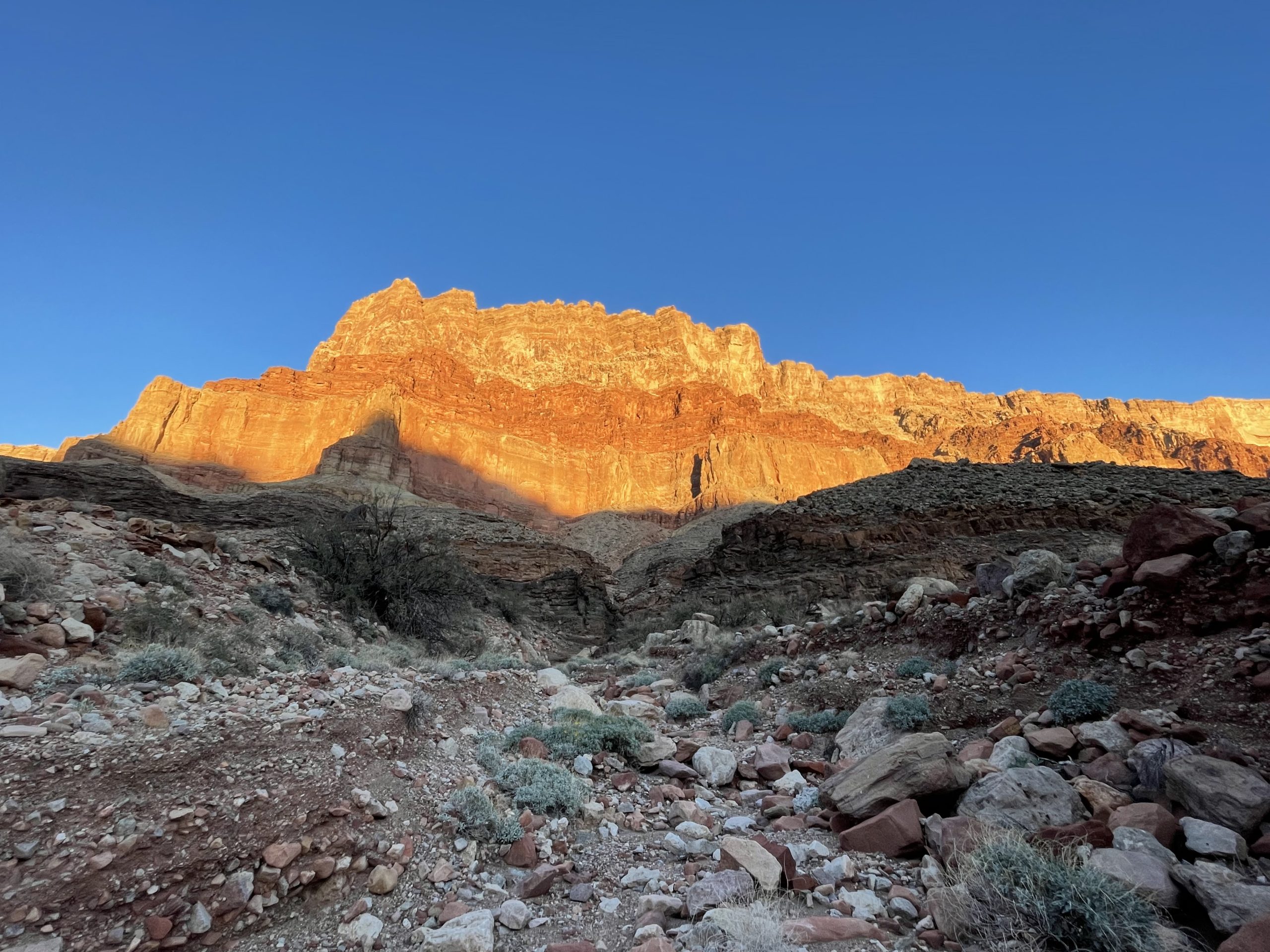
The Tanner Trail starts with a descent down a narrow ravine east of Lipan Point to a saddle above Seventyfive Mile Creek. The entire ravine descent is snow covered, and the trail isn’t entirely obvious in places, but I make it down. I briefly considered camping at the saddle – there’s a great spot for it there with an awesome view – but decided to see if I could push it a bit farther.
I’m successful in this effort but shortly after, I pull off for the night on the east side of the trail. I had a difficult decision to make regarding camping site selection – I’m in a pretty good spot, but there’s still some snow around, so it must still get pretty chilly at night here. I’m not carrying a tent (although i am carrying the fly for emergency purposes) because the weather forecast is pretty clear, so hopefully it doesn’t get too cold.

Grand Canyon National Park
Grand Canyon, Arizona


Grand Canyon National Park
Grand Canyon, Arizona
Grand Canyon Confluence, Day 2: Seventyfive Mile Saddle-Tanner Beach
COLD night. My jug of water that I plan on caching is mostly frozen and just about all my gear is frosted. Including my sleeping bag. I wore a 250 merino beanie last night, thankfully, or the chill might have been worse, but it slowed me down this morning regardless. By around 9 I’m finally packed and back on the trail, descending into the canyon.
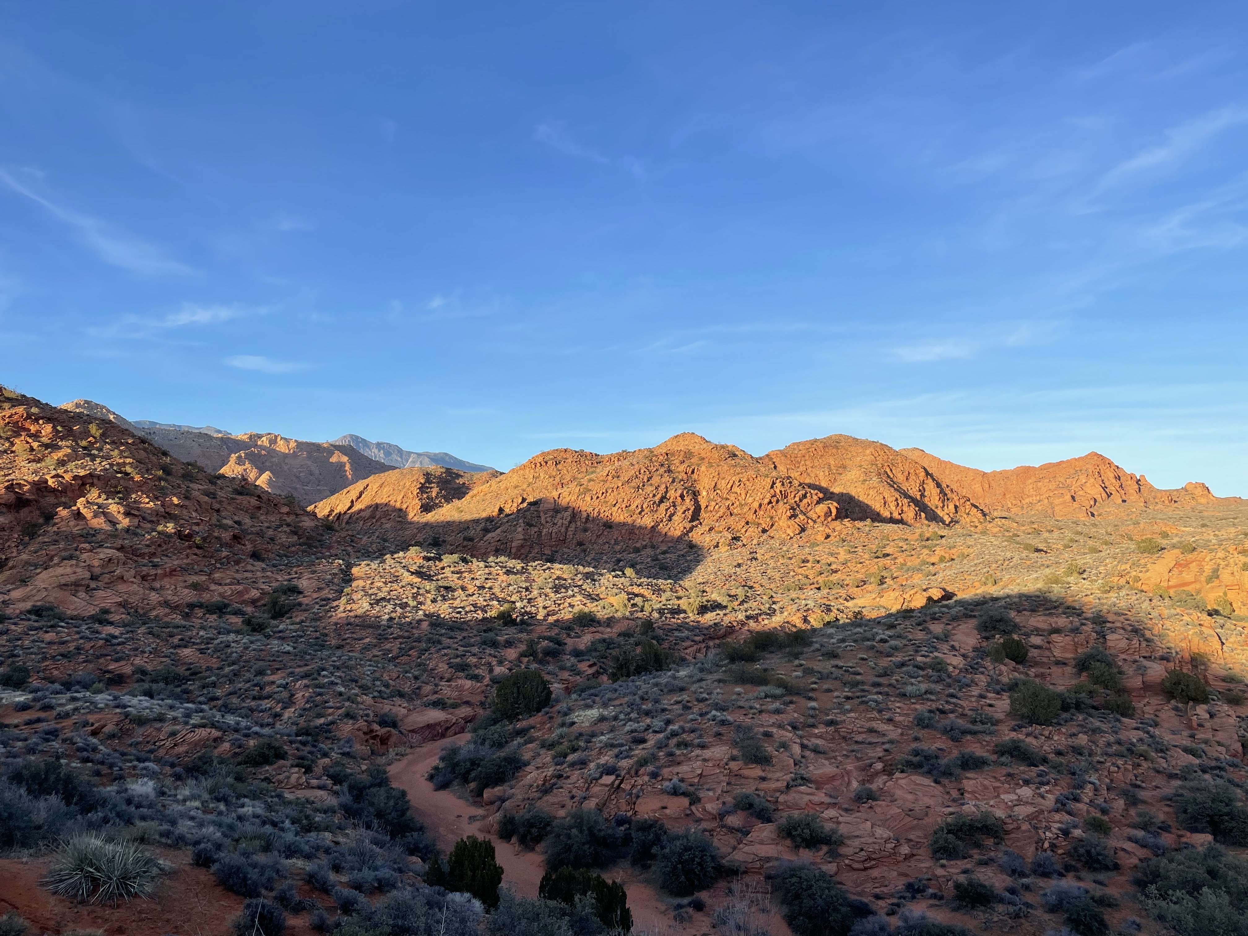
From where I camped at Seventyfive Mile Saddle, there’s an extended traverse across the top of the Redwall Formation for several miles. I cache my water at the top of the Redwall descent. After completing the descents through the Redwall and Tapeats, there is a fantastic overlook down to Tanner Beach and extending not just across the eastern Canyon but also upcanyon toward Lees Ferry and the Vermilion Cliffs as well. The trail then drops steadily down through the Grand Canyon Supergroup (making a rare appearance in this portion of the Canyon) to the river at Tanner Beach.

Grand Canyon National Park
Grand Canyon, Arizona

Grand Canyon National Park
Grand Canyon, Arizona

Grand Canyon National Park
Grand Canyon, Arizona

Grand Canyon National Park
Grand Canyon, Arizona

Grand Canyon National Park
Grand Canyon, Arizona

Grand Canyon National Park
Grand Canyon, Arizona

Grand Canyon National Park
Grand Canyon, Arizona

Grand Canyon National Park
Grand Canyon, Arizona

Grand Canyon National Park
Grand Canyon, Arizona


Grand Canyon National Park
Grand Canyon, Arizona

Grand Canyon National Park
Grand Canyon, Arizona

Grand Canyon National Park
Grand Canyon, Arizona

Grand Canyon National Park
Grand Canyon, Arizona

Grand Canyon National Park
Grand Canyon, Arizona

Grand Canyon National Park
Grand Canyon, Arizona

Grand Canyon National Park
Grand Canyon, Arizona

Grand Canyon National Park
Grand Canyon, Arizona

Grand Canyon National Park
Grand Canyon, Arizona
Grand Canyon Confluence, Day 2: Tanner Beach-Dox Outcrops
From Tanner Beach, the trail begins to follow the river upcanyon. It initially crosses a short Sandy stretch along the easternmost section of the westward-trending Colorado within the canyon. As the river (heading upstream) bends northward, the Beamer Trail ascends and crosses several rugged Dox Sandstone (Grand Canyon Supergroup) outcrops, a rare up-close experience with this particular layer, which isn’t even visible from the core of the South Rim where most people visit.

Grand Canyon National Park
Grand Canyon, Arizona

Grand Canyon National Park
Grand Canyon, Arizona

Grand Canyon National Park
Grand Canyon, Arizona

Grand Canyon National Park
Grand Canyon, Arizona

Grand Canyon National Park
Grand Canyon, Arizona

Grand Canyon National Park
Grand Canyon, Arizona

Grand Canyon National Park
Grand Canyon, Arizona
Grand Canyon Confluence, Day 2: Dox Outcrops-Palisades Creek
After crossing the Dox, the Beamer drops to a sandy stretch as the river bends northward beneath the Palisades of the Desert to the east. The flowers – desert marigolds, I think – blooming here look amazing against the red Dox outcrops behind before the sandy bench widens even further, ultimately reaching Palisades Wash and Lava Canyon Rapids.
At Palisades Creek, a river party is encamped on the other side and wave as I fill up on water for cooking and the morning. I take a brief wander to check for campsites ahead, climbing to the top of the Tapeats, but, eventually descend again to a flat spot near the rapids where I set up for the night. Tomorrow: the long awaited Confluence!

Grand Canyon National Park
Grand Canyon, Arizona

Grand Canyon National Park
Grand Canyon, Arizona

Grand Canyon National Park
Grand Canyon, Arizona

Grand Canyon National Park
Grand Canyon, Arizona

Grand Canyon National Park
Grand Canyon, Arizona

Grand Canyon National Park
Grand Canyon, Arizona


Grand Canyon National Park
Grand Canyon, Arizona

Grand Canyon National Park
Grand Canyon, Arizona

Grand Canyon National Park
Grand Canyon, Arizona

Grand Canyon National Park
Grand Canyon, Arizona

Grand Canyon National Park
Grand Canyon, Arizona

Grand Canyon National Park
Grand Canyon, Arizona

Grand Canyon National Park
Grand Canyon, Arizona

Grand Canyon National Park
Grand Canyon, Arizona

Grand Canyon National Park
Grand Canyon, Arizona

Grand Canyon National Park
Grand Canyon, Arizona

Grand Canyon National Park
Grand Canyon, Arizona

Grand Canyon National Park
Grand Canyon, Arizona

Grand Canyon National Park
Grand Canyon, Arizona


Grand Canyon National Park
Grand Canyon, Arizona


Grand Canyon National Park
Grand Canyon, Arizona
2 thoughts on “Beautiful Grand Canyon: Spectacular Little Colorado/Colorado Rivers Confluence: Days 1-2”