Backpacking the Arizona Trail: Passage 19, Superstition Wilderness
AZT Thruhike, Day 61
Trans Arizona-Utah Day 68
In the land of Arizona
Through desert heat or snow
Winds a trail for folks to follow
From Utah to Old Mexico
It’s the Arizona Trail
A pathway through the great Southwest
A diverse track through wood and stone
Your spirit it will test
Oh, sure you’ll sweat and blister
You’ll feel the miles every day
You’ll shiver at the loneliness
Your feet and seat will pay
But you’ll see moonlight on the borderlands
You’ll see stars on the Mogollon
You’ll feel the warmth of winter sun
And be thrilled straight through to bone
The aches and pains will fade away
You’ll feel renewed and whole
You’ll never be the same again
With Arizona in your soul
Along the Arizona Trail
A reverence and peace you’ll know
Through deserts, canyons, and mountains
From Utah to Old Mexico
-“The Arizona Trail,” Dale R. Shewalter
Arizona Trail: Roosevelt Cemetery to Cottonwood Creek
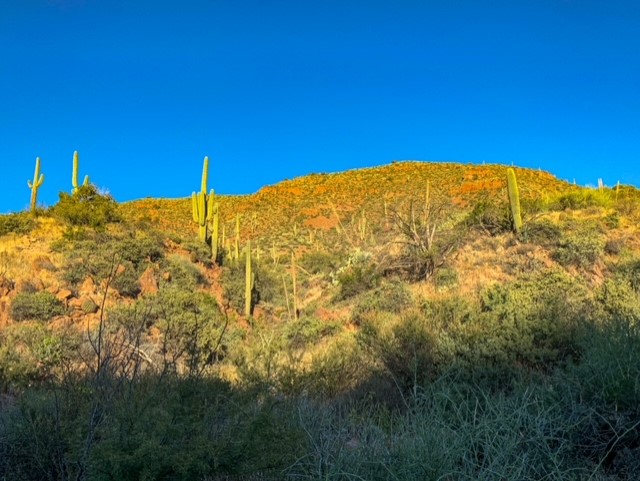
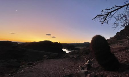
Woke up to a wet sleeping bag again this morning. Going to have to get scientific about sorting out the exact differential between temperature and dew point for such condensation to occur (at least in a desert climate). After drying stuff out, I begin the ascent into the Superstition Mountains, at first on Forest Service roads then along Cottonwood Creek. I quickly feel vindicated in my decision not to chance this section in the rain – on some stretches, there is a 2-3 ft gap between the trail and the creek bed below, evidence of significant recent flash flooding, probably related to the Woodbury Fire that occurred in the watershed this summer. Magnificent views of saguaros are also present, though, as the trail climbs through the creek side vegetation to a wide basin that obviously suffered in the fire, where there’s enough space to make camp for the night before proceeding to the wilderness boundary and beyond tomorrow.
The Superstition Mountains are volcanic in origin. The current mountains are the eroded remnants of the resurgent lava dome of a supervolcano similar to Yellowstone but on a smaller scale – comparable to Yellowstone’s “little brother,” in a sense. The caldera boundary can still be seen within the mountains today. The name comes from the various superstitions that surround them – legends such as that of the Lost Dutchman mine, and a belief among some Apaches that the road to the lower world is located there. More to come on these mountains as we enter them shortly.
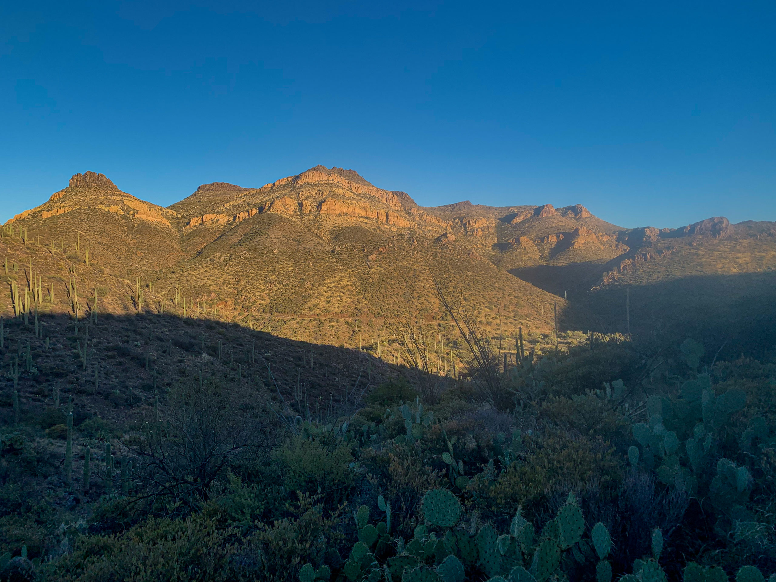
Arizona Trail, Passage 19 (Superstition Wilderness)
Superstition Wilderness
Tonto National Forest

Arizona Trail, Passage 19 (Superstition Wilderness)
Superstition Wilderness
Tonto National Forest

Arizona Trail, Passage 19 (Superstition Wilderness)
Superstition Wilderness
Tonto National Forest

Arizona Trail, Passage 19 (Superstition Wilderness)
Superstition Wilderness
Tonto National Forest

Arizona Trail, Passage 19 (Superstition Wilderness)
Superstition Wilderness
Tonto National Forest

Arizona Trail, Passage 19 (Superstition Wilderness)
Superstition Wilderness
Tonto National Forest
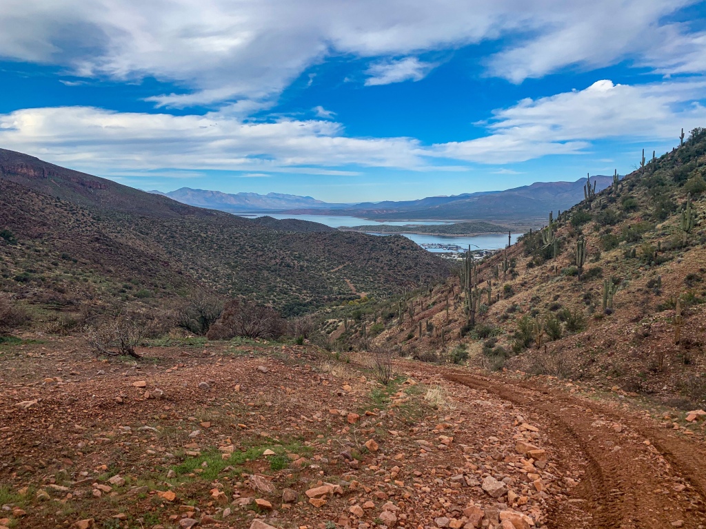
Arizona Trail: Passage 20 Trail Logistics & Passage Ecology
Passage Map: Passage 20 (Four Peaks)
| Passage 20 (Four Peaks) | |
| Trail Surface | Dirt singletrack |
| Length (Mi) | 19 |
| Land Manager and Contact Info | US Forest Service; Tonto National Forest – Home (usda.gov) |
| Season | March-May, September-November |
| Potential Water Sources | Pigeon Spring (Mi 421.6 NB, 421.6 SB) Bear Spring (mi 400.6 NB, 422.5 SB) Shake Spring (mi 392.5 NB, 423.4 SB) Granite Spring (mi 391.5 NB, 431.3 SB) Buckhorn Creek (mi 390.5 NB, 432.9 SB) |
| Trailheads | North: Lone Pine Saddle South: Theodore Roosevelt Lake |
| Trailhead Access | North: Vehicular access; via graded dirt road South: Vehicular access (parking at Roosevelt Lake Marina) |
| Wilderness | Yes |
| Possible resupply points | Phoenix (north end) Roosevelt Lake Marina (south end) Farther, Globe and Tonto Basin |
| ATA-Rated Difficulty | Strenuous |
| Potential campsites (mileages S to N) | Precipitous terrain limits options, but there are some spots around Mills Ridge Trailhead & the Chillicut Trail junction |
| Ecosystems Traversed | Arizona Upland Interior Chaparral Great Basin Conifer Woodland Relict Conifer Woodland |
| Highlights | Four Peaks Views of Tonto Basin & Roosevelt Lake SOBO, first saguaro appearance on trail |
| Arizona Upland | |
| Common Trees/Shrubs | * Fairy duster * Blue and littleleaf palo verde * Fremont wolfberry * Graythorn * Ocotillo * Red barberry * Scrub-live oak * Snapdragon-penstemon * Turpentine bush * Velvet mesquite * Whitethron acacia |
| Common herbaceous plants | * California flannelbush [rare in Arizona, Superstition Mountains included] * Bluedicks * Brittlebush * California poppies * Creamcups * Desert chicory * Desert rockpea * Desert windflower * Fringed red maids * Globemallows * Lupines * Sego-lily |
| Common succulents | * Arizona pencil cholla * Banana yucca * Soaptree yucca * Buckhorn cholla * Cane cholla * Chainfruit * Hedgehog cactus * Pencil cholla * Pincushion cactus * Prickly pears * Saguaro * Teddybear cholla |
One thought on “Amazing, Spectacular Arizona Trail – Cottonwood Creek”