
Thruhiking the AZT: Passage 20, Four Peaks
Arizona Trail Backpacking Day 57
Trans-Arizona/Utah Hiking Day 64

AZT Passage 20 (Four Peaks)
Four Peaks Wilderness
Tonto National Forest
Welcome back to Aspen’s Tracks, thruhiking the Arizona Trail southbound from Utah to Mexico. Today’s route covers backpacking the stretch of Passage 20, the Four Peaks, between the slopes of the Four Peaks themselves in the wilderness of the same name in the Tonto National Forest, to Roosevelt Lake Marina and my shuttle to my resupply in the town of Tonto Basin. You can find today’s hiking logistics below the photo documentation and trail journal of the route.
If you missed my last entry covering the leg through the prior segment of the Four Peaks, that can be found here. The next entry will cover my experience in the town of Tonto Basin during my resupply before entering the Superstition Mountains thereafter. If you enjoy these accounts, please do subscribe to follow along to make sure that you don’t miss out on here or any future accounts to come!
In the land of Arizona
Through desert heat or snow
Winds a trail for folks to follow
From Utah to Old Mexico
It’s the Arizona Trail
A pathway through the great Southwest
A diverse track through wood and stone
Your spirit it will test
Oh, sure you’ll sweat and blister
You’ll feel the miles every day
You’ll shiver at the loneliness
Your feet and seat will pay
But you’ll see moonlight on the borderlands
You’ll see stars on the Mogollon
You’ll feel the warmth of winter sun
And be thrilled straight through to bone
The aches and pains will fade away
You’ll feel renewed and whole
You’ll never be the same again
With Arizona in your soul
Along the Arizona Trail
A reverence and peace you’ll know
Through deserts, canyons, and mountains
From Utah to Old Mexico
-“The Arizona Trail,” Dale R. Shewalter
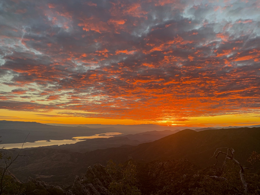
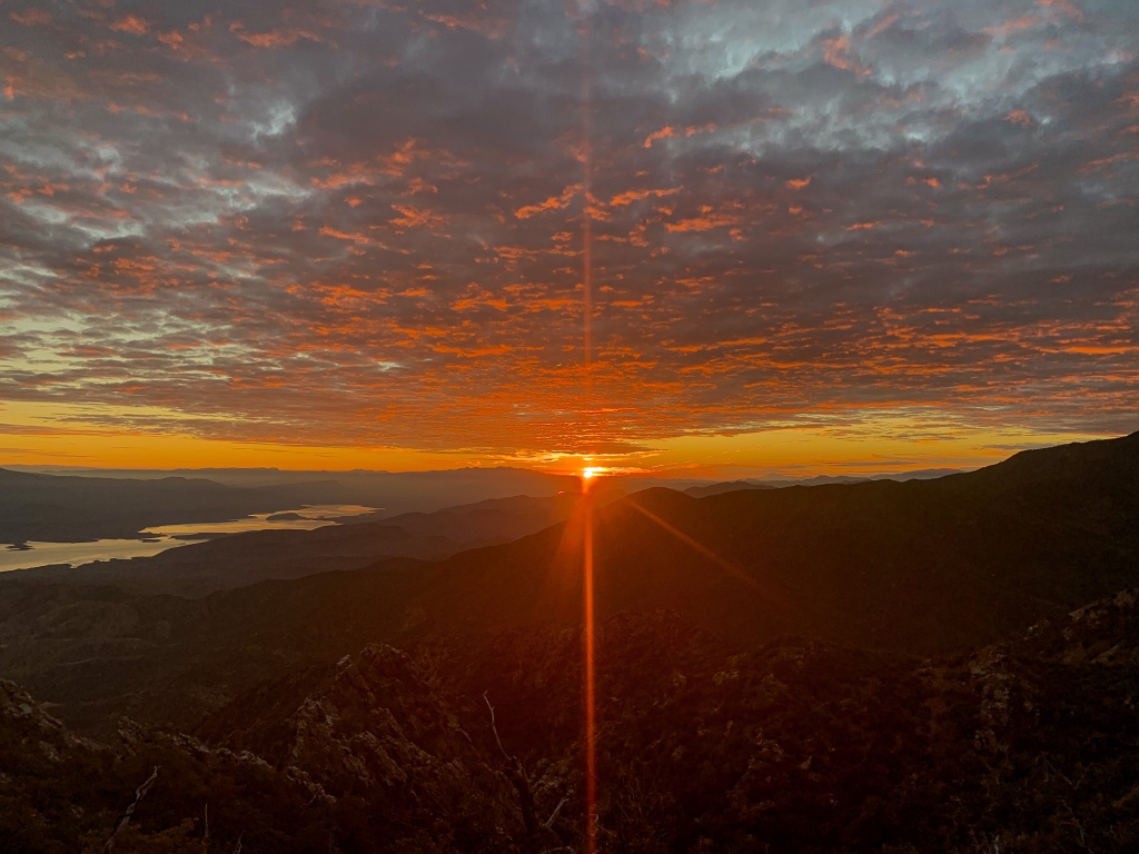
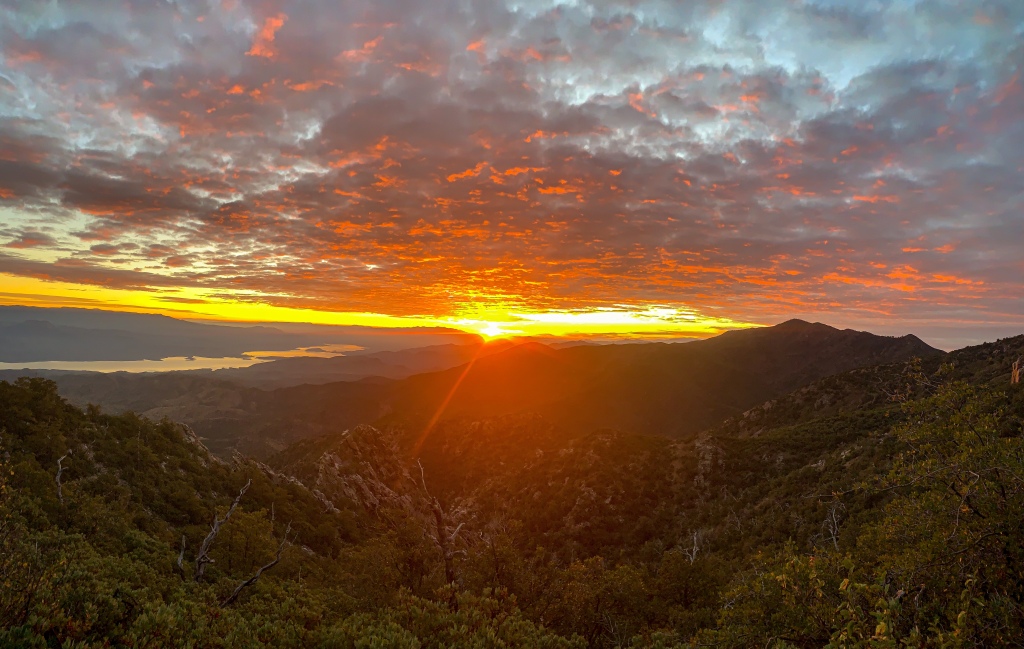
South Four Peaks to Roosevelt Lake
Red sky at night, sailor’s delight
Red sky in the morn, sailor’s be warned.
Sailor’s proverb
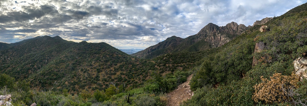
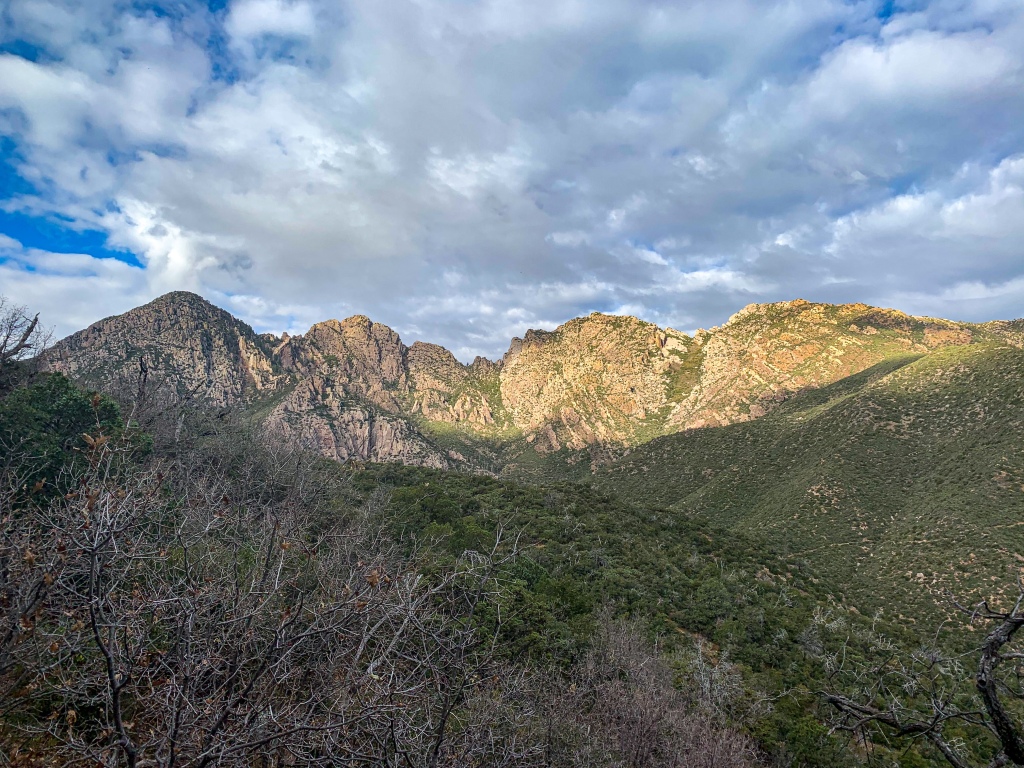
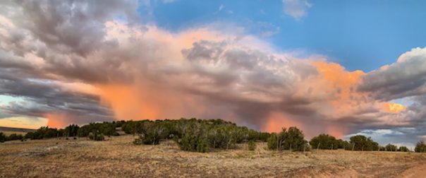
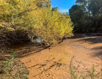
Got an early start this morning. Sunrise is beautiful but ominous. Growing up with family from coastal New England I was always taught the old saying “red sky at night, sailors delight, red sky in the morn, sailors be warned.” The sun illuminated a giant cloud bank red this morning before rising into it. I packed up and started double timing it below the Four Peaks, enjoying the rare glimpses of light shining on the peaks when possible but trying to both beat the rain and my friend from Phoenix to Roosevelt Lake.
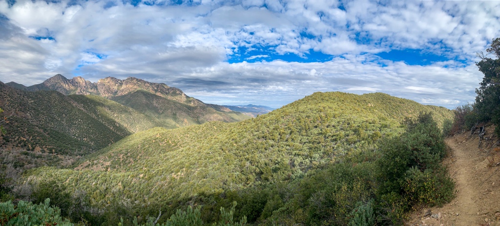
The hike seems endless at points, rolling through drainages in precipitously steep terrain where the trail seems the only flat surface around. My phone died with a couple miles left, so I had to write this retroactively, and the rain hit in the last 30 or so before making it to Roosevelt Lake.
After feasting (after such a long period in the wilderness, food was pretty good to have), I got a lift to Tonto Basin to pick up my packages and wait out what will likely be several days of rain.
AZT Passage 20 (Four Peaks)
Four Peaks Wilderness
Tonto National Forest
AZT Passage 20 (Four Peaks)
Four Peaks Wilderness
Tonto National Forest
AZT Passage 20 (Four Peaks)
Four Peaks Wilderness
Tonto National Forest
AZT Passage 20 (Four Peaks)
Four Peaks Wilderness
Tonto National Forest

AZT Passage 20 (Four Peaks)
Four Peaks Wilderness
Tonto National Forest

AZT Passage 20 (Four Peaks)
Four Peaks Wilderness
Tonto National Forest

AZT Passage 20 (Four Peaks)
Four Peaks Wilderness
Tonto National Forest

AZT Passage 20 (Four Peaks)
Four Peaks Wilderness
Tonto National Forest

AZT Passage 20 (Four Peaks)
Four Peaks Wilderness
Tonto National Forest
AZT Passage 20 (Four Peaks)
Four Peaks Wilderness
Tonto National Forest
Mazatzal Mountain Geology
The Mazatzal Mountains themselves are an incredible place. The origin of the name “Mazatzal” is unclear, though one possible meaning is a Nahuatl term meaning “place of the deer.”
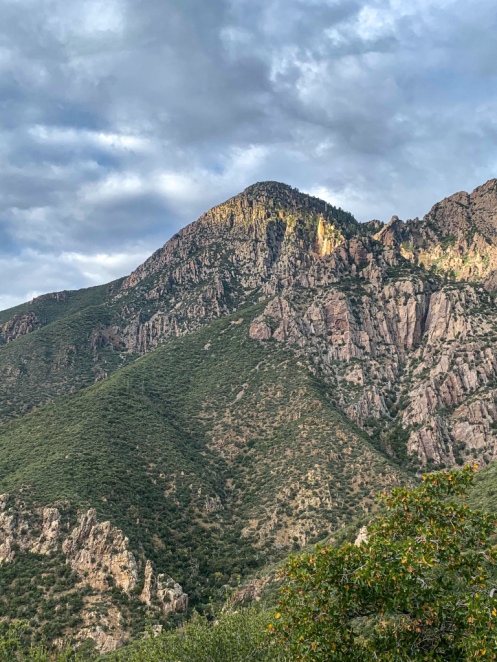
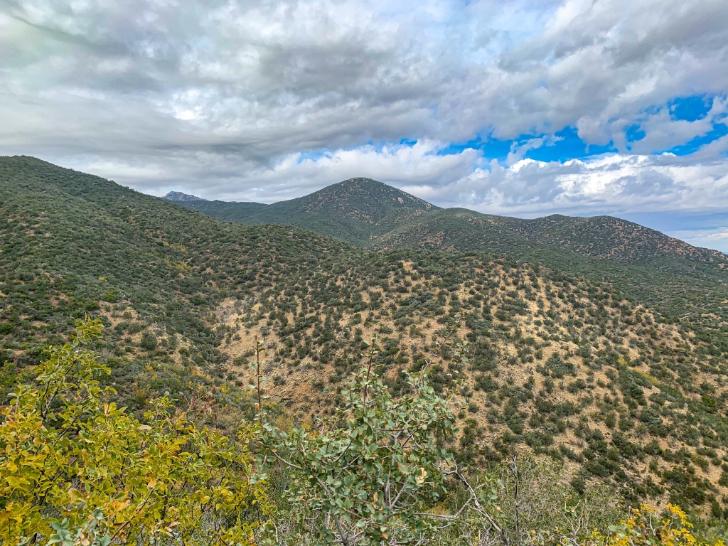
Formed during an orogeny (a term referring to the process that creates mountains) when Arizona was a coastal region on the margin of what became North America, the Mazatzals gained their rugged nature as tectonic collisions compressed rock, lifting it and thrusting it above other rocks (overthrust). The Four Peaks, the highest points of the Mazatzals, tower above the Arizona Trail with a jagged face that makes it appear as though half the mountain was simply cut away.
As the name suggests, there are indeed four Peaks – Amethyst Peak, Sister Peak, Brother Peak, and Brown’s Peak, in increasing elevation. Brown’s is the highest point in the Mazatzals and Maricopa County, while Amethyst hosts the only commercial amethyst mine in the United States. This passage passes through the southern half of the full Mazatzal range.
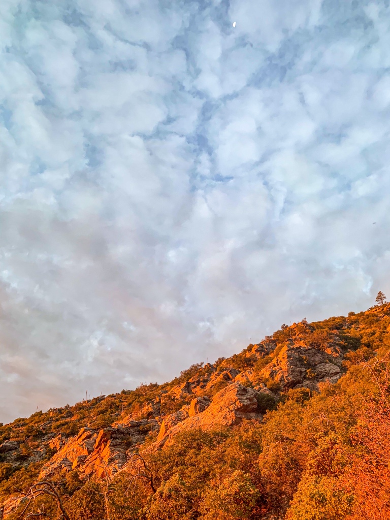
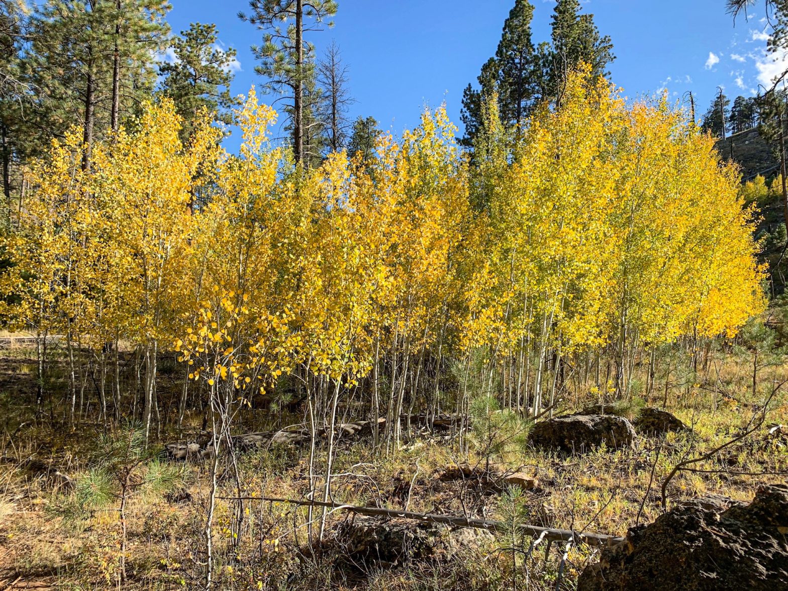
Unfortunately the area was greatly impacted by the Lone & Bush Fires, which burned much (though not all, as we will see) of the old ponderosa forest that had made the mountains one of the most popular long-distance stretches of the Arizona Trail.
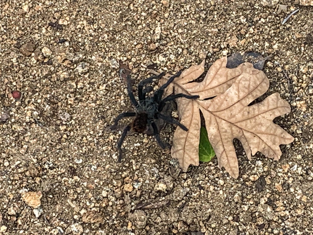
Yet the incredible geology, solitude, sunsets, and views remain for the hardy and prepared souls who venture into this special place. Bagworms spin magnificent webs here, and temperatures are relatively tolerable outside of winter, when snow can make stretches impassable for those without adequate preparation.

AZT Passage 20 (Four Peaks)
Four Peaks Wilderness
Tonto National Forest
AZT Passage 20 (Four Peaks)
Four Peaks Wilderness
Tonto National Forest

AZT Passage 20 (Four Peaks)
Four Peaks Wilderness
Tonto National Forest

AZT Passage 20 (Four Peaks)
Four Peaks Wilderness
Tonto National Forest
AZT Passage 20 (Four Peaks)
Four Peaks Wilderness
Tonto National Forest

AZT Passage 20 (Four Peaks)
Four Peaks Wilderness
Tonto National Forest

AZT Passage 20 (Four Peaks)
Four Peaks Wilderness
Tonto National Forest

AZT Passage 20 (Four Peaks)
Four Peaks Wilderness
Tonto National Forest
AZT Passage 20 (Four Peaks)
Four Peaks Wilderness
Tonto National Forest

AZT Passage 20 (Four Peaks)
Four Peaks Wilderness
Tonto National Forest
AZT Passage 20 (Four Peaks)
Four Peaks Wilderness
Tonto National Forest
AZT Passage 20 (Four Peaks)
Four Peaks Wilderness
Tonto National Forest

AZT Passage 20 (Four Peaks)
Four Peaks Wilderness
Tonto National Forest

AZT Passage 20 (Four Peaks)
Four Peaks Wilderness
Tonto National Forest

AZT Passage 20 (Four Peaks)
Four Peaks Wilderness
Tonto National Forest

AZT Passage 20 (Four Peaks)
Four Peaks Wilderness
Tonto National Forest
Arizona Trail: Passage 20 Trail Logistics & Passage Ecology
Passage Map: Passage 20 (Four Peaks)
| Passage 20 (Four Peaks) | |
| Trail Surface | Dirt singletrack |
| Length (Mi) | 19 |
| Land Manager and Contact Info | US Forest Service; Tonto National Forest – Home (usda.gov) |
| Season | March-May, September-November |
| Potential Water Sources | Pigeon Spring (Mi 421.6 NB, 421.6 SB) Bear Spring (mi 400.6 NB, 422.5 SB) Shake Spring (mi 392.5 NB, 423.4 SB) Granite Spring (mi 391.5 NB, 431.3 SB) Buckhorn Creek (mi 390.5 NB, 432.9 SB) |
| Trailheads | North: Lone Pine Saddle South: Theodore Roosevelt Lake |
| Trailhead Access | North: Vehicular access; via graded dirt road South: Vehicular access (parking at Roosevelt Lake Marina) |
| Wilderness | Yes |
| Possible resupply points | Phoenix (north end) Roosevelt Lake Marina (south end) Farther, Globe and Tonto Basin |
| ATA-Rated Difficulty | Strenuous |
| Potential campsites (mileages S to N) | Precipitous terrain limits options, but there are some spots around Mills Ridge Trailhead & the Chillicut Trail junction |
| Ecosystems Traversed | Arizona Upland Interior Chaparral Great Basin Conifer Woodland Relict Conifer Woodland |
| Highlights | Four Peaks Views of Tonto Basin & Roosevelt Lake SOBO, first saguaro appearance on trail |
| Interior Chaparral | Great Basin Conifer Woodland | Rocky Mountain Montane Conifer Woodland | |
| Common Trees/Shrubs | * Birchleaf Mahogany * Ceanothus * Holly-leaf buckthorn * Manzanita * Shrub live oak * Silktassels * Stansbury cliffrose | * Arizona alder * Holly-leaf buckthorn * Junipers * Oaks, including Arizona oak, canyon live oak, Emory oak, Gambel oak, scrub-live oak * Piñon pine * Red barberry * Serviceberry * Silktassels * Skunkbush * sugar sumac | * Ponderosa Pine * Southwestern white pine * Subalpine fir * White fir * Rocky Mountain maple * Bigtooth maple * Grey alder * Red birch * Red osier dogwood * Cliffbush * Mallow ninebark * New Mexican locust * huckleberry * bilberries |
| Common herbaceous plants | * Buckwheats * Globemallows * Lupines * Penstemons * Sego-lily * Wormwood | * fringed brome * Geyer’s sedge/elk sedge * Ross’ sedge * Bronze sedge/dry land sedge/hillside sedge/hay sedge/Fernald’s hay sedge * screwleaf muhly * bluebunch wheatgrass * Spruce-fir fleabane * wild strawberry/Virginia strawberry * Small-flowered woodrush * mountain sweet Cicely * bittercress ragwort * western meadow-rue * Fendler’s meadow-rue | |
| Common succulents | * Agaves – golden flowered, Parry’s, Toumey’s * Banana & soap tree yucca * Barrel cactus * beargrass * beehive cactus * buckhorn cholla * Cane Cholla * hedgehog cacti * prickly pear cacti * Rock echeveria * Sotol * Whipple’s cholla | * beehive cactus * Claret cup hedgehog cacti * Golden-flowered agave * Parry’s agave * Prickly pear cacti * Whipple cholla * Tonto Basin agave |
israelnightclub
Itís difficult to find educated people for this topic, however, you seem like you know what youíre talking about! Thanks
Jyothi
Awesome sunrise clicks!