
Backpacking the AZT: Passages 42 and 41 (Kaibab Plateau North & Central Kaibab Plateau)
Arizona Trail Day 3
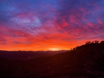
Trans-Arizona/Utah Hike Day 10
Welcome back to Aspen’s Tracks, thruhiking the Arizona Trail SOBO from Utah to Mexico. Today concludes the northern Kaibab Plateau and moves onto the central Kaibab to finish at Jacob Lake.
In the land of Arizona
Through desert heat or snow
Winds a trail for folks to follow
From Utah to Old Mexico
It’s the Arizona Trail
A pathway through the great Southwest
A diverse track through wood and stone
Your spirit it will test
Oh, sure you’ll sweat and blister
You’ll feel the miles every day
You’ll shiver at the loneliness
Your feet and seat will pay
But you’ll see moonlight on the borderlands
You’ll see stars on the Mogollon
You’ll feel the warmth of winter sun
And be thrilled straight through to bone
The aches and pains will fade away
You’ll feel renewed and whole
You’ll never be the same again
With Arizona in your soul
Along the Arizona Trail
A reverence and peace you’ll know
Through deserts, canyons, and mountains
From Utah to Old Mexico
-“The Arizona Trail,” Dale R. Shewalter
Arizona Trail Passage 42 (Kaibab Plateau North): Kaibab Plateau Ascent to US-89A
I encounter my first AZT hiker, Eric, to whom I give a great recommendation for Vermilion Cliffs – anyone who read my entries for the first week of this trek surely knows why. I also encounter some friends from Grand Canyon who were out for a trail run after attending the condor release conducted by the Peregrine Fund at Vermilion Cliffs today. My only regret about this hike was that the timing prevented me from attending, so it was good to hear how that went. I’m sure word of my trek will now make it back to Grand Canyon for my return there in the near future.
The trail winds through extensive ponderosa groves and some large meadows created by wildfires. While smaller fires that clear out underbrush and allow additional nutrients and space is a natural occurrence in the ponderosa forests of the Colorado Plateau – on which sit many smaller, higher plateaus like the Kaibab – large scale fires that reach the crowns of trees can destroy wider sections of forest and subsequently replace it with rice grass meadows. Ricegrass is a common pioneer species – one of the first to move into an area after a disturbance has occurred.
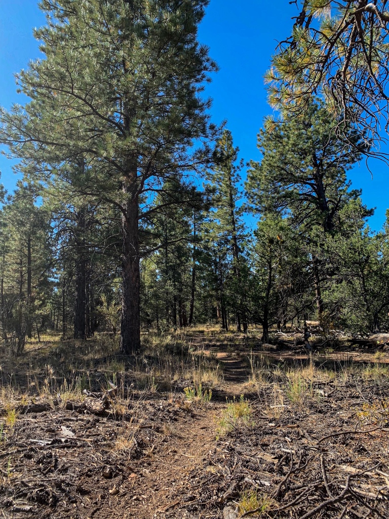
AZT Passage 42 (Kaibab Plateau North)
Kaibab National Forest
Arizona Trail, Passage 42 (Kaibab Plateau North)
Kaibab National Forest
Arizona Trail Passage 41 (Kaibab Plateau Central): US-89A to Jacob Lake
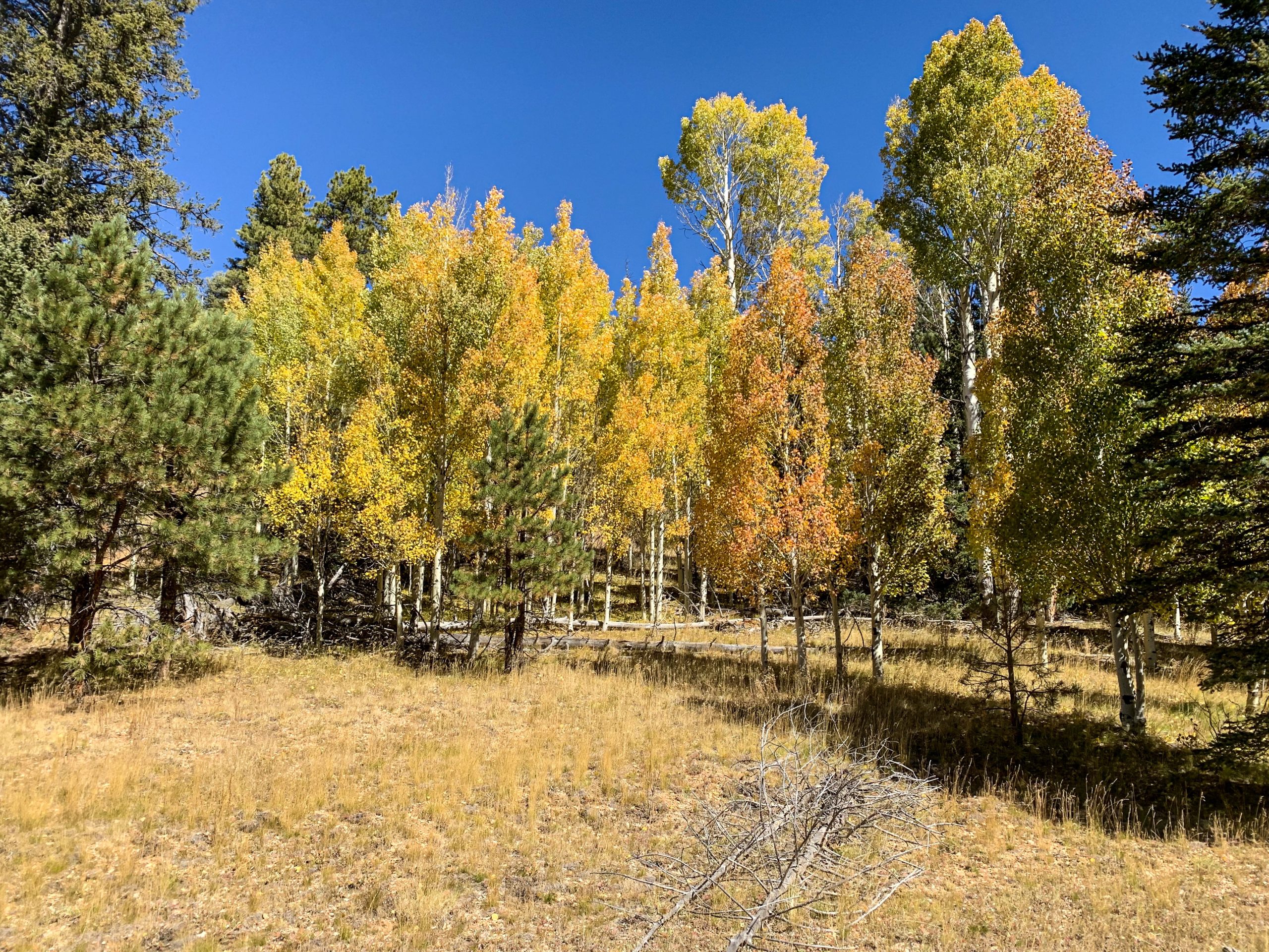
After 5 miles, I cross US-89 and enter Passage 41, the central Kaibab. In the next few miles, the first aspens are sighted. Like the ricegrass, aspens are a pioneer species, one of the first trees to appear after a disturbance. It appears that my hope of seeing some foliage color in the has been fulfilled. Fingers crossed that continues heading south.
After a few more miles, it’s camp for the night and a side hike to Jacob Lake for dinner. Some real food for the first time in almost a week and a half.

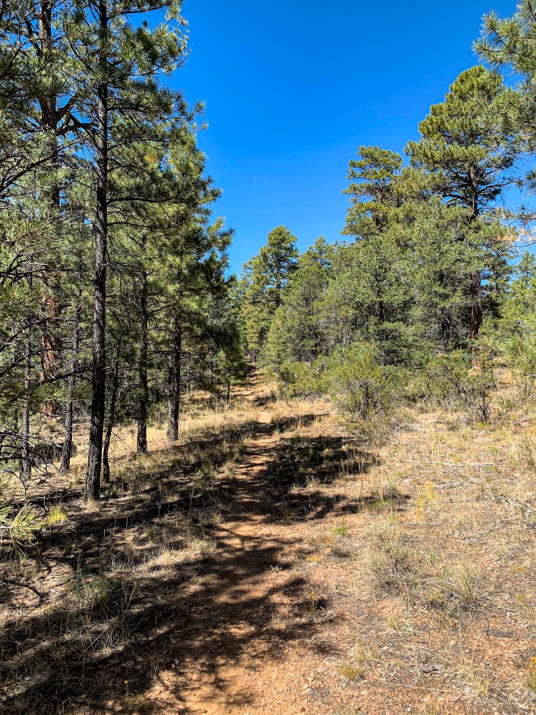
Arizona Trail, Passage 42 (Kaibab Plateau North)
Kaibab National Forest

AZT Passage 42 (Kaibab Plateau North)
Kaibab National Forest
My camp tonight is in a clearing thinned (though not completely exposed) by wildfires on the central Kaibab. I lay looking up at surviving ponderosas creaking and swaying in a gusty Kaibab breeze, one of the loudest winds I’ve ever heard, silhouetted against the light of the Milky Way stretched out across the heavens. I could hear others creaking unseen, the sound the only clue to their presence. Unreal. I’m not sure even if I had my real camera with me to capture that that it could do that moment justice. (If only I had a portable wind turbine as well as a solar panel. I could have charged everything off the breeze in that clearing tonight.)
Tomorrow morning, back to Jacob Lake for a real breakfast and then 15-20 miles down the trail through the central Kaibab.

AZT Passage 42 (Kaibab Plateau North)
Kaibab National Forest

Kaibab National Forest

Kaibab National Forest
Trail Logistics and Passage Ecology Info
| Passage 42 ( Kaibab Plateau North) | Passage 41 (Kaibab Plateau Central) | |
| Trail Surface | Dirt singletrack | Dirt singletrack |
| Length (Mi) | 17 | 17.2 |
| Season | Spring-fall best; extensive snow possible in winter | Spring-fall. No vehicular access to this section December-April. Feet of snow in winter. |
| Potential Water Sources | Rock Creek Apron (mi 13.3 SOBO/mi 775.4 NOBO) Government Reservoir (mi 17.8 SOBO/ 770.9 NOBO) Umbrella Tank (mi 20.3 SOBO/768.4 NOBO) Ponderosa Trick Tank (mi 20 SOBO, 768.7 NOBO) Orderville Trick Tank (mi 21 SOBO, 767.7 NOBO) | Wildlife Tank (mi 36.9 SOBO, 751.8 NOBO) Cement Trough (mi 37.3 SOBO, 751.4 NOBO) |
| Trailheads | North: Winter Road South: US-89A | North: US-89A South: Telephone Hill |
| Trailhead Access | Vehicular access. North trailhead dirt; south paved | Vehicular access |
| Wilderness | No, but it can feel like it outside of the 89 crossing at the south end. | No, but it can feel like it. Most hikers in the area stick to the national park. Or are passing through to reach routes in the national park. |
| Possible resupply points | Jacob Lake | Jacob Lake |
| ATA-Rated Difficulty | Easy | Easy |
| Potential campsites (mileages S to N) | Various points throughout; terrain is not a limiting factor here. | Various points throughout; terrain is not a limitation here. Avoid the burn area from the 2006 Warm Fire in the event of high winds, since shelter is nonexistent there. |
| Ecosystems Traversed | Rocky Mountain Montane Conifer Woodland | Great Basin Subalpine Conifer Forest Rocky Mountain Montane Conifer Woodland |
| Great Basin Subalpine Conifer Forest/Rocky Mountain Montane Conifer Forest | |
| Common Trees/Shrubs | * Corkbark fir * Gambel oak * Quaking aspen * White fir * Blue spruce * Engelmann spruce * Buckwheats * Currants * Dwarf juniper * Elderberry * Fendler’s ceanothus * Greenleaf Manzanita * New Mexican locust * Perry’s rabbitbrush * Raspberry * smooth sumac * Snowberry |
| Common herbaceous plants | * Bracken Fern * Buckwheats * Cinquefoils * Columbines * Fleabane daisies * Geraniums * goldeneye * Goldenrods * Groundsels * Hairy golden aster * Indian paintbrush * Lotus * Lupines * Meadow-rue * Parry’s bellflower * Peavine * Penstemons * Puccoon * Pussytoes * Thistles * Western & white prairie asters * Wild strawberry * Wormwood * Yarrow * Yellow hawkweed |
| Common succulents | Prickly pear, occasionally |
| Aquatic | * Bulrush * Buttercups * Rushes * Sedges * Water plantains |
2 thoughts on “Amazing, Spectacular Arizona Trail Thruhike: Kaibab North-Jacob Lake”