Arizona Trail Passage 27, Blue Ridge
AZT Backpacking Day 38, Part 2
Arizona/Utah Day 45, Part 2
In the land of Arizona
Through desert heat or snow
Winds a trail for folks to follow
From Utah to Old Mexico
It’s the Arizona Trail
A pathway through the great Southwest
A diverse track through wood and stone
Your spirit it will test
Oh, sure you’ll sweat and blister
You’ll feel the miles every day
You’ll shiver at the loneliness
Your feet and seat will pay
But you’ll see moonlight on the borderlands
You’ll see stars on the Mogollon
You’ll feel the warmth of winter sun
And be thrilled straight through to bone
The aches and pains will fade away
You’ll feel renewed and whole
You’ll never be the same again
With Arizona in your soul
Along the Arizona Trail
A reverence and peace you’ll know
Through deserts, canyons, and mountains
From Utah to Old Mexico
-“The Arizona Trail,” Dale R. Shewalter
Arizona Trail: Blue Ridge to Clear Creek
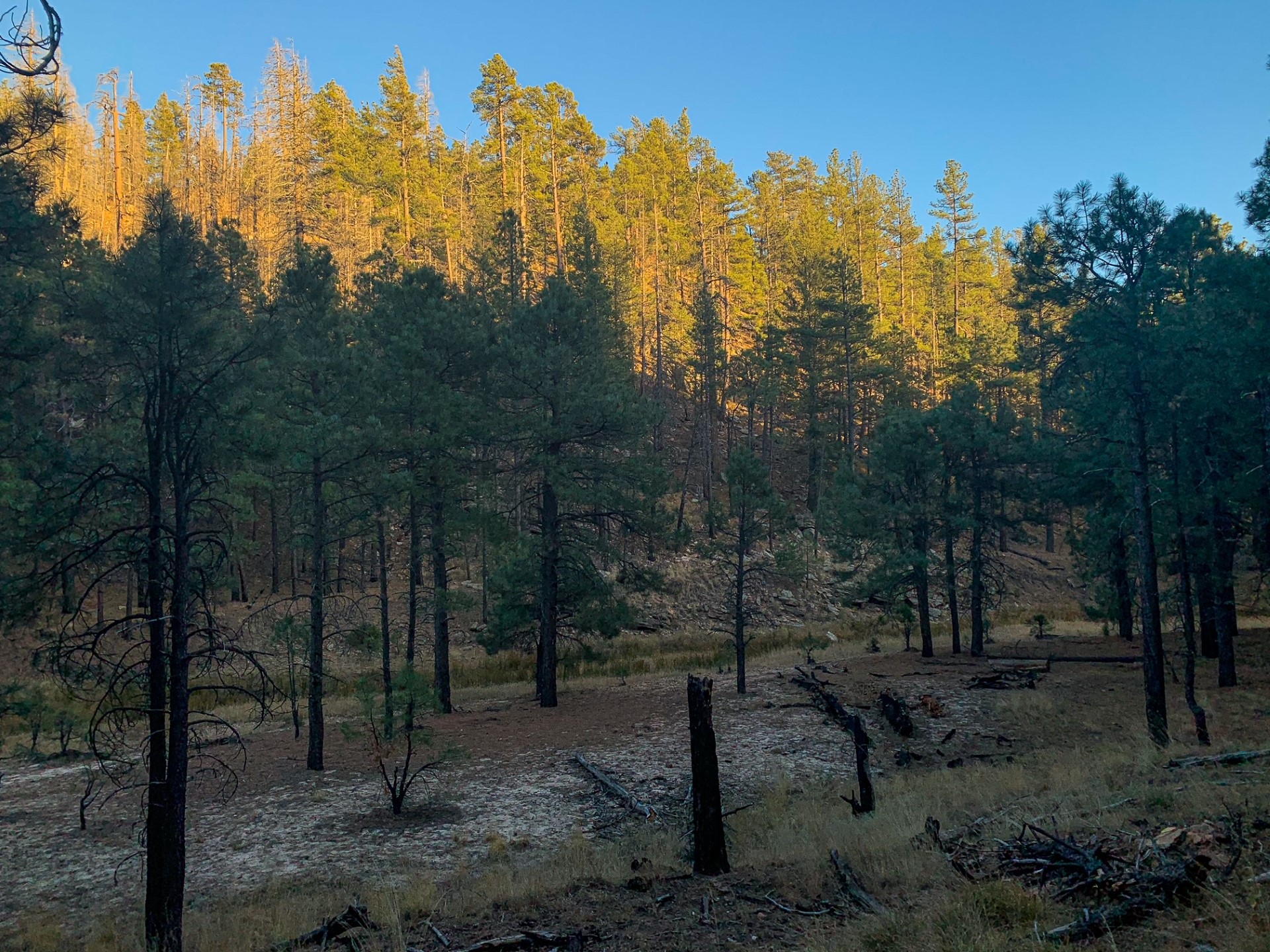
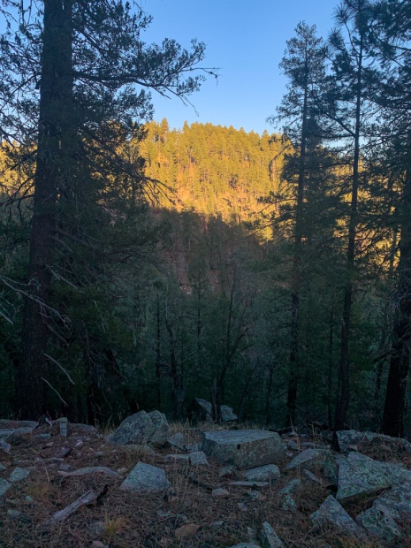
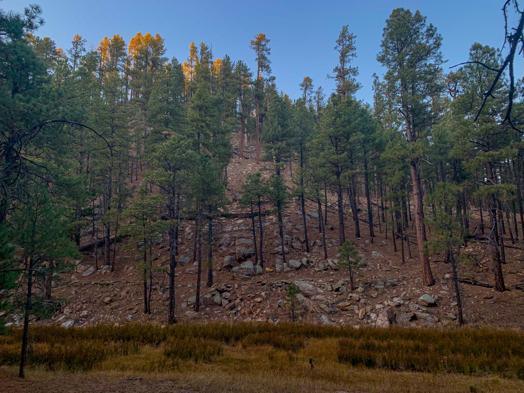
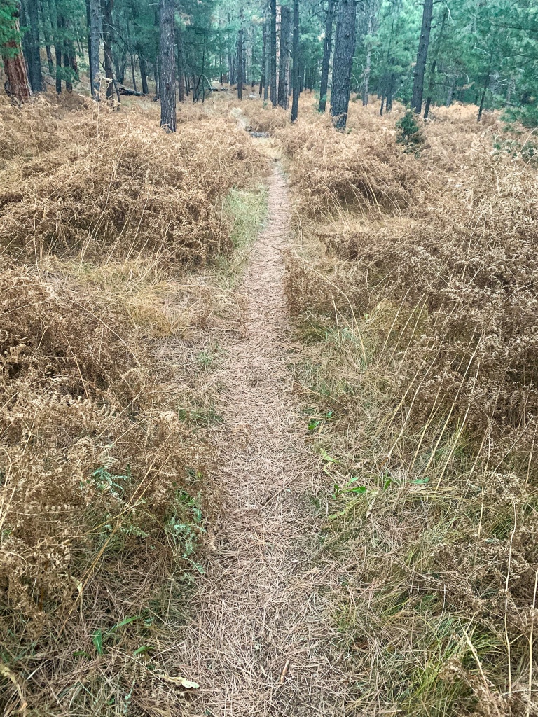
Backpacking south, the trail crosses Blue Ridge and dips across the steep valley of East Clear Creek, dry at the crossing. I was told that there may be water in one direction near the crossing but didn’t need it and therefore didn’t check. Climbing out the other side, the northern aspect of the slope is apparent – while ponderosas covered the southern slope opposite, the northern one featured Douglas fir and blue spruce. Obviously the different sides show different microclimates depending on the sun aspect, the temperature and moisture levels on each side given the orientation and angle of the slope.

Arizona Trail, Passage 28 (Blue Ridge)
Coconino National Forest

Arizona Trail, Passage 28 (Blue Ridge)
Coconino National Forest

Arizona Trail, Passage 28 (Blue Ridge)
Coconino National Forest
Arizona Trail, Passage 28 (Blue Ridge)
Coconino National Forest
Arizona Trail, Passage 28 (Blue Ridge)
Coconino National Forest

Arizona Trail, Passage 29
Coconino National Forest
Arizona Trail, Passage 28 (Blue Ridge)
Coconino National Forest
Arizona Trail: General Springs Canyon-Mogollon Rim
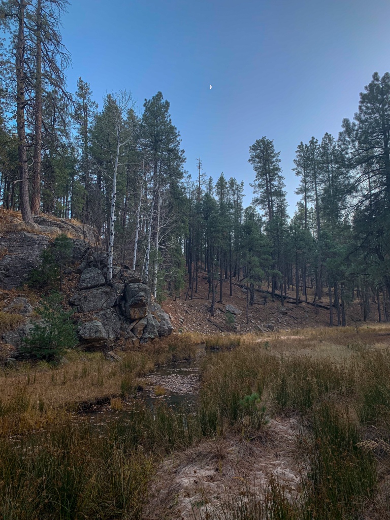
The trail rises back to the ponderosa forests on the Mogollon Plateau and traverses them, the site of my first human sighting in 3 days, then reaches General Springs Canyon. Dipping into General Springs Canyon, silence and quiet take hold.
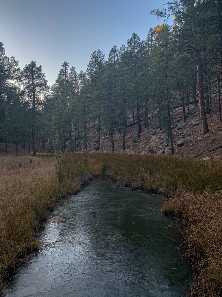
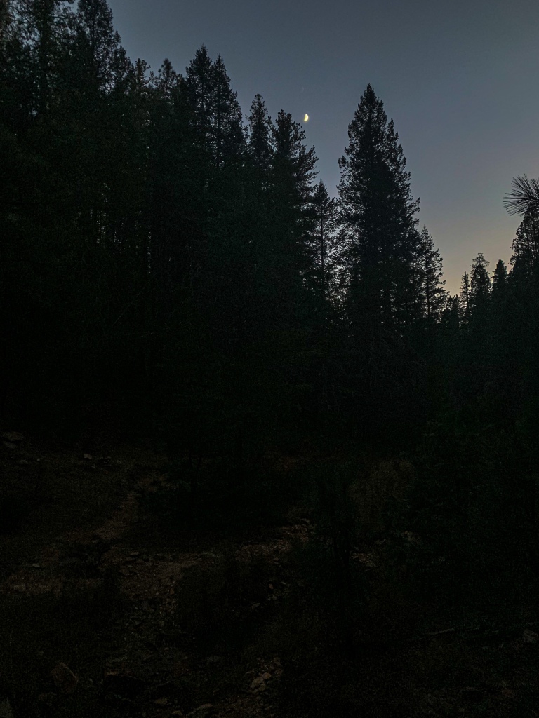
I passed a nice campsite near the end of General Springs Canyon, but the pools nearby were still frozen at the end of the day, suggesting it would get colder in the canyon overnight (and that solar exposure during the day was limited) than on the Rim, so I continued hiking to the rim itself. Lights can be seen in the distance, but I’m not sure which town. Likely Pine or Strawberry. Tomorrow begins the descent off the rim at long last.
Arizona Trail, Passage 28 (Blue Ridge)
Coconino National Forest

Arizona Trail, Passage 28 (Blue Ridge)
Coconino National Forest
Arizona Trail, Passage 28 (Blue Ridge)
Coconino National Forest
Arizona Trail, Passage 28 (Blue Ridge)
Coconino National Forest
Arizona Trail, Passage 28 (Blue Ridge)
Coconino National Forest
Arizona Trail, Passage 28 (Blue Ridge)
Coconino National Forest
Arizona Trail, Passage 28 (Blue Ridge)
Coconino National Forest
Trail Logistics and Ecology
| Passage 27 (Blue Ridge) | |
| AZTA Passage Information | Passage 27 (Blue Ridge) |
| AZTA Passage Map | Passage 27 Map |
| AZTA Elevation Profile | Passage 27 Elevation Profile |
| Trail Surface | Dirt singletrack |
| Length (Mi) | 15.4 |
| Season | Spring-Fall |
| Potential Water Sources | Blue Ridge Ranger Station (mi 292.0 SOBO/496.7 NOBO) Elk Tank/FR 135D (mi 266.7 SOBO/495.9 NOBO) Blue Ridge Campground (mi 293.4 SOBO/495.3 NOBO) Rock Crossing Campground (297.0 SOBO/491.7 NOBO) East Clear Creek (mi 298.7 SOBO/490 NOBO) Stock Tank (mi 299.6 SOBO/489.2 NOBO) General Springs Canyon (mi 306.0 SOBO/482.7 NOBO) Full Water Source Report: AZTA Water Report |
| Trailheads | North: AZ-87 (mi 262.6 SOBO/526.1 NOBO) South: Mogollon Rim (mi 292.1 SOBO, 496.7 NOBO) |
| Trailhead Access | North: Paved road South: Graded dirt road |
| Wilderness | No |
| Possible resupply points | None |
| Difficulty | Moderate |
| Potential campsites (mileages S to N) | Various LNT-compatible locations throughout |
| Threats | Heat – wear a cotton shirt if hot so you can soak it. Synthetics aren’t great in the desert. Hypothermia – nights are generally about 30°F cooler than days in Arizona regardless of the time of year. Consider this in packing gear. Mornings can be cool year-round. Hyponatremia – “drunk on water.” To avoid, ensure adequate salt & electrolyte intake and ensure you eat as well as drink water. Symptoms are almost identical to dehydration, but drinking more makes it worse. Prevention is by far the best solution. Dehydration Lightning |
| Permits Required? | No |
| Cell service? | Limited |
| Ecosystems traversed | Rocky Mountain Montane Conifer Forest |
| Highlights | Largest ponderosa forest in world Mogollon Rim, southern boundary of Colorado Plateau Ecological diversity on slopes of Clear Creek |
| Current Weather Forecast | Blue Ridge Weather |
Passage 27 Ecology
| Rocky Mountain Montane Conifer Woodland | |
| Common Trees/Shrubs | * Ponderosa Pine * Southwestern white pine * Subalpine fir * White fir * Rocky Mountain maple * Bigtooth maple * Grey alder * Red birch * Red osier dogwood * Cliffbush * Mallow ninebark * New Mexican locust * huckleberry * bilberries |
| Common herbaceous plants | * fringed brome * Geyer’s sedge/elk sedge * Ross’ sedge * Bronze sedge/dry land sedge/hillside sedge/hay sedge/Fernald’s hay sedge * screwleaf muhly * bluebunch wheatgrass * Spruce-fir fleabane * wild strawberry/Virginia strawberry * Small-flowered woodrush * mountain sweet Cicely * bittercress ragwort * western meadow-rue * Fendler’s meadow-rue |
ปั้มไลค์
Like!! Great article post.Really thank you! Really Cool.
Linda K
Are you finding the trail easy to follow? Love the poem!
Aspen
For the most part, yes. It helps to have a wayfinding app like Guthook, but it is signed and worn for the most part. I would always recommend hiking a segment to know what to expect, or to have long term experience to fall back on regarding how to read trails in varied terrain.