Arizona Trail, Passage 22 (Saddle Mountain)
AZT Backpacking Day 53
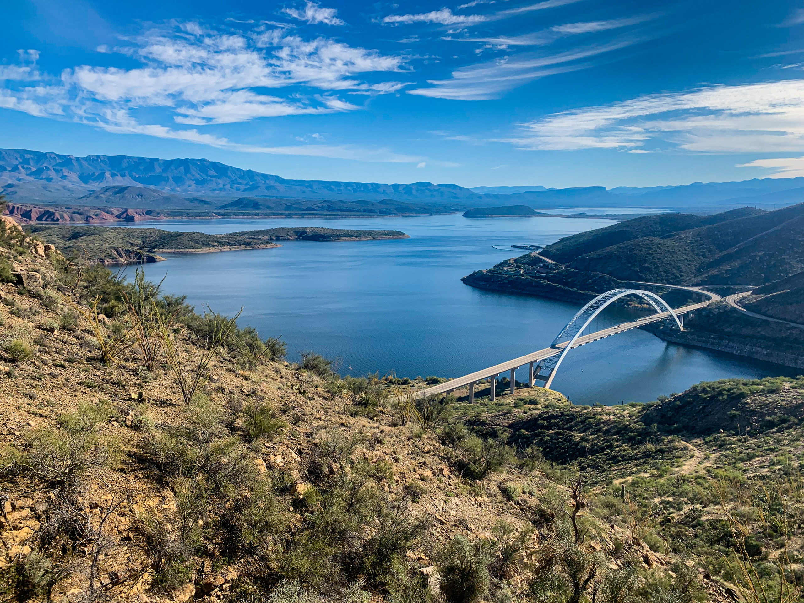
Trans-Arizona/Utah Day 60
Welcome back to Aspen’s Tracks, thruhiking the Arizona Trail southbound from Utah to Mexico. Today’s route covers backpacking the stretch of Passage 22, Saddle Mountain, between the northern passage boundary at the Mt Peeley Trailhead southern edge to my first night’s camp on the passage near McFarland Canyon. You can find today’s hiking logistics below the photo documentation and trail journal of the route.
If you missed my last entry covering the leg through the final stretch of the Mazatzal Divide, that can be found here. The next entry will cover the continued journey along the Saddle Mountain Passage to the area of Sunflower and Sycamore Creek. If you enjoy these accounts, please do subscribe to follow along to make sure that you don’t miss out on here or any future accounts to come!
In the land of Arizona
Through desert heat or snow
Winds a trail for folks to follow
From Utah to Old Mexico
It’s the Arizona Trail
A pathway through the great Southwest
A diverse track through wood and stone
Your spirit it will test
Oh, sure you’ll sweat and blister
You’ll feel the miles every day
You’ll shiver at the loneliness
Your feet and seat will pay
But you’ll see moonlight on the borderlands
You’ll see stars on the Mogollon
You’ll feel the warmth of winter sun
And be thrilled straight through to bone
The aches and pains will fade away
You’ll feel renewed and whole
You’ll never be the same again
With Arizona in your soul
Along the Arizona Trail
A reverence and peace you’ll know
Through deserts, canyons, and mountains
From Utah to Old Mexico
-“The Arizona Trail,” Dale R. Shewalter
Mt Peeley Trailhead-Thicket Spring
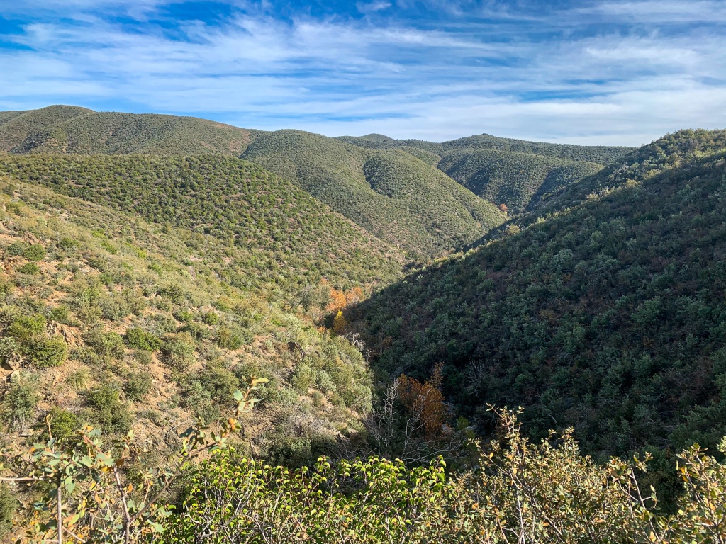
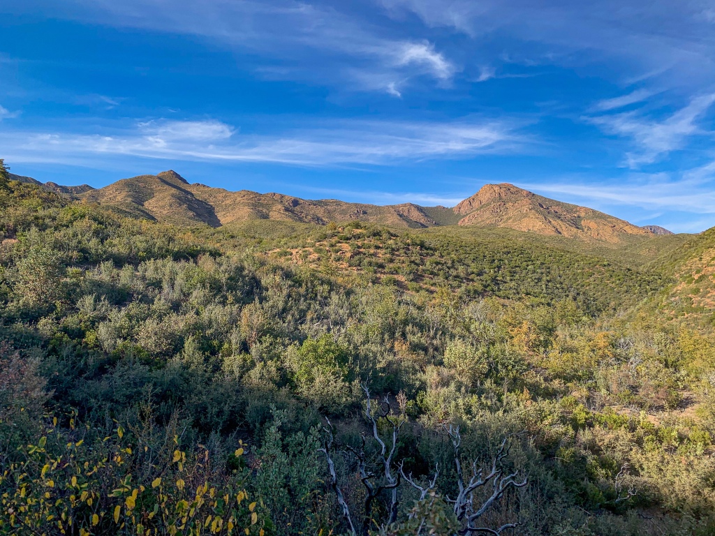
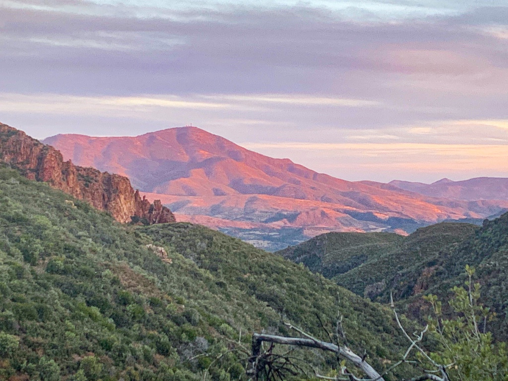
This stretch takes me from the Mount Peeley Trailhead past Thicket Spring to McFarland Canyon. The views of the central Mazatzals, including Mount Peeley & Sheep Mountain, are magnificent. Framed views of the Four Peaks in the southern Mazatzals also present themselves.
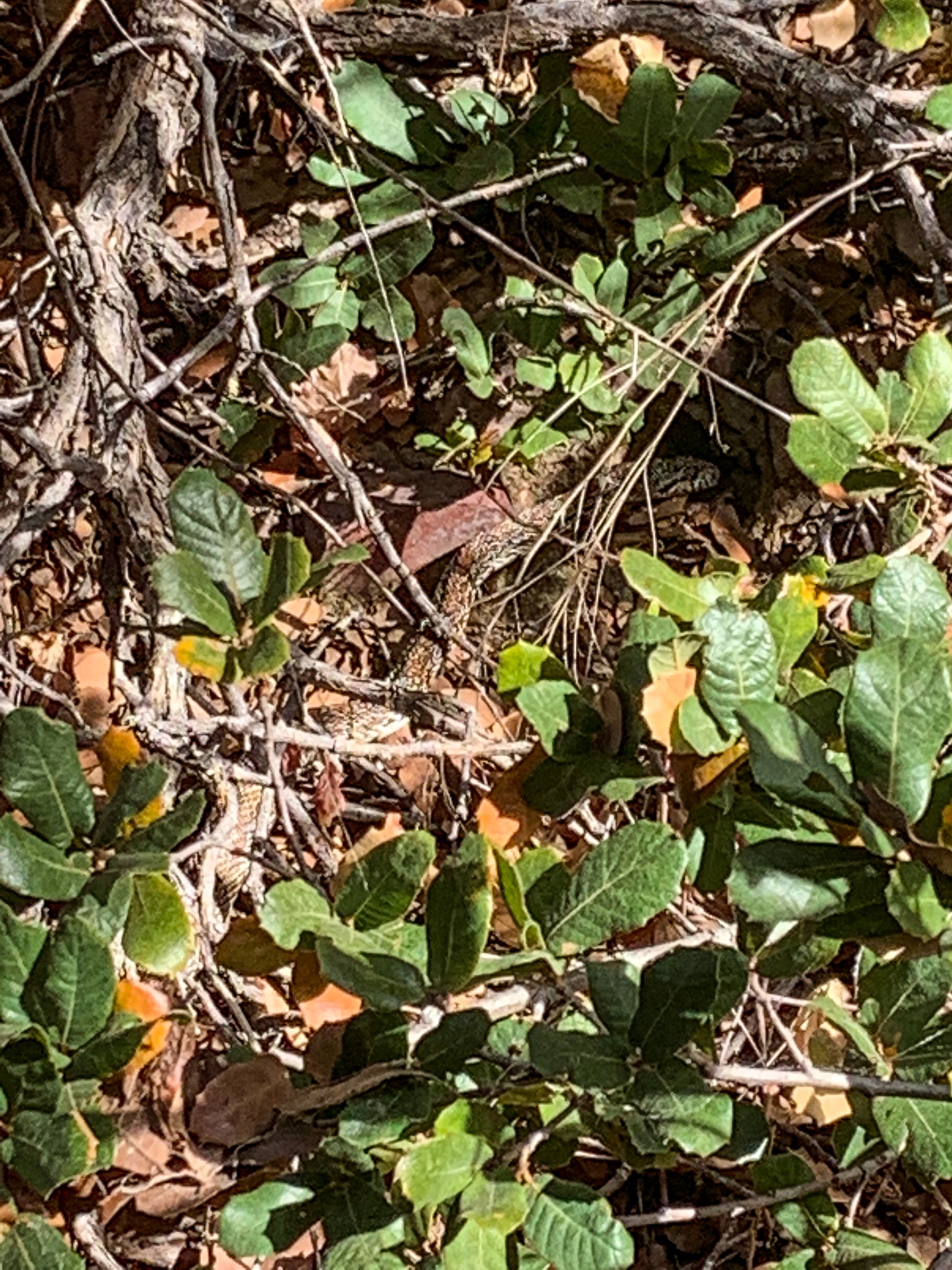
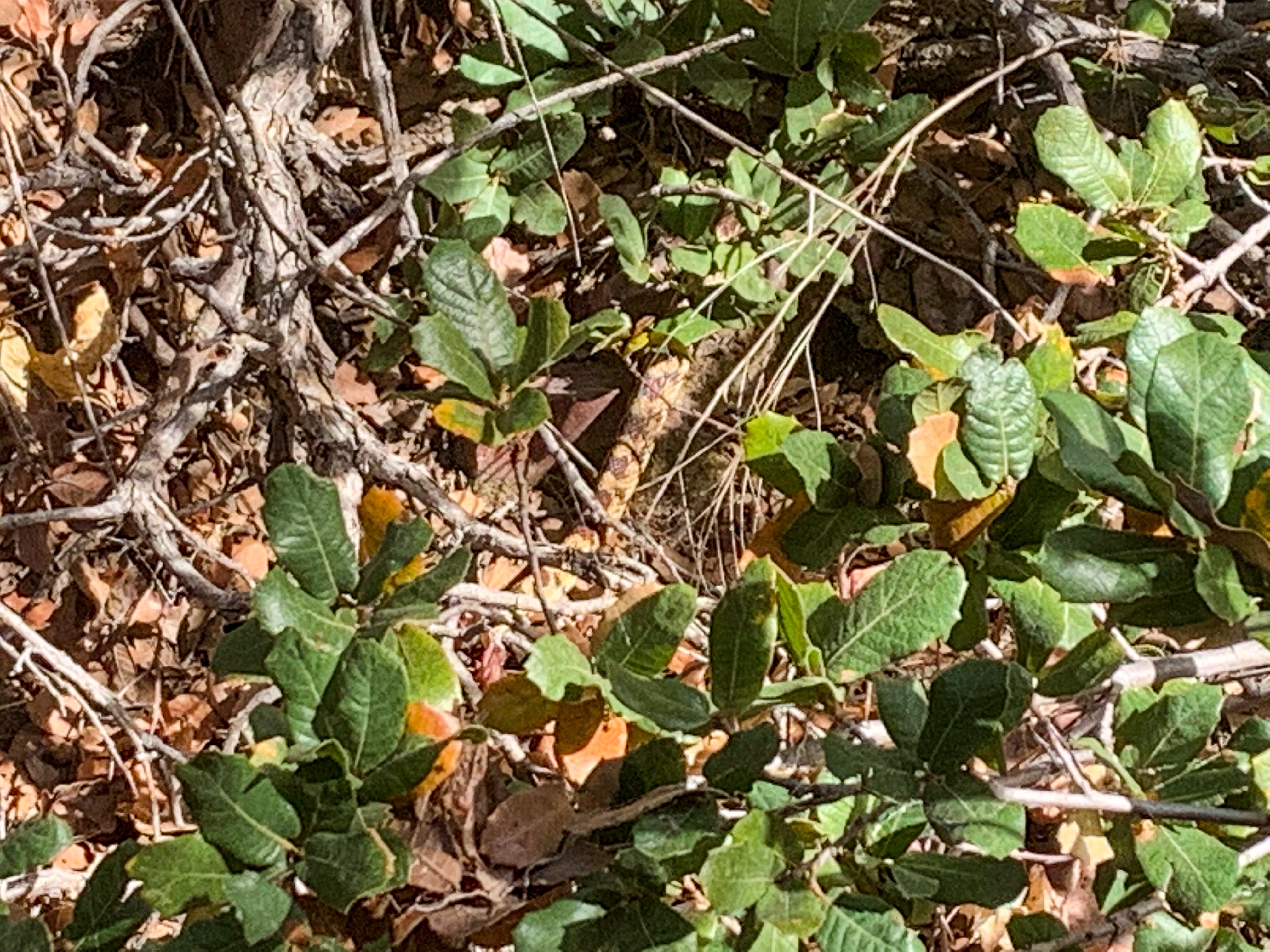
After yesterday found me camped in the vicinity of the trailhead, I continue south down the AZT toward Saddle Mountain and the town of Sunflower. Passing the trailhead, at Thicket Spring, a snake moves hurriedly under a bush as I approach.
Arizona Trail, Passage 22 (Saddle Mountain)
Tonto National Forest
AZT Passage 21, Saddle Mountain
Tonto National Forest

AZT Passage 21, Saddle Mountain
Tonto National Forest
AZT Passage 21, Saddle Mountain
Tonto National Forest
Arizona Trail: Thicket Spring-McFarland Canyon
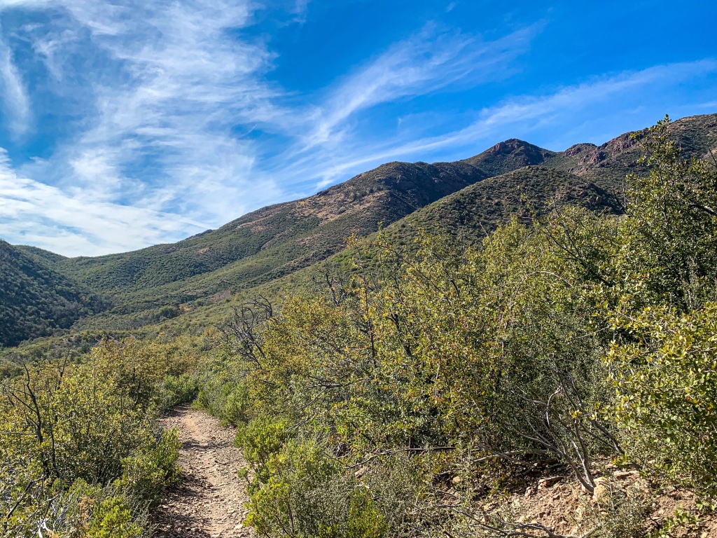
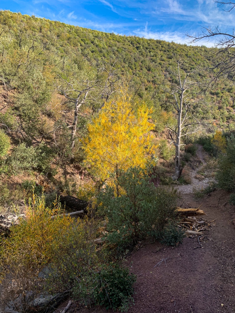
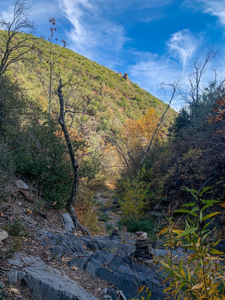
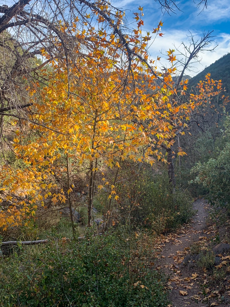
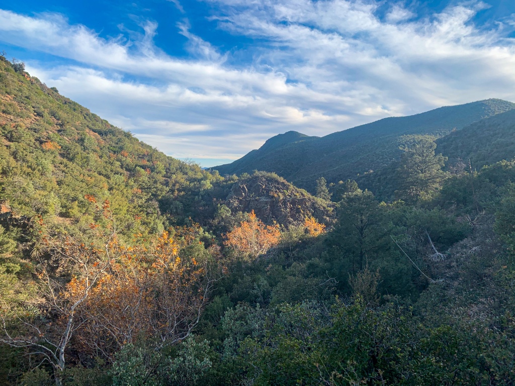
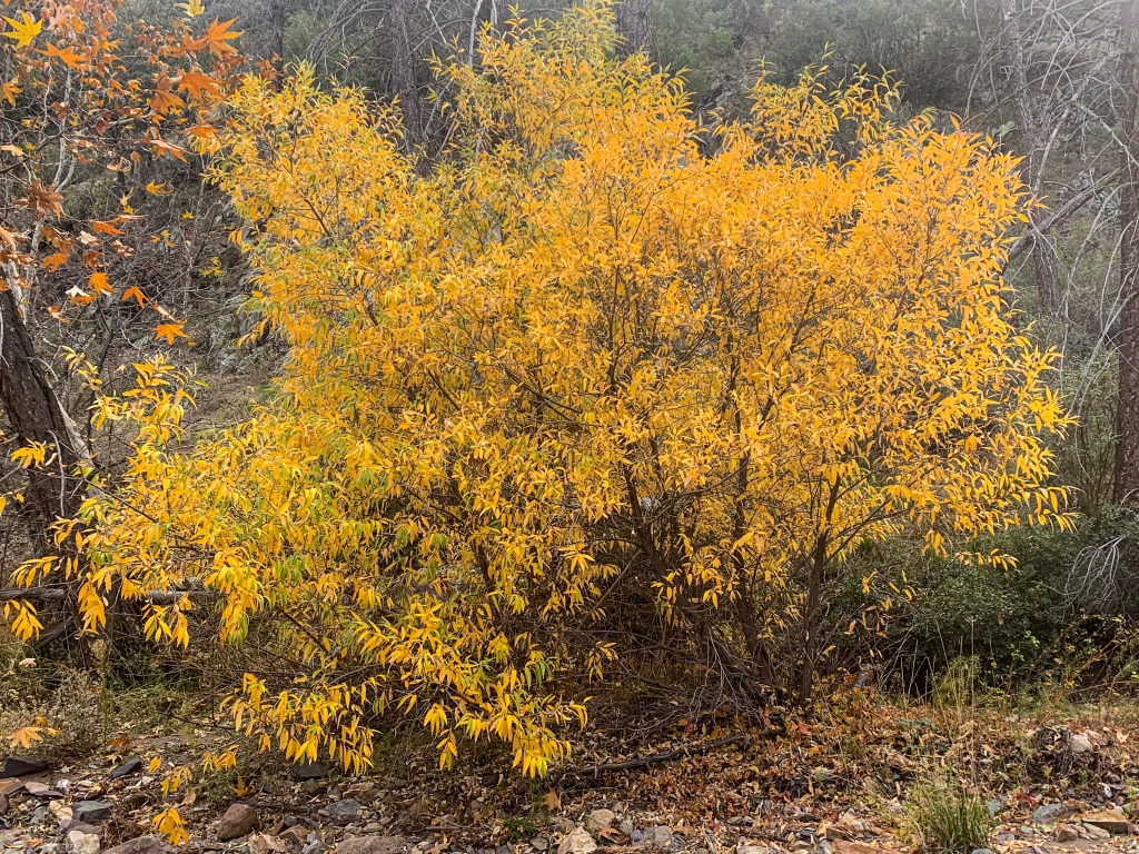
Departing Thicket Spring, the trail descends to Sycamore Creek, which it follows for a short distance before climbing out and traversing south, then west, and finally southwest to McFarland Canyon. The namesake sycamores are still putting on a show in the shady canyon, with gold leaves glowing in the sunlight.
Cliffs on the Mazatzal Mountains as well as peaks such as Sheep Mountain rise above against the brilliant blue sky as the trail departs Sycamore Creek for its rolling traverse to McFarland. Once again, even the traverses of these passages aren’t flat due to the ruggedness of the terrain, let along the climbs or descents. On the way to McFarland Canyon, the trail officially passes the halfway point (there were two possibilities for the exact spot, depending on the precise routing at the time, but both are passed en route).
AZT Passage 21, Saddle Mountain
Tonto National Forest
AZT Passage 21, Saddle Mountain
Tonto National Forest
AZT Passage 21, Saddle Mountain
Tonto National Forest
AZT Passage 21, Saddle Mountain
Tonto National Forest
AZT Passage 21, Saddle Mountain
Tonto National Forest

AZT Passage 21, Saddle Mountain
Tonto National Forest
AZT Passage 21, Saddle Mountain
Tonto National Forest
AZT Passage 21, Saddle Mountain
Mazatzal Wilderness
Tonto National Forest

AZT Passage 21, Saddle Mountain
Mazatzal Wilderness
Tonto National Forest
Arizona Trail: McFarland Canyon-Sunset
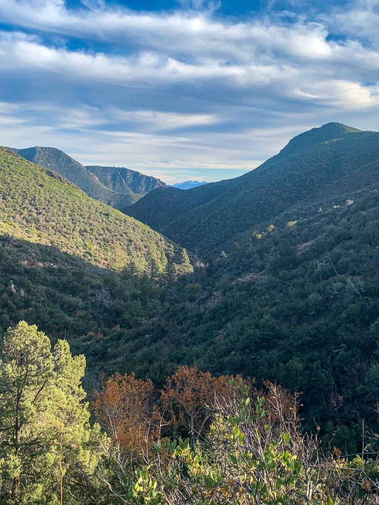
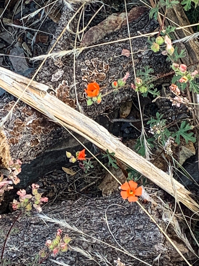
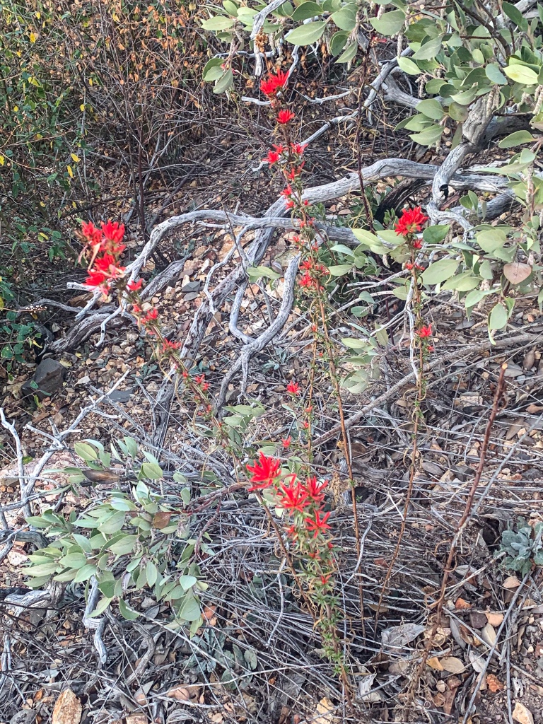
The Arizona Trail arrives at McFarland Canyon, a rugged canyon incised into the sides of the Mazatzal Mountains. Wildflowers bloom and relict conifer forest is still present. Framed views toward the mouth of the canyon feature the Four Peaks in the distance, a set of four distinctive mountains lying just west of Phoenix that I should reach in the coming days. The highest, Brown’s Peak, is the highest point in Maricopa County.
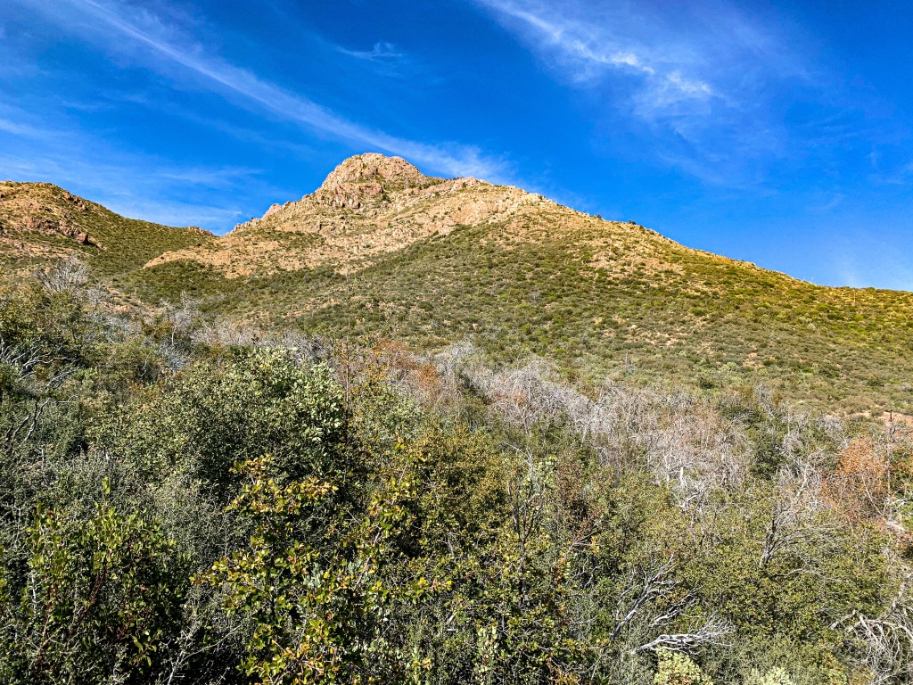
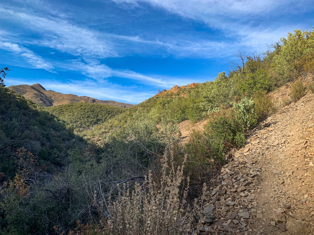
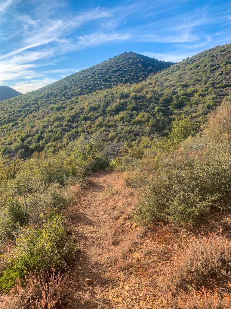
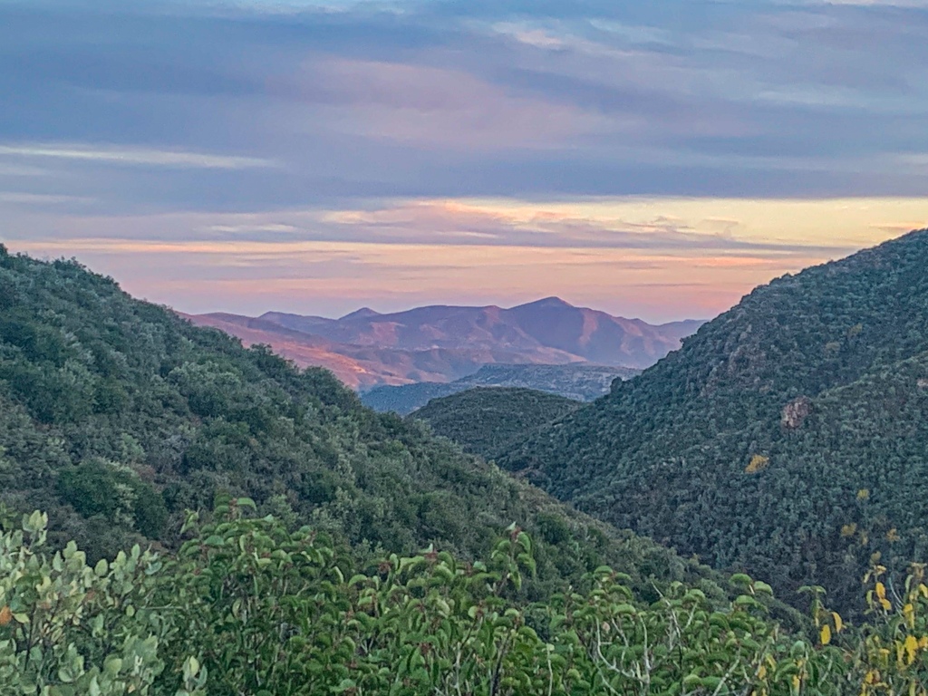
The trail climbs out of McFarland Canyon and back onto the mountain slopes, revealing more magnificent views of other sub peaks and ranges of the Mazatzals – including Mt Ord, Cypress Peak, and Edwards Peak. From McFarland Canyon for about 6 miles south the trail returns to the Mazatzal Wilderness before exiting it for good and beginning its descent from the mountain flanks to AZ-87.
AZT Passage 21, Saddle Mountain
Mazatzal Wilderness
Tonto National Forest
AZT Passage 21, Saddle Mountain
Mazatzal Wilderness
Tonto National Forest
Arizona Trail, Passage 22 (Saddle Mountain)
Tonto National Forest
AZT Passage 21, Saddle Mountain
Mazatzal Wilderness
Tonto National Forest
AZT Passage 21, Saddle Mountain
Tonto National Forest
AZT Passage 21, Saddle Mountain
Mazatzal Wilderness
Tonto National Forest

AZT Passage 21, Saddle Mountain
Mazatzal Wilderness
Tonto National Forest
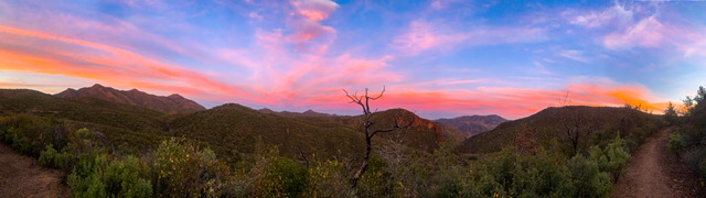
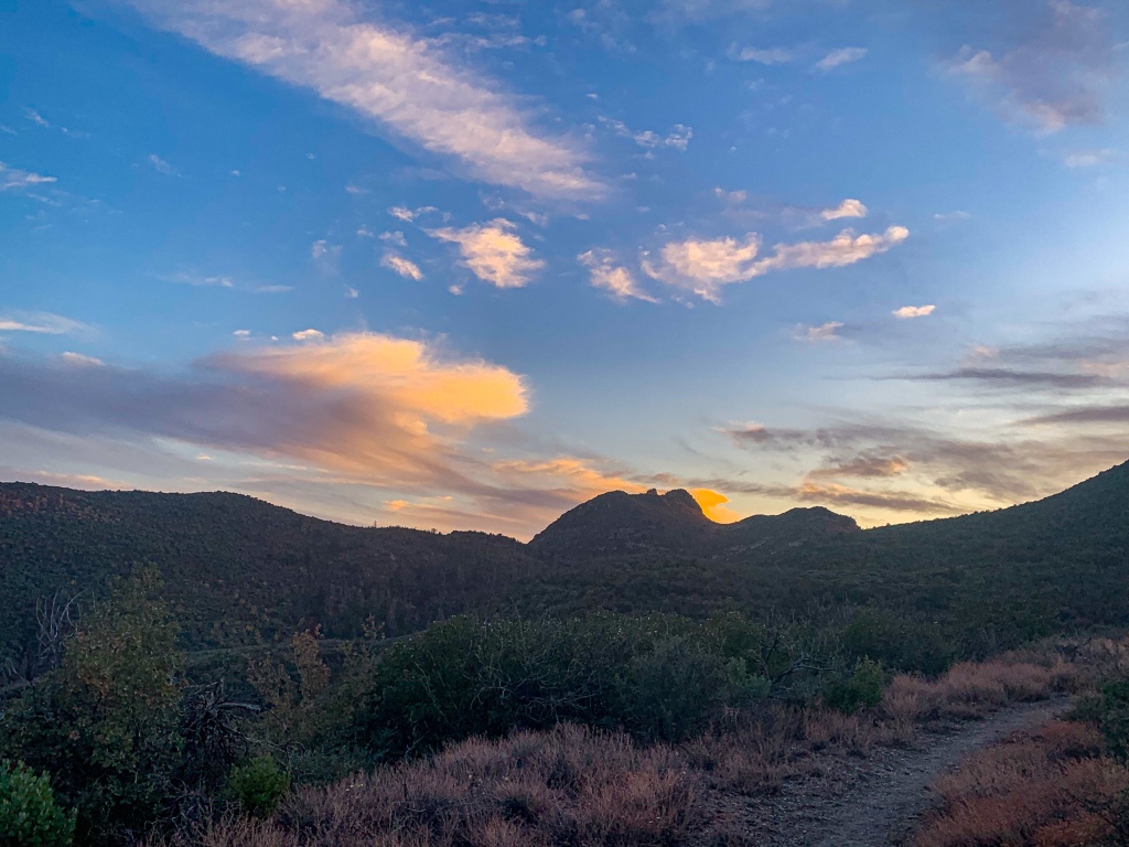
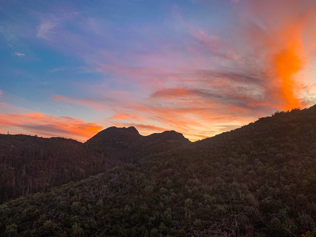
Sunset & Overnight Camp
Another spectacular sunset emerges against the backdrop of the red rock of the mountains and green vegetation on the slopes.

AZT Passage 21, Saddle Mountain
Mazatzal Wilderness
Tonto National Forest
AZT Passage 21, Saddle Mountain
Mazatzal Wilderness
Tonto National Forest
AZT Passage 21, Saddle Mountain
Mazatzal Wilderness
Tonto National Forest
AZT Passage 21, Saddle Mountain
Mazatzal Wilderness
Tonto National Forest

AZT Passage 21, Saddle Mountain
Mazatzal Wilderness
Tonto National Forest
AZT Passage 21, Saddle Mountain
Mazatzal Wilderness
Tonto National Forest

AZT Passage 21, Saddle Mountain
Mazatzal Wilderness
Tonto National Forest
One of my favorite wildlife encounters on the trail occurred at the end of the evening following this day. I was lying in my sleeping bag under the stars after a classic Arizona sunset when I heard a sound near the foot of my sleeping bag. I picked up my headlamp and turned it on to see a Mazatzal fox scurrying around the campsite and trail. When it saw my light, it looked up a then lay down on the ground as if it thought that would get it out of the light and make it invisible before running off. The cycle repeated several times; it seemed quite playful.
The Mazatzal Mountains
This stretch of the Arizona Trail lies within the Mazatzal Wilderness in the Tonto National Forest. The origin of the name “Mazatzal” is unclear, though one possible meaning is a Nahuatl term meaning “place of the deer.” The Wilderness, which the trail will remain within now until just shy of Sunflower in the central Mazatzals, is about 390 square miles in size and surrounds the Mazatzal Mountains. It was one of the original Wilderness Areas designated upon the passage of the Wilderness Act in 1964.
The Mazatzal Mountains themselves are an incredible place. Formed during an orogeny (a term referring to the process that creates mountains) when Arizona was a coastal region on the margin of what became North America, the Mazatzals gained their rugged nature as tectonic collisions compressed rock, lifting it and thrusting it above other rocks (overthrust). We’ll see the resulting folding in the entry of a short side hike on the Barnhardt Trail. Mazatzal Peak, the highest point of the Northern Mazatzals, towers 1700 ft above the trail with a jagged west face that makes it appear as though half the mountain was simply cut away. This passage passes through the northern half of the full range.
Unfortunately the area was greatly impacted by the Willow & Sunflower Fires, which burned much (though not all, as we will see) of the old ponderosa forest that had made the mountains one of the most popular long-distance stretches of the Arizona Trail.
Yet the incredible geology, solitude, sunsets, and views remain for the hardy and prepared souls who venture into this special place. Bagworms spin magnificent webs here, and temperatures are relatively tolerable outside of winter, when snow can make stretches impassable for those without adequate preparation.
Passage 22 (Saddle Mountain) Logistics & Ecology
| Passage 22 (Saddle Mountain) | |
| AZTA Passage Site & Map | Passage 22 (Saddle Mountain) Passage 22 Map |
| Trail Surface | Mostly dirt singletrack |
| Length | 16.6 miles |
| Season | All year, but snow can make sections impassable in winter. |
| Potential Water Sources | Creek (mi 309.9 NOBO/397.9 SOBO) Wash (mi 389.9 NOBO/398.8 SOBO) Rock Spring (mi 383.3 NOBO/ mi 401.4 SOBO) |
| Trailheads | North: Mt Peeley Trailhead South: Sunflower |
| Trailhead Access | North: Vehicle via Mt Peeley Road (closed in winter, not advised when wet) South: Sunflower (park at gate on FR 22) |
| Wilderness | Yes, partially |
| Possible resupply points | Sunflower, W |
| ATA-Rated Difficulty | Moderate |
| Potential campsites (mileages S to N) | Mt Peeley Trailhead (mi 401.5 NOBO/387.3 SOBO) Occasional spots in steep terrain on sides of mountains |
| Ecosystems Traversed | Rocky Mountain Relict Conifer Woodland Great Basin Conifer Woodland Interior Chaparral Semidesert grassland |
| Hazards | Lightning on ridgelines Water availability |
| Highlights | Views of Mazatzal Mountains and Four Peaks Mazatzal Mountains Geology |
Arizona Trail: Passage 22 (Saddle Mountain) Ecology
| Interior Chaparral | Great Basin Conifer Woodland | Rocky Mountain Montane Conifer Woodland | |
| Common Trees/Shrubs | * Birchleaf Mahogany * Ceanothus * Holly-leaf buckthorn * Manzanita * Shrub live oak * Silktassels * Stansbury cliffrose | * Arizona alder * Holly-leaf buckthorn * Junipers * Oaks, including Arizona oak, canyon live oak, Emory oak, Gambel oak, scrub-live oak * Piñon pine * Red barberry * Serviceberry * Silktassels * Skunkbush * sugar sumac | * Ponderosa Pine * Southwestern white pine * Subalpine fir * White fir * Rocky Mountain maple * Bigtooth maple * Grey alder * Red birch * Red osier dogwood * Cliffbush * Mallow ninebark * New Mexican locust * huckleberry * bilberries |
| Common herbaceous plants | * Buckwheats * Globemallows * Lupines * Penstemons * Sego-lily * Wormwood | * fringed brome * Geyer’s sedge/elk sedge * Ross’ sedge * Bronze sedge/dry land sedge/hillside sedge/hay sedge/Fernald’s hay sedge * screwleaf muhly * bluebunch wheatgrass * Spruce-fir fleabane * wild strawberry/Virginia strawberry * Small-flowered woodrush * mountain sweet Cicely * bittercress ragwort * western meadow-rue * Fendler’s meadow-rue | |
| Common succulents | * Agaves – golden flowered, Parry’s, Toumey’s * Banana & soap tree yucca * Barrel cactus * beargrass * beehive cactus * buckhorn cholla * Cane Cholla * hedgehog cacti * prickly pear cacti * Rock echeveria * Sotol * Whipple’s cholla | * beehive cactus * Claret cup hedgehog cacti * Golden-flowered agave * Parry’s agave * Prickly pear cacti * Whipple cholla * Tonto Basin agave |
| Passage 22 (Saddle Mountain) | |
| AZTA Passage Map | AZTA Passage 22 Profile |
| AZTA Elevation Profile | AZTA Elevation Profile |
| AZTA Passage Map | Passage 22 (Saddle Mountain) |
| Trail Surface | Dirt singletrack |
| Length (Mi) | 24.3 |
| Season | All year, but snow can make sections impassable in winter. |
| Potential Water Sources | Thicket Spring (Mi 402.3 NB, 386.4 SB) Sycamore Creek Canyon (mi 400.6 NB, 388.1 SB) Creek (mi 392.5 NB, 396.2 SB) Wash (mi 391.5 NB, 397.2 SB) Stock Pond (mi 390.5 NB, 398.2 SB) Rock Spring (mi 388.9 NB, 399.8 SB) Hiker box at AZ 87 (mi 386.7 NB, 402 SB) |
| Trailheads | North: Mt Peeley Trailhead South: Arizona 87 near Sunflower |
| Trailhead Access | North: Foot & 0.5 mi hike on Cornucopia Trail from dirt road trailhead South: |
| Wilderness | 50% |
| Possible resupply points | None |
| ATA-Rated Difficulty | Moderate |
| Potential campsites (mileages S to N) | There are a number of options, particularly on the southern third of the passage. There are also good sites in the area around McFarland Canyon and a few sites just south of that point. |
| Ecosystems Traversed | Interior Chaparral Great Basin Conifer Woodland Rocky Mountain Montane Conifer Woodland Relict Conifer Woodland |
| Interior Chaparral | Great Basin Conifer Woodland | Rocky Mountain Montane Conifer Woodland | |
| Common Trees/Shrubs | * Birchleaf Mahogany * Ceanothus * Holly-leaf buckthorn * Manzanita * Shrub live oak * Silktassels * Stansbury cliffrose | * Arizona alder * Holly-leaf buckthorn * Junipers * Oaks, including Arizona oak, canyon live oak, Emory oak, Gambel oak, scrub-live oak * Piñon pine * Red barberry * Serviceberry * Silktassels * Skunkbush * sugar sumac | * Ponderosa Pine * Southwestern white pine * Subalpine fir * White fir * Rocky Mountain maple * Bigtooth maple * Grey alder * Red birch * Red osier dogwood * Cliffbush * Mallow ninebark * New Mexican locust * huckleberry * bilberries |
| Common herbaceous plants | * Buckwheats * Globemallows * Lupines * Penstemons * Sego-lily * Wormwood | * fringed brome * Geyer’s sedge/elk sedge * Ross’ sedge * Bronze sedge/dry land sedge/hillside sedge/hay sedge/Fernald’s hay sedge * screwleaf muhly * bluebunch wheatgrass * Spruce-fir fleabane * wild strawberry/Virginia strawberry * Small-flowered woodrush * mountain sweet Cicely * bittercress ragwort * western meadow-rue * Fendler’s meadow-rue | |
| Common succulents | * Agaves – golden flowered, Parry’s, Toumey’s * Banana & soap tree yucca * Barrel cactus * beargrass * beehive cactus * buckhorn cholla * Cane Cholla * hedgehog cacti * prickly pear cacti * Rock echeveria * Sotol * Whipple’s cholla | * beehive cactus * Claret cup hedgehog cacti * Golden-flowered agave * Parry’s agave * Prickly pear cacti * Whipple cholla * Tonto Basin agave |
company gold ira
Well this post certainly made me think! Thank You-I wouldn’t have thought of things this way otherwise.
Air Duct Cleaning
Thank you for your help and this post. It’s been great.