Thruhiking the Arizona Trail: Passages 31 (Walnut Canyon) & 30 (Anderson Mesa)
Backpacking the AZT Day 30
Trans-Arizona/Utah Hiking Day 37
In the land of Arizona
Through desert heat or snow
Winds a trail for folks to follow
From Utah to Old Mexico
It’s the Arizona Trail
A pathway through the great Southwest
A diverse track through wood and stone
Your spirit it will test
Oh, sure you’ll sweat and blister
You’ll feel the miles every day
You’ll shiver at the loneliness
Your feet and seat will pay
But you’ll see moonlight on the borderlands
You’ll see stars on the Mogollon
You’ll feel the warmth of winter sun
And be thrilled straight through to bone
The aches and pains will fade away
You’ll feel renewed and whole
You’ll never be the same again
With Arizona in your soul
Along the Arizona Trail
A reverence and peace you’ll know
Through deserts, canyons, and mountains
From Utah to Old Mexico
-“The Arizona Trail,” Dale R. Shewalter
Welcome back to Aspen’s Tracks, thruhiking the Arizona Trail as part of a 900 mile hike across Utah and Arizona to Mexico.
Marshall Mesa Tank-Marshall Lake
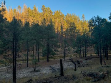
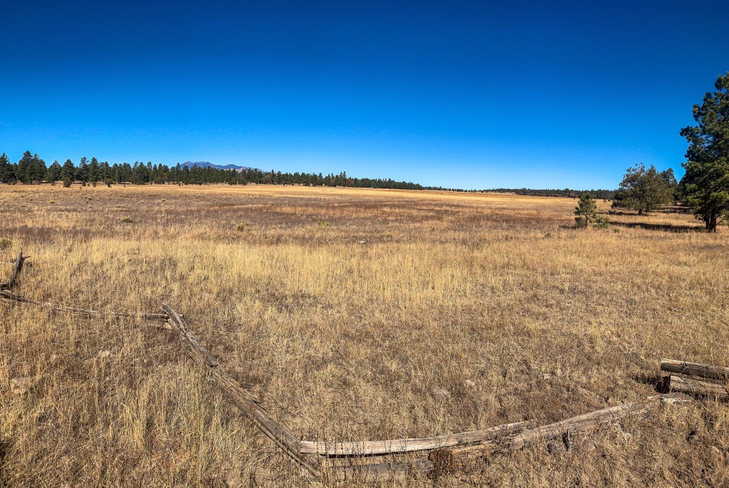
I’m packed up from yesterday’s camp near Marshall Mesa Tank and on the trail by mid morning after unfortunately misplacing a tent stake that costs me some time. No more extra stakes now. I encounter two dayhikers and talk about my time on the trail with them. The trail exits ponderosa forest as it crests Anderson Mesa and then enters PJ scrub with some ponderosa mixed in.
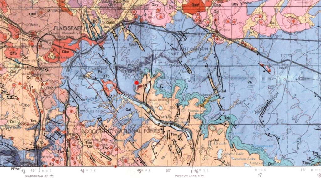
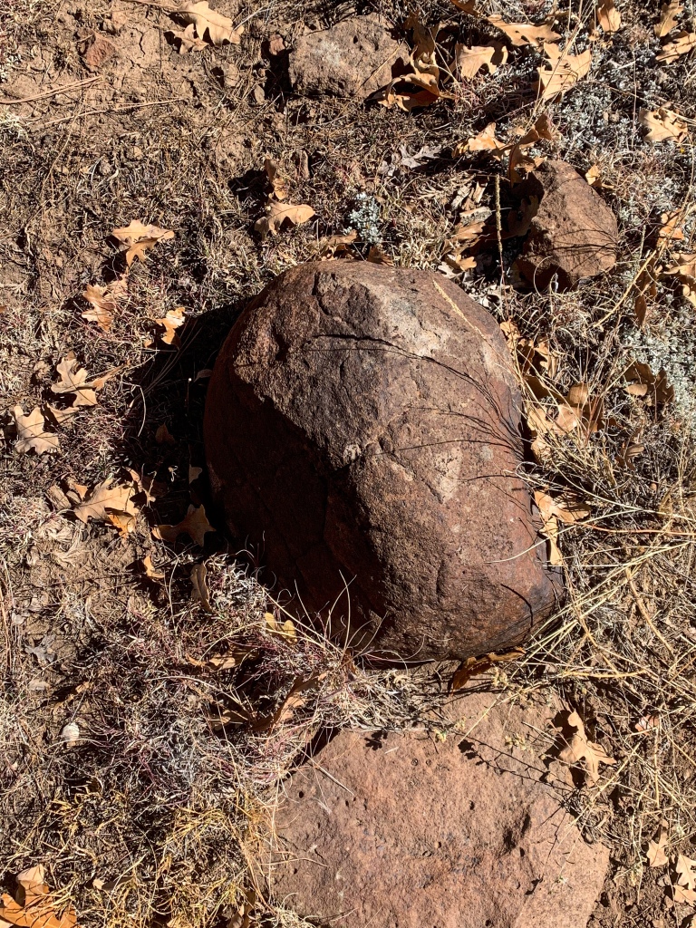
The volcanic rocks from north of the Peaks has returned and covers nearly the entire top of the Mesa – looking at a geologic map of the area, my initial thought of basalt appears to be correct.

Arizona Trail, Passage 31 (Walnut Canyon)
Coconino National Forest
AZT Passage 31 (Walnut Canyon)
Coconino National Forest
Arizona Trail Passage 31 (Walnut Canyon)
Coconino National Forest
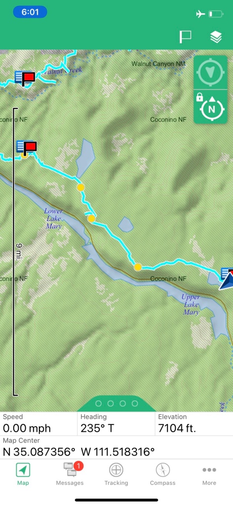
Arizona Trail: Marshall Lake-Lowell Observatory NPOI
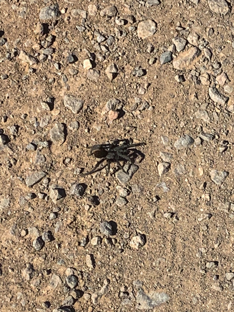
The trail passes numerous small lakes that serve as important waterfowl habitat and are managed as livestock exclosures. I spot a big tarantula – no doubt this time, unlike the one that I saw back on Passage 39 at Grand Canyon – on the trail just south of Marshall Lake where I pass from Passage 31 to Passage 30, Mormon Lake.
Coconino National Forest
AZT Passage 30, Coconino National Forest

Coconino National Forest

Arizona Trail, Passage 30 (Mormon Lake)
Coconino National Forest

Arizona Trail, Passage 30 (Mormon Lake)
Coconino National Forest
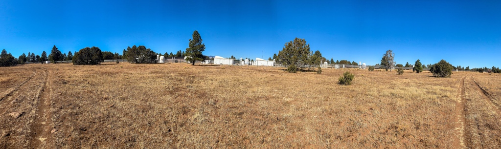
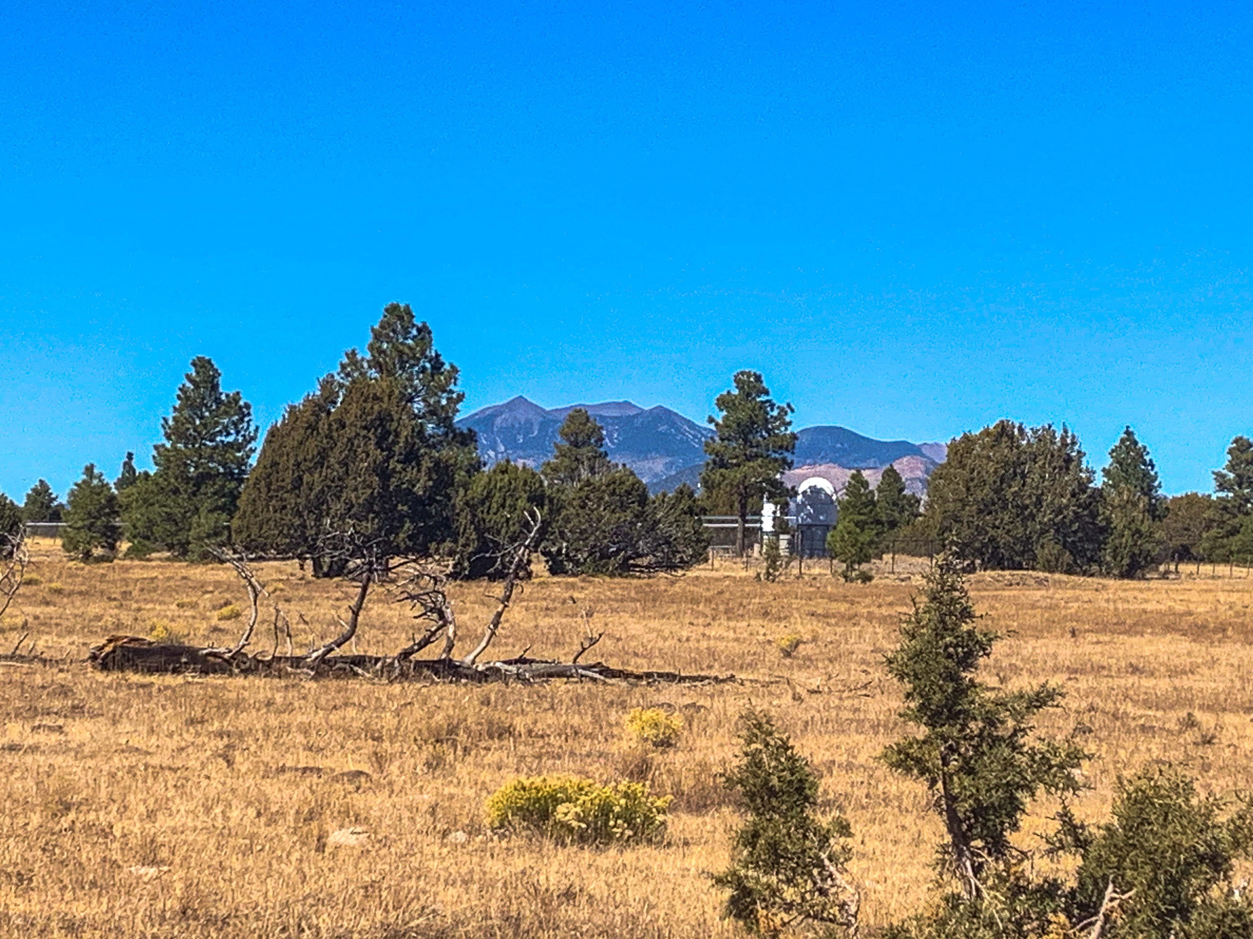
Lowell Observatory NPOI-Lake Mary Overlook
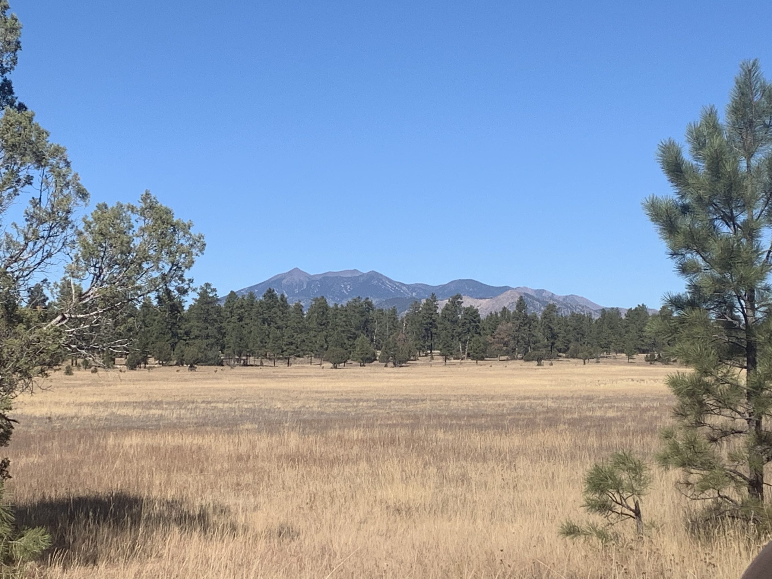
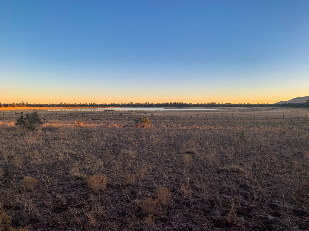
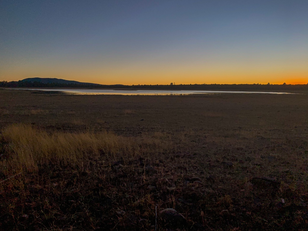
The trail reaches Lowell Observatory’s Navy Precision Optical Interferometer (NPOI). The NPOI measures precise relative positions of stars in the sky for the Naval Observatory to use as reference when determining geographic positions of locations on both Earth and in space, as well as for use in timekeeping. Over four football fields long, it uses a six-mirror array directing multiple light beams from a star to a single point, enhancing image detail and separating stars that are so close that even the largest conventional telescopes cannot separate them visually. Near the NPOI is an excellent view of Upper Lake Mary in the valley of Walnut Creek below, after which the trail continues across Anderson Mesa.
AZT Passage 30 (Mormon Lake)
Coconino National Forest
Arizona Trail, Passage 30, Coconino National Forest
Price Lake along the Arizona Trail
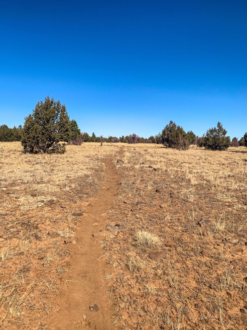
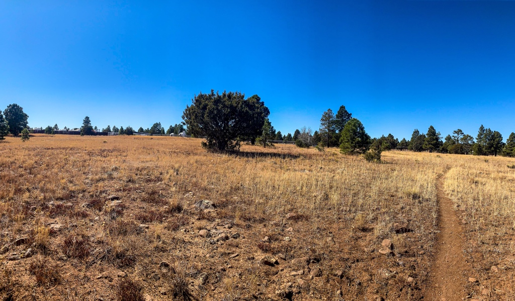
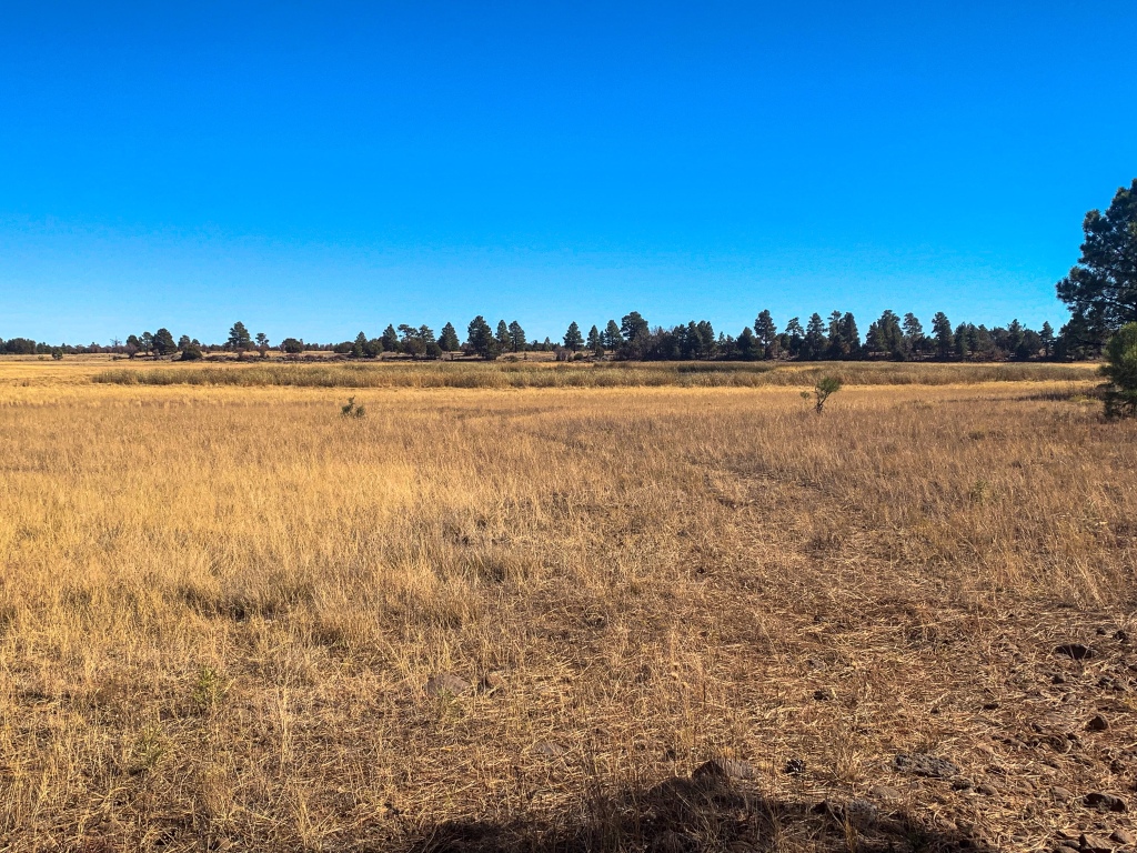
Arizona Trail, Passage 30 (Anderson Mesa)
Coconino National Forest
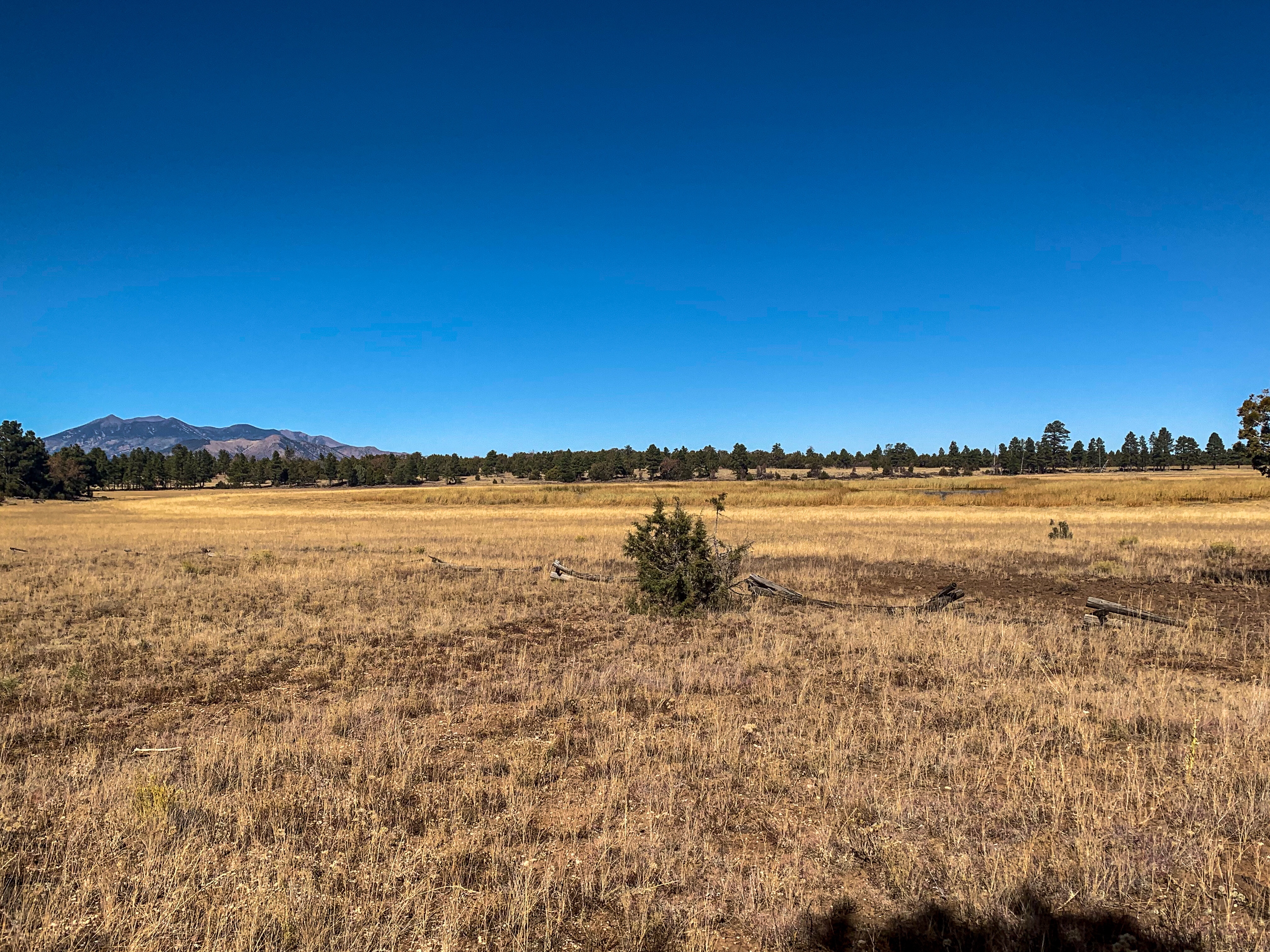
Arizona Trail, Passage 30 (Anderson Mesa)
Coconino National Forest
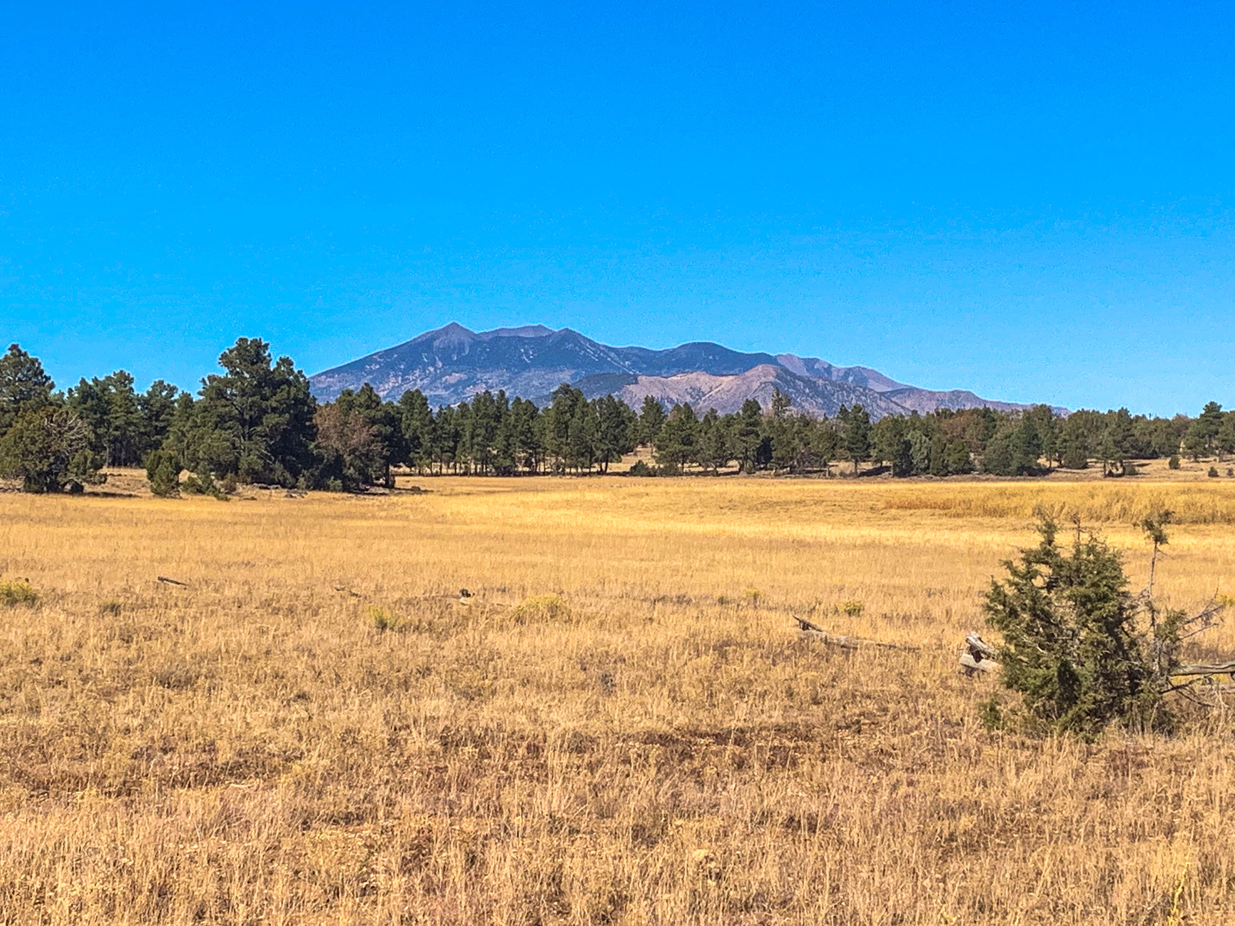
Arizona Trail, Passage 30 (Anderson Mesa)
Coconino National Forest
Arizona Trail, Passage 30 (Anderson Mesa)
Coconino National Forest
Arizona Trail, Passage 30 (Anderson Mesa)
Coconino National Forest

Arizona Trail, Passage 30 (Anderson Mesa)
Coconino National Forest

Arizona Trail, Passage 30 (Anderson Mesa)
Coconino National Forest
Arizona Trail, Passage 30 (Anderson Mesa)
Coconino National Forest

243+ miles down, 558 to go!
Arizona Trail, Passage 30 (Anderson Mesa)
Coconino National Forest
Arizona Trail: Lake Mary Overlook-Horse Lake
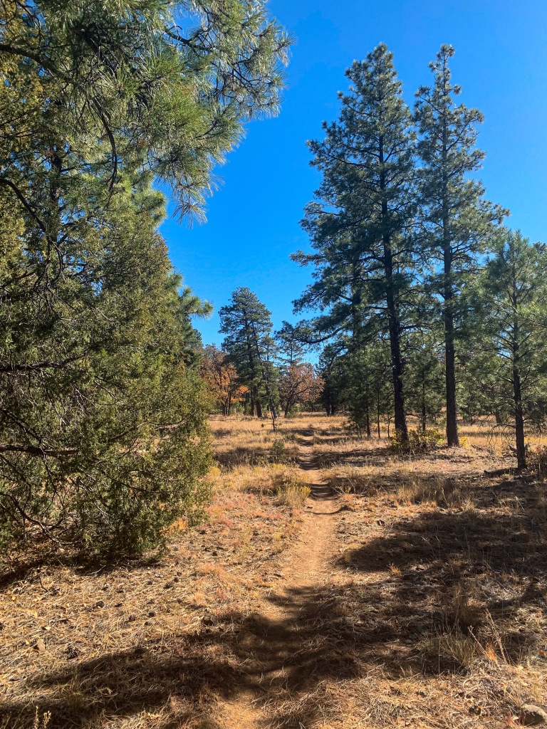
Departing the view of Lake Mary, the trail continues to cross Anderson Mesa, ultimately reaching Horse Lake toward the south end of the crossing. After reaching Horse Lake, I make camp for the night. The sky is black as coal and the night is filled with coyotes howling. Hoping to make it to Mormon Lake tomorrow, I decided not to set up the tent tonight to have extra time in the morning. We shall see if that pays off.

Arizona Trail, Passage 30 (Anderson Mesa)
Coconino National Forest

Arizona Trail, Passage 30 (Anderson Mesa)
Coconino National Forest

Arizona Trail, Passage 30 (Anderson Mesa)
Coconino National Forest
Arizona Trail, Passage 30 (Anderson Mesa)
Coconino National Forest

Belt of Venus and Umbra rising in sky
AZT Passage 30, Coconino National Forest
Passages 31 & 30 Logistics & Ecology Information
| Passage 31 (Walnut Canyon) | Passage 30: Anderson Mesa | |
| AZTA Passage Pages | Passage 31 (Walnut Canyon) | Passage 30: Anderson Mesa |
| Trail Surface | Dirt singletrack | Singletrack. Basalt lava with soil covering. |
| Length (Mi) | 18.5 | 17.8 |
| Season | April-October. Snow can be significant in winter. | April-October. Snow can be significant in winter. |
| Potential Water Sources | Walnut Canyon Visitor Center Wildlife Water Tank (217.5 SOBO, 571.2 NOBO) Wildlife Water Tank (220.2 SOBO, 568.5 NOBO) | Marshall Lake & Lower Tank (230.2 SOBO, 558.5 NOBO) Prime Lake (231.3 SOBO, 557.4 NOBO) Vail Lake (232.7 SOBO, 556.0 NOBO Lakeview Campground (mid-May to mid-October; 234.5 SOBO, 554.2 NOBO) Horse Lake Tank (237.1 SOBO, 551.6 NOBO) Pine Grove Campground (mid-May to mid-October; 241.3 SOBO, 547.4 NOBO) Railroad Tank (242.7 SOBO, 545.9 NOBO) Mayflower Spring (247.8 SOBO, 540.9 NOBO) |
| Trailheads | North: I-40 at Cosnino Road South: Marshall Lake | North: Marshall Lake South: Mayflower Spring |
| Trailhead Access | Vehicular access | North: Graded dirt road South: Dirt road |
| Wilderness | No | No |
| Possible resupply points | East Flagstaff Flagstaff | None |
| ATA-Rated Difficulty | Easy | Moderate (rugged trail surface) |
| Potential campsites (mileages S to N) | Various LNT-compatible points throughout; terrain is not a limitation here. However, camping is not allowed on the west end below Fisher Point or within Walnut Canyon National Monument. | Various LNT-compatible sites throughout, especially on Mesa top. Basalt can prove challenging in places to find smooth spot. Developed Lakeview Campground and Pine Grove Campground. |
| Ecosystems Traversed | Rocky Mountain Montane Conifer Woodland | Great Basin Conifer Woodland (Marshall Lake Trailhead to descent from Anderson Mesa just north of Lake Mary Road) Rocky Mountain Montane Conifer Woodland (just north of Lake Mary Road to Mayflower Spring) |
| Sites of Interest | Walnut Canyon National Monument Fisher Point | Views of San Francisco Peaks & Mormon Mountain Lowell Observatory’s NPOI (Naval Precision Optical Intterferometer) |
| Great Basin Conifer Woodland | Rocky Mountain Montane Conifer Woodland | |
| Common Trees/Shrubs | * Arizona alder * Holly-leaf buckthorn * Junipers * Oaks, including Arizona oak, canyon live oak, Emory oak, Gambel oak, scrub-live oak * Piñon pine * Red barberry * Serviceberry * Silktassels * Skunkbush * sugar sumac | * Ponderosa Pine * Southwestern white pine * Subalpine fir * White fir * Rocky Mountain maple * Bigtooth maple * Grey alder * Red birch * Red osier dogwood * Cliffbush * Mallow ninebark * New Mexican locust * huckleberry * bilberries |
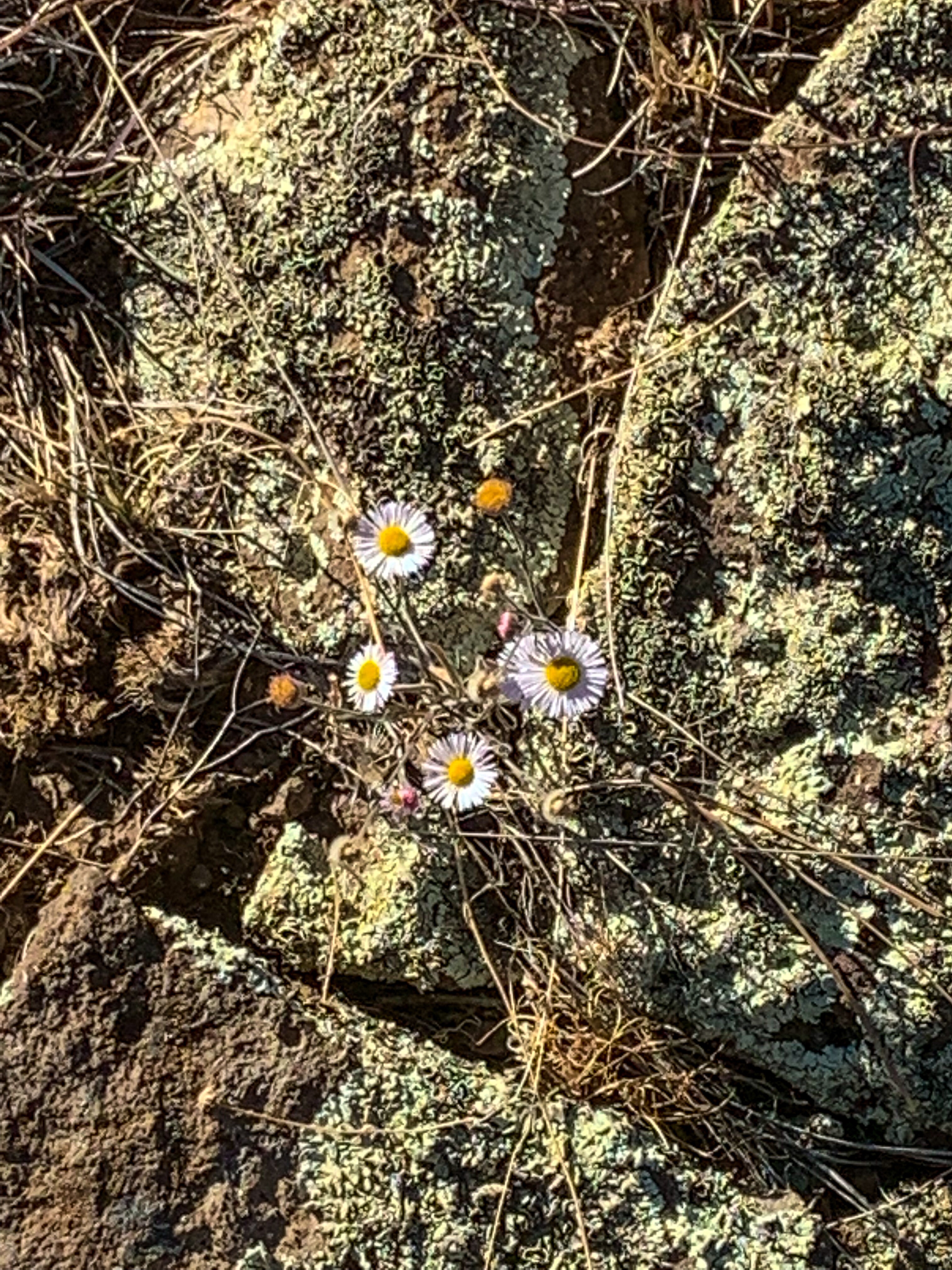
| Common herbaceous plants | * Buckwheats * Globemallows * Lupines * Penstemons * Sego-lily * Wormwood | * fringed brome * Geyer’s sedge/elk sedge * Ross’ sedge * Bronze sedge/dry land sedge/hillside sedge/hay sedge/Fernald’s hay sedge * screwleaf muhly * bluebunch wheatgrass * Spruce-fir fleabane * wild strawberry/Virginia strawberry * Small-flowered woodrush * mountain sweet Cicely * bittercress ragwort * western meadow-rue * Fendler’s meadow-rue |
| Common succulents | * beehive cactus * Claret cup hedgehog cacti * Golden-flowered agave * Parry’s agave * Prickly pear cacti * Whipple cholla * Tonto Basin agave |