Backpacking the Arizona Trail: Passages 27 (Highline)
AZT Thruhike, Day 37
Trans-Arizona/Utah Hike, Day 44
In the land of Arizona
Through desert heat or snow
Winds a trail for folks to follow
From Utah to Old Mexico
It’s the Arizona Trail
A pathway through the great Southwest
A diverse track through wood and stone
Your spirit it will test
Oh, sure you’ll sweat and blister
You’ll feel the miles every day
You’ll shiver at the loneliness
Your feet and seat will pay
But you’ll see moonlight on the borderlands
You’ll see stars on the Mogollon
You’ll feel the warmth of winter sun
And be thrilled straight through to bone
The aches and pains will fade away
You’ll feel renewed and whole
You’ll never be the same again
With Arizona in your soul
Along the Arizona Trail
A reverence and peace you’ll know
Through deserts, canyons, and mountains
From Utah to Old Mexico
-“The Arizona Trail,” Dale R. Shewalter
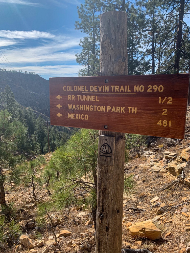
Mogollon Rim-Washington Park
Day 39 on the Arizona Trail. It’s another chilly morning, camped directly on the Mogollon Rim. I’ll be dropping several thousand feet today to the base. I make a short deviation back to General Springs Cabin and spot a historical sign relating to a local conflict between early settlers and native Apaches. (There’s another marker for the same battle further north, by the canyon that passed through on Clear Creek yesterday.)
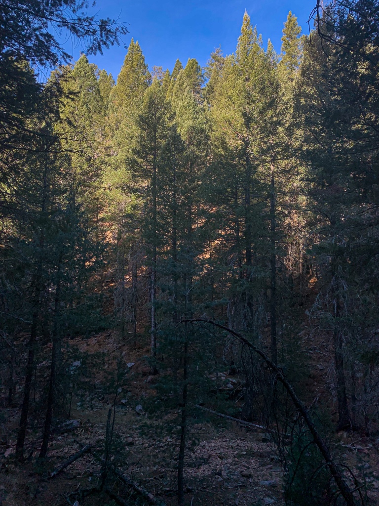
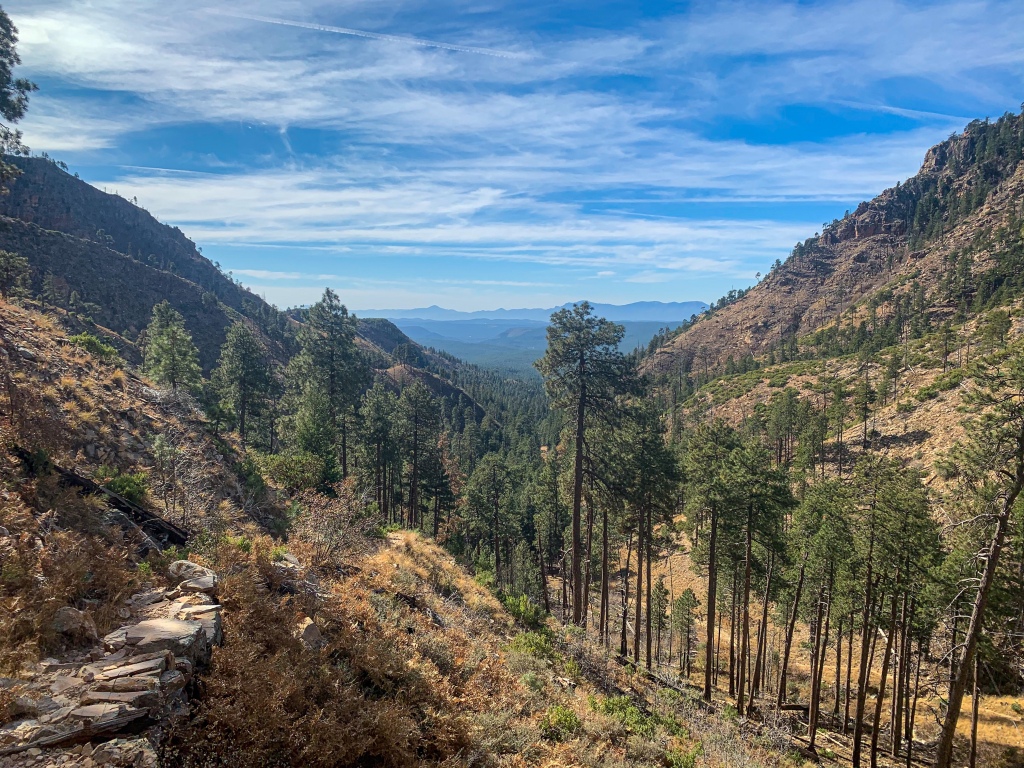
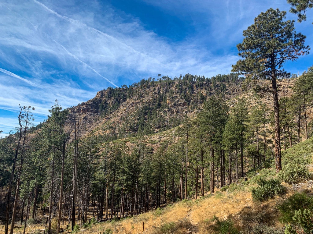
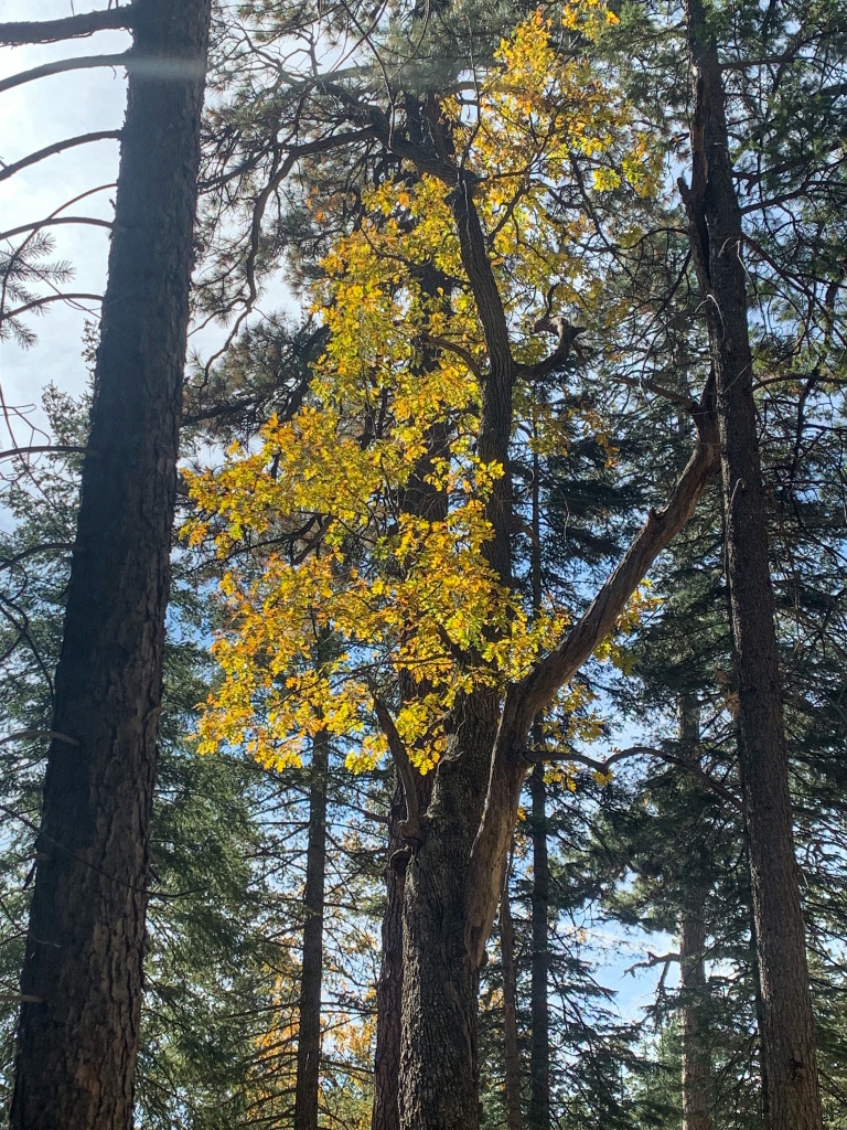
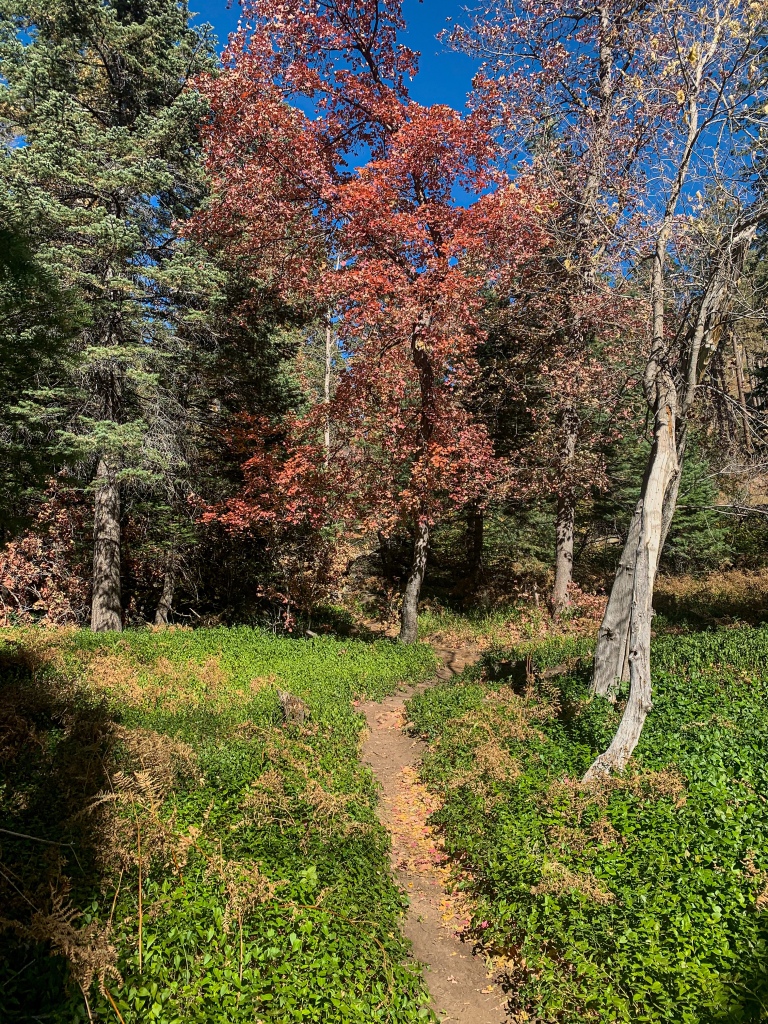
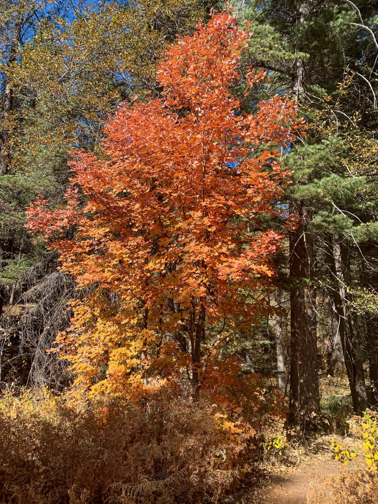
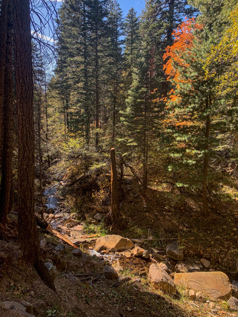
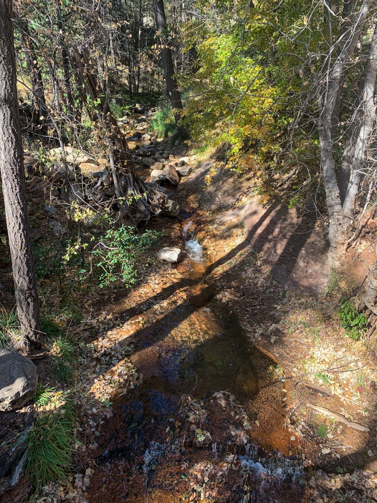
After checking out the cabin and packing up, it’s time to head down off the rim. The descent passes a cool railroad tunnel on a short spur, and since the temperature warms as the elevation drops, fall is still lingering on the descent. A sizeable stream, the start of the East Verde River, also runs along the trail all the way down to Washington Park at the base.
The East Verde is the second of four rivers crossed by the Arizona Trail, and the only one to be crossed twice. I’ll encounter it again in a few days starting the ascent into the Mazatzal Mountains. (The other three rivers are the Colorado, in Grand Canyon; the Salt, east of Phoenix, splitting the Mazatzals and the Superstition Mountains; and the Gila, southeast of Phoenix in Pinal County.)
At this point, the trail completes its lengthy traverse of the Coconino National Forest (which the trail had passed through almost exclusively since north of the San Francisco Peaks) and enters the Tonto National Forest. More to come tomorrow about the beginning of the traverse across the magnificent Highline Trail from Washington Park to Pine, with its incredible views of the Mogollon Rim.

Arizona Trail Passage 28, Blue Ridge
Coconino National Forest
Arizona Trail Passage 28, Blue Ridge
Coconino National Forest

Arizona Trail Passage 28, Blue Ridge
Coconino National Forest

Arizona Trail Passage 28, Blue Ridge
Coconino National Forest
Arizona Trail Passage 27, Highline
Coconino National Forest/Tonto National Forest border
Arizona Trail Passage 27, Highline
Tonto National Forest

Arizona Trail Passage 27, Highline
Tonto National Forest
Arizona Trail Passage 27, Highline
Tonto National Forest

Arizona Trail Passage 27, Highline
Railroad Tunnel Spur
Tonto National Forest
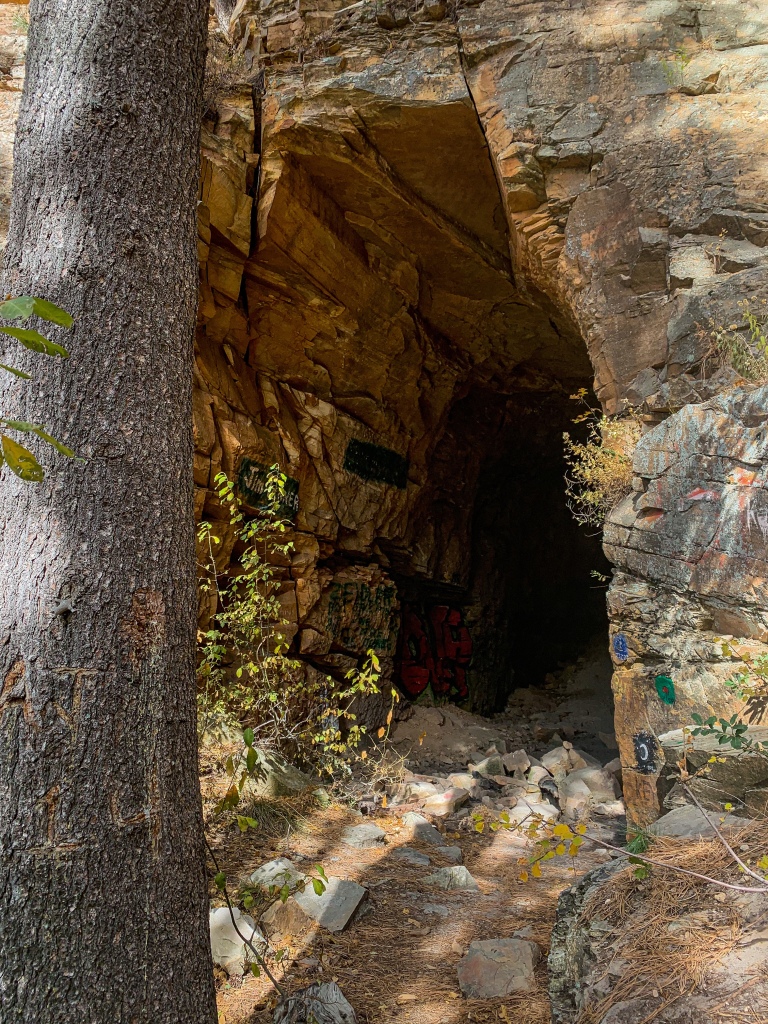
Arizona Trail Passage 27, Highline
Railroad Tunnel Spur
Tonto National Forest

Arizona Trail Passage 27, Highline
Tonto National Forest

Arizona Trail Passage 27, Highline
Tonto National Forest

Arizona Trail Passage 27, Highline
Tonto National Forest

Arizona Trail Passage 27, Highline
Tonto National Forest

Arizona Trail Passage 27, Highline
Tonto National Forest
Arizona Trail Passage 27, Highline
Tonto National Forest

Arizona Trail Passage 27, Highline
Tonto National Forest

Arizona Trail Passage 27, Highline
Tonto National Forest
Arizona Trail Passage 27, Highline
Tonto National Forest
Arizona Trail Passage 27, Highline
Tonto National Forest

Arizona Trail Passage 27, Highline
Tonto National Forest
Arizona Trail Passage 27, Highline
Tonto National Forest
Arizona Trail Passage 27, Highline
Tonto National Forest

Arizona Trail Passage 27, Highline
Tonto National Forest

Arizona Trail Passage 27, Highline
Tonto National Forest

One thought on “Thruhiking the Amazing, Spectacular Arizona Trail: Mogollon Rim-Washington Park”