
AZT Backpacking: Passages 43 & 42
Arizona Trail, Day 2
Arizona-Utah Day 9
AZT Passage 43, Buckskin Mountain
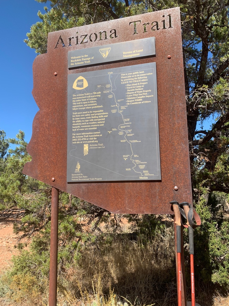
Welcome back to Aspen’s Tracks, thruhiking the Arizona Trail SOBO from Utah to Mexico. Today covers backpacking Passages 43 (Buckskin Mountain) and 42 (Kaibab Plateau North).
In the land of Arizona
Through desert heat or snow
Winds a trail for folks to follow
From Utah to Old Mexico
It’s the Arizona Trail
A pathway through the great Southwest
A diverse track through wood and stone
Your spirit it will test
Oh, sure you’ll sweat and blister
You’ll feel the miles every day
You’ll shiver at the loneliness
Your feet and seat will pay
But you’ll see moonlight on the borderlands
You’ll see stars on the Mogollon
You’ll feel the warmth of winter sun
And be thrilled straight through to bone
The aches and pains will fade away
You’ll feel renewed and whole
You’ll never be the same again
With Arizona in your soul
Along the Arizona Trail
A reverence and peace you’ll know
Through deserts, canyons, and mountains
From Utah to Old Mexico
-“The Arizona Trail,” Dale R. Shewalter
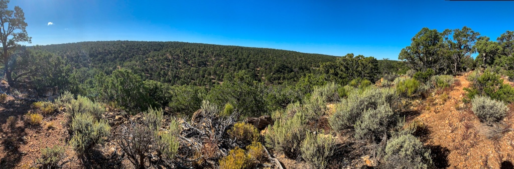
Arizona Trail Passage 43: Buckskin Mountain
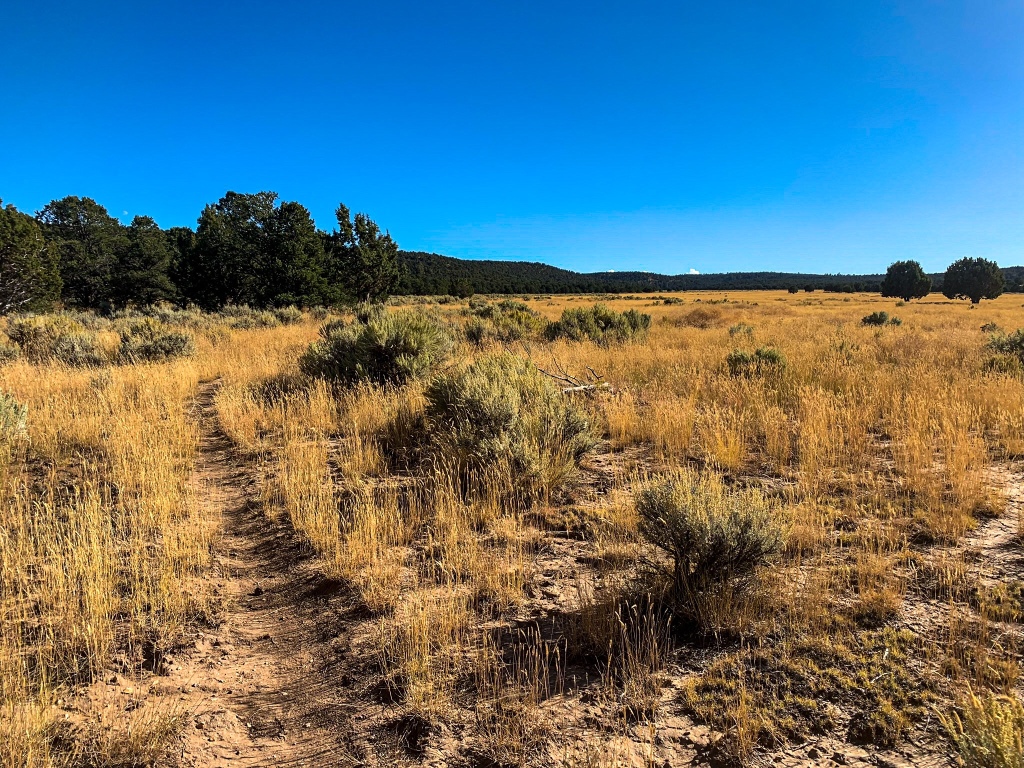
Another early start. I make it off Passage 43 (Buckskin Mountain) by mid morning and break into the northern Kaibab Plateau (Passage 42).
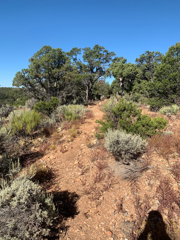
AZT Passage 43, Buckskin Mountain
AZT Passage 43, Buckskin Mountain
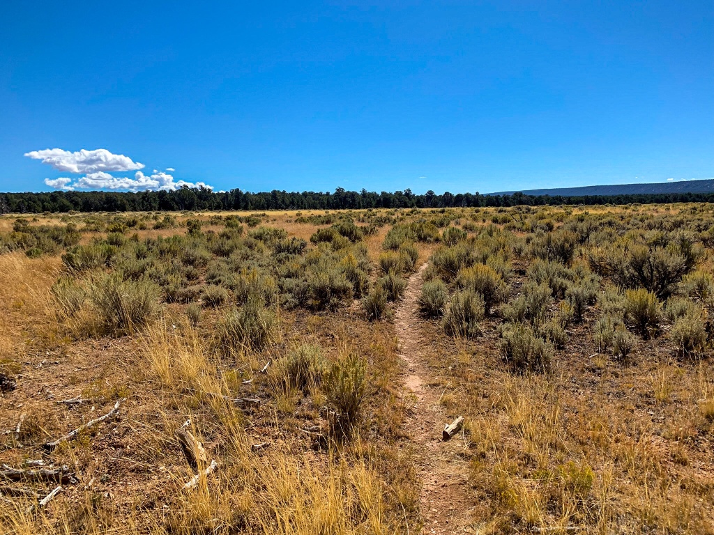
Arizona Trail Passage 42 (Kaibab Plateau North): Passage Boundary to Kaibab Plateau Ascent
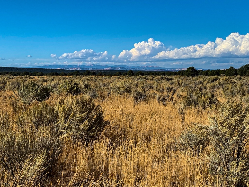
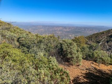
The land shifts from BLM land at the start and enters the Kaibab National Forest south of the Passage boundary. I’m having some issues charging given the intermittent shade cast by the continuing pinyon-juniper (PJ) forest landscape, so this will be brief. After a crossing of the Old Spanish Trail and long meadow section that ends near Government Reservoir, there’s a brisk climb to the end of the day after 14.3 miles.
Arizona Trail Passage 42, Kaibab Plateau North
AZT Passage 42, Kaibab Plateau North
Arizona Trail Passage 42, Kaibab Plateau North
Arizona Trail Passage 42, Kaibab Plateau North

Arizona Trail Passage 42, Kaibab Plateau North

AZT Passage 42, Kaibab Plateau North
Arizona Trail Passage 42, Kaibab Plateau North
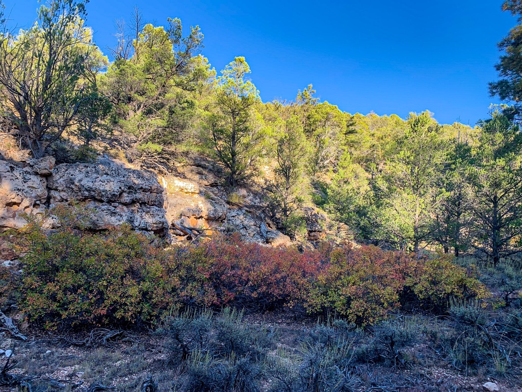
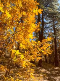
Some immense Kaibab Limestone outcrops are the highlight glowing gold in the evening light. I’ve broken into ponderosa forest and spotted some Gamble Oaks with tinges of fall color. It’s still pretty warm but fall is on the way.
Arizona Trail Passage 42, Kaibab Plateau North
Arizona Trail Passage 42, Kaibab Plateau North
Kaibab National Forest
AZT Passage 42, Kaibab Plateau North
Kaibab National Forest
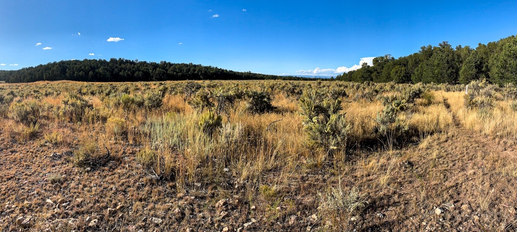
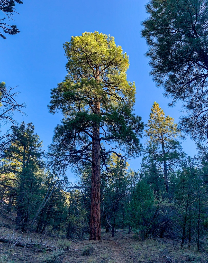
The shift from PJ to ponderosa forest represents the first major ecosystem change on a trail famed for its diversity, and it is indeed quite the shift from a landscape perspective. Instead of shorter trees and intermittent shade, interspersed with meadows offering more direct sunlight, the landscape now features mature ponderosa and widespread shading and much more filtered light.
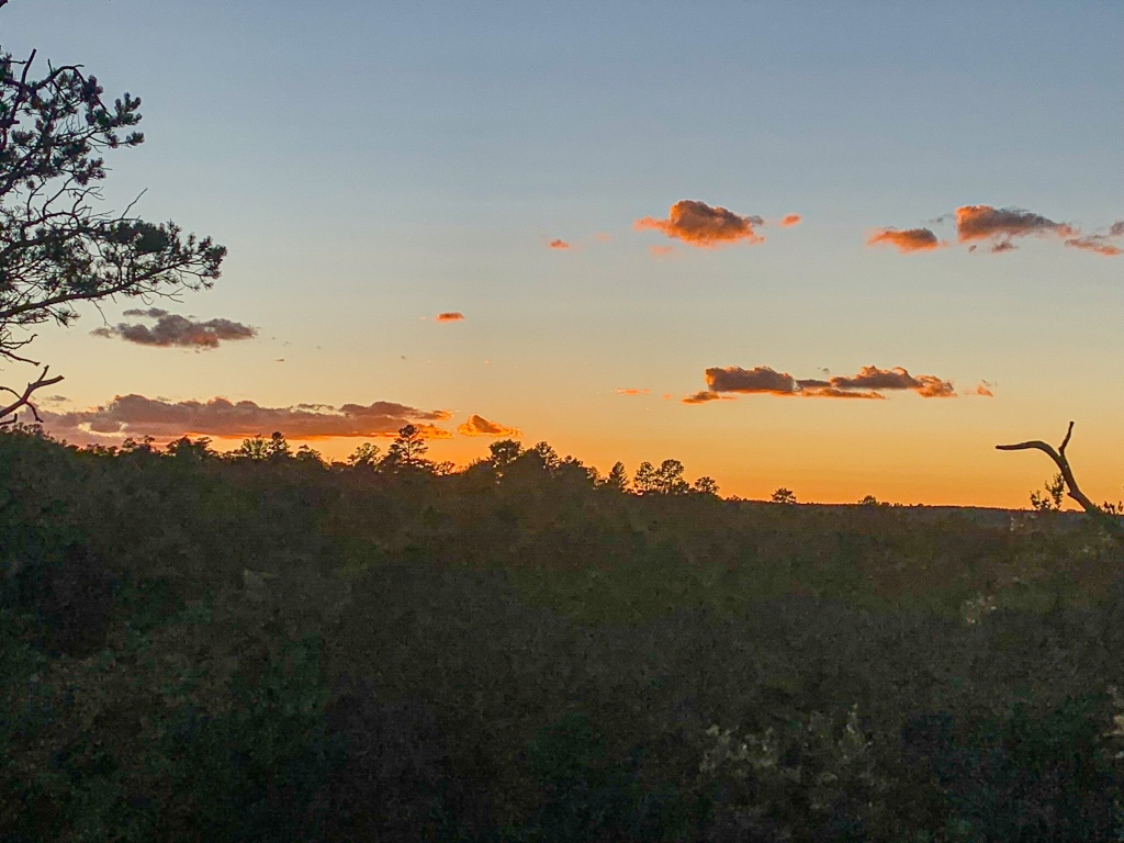
I should be to Jacob Lake in time for dinner tomorrow evening (and hopefully breakfast the following morning) before heading into the central Kaibab. Looking forward to my first real meal in 1-2 weeks.
Trail Logistics and Passage Ecology
| Passage 43 (Buckskin Mountain) | Passage 42 (Kaibab Plateau North) | |
| Passage Map | Passage 43 | Passage 42 |
| Trail Surface | Dirt singletrack | Dirt singletrack |
| Length (Mi) | 10.8 | 16.4 |
| Season | March-November. Lower elevations hot in summer with little shade. | Spring-Fall |
| Potential Water Sources | Seasonal tank (mi 4.1 SOBO/784.6 NOBO) Seasonal tank (mi 10.6 SOBO/778.1 NOBO) AZTA List | Rock Creek Apron (mi 13.3 SOBO/775.4 NOBO), off trail Government Reservoir (mi 17.8 SOBO/770.9 NOBO), off trail Ponderosa Trick Tank (mi 20.0 SOBO/768.7 NOBO), off trail Umbrella Tank (mi 20.3 SOBO/768.4 NOBO) Orderville Trick Tank (mi 21 SOBO/767.7 NOBO), off trail AZTA List |
| Trailheads | North: Utah border at Coyote Valley (mi 0 SOBO/788.7 NOBO) South: Winter Road Trailhead (mi 10.6 SOBO/778.1 NOBO) | North: Winter Road Trailhead (mi 10.6 SOBO/778.1 NOBO) South: US-89A east of Jacob Lake |
| Trailhead Access | Vehicular access to all trailheads | North: Vehicular access (dirt road) South: Vehicular access (paved road) |
| Wilderness | No | No |
| Possible resupply points | None | Jacob Lake |
| Difficulty | Easy | Easy to moderate |
| Potential campsites (mileages S to N) | Best near summit of Buckskin Mountain, after initial climb out of Coyote Valley/just before final descent into Coyote Valley. Developed campsite at Utah state line in Coyote Valley. | Good LNT-compatible sites through National Forest. I liked a spot right at the northern end of the ponderosa forest, at the north tip of the Kaibab itself. |
| Threats | Heat – wear a cotton shirt so you can soak it. Synthetics aren’t great in the desert. Hyponatremia – “drunk on water.” To avoid, ensure adequate salt & electrolyte intake and ensure you eat as well as drink water. Symptoms are almost identical to dehydration, but drinking more makes it worse. Prevention is by far the best solution. Dehydration Lightning | Heat – wear a cotton shirt so you can soak it. Synthetics aren’t great in the desert. Hyponatremia – “drunk on water.” To avoid, ensure adequate salt & electrolyte intake and ensure you eat as well as drink water. Symptoms are almost identical to dehydration, but drinking more makes it worse. Prevention is by far the best solution. Dehydration Lightning |
| Permits Required? | No | No |
| Cell service? | Limited | Limited to nonexistent |
| Ecosystems traversed | Great Basin Conifer Woodland | Great Basin Conifer Woodland Rocky Mountain Montane Conifer Forest |
| Great Basin Conifer Woodland | Rocky Mountain Montane Conifer Forest | |
| Common Trees/Shrubs | * Big sagebrush * Fernbush * Fremont barberry * Gambel oak * Hopbush * Mormon tea * Rabbitbrush * Serviceberry * Stansbury cliffrose * Junipers * Piñon pine | * Ponderosa Pine * Southwestern white pine * Subalpine fir * White fir * Rocky Mountain maple * Bigtooth maple * Grey alder * Red birch * Red osier dogwood * Cliffbush * Mallow ninebark * New Mexican locust * huckleberry * bilberries |
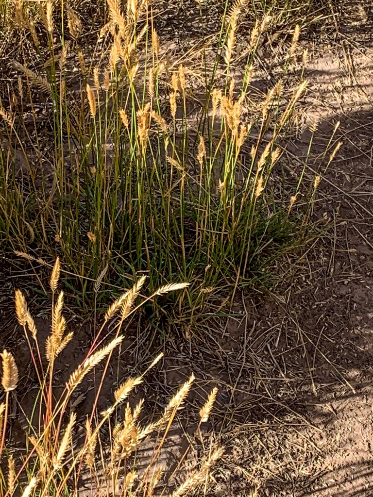
| Common herbaceous plants | * Cutleaf * Phacelia * Wild onions * Buckwheats * Bladderpods * Evening primrose * Penstemons * Sego-lily * Grasses such as muttongrass & squirreltail * Groundsel * Indian paintbrush * Locoweed * Phlox * Pinque rubberweed * Sedges, such as clustered field sedge & western sedge * Wild cabbage (unusual, thick stemmed) | * fringed brome * Geyer’s sedge/elk sedge * Ross’ sedge * Bronze sedge/dry land sedge/hillside sedge/hay sedge/Fernald’s hay sedge * screwleaf muhly * bluebunch wheatgrass * Spruce-fir fleabane * wild strawberry/Virginia strawberry * Small-flowered woodrush * mountain sweet Cicely * bittercress ragwort * western meadow-rue * Fendler’s meadow-rue |
| Common succulents | * Banana & Bailey’s yucca * Beehive cactus * Claret cup hedgehog cacti * Prickly pear cacti * Whipple cholla |
self directed precious metals ira
You can create interest in any topic! Bravo!