Thruhiking the AZT: Passages 20 & 19, Four Peaks & Superstition Wilderness
Arizona Trail Backpacking Day 60
Trans-Arizona/Utah Hiking Day 67
In the land of Arizona
Through desert heat or snow
Winds a trail for folks to follow
From Utah to Old Mexico
It’s the Arizona Trail
A pathway through the great Southwest
A diverse track through wood and stone
Your spirit it will test
Oh, sure you’ll sweat and blister
You’ll feel the miles every day
You’ll shiver at the loneliness
Your feet and seat will pay
But you’ll see moonlight on the borderlands
You’ll see stars on the Mogollon
You’ll feel the warmth of winter sun
And be thrilled straight through to bone
The aches and pains will fade away
You’ll feel renewed and whole
You’ll never be the same again
With Arizona in your soul
Along the Arizona Trail
A reverence and peace you’ll know
Through deserts, canyons, and mountains
From Utah to Old Mexico
-“The Arizona Trail,” Dale R. Shewalter
Tonto Basin to Inspiration Point
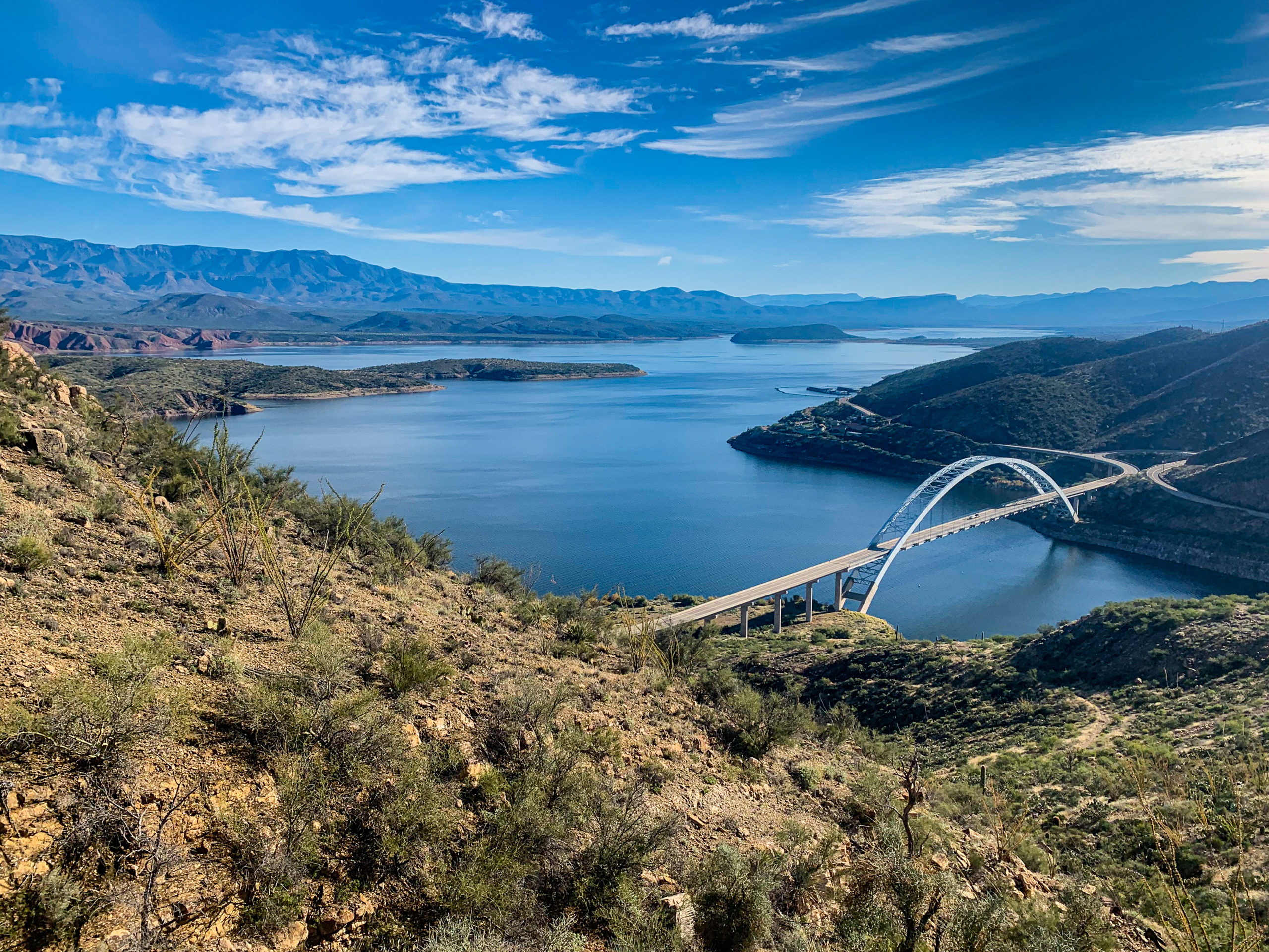
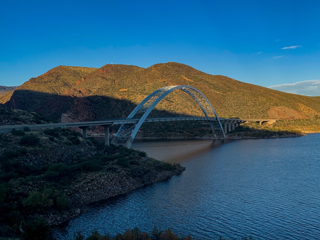
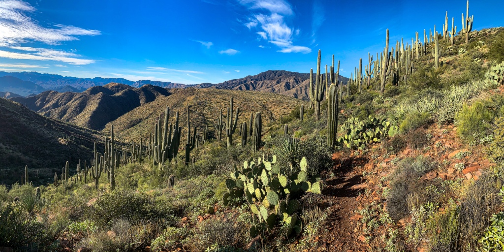
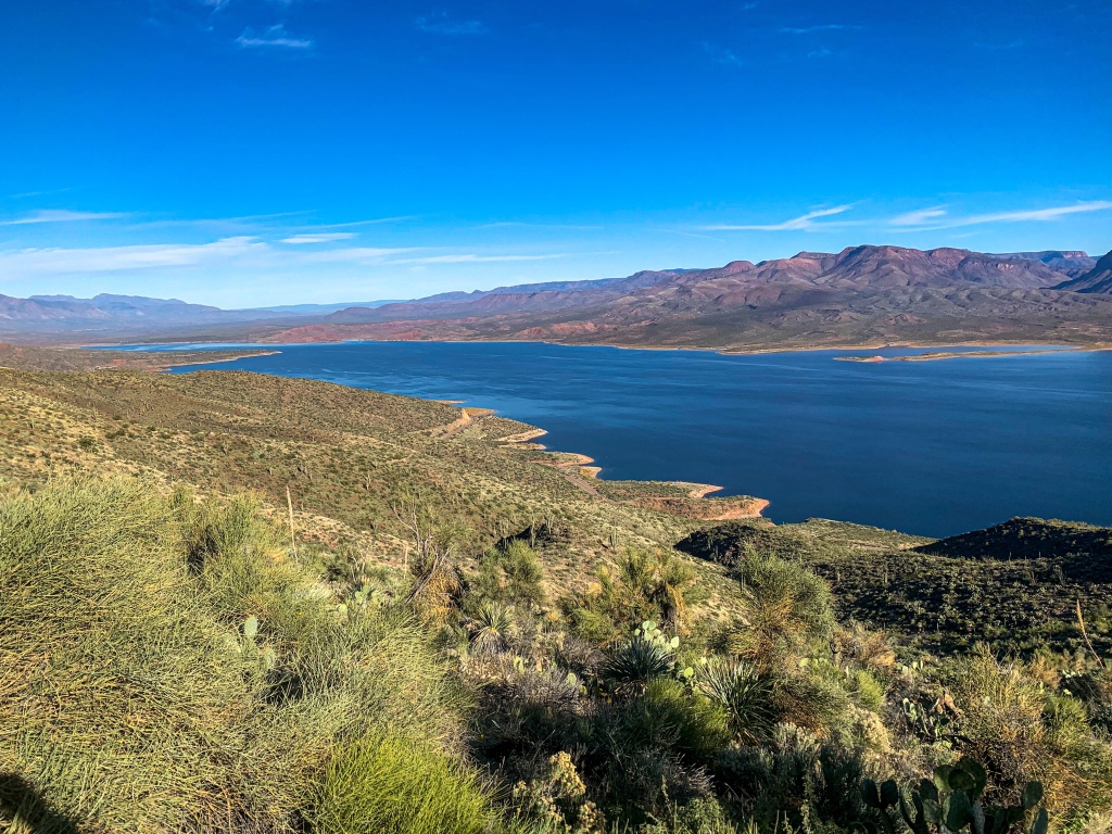
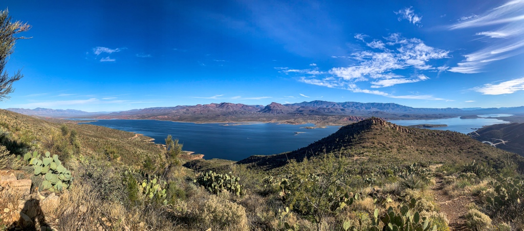
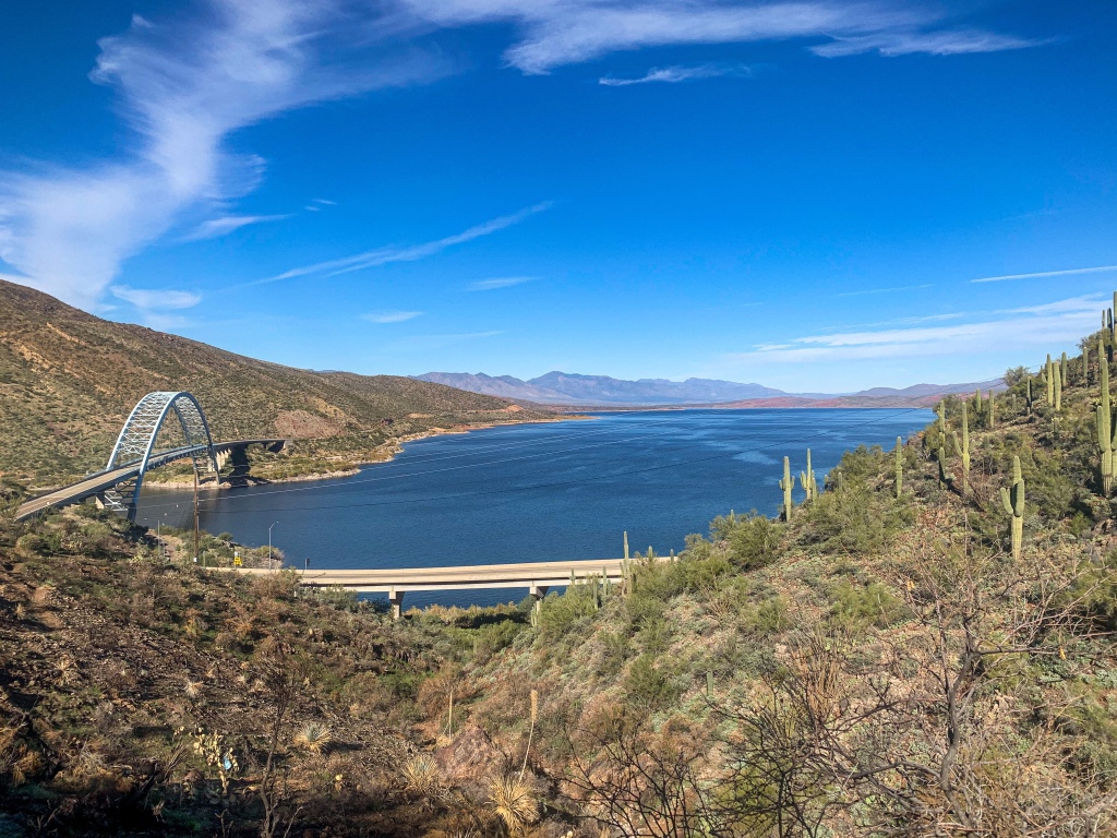
After getting a ride back to Roosevelt Lake from Walter, owner of one of the inns in Tonto Basin, I did a short hike back up to Inspiration Point above the lake on the north side of the Salt River. The morning light on the rocks and saguaros is gorgeous, and the greens of the cacti and the blue of the lake seem deeper than ever. It’s a markedly different experience, and incredibly striking scene relative to the last three days in Tonto Basin.
Arizona Trail, Passage 19 (Superstition Wilderness)
Tonto National Forest


Arizona Trail, Passage 19 (Superstition Wilderness)
Tonto National Forest

Arizona Trail, Passage 19 (Superstition Mountains)
Tonto National Forest

Arizona Trail, Passage 20/19 (Superstition Wilderness/Four Peaks)
Tonto National Forest
Arizona Trail, Passage 20 (Four Peaks)
Tonto National Forest
Arizona Trail, Passage 20 (Four Peaks)
Tonto National Forest
Arizona Trail, Passage 20 (Four Peaks)
Tonto National Forest
Arizona Trail, Passage 20 (Four Peaks)
Tonto National Forest

Arizona Trail, Passage 20 (Four Peaks)
Tonto National Forest
Arizona Trail, Passage 20 (Four Peaks)
Tonto National Forest
Arizona Trail, Passage 20 (Four Peaks)
Tonto National Forest
Arizona Trail, Passage 20 (Four Peaks)
Tonto National Forest

Arizona Trail, Passage 19 (Superstition Wilderness)
Tonto National Forest
Inspiration Point-Roosevelt Cemetery
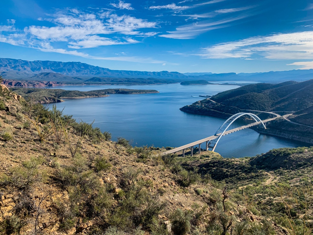
Having soaked in the gorgeous and far-more-pleasant view from Inspiration Point this time around, I once again descend from the Point and follow the trail back south across the bridge at Theodore Roosevelt Dam and onto passage 19, the Superstitions. Climbing out of the canyon of the Salt River, it winds among the foothills of the Superstition Mountains before reaching the old Roosevelt Cemetery and the actual side trail to Roosevelt Lake. I drop my pack near here for a bit and head down the road to explore Tonto National Monument, which will get its own entry as a national park.
Arizona Trail, Passage 19 (Superstition Wilderness)
Tonto National Forest
Arizona Trail, Passage 19 (Superstition Wilderness)
Tonto National Forest
Arizona Trail Geology: Mazatzal and Superstition Mountains
Mazatzal Mountains
This short stretch bridges the Mazatzal and Superstition Mountains. The Mazatzal Mountains formed during an orogeny (a term referring to the process that creates mountains) when Arizona was a coastal region on the margin of what became North America, the Mazatzals gained their rugged nature as tectonic collisions compressed rock, lifting it and thrusting it above other rocks (overthrust).
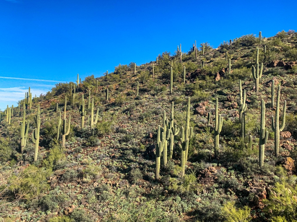
Mazatzal Peak, the highest point of the Northern Mazatzals, towers 1700 ft above the trail with a jagged west face that makes it appear as though half the mountain was simply cut away, while the Four Peaks, iconic mountain landmarks of Phoenix, are the highest in the range and include a rare active amethyst mine legendary for its quality.
Unfortunately both regions of the range have been greatly impacted by recent fires. The Willow and Sunflower Fires burned much of the northern portion, while the Lone Pine and Bush Fires have burned much of the southern. This hike was completed before the 2020 Bush Fire, so the area will have changed since the following images were taken. Much of the old ponderosa forest that had made the mountains one of the most popular long-distance stretches of the Arizona Trail has been lost in these burns. Yet the incredible geology, solitude, sunsets, and views remain for the hardy and prepared souls who venture into this special place.
Bagworms spin magnificent webs here, and temperatures are relatively tolerable outside of winter, when snow can make stretches impassable for those without adequate preparation.
Arizona Trail, Passage 19 (Superstition Wilderness)
Tonto National Forest
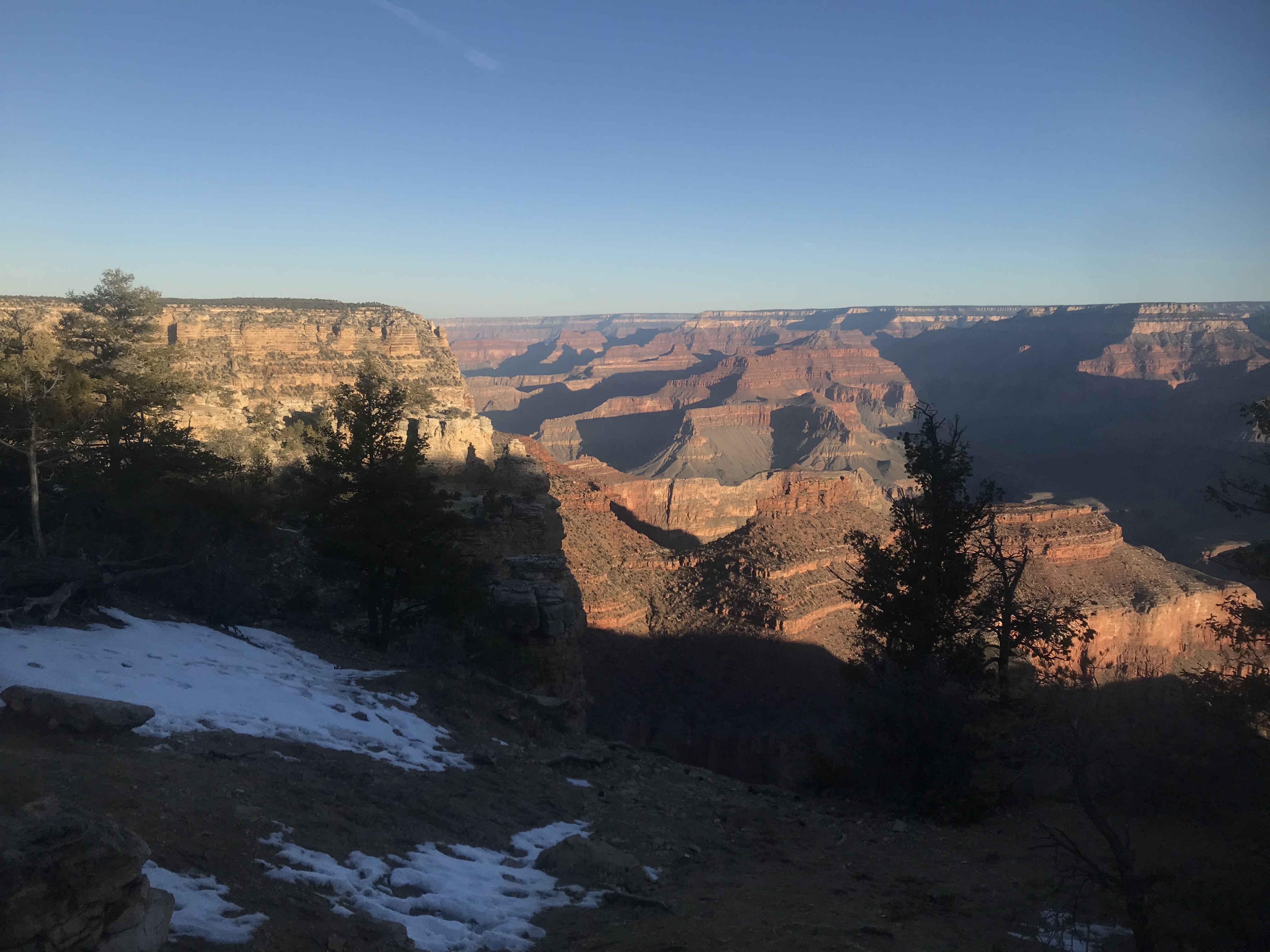
Superstition Mountains
The Superstition Mountains, by contrast, are volcanic in origin. The current mountains are the eroded remnants of the resurgent lava dome of a supervolcano similar to Yellowstone but on a smaller scale – comparable to Yellowstone’s “little brother,” in a sense. The caldera boundary can still be seen within the mountains today.
The name comes from the various superstitions that surround them – legends such as that of the Lost Dutchman mine, and a belief among some Apaches that the road to the lower world is located there. More to come on these mountains as we enter them shortly.
Arizona Trail: Passage 20 Trail Logistics & Passage Ecology
Passage Map: Passage 20 (Four Peaks)
| Passage 20 (Four Peaks) | |
| Trail Surface | Dirt singletrack |
| Length (Mi) | 19 |
| Land Manager and Contact Info | US Forest Service; Tonto National Forest – Home (usda.gov) |
| Season | March-May, September-November |
| Potential Water Sources | Pigeon Spring (Mi 421.6 NB, 421.6 SB) Bear Spring (mi 400.6 NB, 422.5 SB) Shake Spring (mi 392.5 NB, 423.4 SB) Granite Spring (mi 391.5 NB, 431.3 SB) Buckhorn Creek (mi 390.5 NB, 432.9 SB) |
| Trailheads | North: Lone Pine Saddle South: Theodore Roosevelt Lake |
| Trailhead Access | North: Vehicular access; via graded dirt road South: Vehicular access (parking at Roosevelt Lake Marina) |
| Wilderness | Yes |
| Possible resupply points | Phoenix (north end) Roosevelt Lake Marina (south end) Farther, Globe and Tonto Basin |
| ATA-Rated Difficulty | Strenuous |
| Potential campsites (mileages S to N) | Precipitous terrain limits options, but there are some spots around Mills Ridge Trailhead & the Chillicut Trail junction |
| Ecosystems Traversed | Arizona Upland Interior Chaparral Great Basin Conifer Woodland Relict Conifer Woodland |
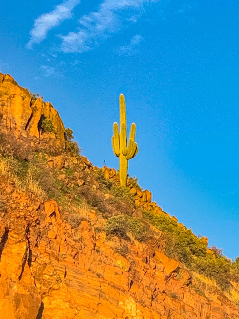
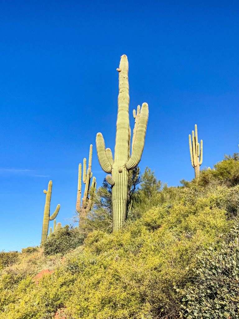
| Highlights | Four Peaks Views of Tonto Basin & Roosevelt Lake SOBO, first saguaro appearance on trail |
| Arizona Upland | |
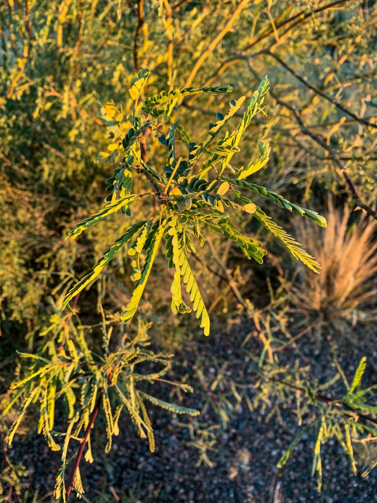
| Common Trees/Shrubs | * Fairy duster * Blue and littleleaf palo verde * Fremont wolfberry * Graythorn * Ocotillo * Red barberry * Scrub-live oak * Snapdragon-penstemon * Turpentine bush * Velvet mesquite * Whitethron acacia |
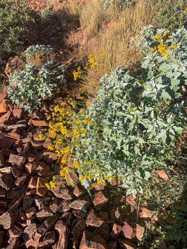
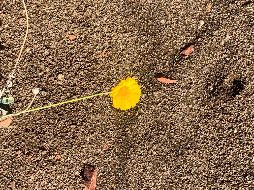
| Common herbaceous plants | * California flannelbush [rare in Arizona, Superstition Mountains included] * Bluedicks * Brittlebush * California poppies * Creamcups * Desert chicory * Desert rockpea * Desert windflower * Fringed red maids * Globemallows * Lupines * Sego-lily |
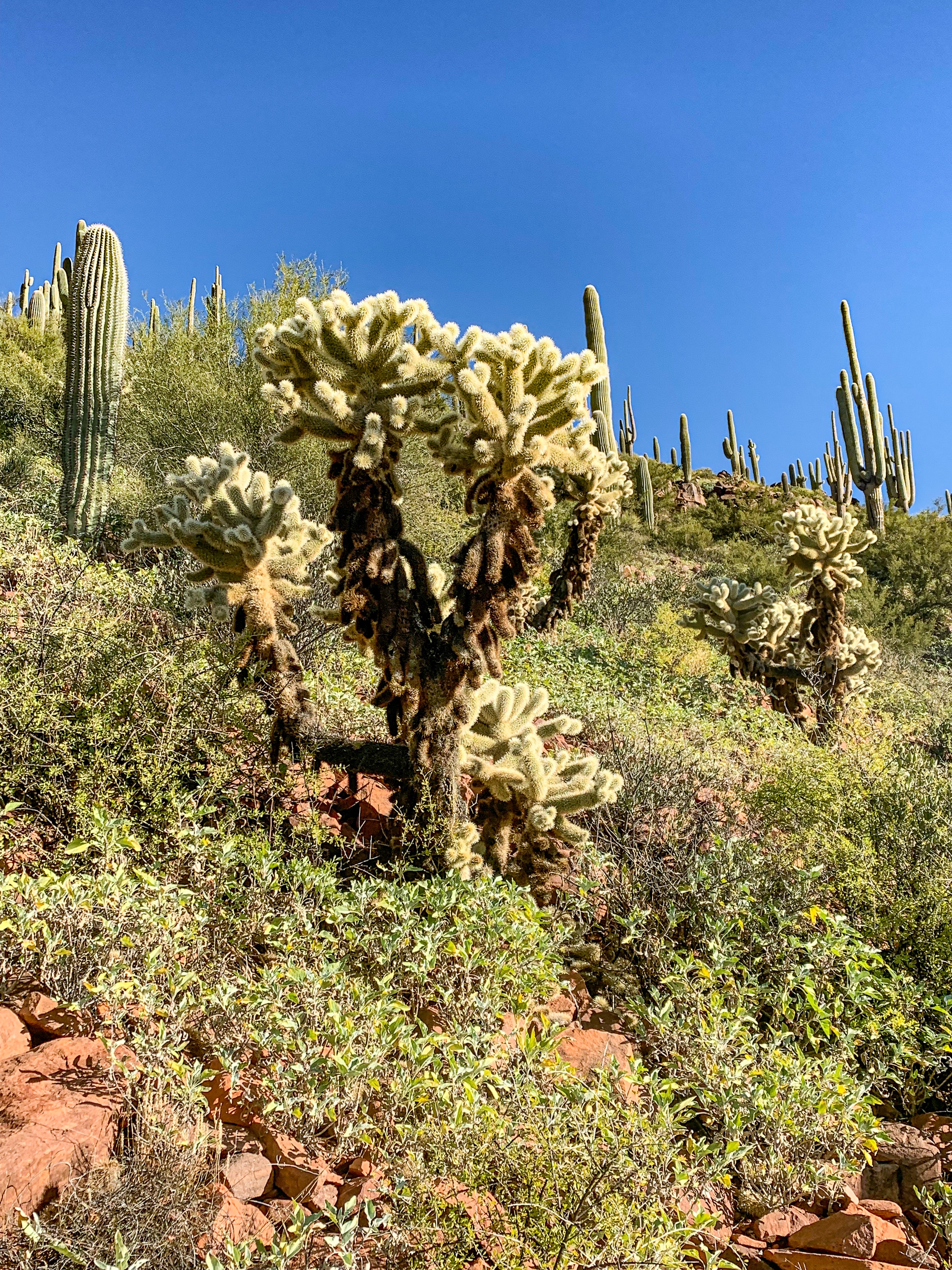
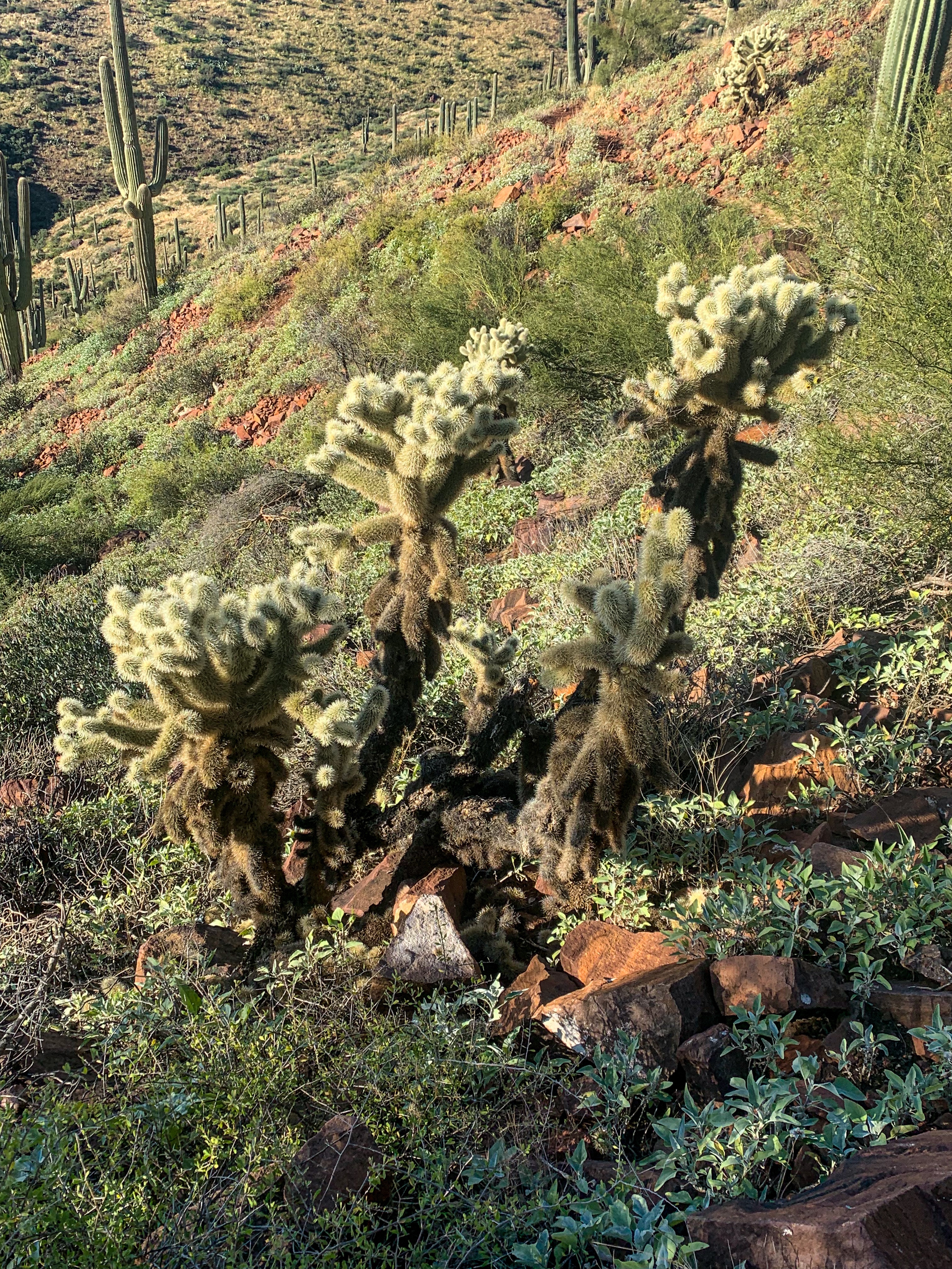
| Common succulents | * Arizona pencil cholla * Banana yucca * Soaptree yucca * Buckhorn cholla * Cane cholla * Chainfruit * Hedgehog cactus * Pencil cholla * Pincushion cactus * Prickly pears * Saguaro * Teddybear cholla |
Colette Remington
Hi aspenstracks.com owner, You always provide helpful information.
Cleveland Musgrave
Hello aspenstracks.com admin, You always provide in-depth analysis and understanding.
Linda K
Some gorgeous photos with the sun on the cactus!