
In the land of Arizona
Through desert heat or snow
Winds a trail for folks to follow
From Utah to Old Mexico
It’s the Arizona Trail
A pathway through the great Southwest
A diverse track through wood and stone
Your spirit it will test
Oh, sure you’ll sweat and blister
You’ll feel the miles every day
You’ll shiver at the loneliness
Your feet and seat will pay
But you’ll see moonlight on the borderlands
You’ll see stars on the Mogollon
You’ll feel the warmth of winter sun
And be thrilled straight through to bone
The aches and pains will fade away
You’ll feel renewed and whole
You’ll never be the same again
With Arizona in your soul
Along the Arizona Trail
A reverence and peace you’ll know
Through deserts, canyons, and mountains
From Utah to Old Mexico
-“The Arizona Trail,” Dale R. Shewalter
Sycamore Creek-Boulder Canyon Summit
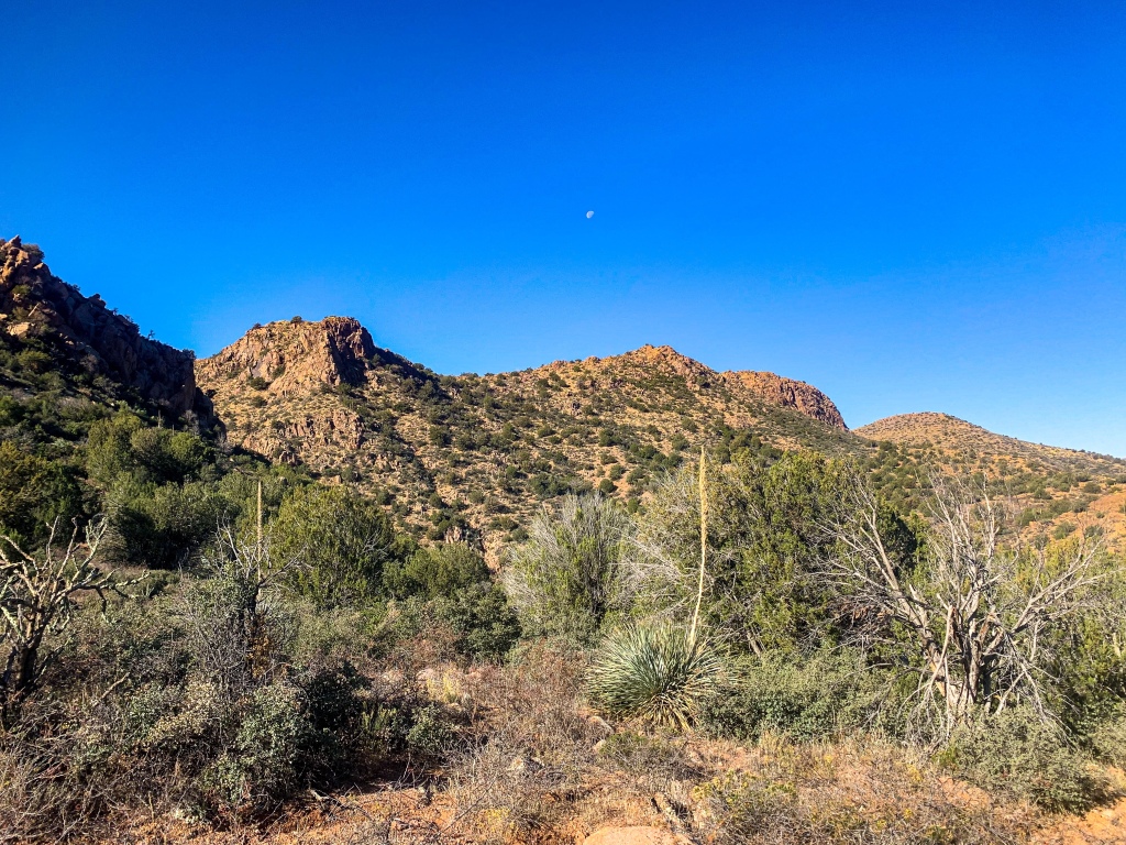
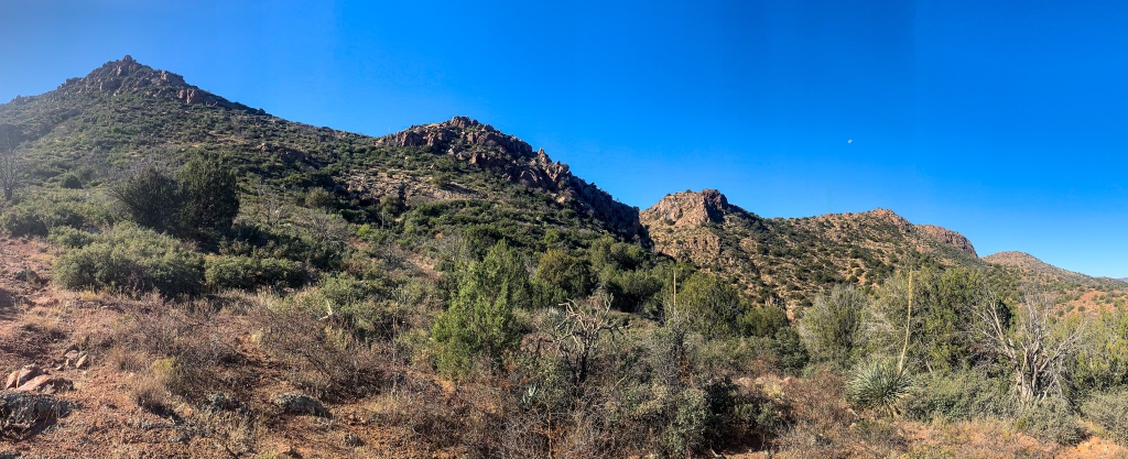
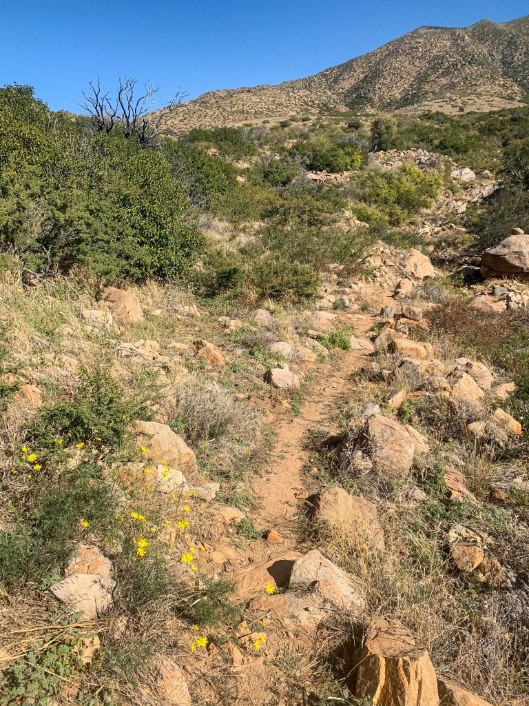
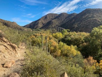
I pack up yesterday’s camp this morning along the banks of Sycamore Creek. Hiking south from Sycamore Creek, the Arizona Trail enters Passage 21 (Pine Mountain) and begins to climb into the southern Mazatzal Mountains through Boulder Canyon on the rugged Boulder Creek Trail dominated by Interior Chaparral landscapes.
The warmer and drier features observed on the lower slopes of the north-central Mazatzals yesterday continue today. Sycamore Creek, near the northern end of this passage at Sunflower, offers an excellent camp spot with flowing, relatively reliable water. The climb to the top of the ridge from here is prolonged, exposed, and rugged; it’s recommended to drink up before setting out. The next best opportunity may not come again until the opposite end of the passage at the Pigeon Forge Trailhead.
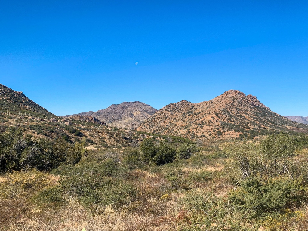
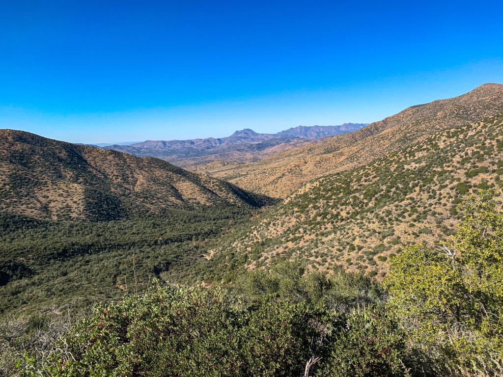
Rocky Mazatzal foothills dominate the early miles of the passage, with their tan rock accented by splashes of green. Views of Crabtree Butte, Boulder Mountain, Mount Ord, Eagle Peak, and more can be enjoyed on this stretch, as can the northern Mazatzals across Kitty Joe Canyon, particularly Saddle Mountain as one backpacks closer to the ridgeline ahead and looks north toward the northern Mazatzals. Mount Ord, the source of cell service in the area, rises to the east.
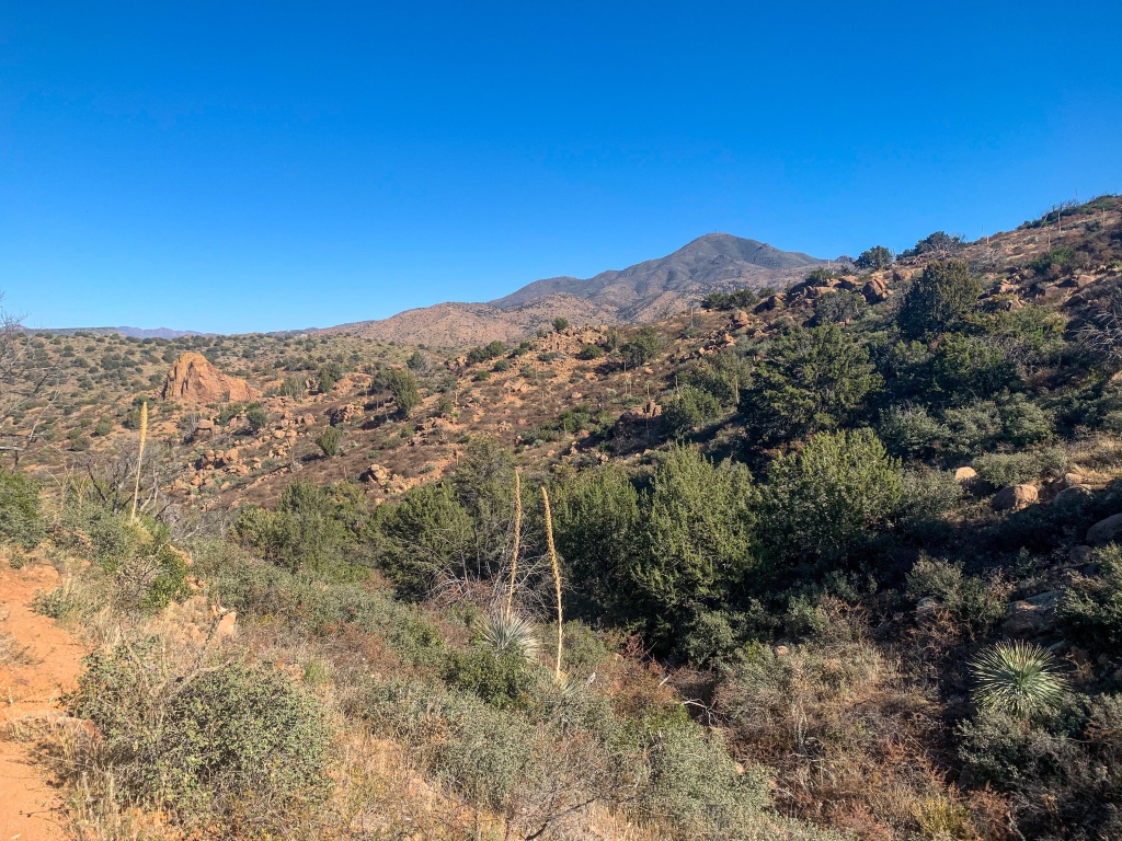
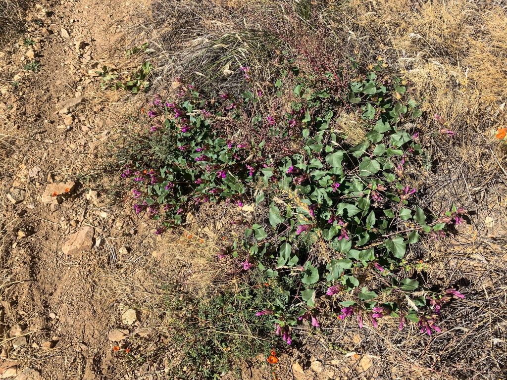
Depending on the time of year and recent rainfall you may spot wildflowers among the rocks as well. Small forests of sugar bush can be found on the more gradual lower slopes but fade away into other shrubs as the grade picks up. It’s easy to tell that seasonal Boulder Creek flows in this valley – looking down on it from the mid-to-upper slopes, there’s significantly more greenery in the valley than on the surrounding slopes.
As I noted in my past entry, Sunflower is more a community than a full town, it appears, at least from a services perspective. If you need supplies from here, your best options are probably metro Phoenix, Payson, or Tonto Basin. I had a box shipped to the latter.
I now decide that I will probably try to push through to Roosevelt Lake and then return to Tonto Basin for the package, since I might be needing it more at that point, although I have another box going to Roosevelt Lake so I’ll probably wind up mailing some stuff ahead to Superior or Kearny, two of the next main resupply points I’ve either considered or planned on. It seems like it’ll be easier to get there from Roosevelt, so rather than cut across to Tonto Basin from here, which could slow me down a day or so – at a time when a substantial storm, the first major front of the winter, is supposed to hit – and only add to the load I’m carrying.
Plus, with the chance for storms, I may need to take a zero or two in town. Areas like the Superstitions were badly burned in the Woodbury Fire and therefore carry a significant flash flood risk. The trail that the Arizona Trail uses to climb into the Supes follows the route of a creek known for flooding. And Tonto Basin only makes sense as the logical place to pause and rest should that occur.
(In retrospect I might have skipped the box to Tonto Basin altogether but we’ll see how that turns out.)
(If you missed my description of the Mazatzal Mountains, you can find that as well as logistics and ecology reports for the passage after the photos.)
Arizona Trail, Passage 21 (Pine Mountain)
Tonto National Forest
Arizona Trail, Passage 21 (Pine Mountain)
Tonto National Forest
Arizona Trail, Passage 21 (Pine Mountain)
Tonto National Forest

Arizona Trail, Passage 21 (Pine Mountain)
Tonto National Forest
Arizona Trail, Passage 21 (Pine Mountain)
Tonto National Forest

Arizona Trail, Passage 21 (Pine Mountain)
Tonto National Forest
Arizona Trail, Passage 21 (Pine Mountain)
Tonto National Forest

Arizona Trail, Passage 21 (Pine Mountain)
Tonto National Forest

Arizona Trail, Passage 21 (Pine Mountain)
Tonto National Forest
Arizona Trail, Passage 21 (Pine Mountain)
Tonto National Forest
Arizona Trail, Passage 21 (Pine Mountain)
Tonto National Forest
Mazatzal Mountain Geology
The Mazatzal Mountains themselves are an incredible place. The origin of the name “Mazatzal” is unclear, though one possible meaning is a Nahuatl term meaning “place of the deer.”
Formed during an orogeny (a term referring to the process that creates mountains) when Arizona was a coastal region on the margin of what became North America, the Mazatzals gained their rugged nature as tectonic collisions compressed rock, lifting it and thrusting it above other rocks (overthrust), perhaps best seen on the far northern and southern segments of the range, around the Mazatzal Divide and the Four Peaks.
Mazatzal Peak, the highest point of the Northern Mazatzals, towers 1700 ft above the trail with a jagged west face that makes it appear as though half the mountain was simply cut away. Unfortunately the area was greatly impacted by the Willow & Sunflower Fires in the northern range and the Lone Pine Fire in the southern range, which burned much (though not all, as we will see) of the old ponderosa forest that had made the mountains one of the most popular long-distance stretches of the Arizona Trail.
Yet the incredible geology, solitude, sunsets, and views remain for the hardy and prepared souls who venture into this special place. The Mazatzals remain one of the most significant and dominant stretches of the AZT, with the proper range and Red Hills occupying 5 passages of the entire trail, more than any other single mountain range across its entire length, and more than any geographic feature other than the Colorado Plateau, which is crossed by passages occupying 1/3 of the entire trail.
Bagworms spin magnificent webs in the higher elevations here, and temperatures are relatively tolerable outside of winter, when snow can make stretches impassable for those without adequate preparation, though Passage 21 is less impacted than the rugged and higher elevation Divide and Four Peaks (passages 23 and 20.)
Note: Since this hike, the Bush Fire burned this area again in 2020. While the area will eventually rebound – slowly, this being a desert – the images here now serve as documentation of the area as it was before the fire.
It’s important to note that unlike the ponderosa forest in the north, chaparral is not a fire-adapted (let alone fire-dependent) landscape, and is extremely vulnerable during times of high fire danger. Please keep fire warnings and regulations in mind and don’t put these landscapes, as well as the communities – of humans and animals – that live in them at risk.
Arizona Trail: Pine Mountain Passage Logistics and Ecology
| Passage 21 (Pine Mountain) | |
| AZTA Passage Page & Map | Passage 21 (Pine Mountain) |
| Trail Surface | Dirt singletrack (Sunflower to FR 422 near Circle M Spring) Dirt forest road (just north of Circle M Spring to Pigeon Spring Trailhead) |
| Length (Mi) | 19.8 |
| Season | All year, but snow can make sections impassable in winter. |
| Potential Water Sources | Sycamore Creek (mi 384.8 NB, 403.9 SB) Boulder Creek (mi 382.5 NB, 406.3 SB) Stock Pond (mi 382.3 NB, 406.4 SB) Boulder Creek (mi 380.8 NB, 407.9 SB) Boulder Creek pools (mi 380.5 NB, 408.2 SB) Boulder Creek (mi 380.1 NB, 408.6 SB) Boulder Creek (mi 379.7 NB, 409 SB) Circle M Spring (mi 377.8 NB, 411 SB) Little Pine Flat (mi 376.2 NB, 412.6 SB) Pigeon Spring (mi 367.1 NB, 421.6 SB) |
| Trailheads | North: Sunflower South: Pigeon Spring Trailhead |
| Trailhead Access | North: Vehicular access; immediately off paved AZ-87. South: Vehicular access via graded dirt road |
| Wilderness | No |
| Possible resupply points | Phoenix |
| ATA-Rated Difficulty | Difficult (Boulder Creek segment) Moderate (FR 422 segment) |
| Potential campsites (mileages S to N) | Sycamore Canyon is ideal near the start. Options are limited to virtually nonexistent in places on the rugged climb thereafter. There are good options along the ridgetop traverse once the climb abates but you may have competition from Phoenix residents at times since that stretch follows a dirt forest road with a direct connection to suburban Phoenix. |
| Ecosystems Traversed | Interior Chaparral Semidesert grassland |
| Pet Friendly? | Yes |
| Bike Friendly? | Yes, legally, but you might have some challenges trying to ride on this trail |
| Interior Chaparral | Semidesert Grassland | |
| Common Trees/Shrubs | * Birchleaf Mahogany * Ceanothus * Holly-leaf buckthorn * Manzanita * Shrub live oak * Silktassels * Stansbury cliffrose | * barberry * Catclaw acacia * Desert hackberry * Graythorn * ocotillo * One-sided juniper * velvet mesquite |
| Common grasses | * Curly mesquite * fluff grass * grams grasses * slim tridens * tanglehead * Three awn | |
| Common succulents | * Agaves – golden flowered, Parry’s, Toumey’s * Banana & soap tree yucca * Barrel cactus * beargrass * beehive cactus * buckhorn cholla * Cane Cholla * hedgehog cacti * prickly pear cacti * Rock echeveria * Sotol * Whipple’s cholla | * banana yucca * barrel cactus * beargrass * beehive cactus * brown spined prickly pear cacti * cane cholla * Englemann prickly pear cacti * Golden-flowered agave * hedgehog cacti * pancake prickly pear cacti * Parry’s agave * soaptree yucca * stool |
see here
Going to volunteer more concerning this topic? I figure you might be downplaying some of your polarized details, but I would certainly love reading them!
שירותי ליווי בתל אביב
Greetings! Very useful advice in this particular article! It is the little changes that produce the greatest changes. Thanks a lot for sharing!
xlcrgirl
Enjoyed the poem. Your entries are so enlightening and great to read. Great adventure