Backpacking the AZT: Passage 21, Pine Mountain
Arizona Trail Thruhike Day 55
Trans-Arizona/Utah Day 62
Welcome back to Aspen’s Tracks, thruhiking the Arizona Trail southbound from Utah to Mexico. Today’s route covers backpacking the stretch of Passage 21, Pine Mountain, between FR 422 at the top of the Boulder Canyon trail and the start of the Four Peaks passage. You can find today’s hiking logistics below the photo documentation and trail journal of the route.
In the land of Arizona
Through desert heat or snow
Winds a trail for folks to follow
From Utah to Old Mexico
It’s the Arizona Trail
A pathway through the great Southwest
A diverse track through wood and stone
Your spirit it will test
Oh, sure you’ll sweat and blister
You’ll feel the miles every day
You’ll shiver at the loneliness
Your feet and seat will pay
But you’ll see moonlight on the borderlands
You’ll see stars on the Mogollon
You’ll feel the warmth of winter sun
And be thrilled straight through to bone
The aches and pains will fade away
You’ll feel renewed and whole
You’ll never be the same again
With Arizona in your soul
Along the Arizona Trail
A reverence and peace you’ll know
Through deserts, canyons, and mountains
From Utah to Old Mexico
-“The Arizona Trail,” Dale R. Shewalter
Arizona Trail: Boulder Creek Junction-Pine Mountain
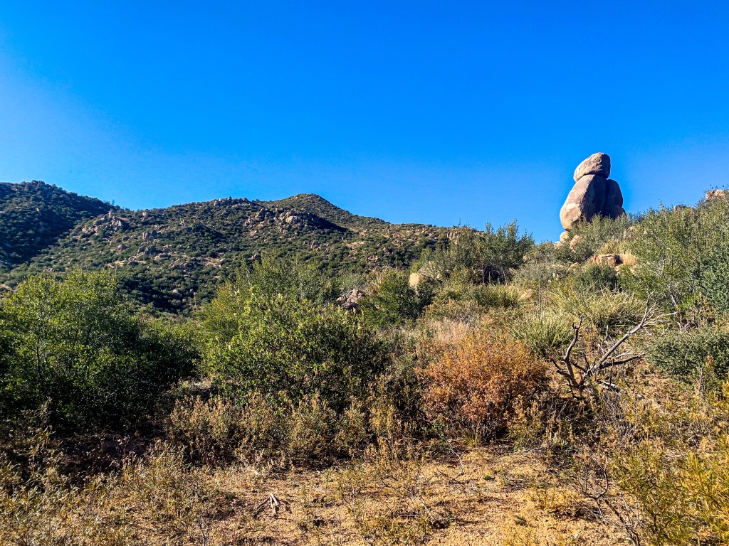
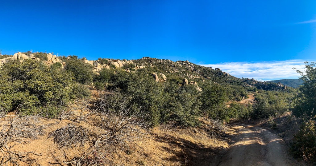
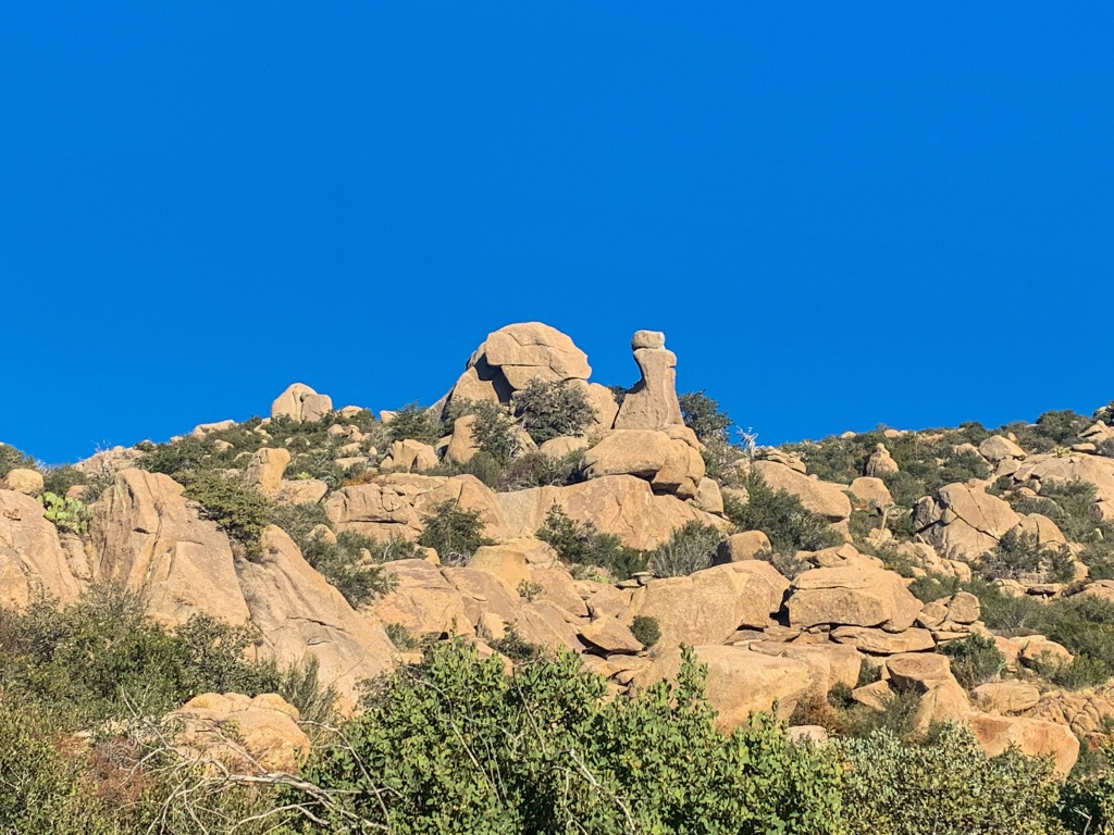
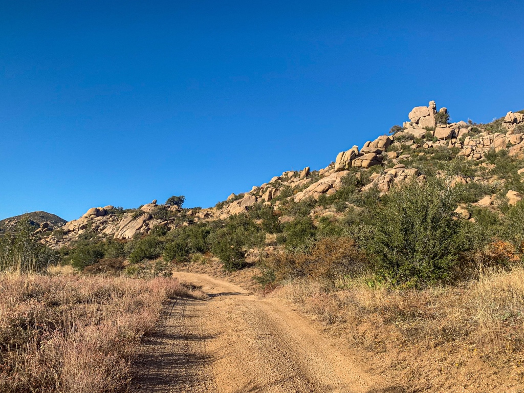
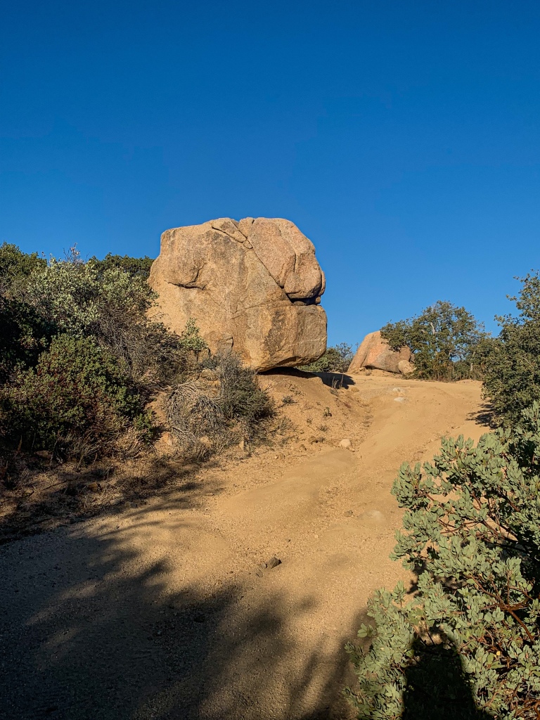
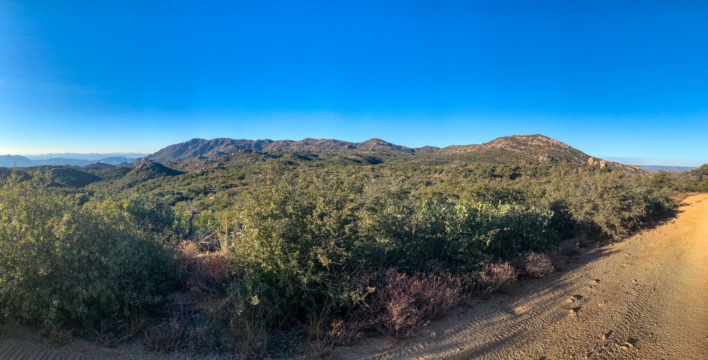
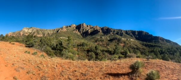
Cresting the climb up Boulder Creek as the southbound thruhike continues, the Arizona Trail emerges onto FR 422 and begins to roll through the south-central Mazatzal Mountains. The vast majority of the route is in shrubland and allows magnificent views of the Mazatzals as well as Tonto Basin and the Sierra Ancha to the west. Sandstone spires rise above the trail, reminiscent of the landscape of Joshua Tree National Park (albeit without the namesake trees). The rock seems to glow somewhat.

Arizona Trail, Passage 21 (Pine Mountain)
Tonto National Forest

Arizona Trail, Passage 21 (Pine Mountain)
Tonto National Forest

Arizona Trail, Passage 21 (Pine Mountain)
Tonto National Forest
Arizona Trail, Passage 21 (Pine Mountain)
Tonto National Forest
Arizona Trail, Passage 21 (Pine Mountain)
Tonto National Forest
Tonto National Forest
Arizona Trail, Passage 21 (Pine Mountain)
Tonto National Forest

Arizona Trail, Passage 21 (Pine Mountain)
Tonto National Forest
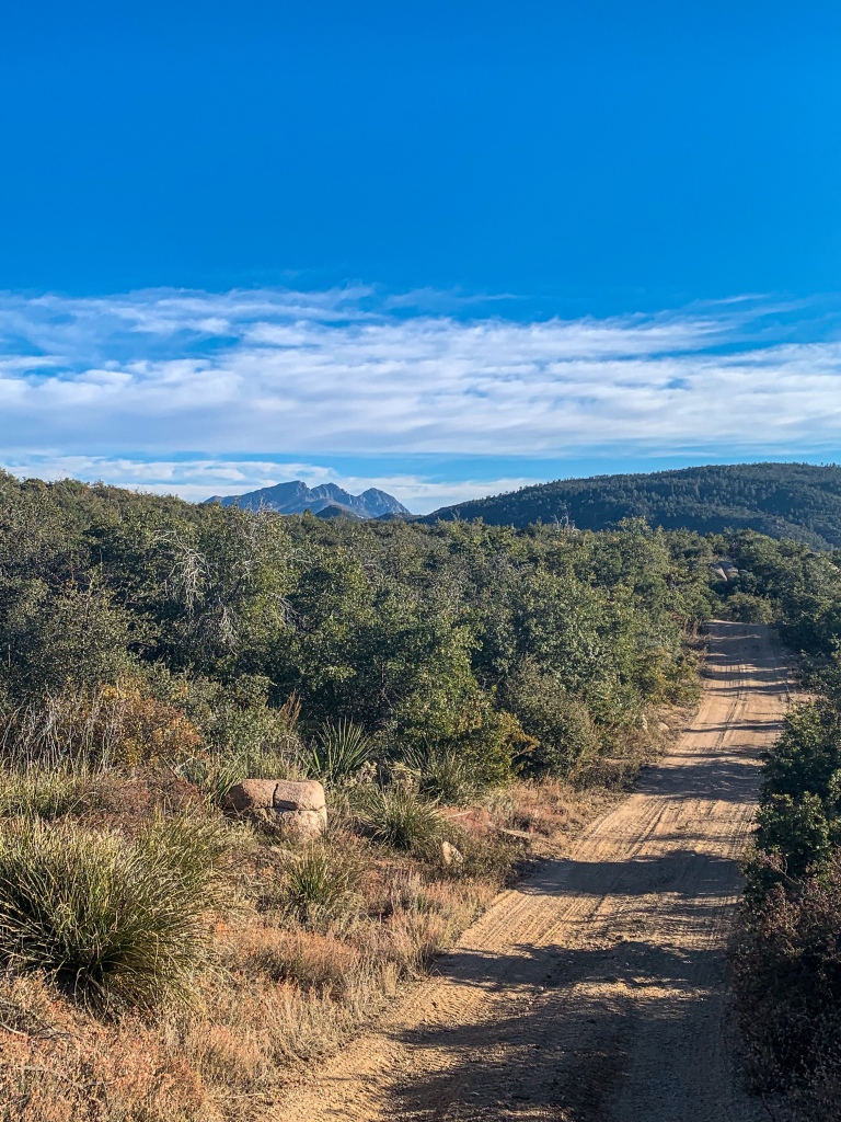
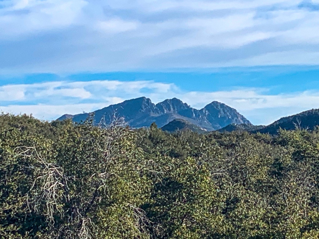
Arizona Trail: Pine Mountain to Pigeon Spring TH
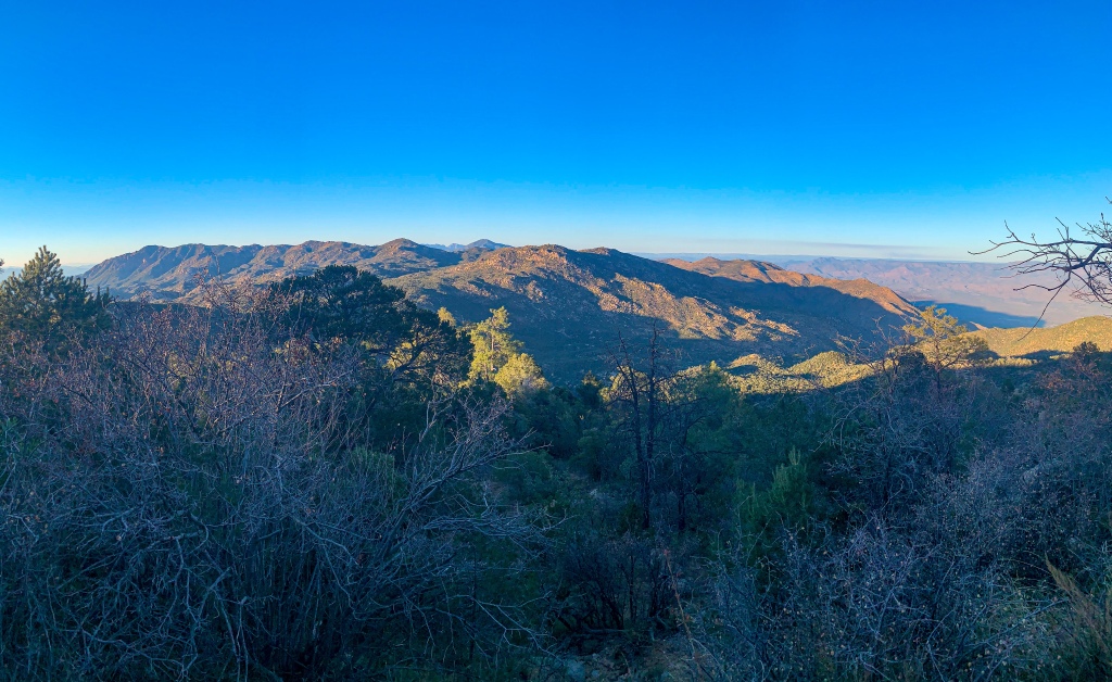
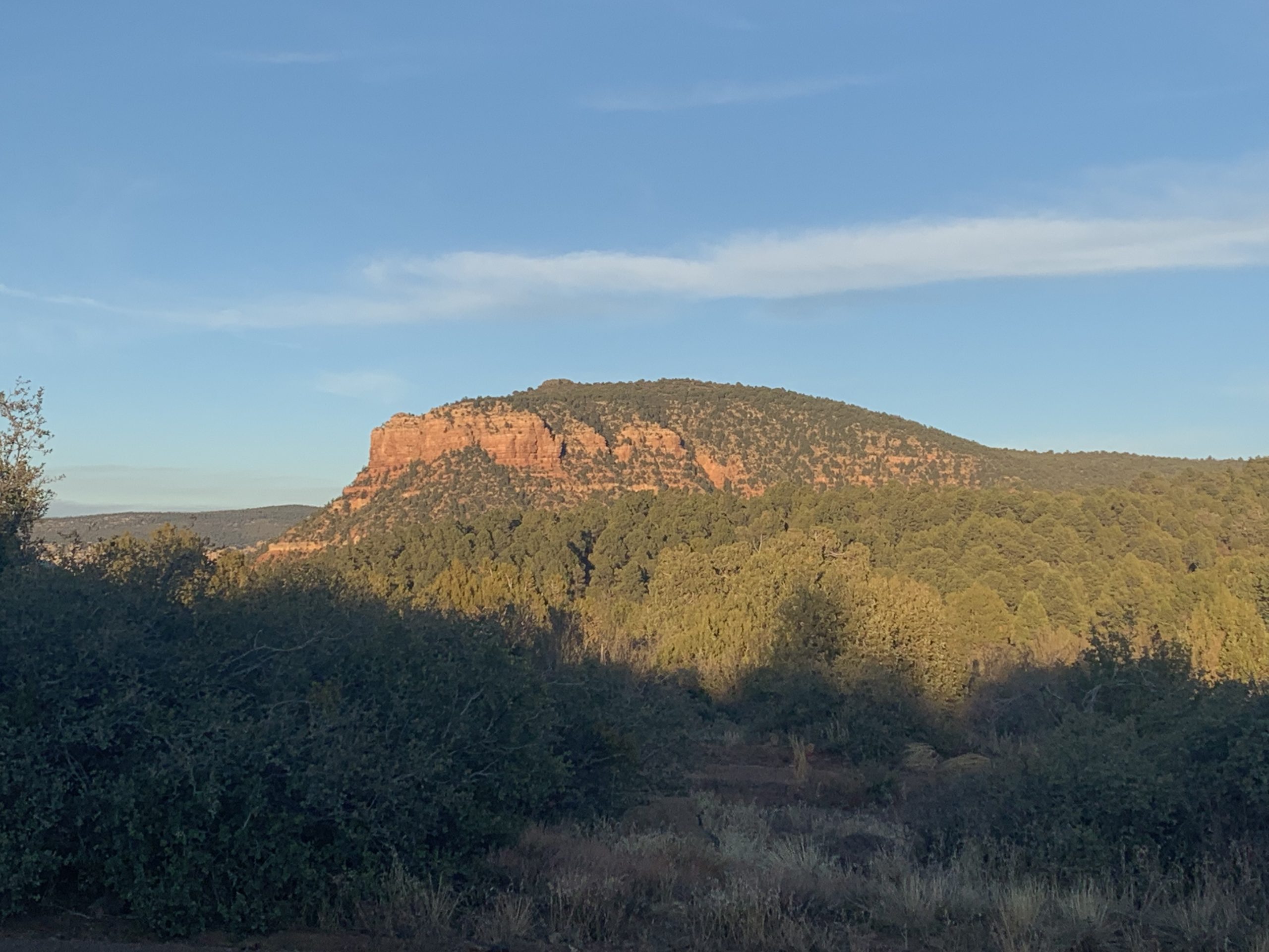
The trail rolls through a basin and then the legendary, magnificent Four Peaks emerge over the ridgeline ahead. As the trail winds along the crest, the whole mountains appear, and one can look down off the mountains to the west into the Valley of the Sun and Phoenix, and to the east into Tonto Basin. I reach Pigeon Spring trailhead and encounter a couple from Phoenix out camping for the night. They refill my water to get me to Roosevelt Lake and invite me to eat with them while sharing stories from the trail.
Arizona Trail, Passage 21 (Pine Mountain)
Tonto National Forest
Arizona Trail, Passage 21 (Pine Mountain)
Tonto National Forest
Arizona Trail, Passage 21 (Pine Mountain)
Tonto National Forest
Arizona Trail, Passage 21 (Pine Mountain)
Tonto National Forest

Arizona Trail, Passage 21 (Pine Mountain)
Tonto National Forest
Arizona Trail, Passage 21 (Pine Mountain)
Tonto National Forest
Arizona Trail, Passage 21 (Pine Mountain)
Tonto National Forest

Arizona Trail, Passage 21 (Pine Mountain)
Tonto National Forest
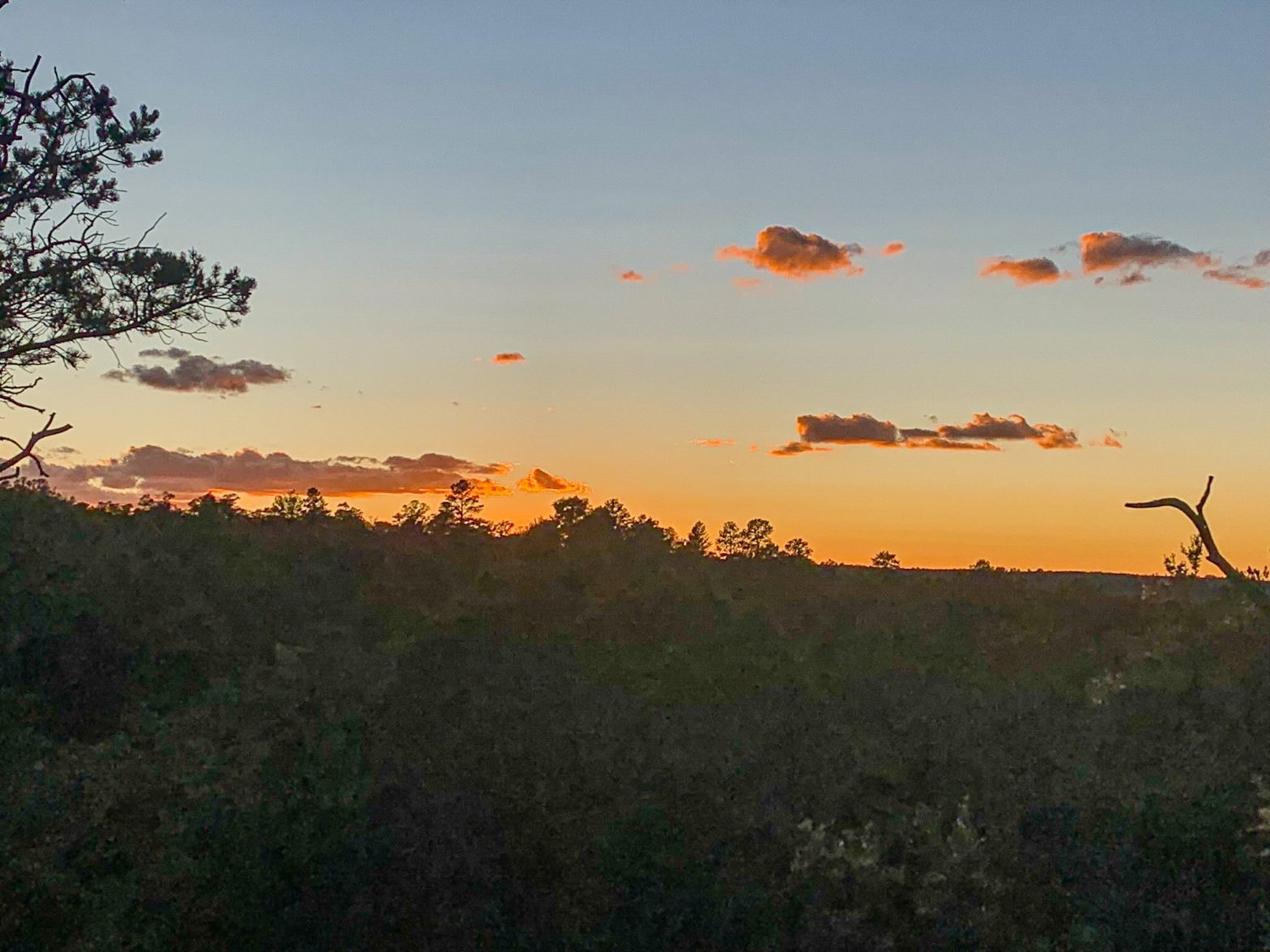
Pigeon Spring Overnight
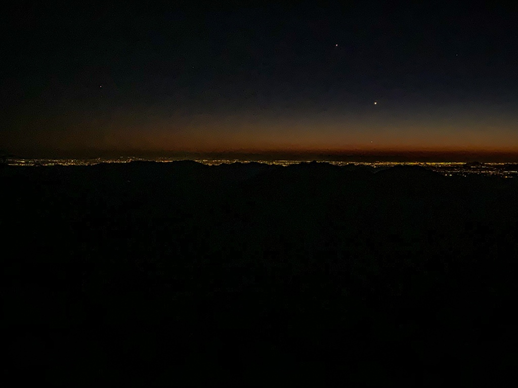
As night falls, I head partway back and find a pull off along the trail to sleep for the night. It’s striking how exceptionally dark the sky on the mountains and the Tonto Basin side remains despite how bright the light in the Phoenix sky is and how sprawling the development in the Valley is. I’m guessing that in addition to the topography helping block the light pollution, the lack of humidity in the air helps contain it as well (clouds tend to absorb and reflect/reemit light pollution, which is why light pollution is worse on cloudy nights than clear nights). Going to be great to see the views as the trail wraps around the Four Peaks themselves tomorrow.
Metro Phoenix can be accessed off of FR 422 and provides the main resupply option on this passage, though there’s also a way to cut across to AZ-188 as well on the northern segment of the passage, which provides the potential opportunity to cut to Tonto Basin as well. Water supplies is limited on the crest along 422; especially in the fall it’s probably best to assume it will not be available. There are quite a few spots to camp along 422 as well, though.
Arizona Trail, Passage 21 (Pine Mountain)
Tonto National Forest
(If you missed my description of the Mazatzal Mountains, you can find that as well as logistics and ecology reports for the passage after the photos.)
Mazatzal Mountains
The Mazatzal Mountains, themselves are an incredible place. The origin of the name “Mazatzal” is unclear, though one possible meaning is a Nahuatl term meaning “place of the deer.” Formed during an orogeny (a term referring to the process that creates mountains) when Arizona was a coastal region on the margin of what became North America, the Mazatzals gained their rugged nature as tectonic collisions compressed rock, lifting it and thrusting it above other rocks (overthrust).
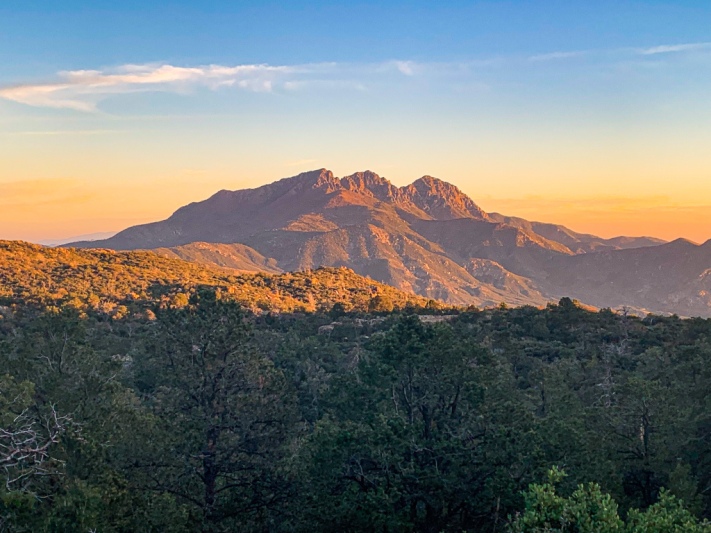
Mazatzal Peak, the highest point of the Northern Mazatzals, towers 1700 ft above the trail with a jagged west face that makes it appear as though half the mountain was simply cut away. This passage passes through the southern half of the full range, dominated by views of the Four Peaks, the highest in the range as a whole, and Roosevelt Lake, a reservoir on the Salt River below whose blue waters are a striking contrast to the surrounding desert.
Passage 21 (Pine Mountain) Logistics
| Passage 21 (Pine Mountain) | |
| AZTA Passage Info & Map | Passage 21 (Pine Mountain) Passage 21 Map |
| Trail Surface | Dirt singletrack (Sunflower to FR 422 near Circle M Spring) Dirt forest road (just north of Circle M Spring to Pigeon Spring Trailhead) |
| Length (Mi) | 19.8 |
| Season | All year, but snow can make sections impassable in winter. |
| Potential Water Sources | Sycamore Creek (mi 384.8 NB, 403.9 SB) Boulder Creek (mi 382.5 NB, 406.3 SB) Stock Pond (mi 382.3 NB, 406.4 SB) Boulder Creek (mi 380.8 NB, 407.9 SB) Boulder Creek pools (mi 380.5 NB, 408.2 SB) Boulder Creek (mi 380.1 NB, 408.6 SB) Boulder Creek (mi 379.7 NB, 409 SB) Circle M Spring (mi 377.8 NB, 411 SB) Little Pine Flat (mi 376.2 NB, 412.6 SB) Pigeon Spring (mi 367.1 NB, 421.6 SB) |
| Trailheads | North: Sunflower South: Pigeon Spring Trailhead |
| Trailhead Access | North: Vehicular access; immediately off paved AZ-87. South: Vehicular access via graded dirt road |
| Wilderness | No |
| Possible resupply points | Phoenix |
| ATA-Rated Difficulty | Difficult (Boulder Creek segment) Moderate (FR 422 segment) |
| Potential campsites (mileages S to N) | Sycamore Canyon is ideal near the start. Options are limited to virtually nonexistent in places on the rugged climb up Boulder Creek thereafter. There are good options along the ridgetop traverse once the climb abates but you may have competition from Phoenix residents at times since that stretch follows a dirt forest road with a direct connection to suburban Phoenix. |
| Ecosystems Traversed | Interior Chaparral Semidesert grassland |
| Hazards | Lightning on ridgelines Water availability |
| Highlights | Views of Mazatzal Mountains, Sierra Ancha, Roosevelt Lake, and Phoenix Mazatzal Mountains Geology |
| Interior Chaparral | Great Basin Conifer Woodland | Rocky Mountain Montane Conifer Woodland | |
| Common Trees/Shrubs | * Birchleaf Mahogany * Ceanothus * Holly-leaf buckthorn * Manzanita * Shrub live oak * Silktassels * Stansbury cliffrose | * Arizona alder * Holly-leaf buckthorn * Junipers * Oaks, including Arizona oak, canyon live oak, Emory oak, Gambel oak, scrub-live oak * Piñon pine * Red barberry * Serviceberry * Silktassels * Skunkbush * sugar sumac | * Ponderosa Pine * Southwestern white pine * Subalpine fir * White fir * Rocky Mountain maple * Bigtooth maple * Grey alder * Red birch * Red osier dogwood * Cliffbush * Mallow ninebark * New Mexican locust * huckleberry * bilberries |
| Common herbaceous plants | * Buckwheats * Globemallows * Lupines * Penstemons * Sego-lily * Wormwood | * fringed brome * Geyer’s sedge/elk sedge * Ross’ sedge * Bronze sedge/dry land sedge/hillside sedge/hay sedge/Fernald’s hay sedge * screwleaf muhly * bluebunch wheatgrass * Spruce-fir fleabane * wild strawberry/Virginia strawberry * Small-flowered woodrush * mountain sweet Cicely * bittercress ragwort * western meadow-rue * Fendler’s meadow-rue | |
| Common succulents | * Agaves – golden flowered, Parry’s, Toumey’s * Banana & soap tree yucca * Barrel cactus * beargrass * beehive cactus * buckhorn cholla * Cane Cholla * hedgehog cacti * prickly pear cacti * Rock echeveria * Sotol * Whipple’s cholla | * beehive cactus * Claret cup hedgehog cacti * Golden-flowered agave * Parry’s agave * Prickly pear cacti * Whipple cholla * Tonto Basin agave |
Isaias Hopfer
I’m impressed, I have to admit. Seldom do I encounter a blog that’s both educative and interesting, and let me tell you, you have hit the nail on the head. The issue is something not enough men and women are speaking intelligently about. I’m very happy that I stumbled across this in my hunt for something concerning this.
Maria+Stephen
The “golden hour” photos are beautiful!