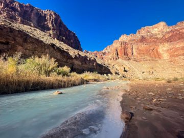
Arizona Trail Passage 23 (Mazatzal Divide), Part III
AZT Backpacking Day 46, Part III
Trans-Arizona/Utah Hiking Day 53, Part III
In the land of Arizona
Through desert heat or snow
Winds a trail for folks to follow
From Utah to Old Mexico
It’s the Arizona Trail
A pathway through the great Southwest
A diverse track through wood and stone
Your spirit it will test
Oh, sure you’ll sweat and blister
You’ll feel the miles every day
You’ll shiver at the loneliness
Your feet and seat will pay
But you’ll see moonlight on the borderlands
You’ll see stars on the Mogollon
You’ll feel the warmth of winter sun
And be thrilled straight through to bone
The aches and pains will fade away
You’ll feel renewed and whole
You’ll never be the same again
With Arizona in your soul
Along the Arizona Trail
A reverence and peace you’ll know
Through deserts, canyons, and mountains
From Utah to Old Mexico
-“The Arizona Trail,” Dale R. Shewalter
Barnhardt Trail-Mazatzal Peak
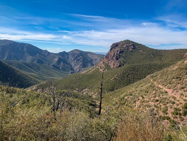
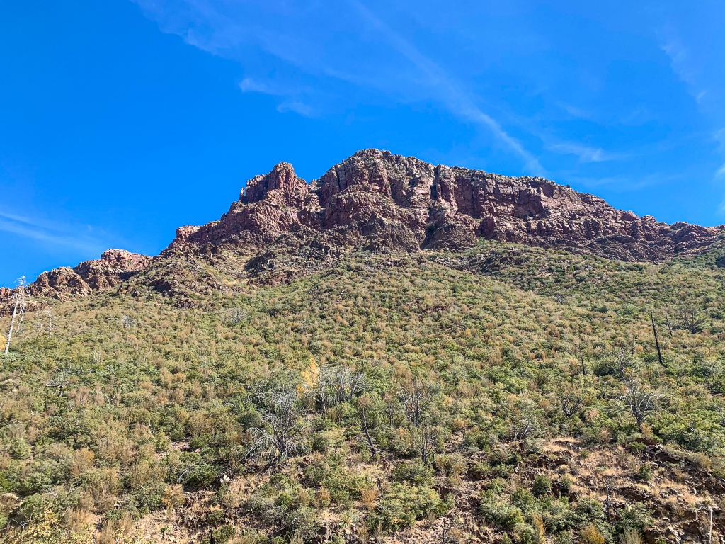
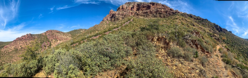
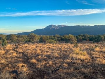
Ran into Kristoff and Lissa, who were pretty out of it last night but much more alert and engaging this morning. They’re also hiking SOBO toward Mexico. I take a few minutes to do a detour to view the exposed geography on the Barnhardt Trail. Then it’s back on the regular AZT route hiking south. The trail wraps precipitously around the west flank of Mazatzal Peak, the highest point of the Northern Mazatzals with 1700 foot cliffs rising above the trail. It had also been believed to be the highest point of Gila County until a couple higher spots were found along the Mogollon Rim, and it remains the highest peak in the county.

Arizona Trail, Passage 23 (Mazatzal Divide)
Mazatzal Wilderness
Tonto National Forest

Arizona Trail, Passage 23 (Mazatzal Divide)
Mazatzal Wilderness
Tonto National Forest

Arizona Trail, Passage 23 (Mazatzal Divide)
Mazatzal Wilderness
Tonto National Forest

Arizona Trail, Passage 23 (Mazatzal Divide)
Mazatzal Wilderness
Tonto National Forest
Arizona Trail: Mazatzal Peak-Divide Highpoint
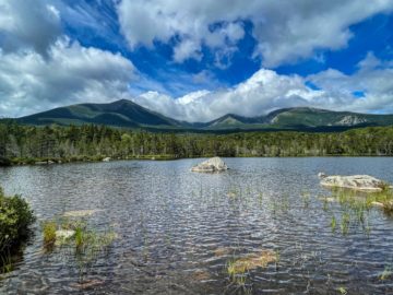
Portions of the Arizona Trail in this area are slightly overgrown with manzanita and finding places to rest is difficult. Protective clothing – hiking pants, windbreaker – is important here to avoid getting scratched. Patches of old growth ponderosas are found among the burned out groves left from the Willow and Sunflower Fires of 2004 and 2012. Most has still been replaced by chaparral, at least for now. Still, the views and exposed geology are outstanding as the trail cuts across steep slopes toward Bear Spring.

Arizona Trail, Passage 23 (Mazatzal Divide)
Mazatzal Wilderness
Tonto National Forest
Arizona Trail, Passage 23 (Mazatzal Divide)
Mazatzal Wilderness
Tonto National Forest

Mazatzal Wilderness
Tonto National Forest

Arizona Trail, Passage 23 (Mazatzal Divide)
Mazatzal Wilderness
Tonto National Forest
Arizona Trail, Passage 23 (Mazatzal Divide)
Mazatzal Wilderness
Tonto National Forest
Arizona Trail, Passage 23 (Mazatzal Divide)
Mazatzal Wilderness
Tonto National Forest
Mazatzal Divide Logistics and Ecology
For a topographic map of this passage visit: Passage 23 Map (Mazatzal Divide)
| Passage 23 (Mazatzal Divide) | |
| Passage Map | Mazatzal Divide Topo Map |
| Trail Surface | Dirt trail |
| Length (Mi) | 24.3 |
| Season | All year, but snow can make sections impassable in winter. |
| Potential Water Sources | Horse Camp Seep Hopi Spring Chilson Spring Bear Spring For a full list including status, check the FarOut app and the AZTA website: AZT Water Report |
| Trailheads | North: Red Hills Trail Junction South: Mount Peeley Trailhead |
| Trailhead Access | North: Foot only. 5.75 mi from City Creek Trailhead South: Foot & 0.5 mi hike on Cornucopia Trail from trailhead. |
| Wilderness | Most |
| Possible resupply points | None |
| ATA-Rated Difficulty | Moderate |
| Potential campsites (mileages S to N) | 6.7, 9.4, 19.4, 22 |
| Hazards | Heat – wear a cotton shirt so you can soak it. Synthetics aren’t great in the desert. Hyponatremia – “drunk on water.” To avoid, ensure adequate salt & electrolyte intake and ensure you eat as well as drink water. Symptoms are almost identical to dehydration, but drinking more makes it worse. Prevention is by far the best solution. Dehydration |
| Ecosystems Traversed | Interior Chaparral Great Basin Conifer Woodland Rocky Mountain Montane Conifer Woodland Relict Conifer Woodland |
| AZTA Passage Description | Passage 23: Mazatzal Divide |
| Current Weather (NWS) | Mazatzal Divide Weather |
Passage 23 Ecology
| Interior Chaparral | Great Basin Conifer Woodland | Rocky Mountain Montane Conifer Woodland | |
| Common Trees/Shrubs | * Birchleaf Mahogany * Ceanothus * Holly-leaf buckthorn * Manzanita * Shrub live oak * Silktassels * Stansbury cliffrose | * Arizona alder * Holly-leaf buckthorn * Junipers * Oaks, including Arizona oak, canyon live oak, Emory oak, Gambel oak, scrub-live oak * Piñon pine * Red barberry * Serviceberry * Silktassels * Skunkbush * sugar sumac | * Ponderosa Pine * Southwestern white pine * Subalpine fir * White fir * Rocky Mountain maple * Bigtooth maple * Grey alder * Red birch * Red osier dogwood * Cliffbush * Mallow ninebark * New Mexican locust * huckleberry * bilberries |
| Common herbaceous plants | * Buckwheats * Globemallows * Lupines * Penstemons * Sego-lily * Wormwood | * fringed brome * Geyer’s sedge/elk sedge * Ross’ sedge * Bronze sedge/dry land sedge/hillside sedge/hay sedge/Fernald’s hay sedge * screwleaf muhly * bluebunch wheatgrass * Spruce-fir fleabane * wild strawberry/Virginia strawberry * Small-flowered woodrush * mountain sweet Cicely * bittercress ragwort * western meadow-rue * Fendler’s meadow-rue | |
| Common succulents | * Agaves – golden flowered, Parry’s, Toumey’s * Banana & soap tree yucca * Barrel cactus * beargrass * beehive cactus * buckhorn cholla * Cane Cholla * hedgehog cacti * prickly pear cacti * Rock echeveria * Sotol * Whipple’s cholla | * beehive cactus * Claret cup hedgehog cacti * Golden-flowered agave * Parry’s agave * Prickly pear cacti * Whipple cholla * Tonto Basin agave |
2 thoughts on “Thruhiking the Amazing, Spectacular Arizona Trail: Barnhardt Trail-Divide Highpoint”