Arizona Trail Backpacking: Passage 23 (Mazatzal Divide), Part II
AZT Backpacking Day 47-50
Trans-Arizona/Utah Hiking Day 54-57
In the land of Arizona
Through desert heat or snow
Winds a trail for folks to follow
From Utah to Old Mexico
It’s the Arizona Trail
A pathway through the great Southwest
A diverse track through wood and stone
Your spirit it will test
Oh, sure you’ll sweat and blister
You’ll feel the miles every day
You’ll shiver at the loneliness
Your feet and seat will pay
But you’ll see moonlight on the borderlands
You’ll see stars on the Mogollon
You’ll feel the warmth of winter sun
And be thrilled straight through to bone
The aches and pains will fade away
You’ll feel renewed and whole
You’ll never be the same again
With Arizona in your soul
Along the Arizona Trail
A reverence and peace you’ll know
Through deserts, canyons, and mountains
From Utah to Old Mexico
-“The Arizona Trail,” Dale R. Shewalter
Arizona Trail: Red Hills Junction to Rocky Ridge
It’s here.
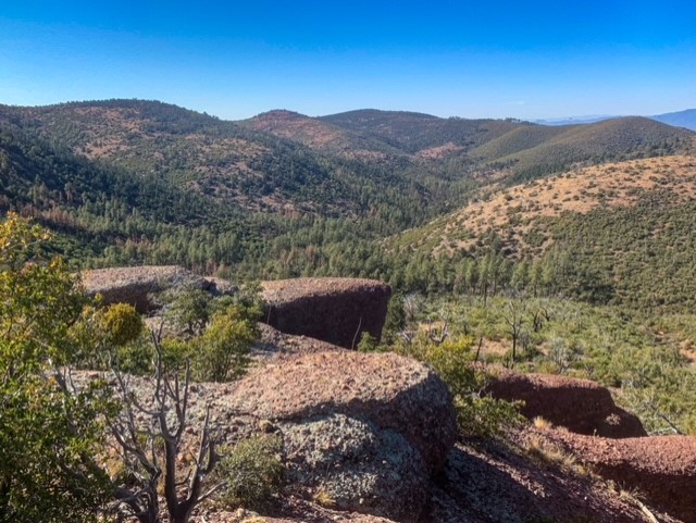
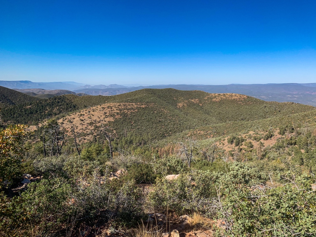
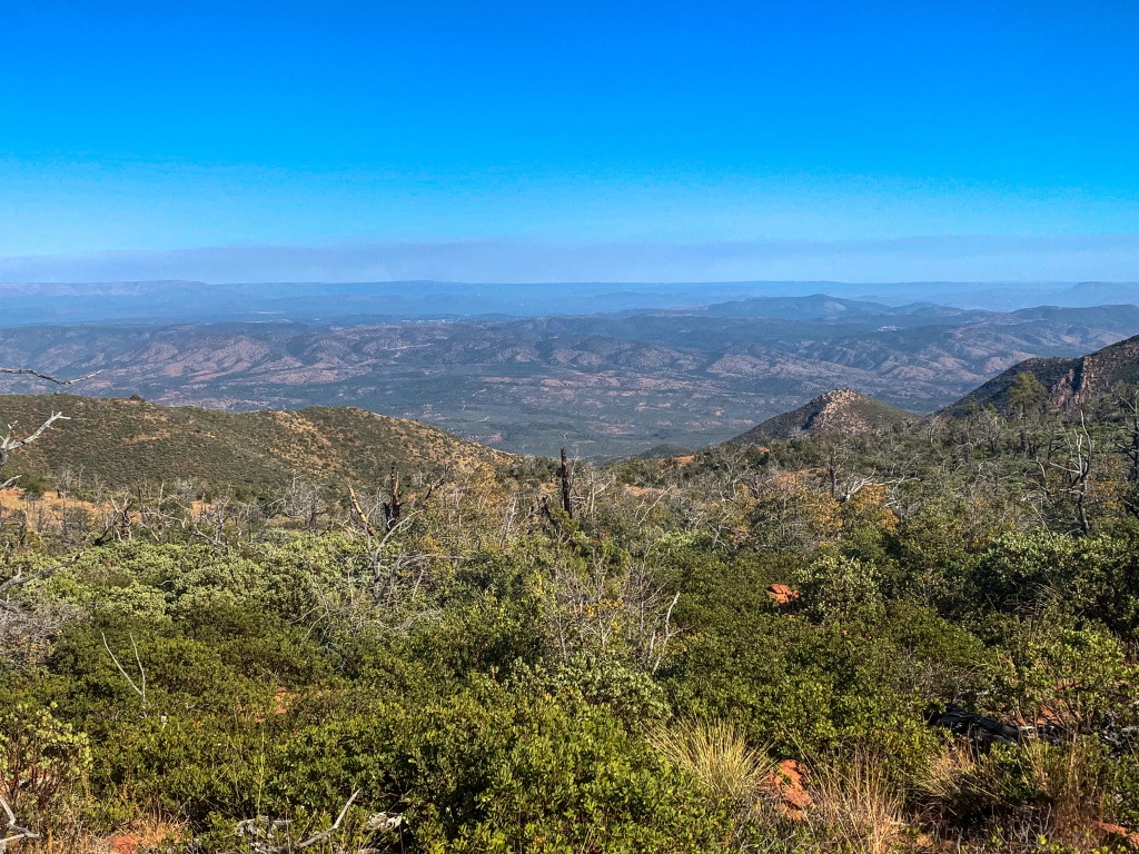
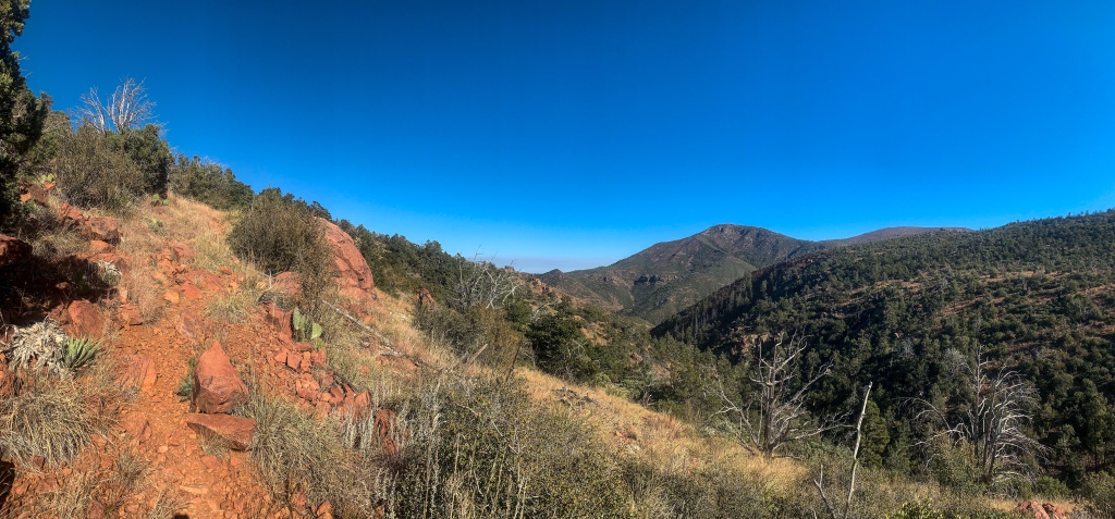
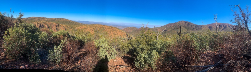
The Mazatzal Divide represents the heart of the longest stretch of the Arizona Trail within a designated wilderness area.
To that end, a reminder on the meaning of wilderness. Under the Wilderness Act of 1964, wilderness is “an area where man is but a visitor and does not remain.” Consequently, motorized access as well as, more controversially among some, bikes are prohibited. The Mazatzal Wilderness, which the trail will remain within until just shy of Strawberry in the central Mazatzals, is about 390 square miles in size. It was one of the original Wilderness Areas designated upon the passage of the Wilderness Act in 1964. (For more discussion of the significance and idea of wilderness, check out the linked article).
If today is any indication, the Mazatzals are one of the best examples of wilderness around.
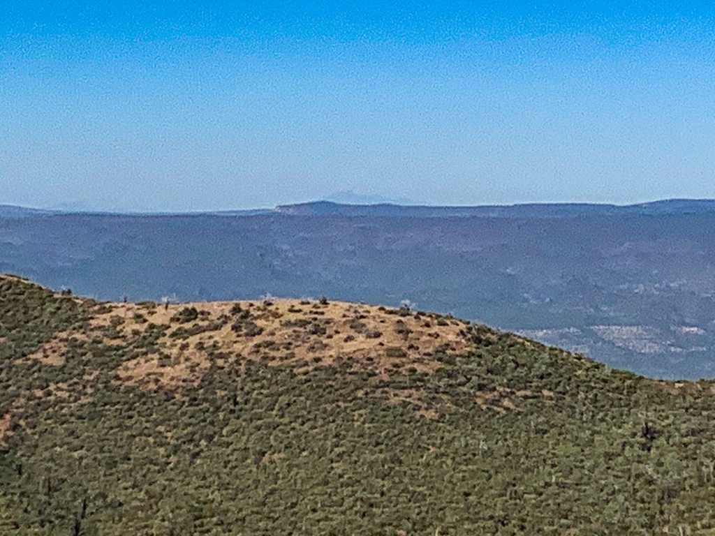
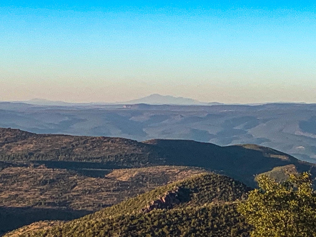
Heading north through the Hills, they provide incredible views all around, including to the San Francisco Peaks and the Mogollon Rim.
Arizona Trail, Passage 23 (Mazatzal Divide)
Mazatzal Wilderness
Tonto National Forest
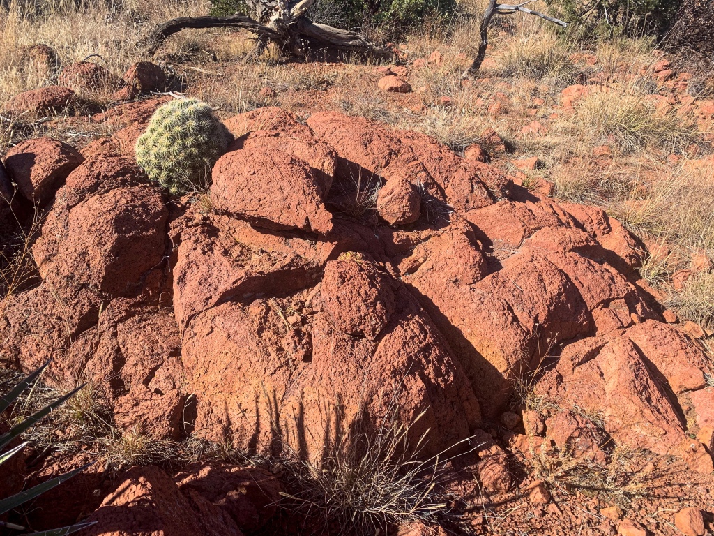
Arizona Trail, Passage 23 (Mazatzal Divide)
Mazatzal Wilderness
Tonto National Forest
Arizona Trail, Passage 23 (Mazatzal Divide)
Mazatzal Wilderness
Tonto National Forest
Arizona Trail, Passage 23 (Mazatzal Divide)
Mazatzal Wilderness
Tonto National Forest

Arizona Trail, Passage 23 (Mazatzal Divide)
Mazatzal Wilderness
Tonto National Forest
Arizona Trail, Passage 23 (Mazatzal Divide)
Mazatzal Wilderness
Tonto National Forest
Arizona Trail, Passage 23 (Mazatzal Divide)
Mazatzal Wilderness
Tonto National Forest
Arizona Trail, Passage 23 (Mazatzal Divide)
Mazatzal Wilderness
Tonto National Forest
Arizona Trail, Passage 23 (Mazatzal Divide)
Mazatzal Wilderness
Tonto National Forest

Arizona Trail, Passage 23 (Mazatzal Divide)
Mazatzal Wilderness
Tonto National Forest
Arizona Trail, Passage 23 (Mazatzal Divide)
Mazatzal Wilderness
Tonto National Forest
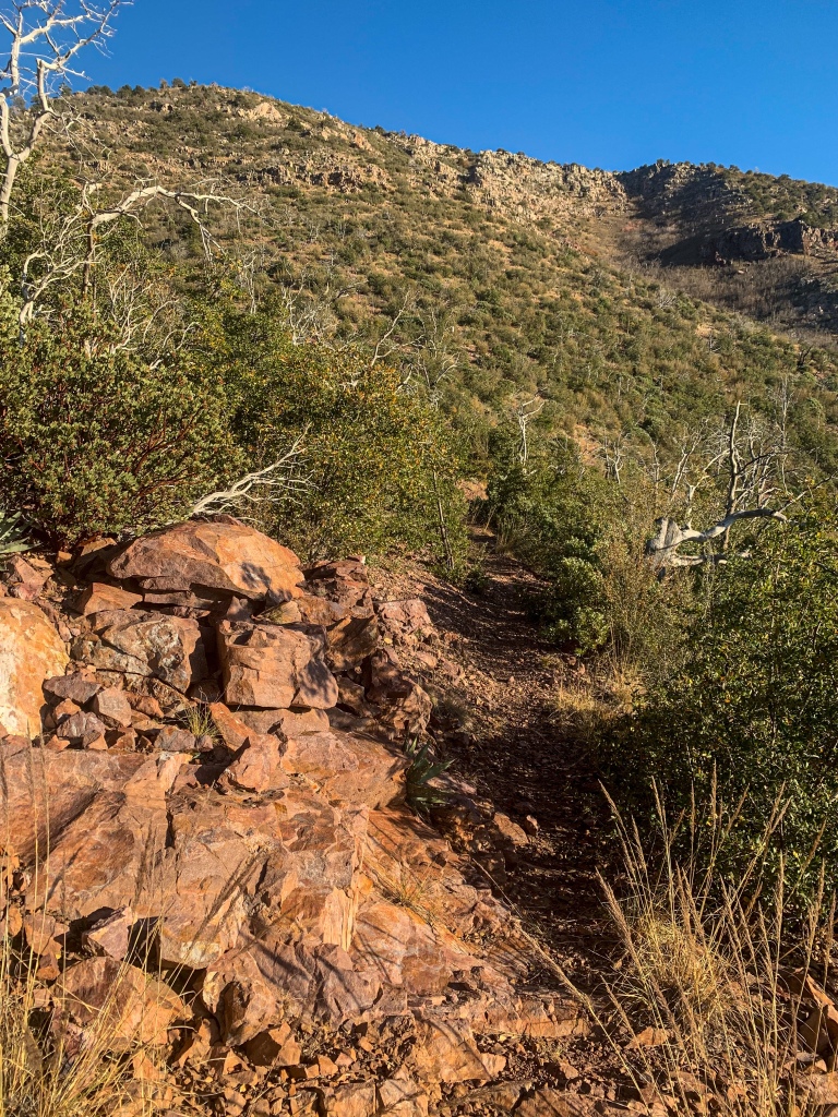
Arizona Trail: The Park to Rocky Ridge
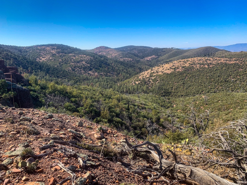
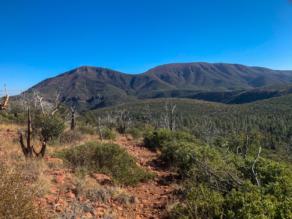
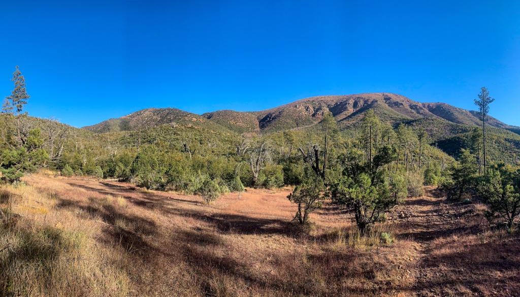
The Arizona Trail heads south from the Red Hills trail junction and through an area known as “The Park” in the shadow of North Peak where remnant ponderosa pines survived the Willow Fire. The Park provides a welcome source of shade and landscape shift from the primarily scrubland coverage that had lasted from the East Verde River. Hiking on from the The Park, the trail winds and climbs out of Maverick Basin to the top of Rocky Ridge as the day wears on.
Arizona Trail, Passage 23 (Mazatzal Divide)
Mazatzal Wilderness
Tonto National Forest
Arizona Trail, Passage 23 (Mazatzal Divide)
Mazatzal Wilderness
Tonto National Forest

Arizona Trail, Passage 23 (Mazatzal Divide)
Mazatzal Wilderness
Tonto National Forest

Arizona Trail, Passage 23 (Mazatzal Divide)
Mazatzal Wilderness
Tonto National Forest
Arizona Trail: Rocky Ridge-Horse Camp Seep
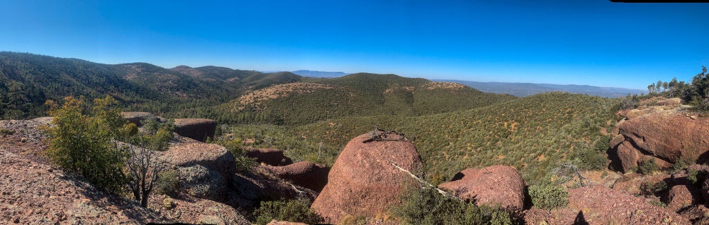
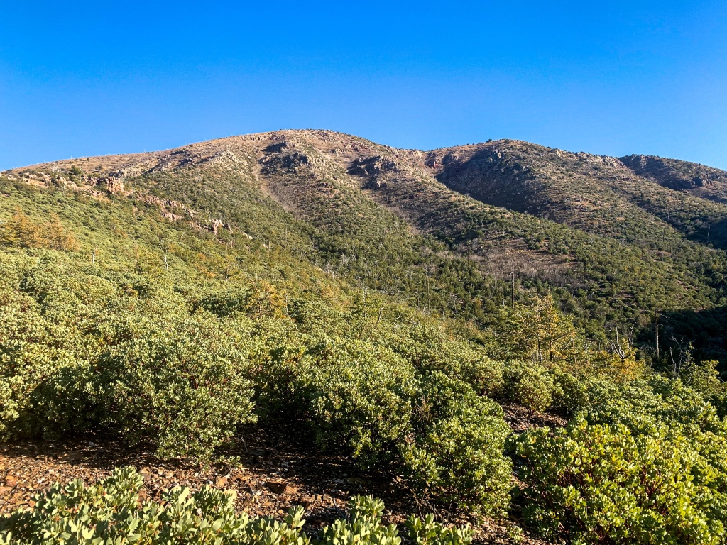
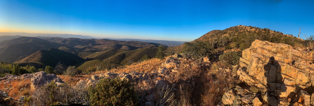
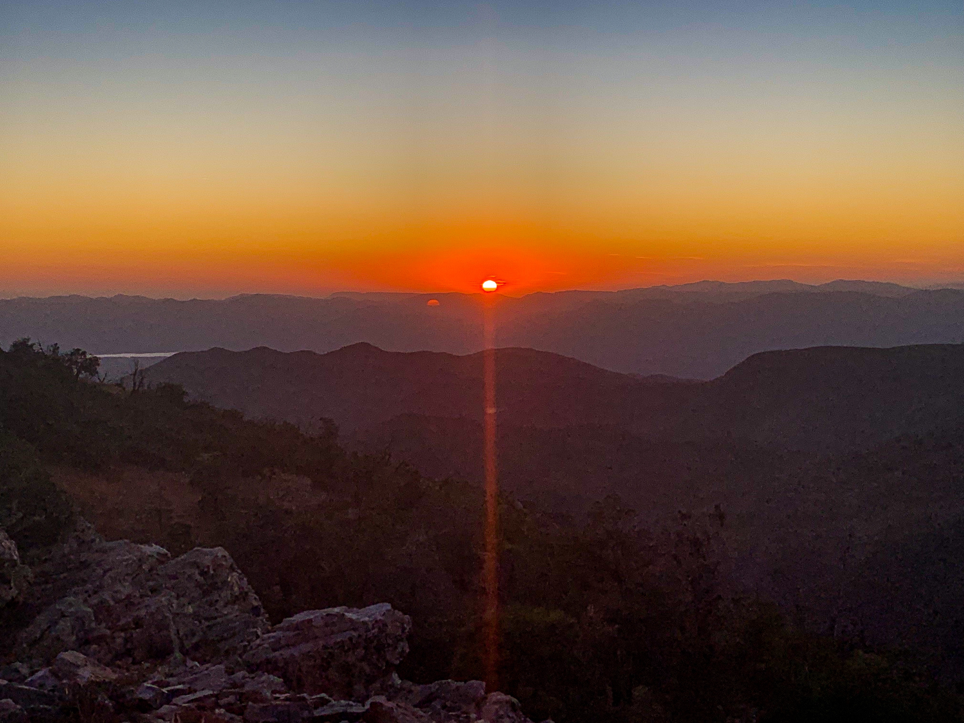
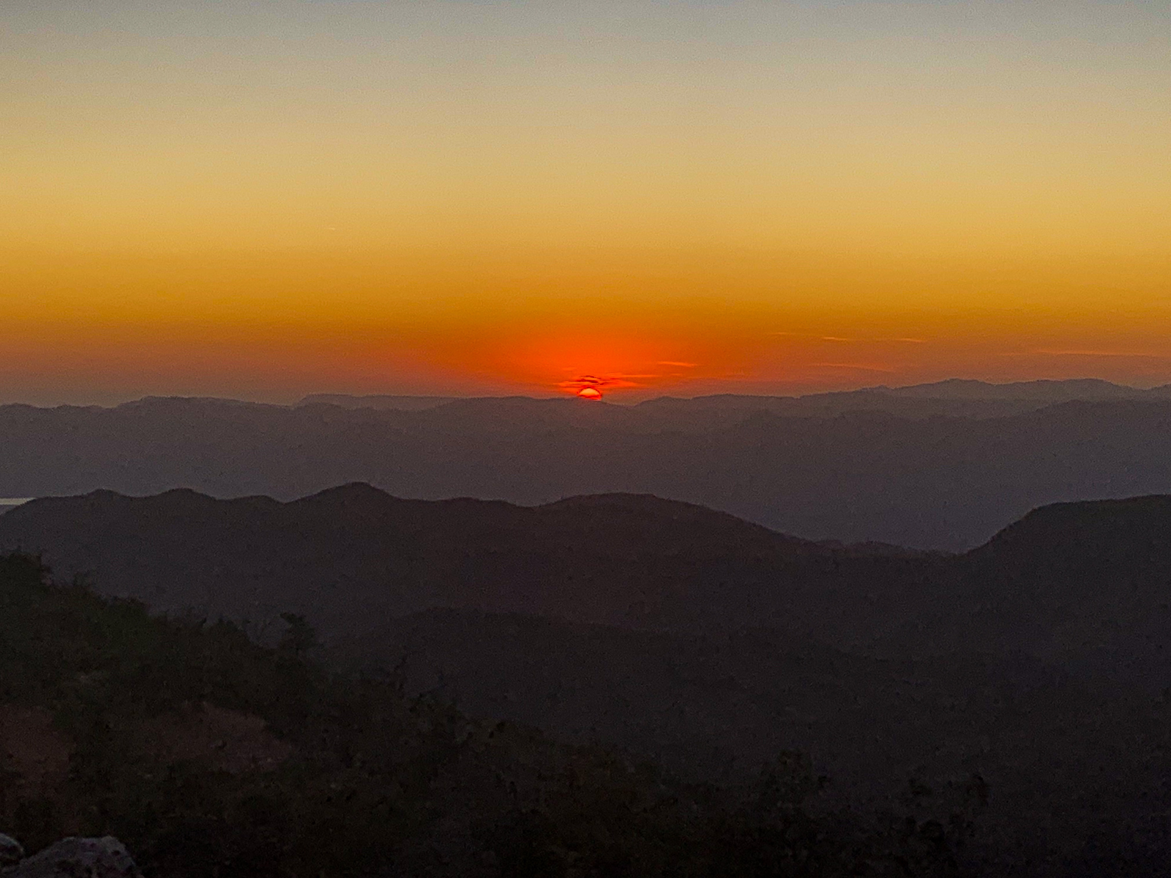
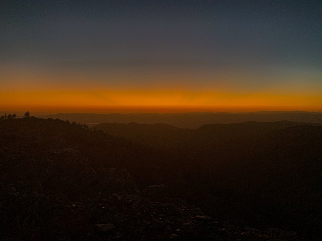
Hiking through afternoon and into evening, Rocky Ridge provides the most memorable experience of the day. The silence and solitude are incredible – I could hear the wings of a raven flap as it flew in front of me, and one could hear single birds cry and echo among the hills. Magnificent. Sunset proved epic too. The colors alone were great, but you could also see the crepuscular rays coming up from the horizon. It looked like someone stretched the Arizona flag across the sky – only the second time I’ve used that description, and first in 5 years. Just magnificent. Needing water, I push on to Horse Camp Seep and filter some from a pothole there. Interview tomorrow, then on southbound.

Arizona Trail, Passage 23 (Mazatzal Divide)
Mazatzal Wilderness
Tonto National Forest
Arizona Trail, Passage 23 (Mazatzal Divide)
Mazatzal Wilderness
Tonto National Forest
Arizona Trail, Passage 23 (Mazatzal Divide)
Mazatzal Wilderness
Tonto National Forest
Arizona Trail, Passage 23 (Mazatzal Divide)
Mazatzal Wilderness
Tonto National Forest

Arizona Trail, Passage 23 (Mazatzal Divide)
Mazatzal Wilderness
Tonto National Forest

Arizona Trail, Passage 23 (Mazatzal Divide)
Mazatzal Wilderness
Tonto National Forest
Arizona Trail, Passage 23 (Mazatzal Divide)
Mazatzal Wilderness
Tonto National Forest
Passage 23 Logistics
| Passage 23 (Mazatzal Divide) | |
| Passage Map | Mazatzal Divide Topo Map |
| Trail Surface | Dirt trail |
| Length (Mi) | 24.3 |
| Season | All year, but snow can make sections impassable in winter. |
| Potential Water Sources | Horse Camp Seep Hopi Spring Chilson Spring Bear Spring For a full list including status, check the FarOut app and the AZTA website: AZT Water Report |
| Trailheads | North: Red Hills Trail Junction South: Mount Peeley Trailhead |
| Trailhead Access | North: Foot only. 5.75 mi from City Creek Trailhead South: Foot & 0.5 mi hike on Cornucopia Trail from trailhead. |
| Wilderness | Most |
| Possible resupply points | None |
| ATA-Rated Difficulty | Moderate |
| Potential campsites (mileages S to N) | 6.7, 9.4, 19.4, 22 |
| Hazards | Heat – wear a cotton shirt so you can soak it. Synthetics aren’t great in the desert. Hyponatremia – “drunk on water.” To avoid, ensure adequate salt & electrolyte intake and ensure you eat as well as drink water. Symptoms are almost identical to dehydration, but drinking more makes it worse. Prevention is by far the best solution. Dehydration |
| Ecosystems Traversed | Interior Chaparral Great Basin Conifer Woodland Rocky Mountain Montane Conifer Woodland Relict Conifer Woodland |
| AZTA Passage Description | Passage 23: Mazatzal Divide |
| Current Weather (NWS) | Mazatzal Divide Weather |
Passage 23 Ecology
| Interior Chaparral | Great Basin Conifer Woodland | Rocky Mountain Montane Conifer Woodland | |
| Common Trees/Shrubs | * Birchleaf Mahogany * Ceanothus * Holly-leaf buckthorn * Manzanita * Shrub live oak * Silktassels * Stansbury cliffrose | * Arizona alder * Holly-leaf buckthorn * Junipers * Oaks, including Arizona oak, canyon live oak, Emory oak, Gambel oak, scrub-live oak * Piñon pine * Red barberry * Serviceberry * Silktassels * Skunkbush * sugar sumac | * Ponderosa Pine * Southwestern white pine * Subalpine fir * White fir * Rocky Mountain maple * Bigtooth maple * Grey alder * Red birch * Red osier dogwood * Cliffbush * Mallow ninebark * New Mexican locust * huckleberry * bilberries |
| Common herbaceous plants | * Buckwheats * Globemallows * Lupines * Penstemons * Sego-lily * Wormwood | * fringed brome * Geyer’s sedge/elk sedge * Ross’ sedge * Bronze sedge/dry land sedge/hillside sedge/hay sedge/Fernald’s hay sedge * screwleaf muhly * bluebunch wheatgrass * Spruce-fir fleabane * wild strawberry/Virginia strawberry * Small-flowered woodrush * mountain sweet Cicely * bittercress ragwort * western meadow-rue * Fendler’s meadow-rue | |
| Common succulents | * Agaves – golden flowered, Parry’s, Toumey’s * Banana & soap tree yucca * Barrel cactus * beargrass * beehive cactus * buckhorn cholla * Cane Cholla * hedgehog cacti * prickly pear cacti * Rock echeveria * Sotol * Whipple’s cholla | * beehive cactus * Claret cup hedgehog cacti * Golden-flowered agave * Parry’s agave * Prickly pear cacti * Whipple cholla * Tonto Basin agave |
3 thoughts on “Amazing, Spectacular Arizona Trail Thruhike: The Park-Horse Camp Seep”