Arizona Trail Approach Day 8, Part 3
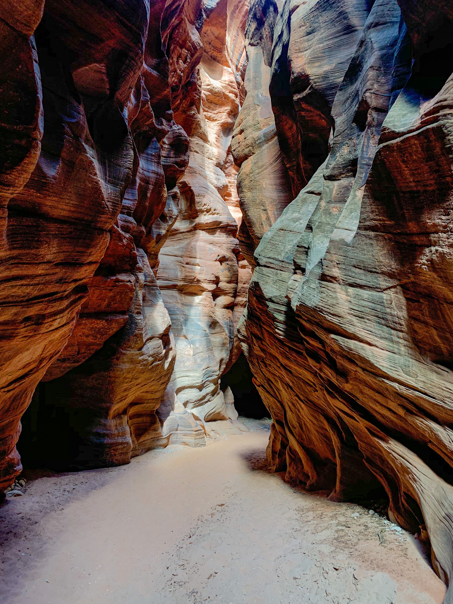
Buckskin Gulch-Wire Pass Day 3, Part 3

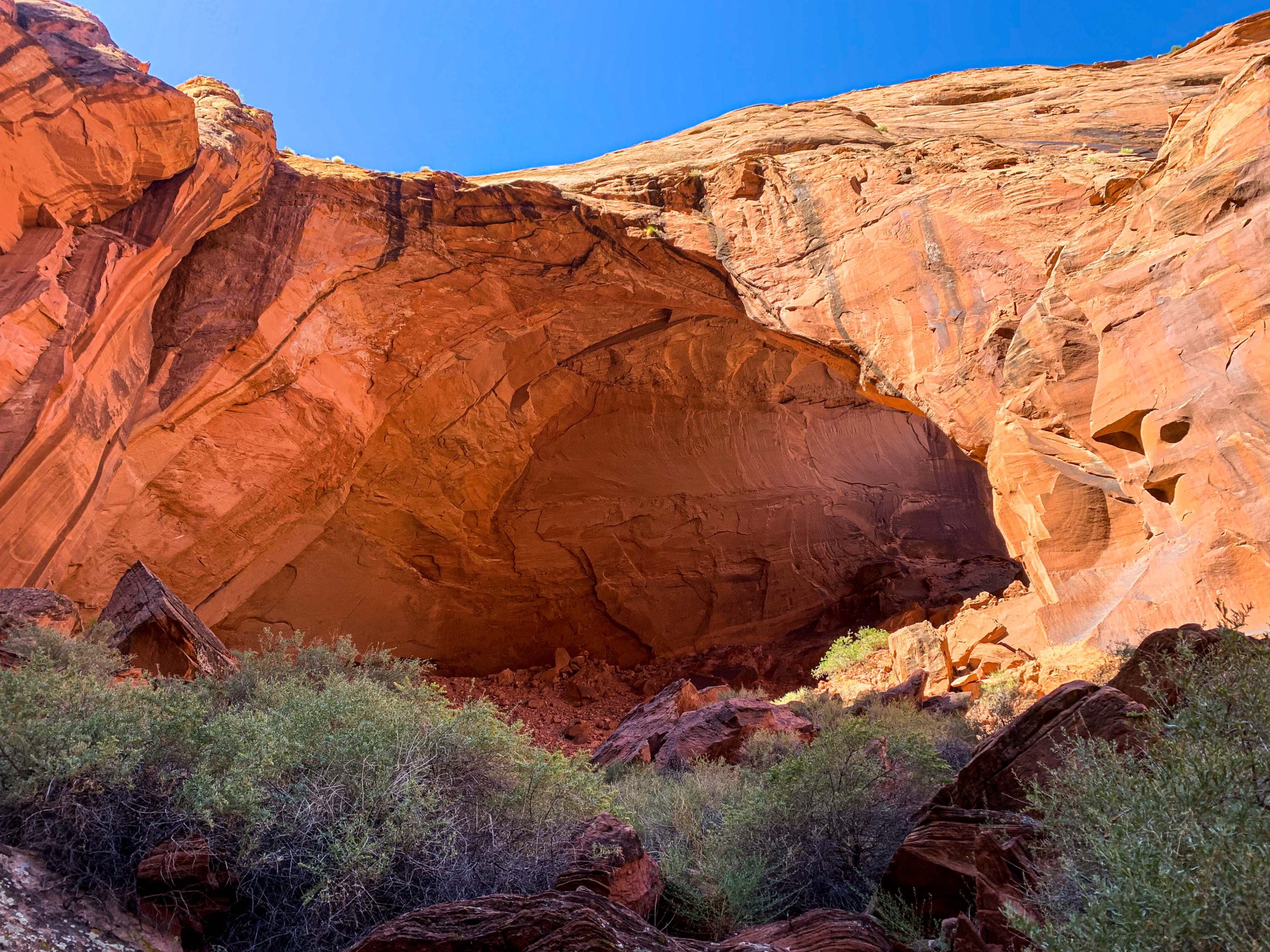
Paria Canyon-Vermilion Cliffs Wilderness
Buckskin Gulch-Wire Pass
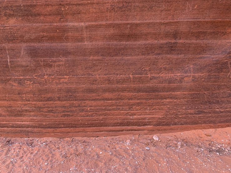
As the day continues, I hike out the last 1.5 miles through Buckskin Gulch to the junction with Wire Pass in the Paria Canyon-Vermilion Cliffs Wilderness, and find another large petroglyph panel at the junction. Buckskin continues northward, but I turn off here toward Wire Pass, a tributary slot canyon that winds westward.
Paria Canyon-Vermilion Cliffs Wilderness
Paria Canyon-Vermilion Cliffs Wilderness


Buckskin Gulch petroglyphs
Undisclosed location within Paria Canyon-Vermilion Cliffs Wilderness
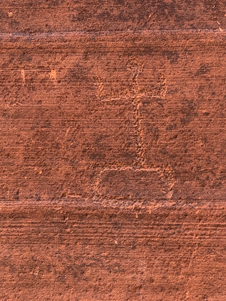
Buckskin Gulch petroglyphs
Undisclosed location within Paria Canyon-Vermilion Cliffs Wilderness

Buckskin Gulch petroglyphs
Undisclosed location within Paria Canyon-Vermilion Cliffs Wilderness
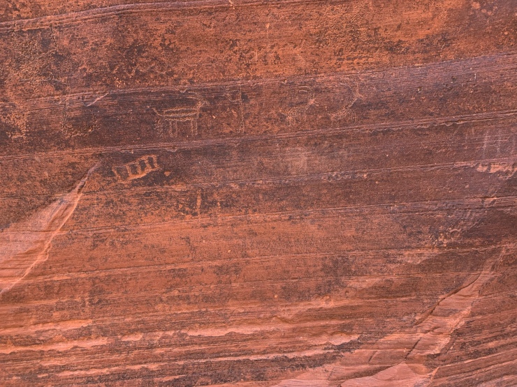
Buckskin Gulch petroglyphs
Undisclosed location within Paria Canyon-Vermilion Cliffs Wilderness
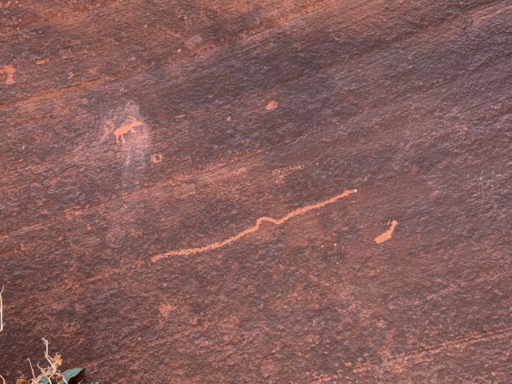
Buckskin Gulch petroglyphs
Undisclosed location within Paria Canyon-Vermilion Cliffs Wilderness
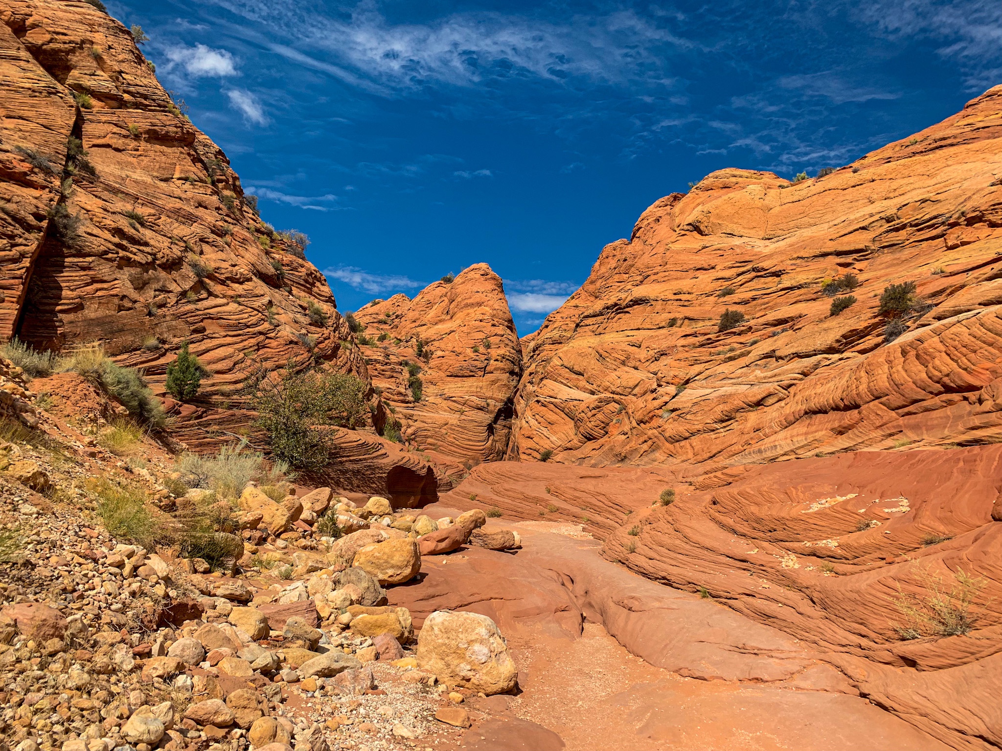
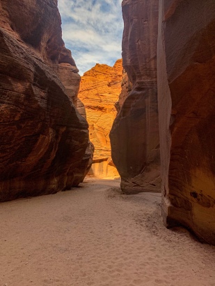
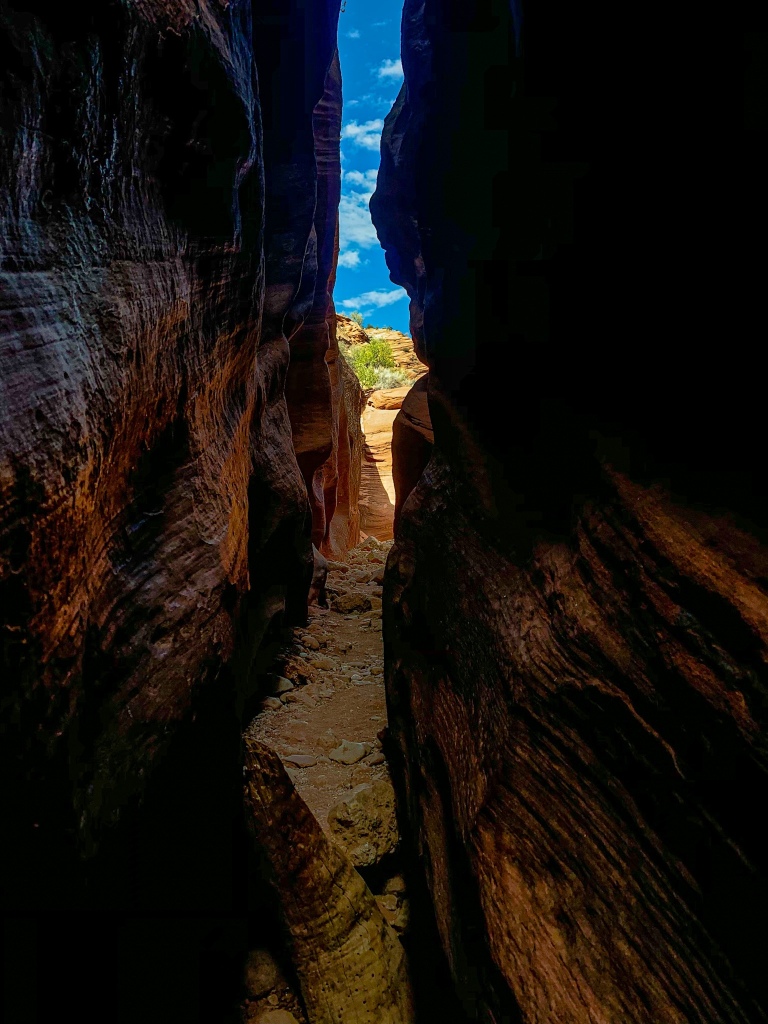
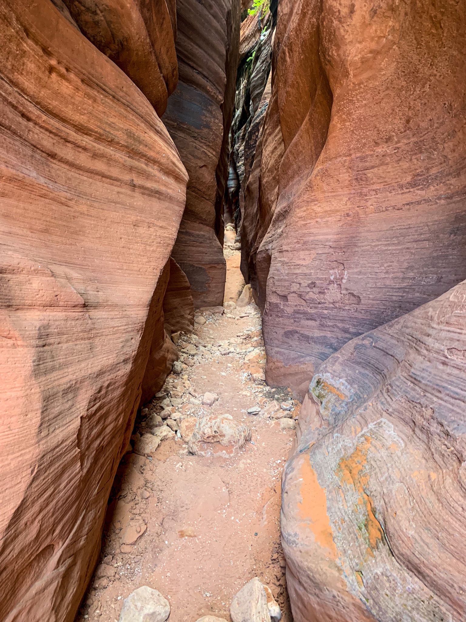
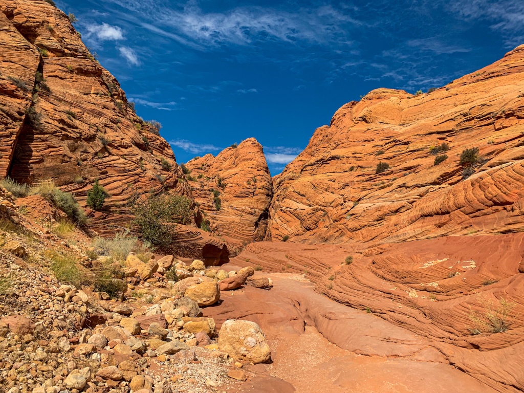
Wire Pass
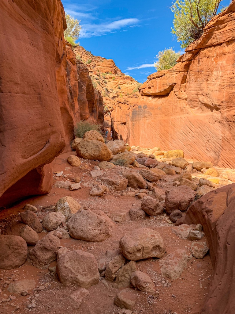
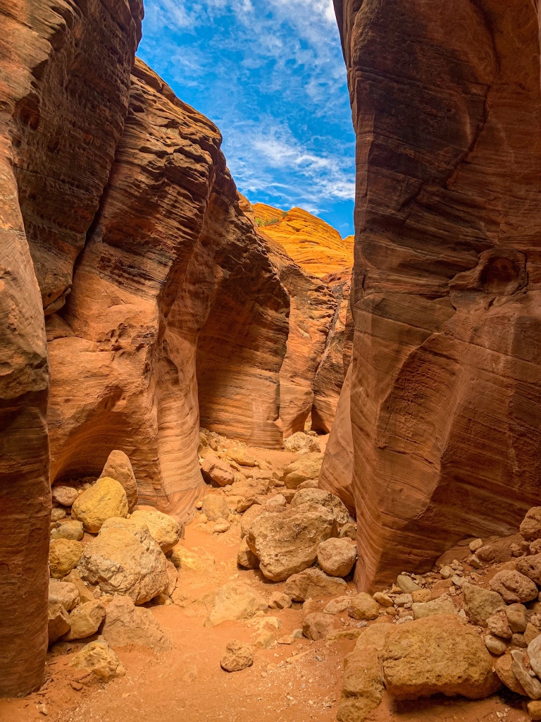
After a tight squeeze through the Wire Pass narrows – I had to take my pack off and pass it through separately – the canyon widens into a wider wash surrounded by bright orange rock under a brilliant blue sky. I cross paths with Pete from Massachusetts for some interesting conversation and fill up on water – then reunite with my friends from Oklahoma who give me a lift over to the AZT.
Undisclosed location within Paria Canyon-Vermilion Cliffs Wilderness
Wire Pass
Paria Canyon-Vermilion Cliffs Wilderness
 Wire Pass
Paria Canyon-Vermilion Cliffs Wilderness
Wire Pass
Paria Canyon-Vermilion Cliffs Wilderness
Wire Pass
Paria Canyon-Vermilion Cliffs Wilderness
Paria Canyon-Vermilion Cliffs Wilderness
Paria Canyon-Vermilion Cliffs Wilderness Logistics
| Paria Canyon-Vermilion Cliffs Wilderness | |
| BLM Information | Paria Canyon-Vermilion Cliffs Wilderness |
| Weather Forecast | Buckskin Gulch Weather |
| Trail Surface | Rustic (the river is the trail) |
| Length (Mi) | 45 (Lee’s Ferry to Wire Pass via Buckskin Gulch) 38 (Paria Canyon, Lee’s Ferry to White House) 20 (Wire Pass to White House via Buckskin Gulch) 22, approx. (Buckskin Gulch to White House) 1.8 (Wire Pass to Buckskin Gulch) |
| Season | Fall-Spring. Brutally hot in summer. |
| Potential Water Sources | Springs. Unless informed otherwise by a BLM ranger, there is likely no drinkable water in Buckskin Gulch, and the Paria River should be considered undrinkable even when filtered. Know how to recognize desert springs. |
| Trailheads | Paria Canyon North: White House Paria Canyon South: Lee’s Ferry Buckskin Gulch Middle Exit Buckskin Gulch West Wire Pass |
| Trailhead Access | Vehicular access to all trailheads |
| Wilderness | Yes |
| Possible resupply points | None |
| Difficulty | Strenuous |
| Potential campsites | Best near springs. Some higher-water campsites in north, south of Buckskin Gulch-Paria Canyon confluence. Use higher water sites if there is any risk of rain. Few to no campsites in Buckskin Gulch. |
| Threats | Flash flooding – Extreme hazard here. Know the forecast daily (an inReach or other satellite communicator helps with this). Know how to recognize the signs of a flash flood and how to react. You cannot outrun a flash flood; you must climb above it. This is not possible in Buckskin Gulch – do not enter it if storms are in the forecast during your trip. Heat – wear a cotton shirt so you can soak it. Synthetics aren’t great in the desert. Hyponatremia – “drunk on water.” To avoid, ensure adequate salt & electrolyte intake and ensure you eat as well as drink water. Symptoms are almost identical to dehydration, but drinking more makes it worse. Prevention is by far the best solution. Dehydration Hypothermia in winter, made worse by exposure to cold water Because there is no trail, there are places where boulders must be climbed around or over and at least one spot where your pack must be hauled over a boulder jab. Flash floods change the trail, shifting obstacles around, removing some and adding others. Expect the unexpected. |
| Permits Required? | Yes. 20 people max per night issued on recreation.gov . |
| Miscellaneous | Leave No Trace is different in the desert. Know desert principles and carry wag bags. |
| Cell service? | Nonexistent |