Today begins the about 900 mile trek south to Mexico from Lee’s Ferry, Arizona. While I could have just arranged a shuttle directly to the AZT trailhead, that would be too easy! And when there is a public land area like Vermillion Cliffs just next door, which I have been yearning to get to for months, my glutton for punishment side takes over.
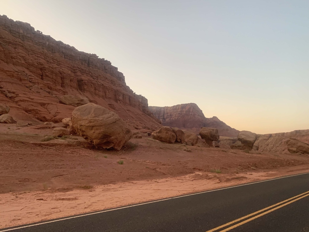
So I took the shuttle today from the South Rim of Grand Canyon to Marble Canyon and hiked down the road to the campground at Lee’s Ferry. It is still pretty warm during the day, in the mid-90s. Substantially warmer than the South Rim, so it’s apparent pretty quick there will be some acclimation involved. The shuttle driver, knowing my intentions, asks for my photo ”just in case no one ever sees you again,” or something to that effect. The reason is a little macabre, but I oblige. Walking down to the campground from Marble Canyon, the road passes by towering red rock cliffs and giant boulders.
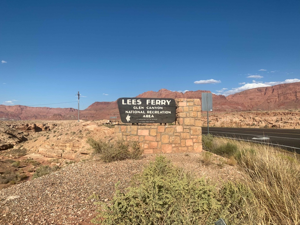
Glen Canyon National Recreation Area

Glen Canyon National Recreation Area
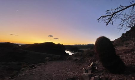
Lee’s Ferry and the Vermilion Cliffs are one of my favorite sunset spots around, and I expect the next few days will be no different. It’s still feels like summer during the days here, getting into the mid-90s. But the night is cool, dipping into the 70s.
Tomorrow I hope to take a brief wander down to the Colorado River in search of a remote Grand Canyon National Park entry sign. A friend who visited this summer brought it to my attention. I’ll stop by the ranger program apparently being held at Lonely Dell Ranch before heading up Paria Canyon into the Paria Canyon-Vermilion Cliffs Wilderness.
That will take me to my first steps out on this 850 or so mile journey to Mexico.
Glen Canyon National Recreation Area
The plan? Over the next few days, hike the 45 miles from Lee’s Ferry to the Wire Pass Trailhead, first through Paria Canyon and then through Buckskin Gulch, the longest and deepest slot canyon in the world. From there, it’s 1.5 miles to the northern trailhead of the Arizona National Scenic Trail, and then about 800 miles to Mexico.
It all starts tomorrow.

- Beautiful Baxter State Park: Wassataquoik Lake & Green Falls (Part 2)
- Beautiful Baxter State Park: Wassataquoik Lake & Green Falls (Part 1)
- Beautiful Red Cliffs Desert Reserve: Sand Hill/Dino Cliffs Loop
- Beautiful Katahdin Woods & Waters NM: Spectacular Mountain Views
- How to Plan Around the Potential Impacts of a Government Shutdown on National Parks and Public Lands
Fashion Styles
Hello. splendid job. I did not imagine this. This is a excellent story. Thanks!
Fashion Styles
wonderful post, very informative. I wonder why the other experts of this sector don’t notice this. You must continue your writing. I’m sure, you’ve a huge readers’ base already!
Fashion Styles
I like the helpful information you provide in your articles. I will bookmark your blog and check again here frequently. I’m quite sure I will learn lots of new stuff right here! Best of luck for the next!
Latest Hairstyles
Can you write more about it? Your articles are always helpful to me. Thank you!
Health Fitness
The articles you write help me a lot and I like the topic
Health Fitness
The articles you write help me a lot and I like the topic
Beauty Fashion
Thank you for your articles. I find them very helpful. Could you help me with something?
Beauty Fashion
The articles you write help me a lot and I like the topic
Beauty Fashion
Thank you for your post. I really enjoyed reading it, especially because it addressed my issue. It helped me a lot and I hope it will also help others.
17 Best Short Hairstyles for Women Over 50 With Glasses
Hey There. I found your blog using msn. This is a really well written article. I will be sure to bookmark it and come back to read more of your useful information. Thanks for the post. I will definitely return.
Beauty Fashion
Wow, incredible blog structure! How long have you been running a blog for? you made running a blog glance easy. The total look of your site is magnificent, as neatly as the content!
Hairstyles
I am constantly looking online for ideas that can facilitate me. Thx!
Hairstyles
You are a very bright person!
Beauty Fashion
I do agree with all the ideas you have presented in your post. They’re really convincing and will certainly work. Still, the posts are very short for novices. Could you please extend them a bit from next time? Thanks for the post.
Beauty Fashion
Once I initially commented I clicked the -Notify me when new feedback are added- checkbox and now each time a comment is added I get 4 emails with the identical comment. Is there any method you’ll be able to take away me from that service? Thanks!
Aspen
I believe I may be able to modify that, but I don’t see your username listed as a registered subscriber. Do you know what you registered under? Thanks!
Hi Hairstyles
I really like your blog.. very nice colors & theme. Did you make this website yourself or did you hire someone to do it for you? Plz respond as I’m looking to create my own blog and would like to find out where u got this from. thanks a lot
Aspen
Thanks! I did it myself based on a WordPress theme.
Fashion Styles
Wonderful work! This is the type of information that should be shared around the web. Shame on the search engines for not positioning this post higher! Come on over and visit my website . Thanks =)
Hairstyles
Someone essentially help to make seriously posts I would state. This is the first time I frequented your web page and thus far? I surprised with the research you made to create this particular publish incredible. Excellent job!
Hairstyles
Thanks a lot for sharing this with all folks you actually know what you are speaking about! Bookmarked. Please also visit my web site =). We can have a link change agreement between us!
Fashion Styles
I was recommended this blog by my cousin. I’m not sure whether this post is written by him as no one else know such detailed about my problem. You’re wonderful! Thanks!
Hi Hairstyles
We are a group of volunteers and opening a new scheme in our community. Your website provided us with valuable info to paintings on. You’ve performed a formidable job and our whole neighborhood can be thankful to you.
Hairstyles
Great ?I should definitely pronounce, impressed with your site. I had no trouble navigating through all the tabs and related information ended up being truly easy to do to access. I recently found what I hoped for before you know it in the least. Reasonably unusual. Is likely to appreciate it for those who add forums or something, site theme . a tones way for your client to communicate. Nice task..
Fashion Styles
Have you ever considered about adding a little bit more than just your articles? I mean, what you say is valuable and all. Nevertheless think of if you added some great graphics or videos to give your posts more, “pop”! Your content is excellent but with pics and videos, this website could definitely be one of the most beneficial in its niche. Excellent blog!
Beauty Fashion
Wow, awesome blog structure! How lengthy have you ever been blogging for? you made running a blog glance easy. The entire look of your web site is excellent, as smartly as the content!
Fashion Styles
Wonderful blog! I found it while surfing around on Yahoo News. Do you have any tips on how to get listed in Yahoo News? I’ve been trying for a while but I never seem to get there! Thanks
Hairstyles
I’m usually to blogging and i actually respect your content. The article has really peaks my interest. I’m going to bookmark your web site and maintain checking for brand new information.
Hairstyles
Normally I don’t learn post on blogs, but I would like to say that this write-up very pressured me to try and do it! Your writing style has been amazed me. Thank you, very nice post.
Gal Jerman
Top site ,.. amazaing post ! Just keep the work on !
Beauty Fashion
Pretty section of content. I just stumbled upon your web site and in accession capital to assert that I acquire actually enjoyed account your blog posts. Anyway I will be subscribing to your augment and even I achievement you access consistently rapidly.
Hairstyles Women
Terrific work! This is the type of information that should be shared around the web. Shame on Google for not positioning this post higher! Come on over and visit my web site . Thanks =)
Mark
Thanks for your blog, nice to read. Do not stop.