Cedar Breaks: Brian Head to North Overlook
CRUNCH. CRUNCH. I felt warm back at the car – usually an indication of being overdressed. Guess not; the wind is accommodating whatever extra layers I might have thought I had on. The road flattens as it passes barely visible road signs marking the area around a Dixie National Forest viewpoint and approaches the entrance sign for Cedar Breaks National Monument, a jewel of a national park just north of Zion National Park and an easy day trip from the great road trip city of Saint George in southwest Utah.

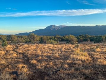
It’s a real winter in southern Utah, and I’ve driven up from Saint George to the ski town of Brian Head, strapped on my snowshoes and am heading up the closed section of UT-143 above the slopes. As I climb the slope of the road, buried in feet of snow, the wind scrapes the top layer of snow off of the pack and blasts it in my face. I bury my chin in my jacket, pull up my outer hood, and take a break every now and then to admire the view of Brian Head peak above.

Approaching the entrance sign, it becomes immediately apparent that only the Arrowhead and the very top bar of the sign, containing the line “National Park Service – US Department of the Interior” are visible. The actual park name and designation are buried in the feet of snow. I’m able to dig out the park name, but beneath that, the snow is simply too deep and compacted. Onward ho.
North Overlook
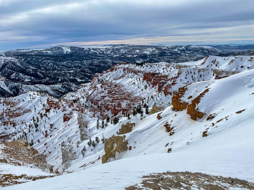
I pull up to the first overlook, the North Overlook of the eroded edge of the Markagunt Plateau known as Cedar Breaks. It’s a spectacular southern view of colorful rocks coated by snow. Returning to the “road,” the route continues past the junction between UT-143 (which turns west to Panguitch) and UT-148 (which continues south through the monument to UT-14 in Cedar Canyon.

Cedar Breaks National Monument, Utah

Cedar Breaks National Monument, Utah
Cedar Breaks: North Overlook-Chessmen’s Ridge Overlook
Following the 148 corridor, the wind abates in small groves of stunted evergreens. The route passes in the process the north end of the alpine lake loop and eventually comes to another set of overlooks, including the Chessmen’s Ridge Overlook. Here, there is a USGS marker, with a backdrop of the eroded ridgelines as they stretch westward.

Cedar Breaks National Monument, Utah

Cedar Breaks National Monument, Utah

Cedar Breaks National Monument, Utah

Cedar Breaks National Monument, Utah


Cedar Breaks National Monument, Utah


Cedar Breaks National Monument, Utah

Cedar Breaks National Monument, Utah

Cedar Breaks National Monument, Utah

Cedar Breaks National Monument, Utah
Chessmen’s Ridge Overlook-Sunset Point
The home stretch takes me down a slope to Sunset Point before I return to my car. From Chessmen’s Ridge there is a long descent down to Sunset Point, so if you don’t want to climb this, either on your way out if coming from UT-14 to the south or on your way back if coming from Brian Head as I did from the north, then factor that into your decision.
Ran out of time to make it to Point Supreme, but still a fantastic day on the trails of Southwest Utah. Maybe next time I’ll be able to come up from the UT-14 side and be able to tack on the Ramparts Trail as well. I managed it in the summer before.

Cedar Breaks National Monument, Utah

Cedar Breaks National Monument, Utah

Cedar Breaks National Monument, Utah

Cedar Breaks National Monument, Utah

Cedar Breaks National Monument, Utah

Cedar Breaks National Monument Geology
Cedar Breaks National Monument is the top of Utah’s geologic feature known as the Grand Staircase. Designated in 1933 by President Franklin Delano Roosevelt, Cedar Breaks preserves a large amphitheater on the western edge of the Markagunt Plateau (which is also a key feature of Zion National Park to the south). Called the “Circle of Painted Cliffs” by the indigenous population, its colors are more subtle than those at Bryce Canyon, but still notable.
Shale, limestone, and sandstone deposited at the bottom of ancient Lake Claron (about the size of Lake Erie today) are now eroding off the plateau at 2 inches/year, and the entire plateau is capped with volcanic tuff, deposited prior to the rise of the plateau in some of the largest eruptions in the history of the earth, from volcanoes near the Utah/Nevada state line today.
The still-active Hurricane Fault has subsequently raised Cedar Breaks and the Markagunt while lowering the valley to the west, and forms the border between the Colorado Plateau and the Basin and Range of western Utah and Nevada. Subsequent weathering of the rock has produced the landscape known today as Cedar Breaks: fins, hoodoos, caves, arches, and slumps all are products of weathering of the elevated plateau, which now sits around 10,500 feet in height. For more information about the geology of Cedar Breaks, check out the NPS site on the topic.
In addition to its geologic wonders, Cedar Breaks is also home to a ridiculous profusion of wildflowers in the summer as well as the oldest trees in the world, bristlecone pines. These long-lived survivors are capable of essentially hibernating parts of the tree in dry times in order to conserve resources. They are best seen along the Ramparts Trail. Please remember to leave no trace, especially when it comes to fragile wildflower meadows. Enjoy something from a distance, but please remember that someone else will also enjoy it and do not enter the meadows or pick the flowers.
Cultural History
Cedar Breaks has long been a focal point for human settlement of the area. Southern Paiutes referred to the area as “u-map-wich” or “the place where the rocks are sliding down all the time.” It was also known as Ungkaw Pekonump, or “red-cove.” Cedar Breaks is the European settler term for the area, based on the similar appearance of juniper trees to cedars and the common regional term “breaks,” referring to an area with a sharp change in topography. The area was established as a national monument separate from Dixie National Forest in 1933. For more, see the cultural information available on the Cedar Breaks website.
| Park Website | Cedar Breaks National Monument |
| Park Weather | Cedar Breaks Weather |
| Length | Minimum route from Brian Head to North Overlook: depends on closure point, but in heavy snow year it was about 2-3 miles. That is probably the maximum assuming UT-143 to Brian Head is open at all. Brian Head to Chessmen’s Ridge Overlook: 8.2 miles round trip Brian Head to Sunset Point: 10.2 miles round trip (written above) Brian Head to Point Supreme: 12 miles round trip Brian Head to UT-14: 19.2 miles round trip (9.6 miles one way) |
| Trail Options (Winter, snowshoe only) | Ramparts Trail (unmarked) UT-148 and part of UT-143 |
| Trail Options (summer) | Alpine Pond Trail Ramparts Trail |
real madrid shirt ramos
such a great word which you use in your article and article is amazing knowledge. thank you for sharing it.
Фурнитура для амбарных дверей
Its such as you read my thoughts! You seem to grasp so much about this, like you wrote the e-book in it or something. I believe that you simply could do with a few to pressure the message home a little bit, however instead of that, that is fantastic blog. A fantastic read. I’ll definitely be back.
тута
I was able to find good advice from your articles.
Русский сайт Linux Mint | Линукс Минт
Hi there to every body, it’s my first pay a visit of this website; this webpage consists of remarkable and in fact good information designed for readers.
объявления
Hi, I check your blogs on a regular basis. Your story-telling style is awesome, keep it up!