Backpacking the Arizona Trail: Passage 33, Flagstaff
AZT Day 22
Trans-Arizona/Utah Day 29
In the land of Arizona
Through desert heat or snow
Winds a trail for folks to follow
From Utah to Old Mexico
It’s the Arizona Trail
A pathway through the great Southwest
A diverse track through wood and stone
Your spirit it will test
Oh, sure you’ll sweat and blister
You’ll feel the miles every day
You’ll shiver at the loneliness
Your feet and seat will pay
But you’ll see moonlight on the borderlands
You’ll see stars on the Mogollon
You’ll feel the warmth of winter sun
And be thrilled straight through to bone
The aches and pains will fade away
You’ll feel renewed and whole
You’ll never be the same again
With Arizona in your soul
Along the Arizona Trail
A reverence and peace you’ll know
Through deserts, canyons, and mountains
From Utah to Old Mexico
-“The Arizona Trail,” Dale R. Shewalter
Welcome back to Aspen’s Tracks, thruhiking the Arizona Trail from Utah to Mexico.
Arizona Trail: Schultz Pass
The trail continues through forest that opens up as it heads south. The forest here looks younger, possibly impacted by fires more recently. Indeed, a fire – possibly the one I saw yesterday, or a different one – appears to be burning to the southwest, possibly in the Bradshaw Mountains. Flagstaff can be seen in the immediate foreground; the fire is on the horizon across a mountain ridgeline. Appears to possibly be in the general direction of Prescott. Again, could be a prescribed burn given the showers and virga that passed through recently.
Arizona Trail: Dry Lake Hills
Hiking out the west side of Schultz Pass, the trail enters and wraps around the west and south sides of the Dry Lake Hills, and immense burn piles appear beside the trail, obvious preparations for future prescribed burns that add to the more open views and young trees, as well as the burn marks on trees (living and dead) to project a general impression of a more fire-impacted landscape. There was a large fire in this general vicinity this summer, the Museum Fire, but it’s unclear if this was an area impacted by that. It’s quite possible, however.
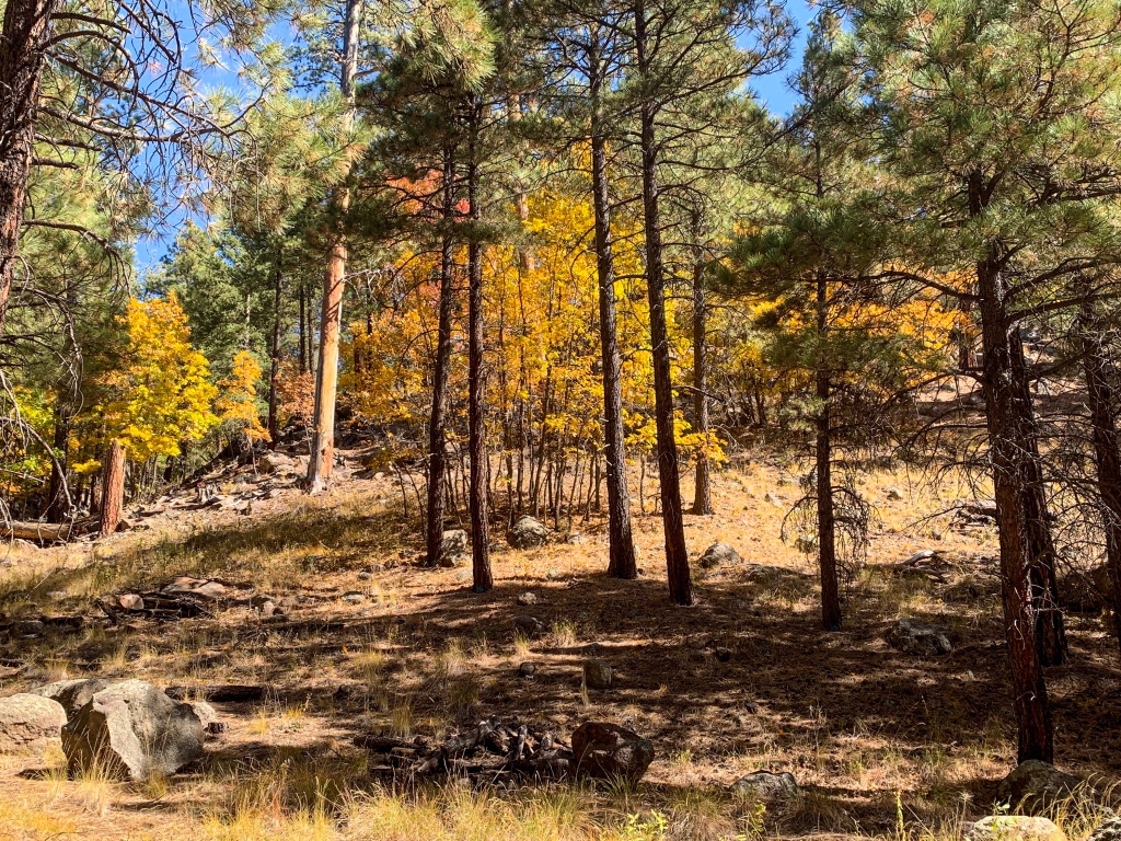
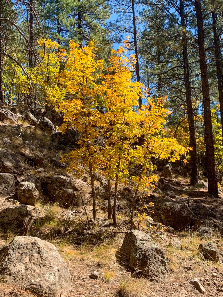
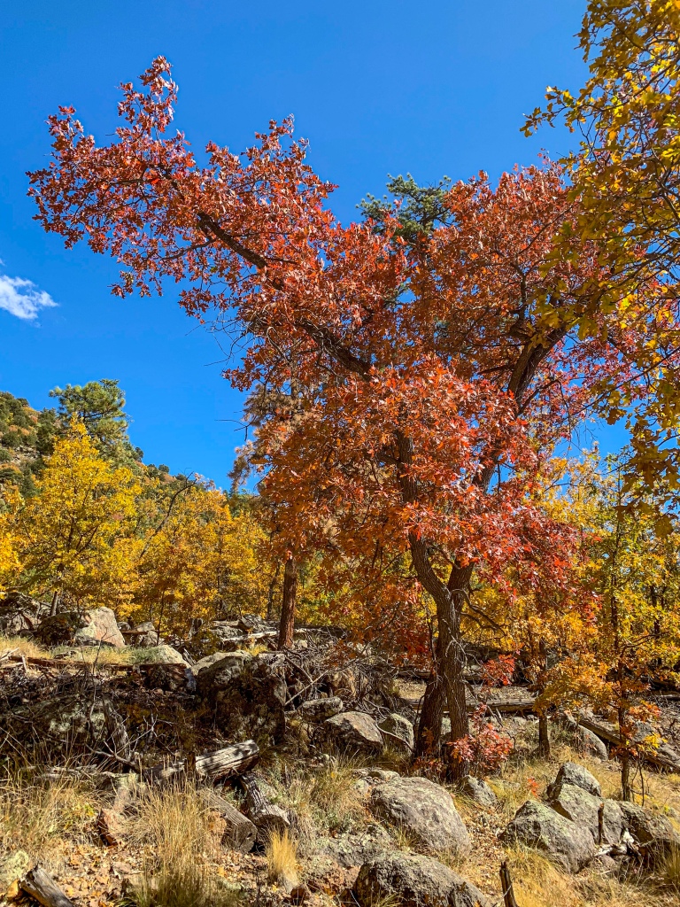
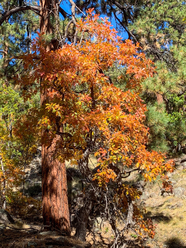
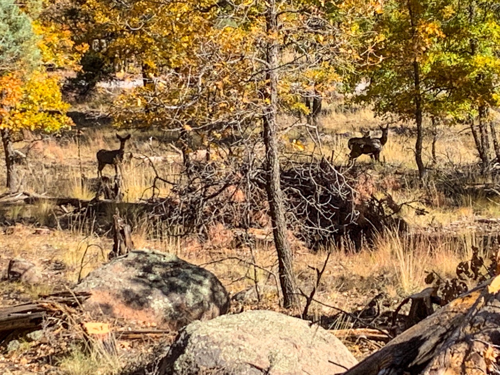
The gambel oaks are glorious with the light passing through the leaves, and the views of Elden Mountain – the other side of which was “apocalyptically burned” in the 1970s Radio Fire, according to my AZT guidebook – are spectacular. Mule deer graze among the rice grass and trees. The gambel oaks continue to look incredible. It’s amazing how as I progress south I seem to be seeing the progression of the foliage across different tree species as well as within the species. Makes for an ever changing and spectacular color display.

AZT Passage 33 (Flagstaff)
Coconino National Forest
AZT Passage 33 (Flagstaff)
Coconino National Forest
Arizona Trail, Passage 33 (Flagstaff)
Coconino National Forest

Arizona Trail, Passage 33 (Flagstaff)
Coconino National Forest

AZT Passage 33 (Flagstaff)
Coconino National Forest

Arizona Trail, Passage 33 (Flagstaff)
Coconino National Forest

Arizona Trail, Passage 33 (Flagstaff)
Coconino National Forest

Arizona Trail, Passage 33 (Flagstaff)
Coconino National Forest
Arizona Trail, Passage 33 (Flagstaff)
Coconino National Forest

Arizona Trail, Passage 33 (Flagstaff)
Coconino National Forest
Arizona Trail, Passage 33 (Flagstaff)
Coconino National Forest
Arizona Trail, Passage 33 (Flagstaff)
Coconino National Forest

Arizona Trail, Passage 33 (Flagstaff)
Coconino National Forest

Arizona Trail, Passage 33 (Flagstaff)
Coconino National Forest

Arizona Trail, Passage 33 (Flagstaff)
Coconino National Forest

Arizona Trail (Passage 33, Flagstaff)
Coconino National Forest

Arizona Trail, Passage 33 (Flagstaff)
Coconino National Forest
Arizona Trail, Passage 33 (Flagstaff)
Coconino National Forest

Arizona Trail, Passage 33 (Flagstaff)
Coconino National Forest
Passage Logistics and Ecology
| Passage 33 (Flagstaff) | |
| Trail Surface | Mostly dirt singletrack. Short paved stretch crossing through downtown Flagstaff |
| Length (Mi) | 15.5 |
| Season | April-October |
| Potential Water Sources | Flagstaff |
| Trailheads | North: AZT Passages 34/32 at Schultz Pass Middle: Downtown Flagstaff South: AZT Passage 31 at Fisher Point |
| Trailhead Access | North: Graded dirt road Middle: Paved South: Foot access only |
| Wilderness | No |
| Possible resupply points | Flagstaff |
| ATA-Rated Difficulty | Moderate |
| Potential campsites (mileages S to N) | Few at best. There are good spots near the ends of the adjacent passages |
| Hazards | Heat – wear a cotton shirt so you can soak it. Synthetics aren’t great in the desert. Hyponatremia – “drunk on water.” To avoid, ensure adequate salt & electrolyte intake and ensure you eat as well as drink water. Symptoms are almost identical to dehydration, but drinking more makes it worse. Prevention is by far the best solution. Dehydration |
| Ecosystems Traversed | Rocky Mountain Montane Conifer Woodland |
| Highlights | Views of San Francisco Peaks Views of Elden Mountain Dry Lake Hills |
| Rocky Mountain Montane Conifer Woodland | |
| Common Trees/Shrubs | * Ponderosa Pine * Southwestern white pine * Subalpine fir * White fir * Rocky Mountain maple * Bigtooth maple * Grey alder * Red birch * Red osier dogwood * Cliffbush * Mallow ninebark * New Mexican locust * huckleberry * bilberries |
| Common herbaceous plants | * fringed brome * Geyer’s sedge/elk sedge * Ross’ sedge * Bronze sedge/dry land sedge/hillside sedge/hay sedge/Fernald’s hay sedge * screwleaf muhly * bluebunch wheatgrass * Spruce-fir fleabane * wild strawberry/Virginia strawberry * Small-flowered woodrush * mountain sweet Cicely * bittercress ragwort * western meadow-rue * Fendler’s meadow-rue |