Barnhardt Trail: Out & Back or AZT Access/Combo Option
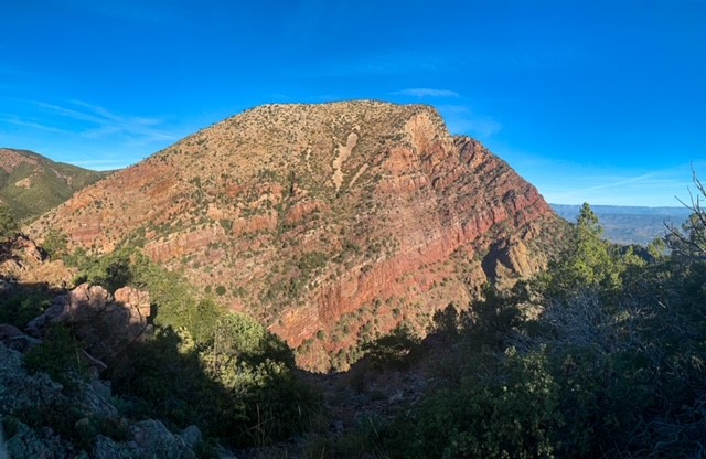
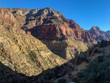
Took about a 3 mile detour this morning from the southbound Mazatzal Divide segment of the AZT to see some magnificent chevron folding exposed in Barnhardt Canyon. The Barnhardt Trail runs through the Mazatzal Wilderness in the canyon of the same name, providing a great Arizona hiking connection between Tonto Basin and the Arizona Trail on the Mazatzal Divide and exposing some of the finest geology around. The full trail is 12 miles long, 6 each way, but you can get a pretty good experience on even just the upper 3-4 miles if you are coming from the Arizona Trail headed north or south. The AZT crosses the upper end of Barnhardt Canyon just south of Chilson Spring. Some of the finest exposed geology in the Mazatzals is ready to be seen a short distance to the east in the form of exposed chevron folds on sheer cliffs.
Mazatzal Wilderness
Tonto National Forest
Mazatzal Wilderness
Tonto National Forest
Mazatzal Wilderness
Tonto National Forest

Mazatzal Wilderness
Tonto National Forest

Barnhardt Trail
Mazatzal Wilderness
Tonto National Forest

Barnhardt Trail
Mazatzal Wilderness
Tonto National Forest

Mazatzal Wilderness
Tonto National Forest
Mazatzal Mountains Wilderness & Geology
The Barnhardt Trail lies within the Mazatzal Wilderness in the Tonto National Forest. The origin of the name “Mazatzal” is unclear, though one possible meaning is a Nahuatl term meaning “place of the deer.” The Wilderness, which the trail will remain within now until just shy of Sunflower in the central Mazatzals, is about 390 square miles in size and surrounds the Mazatzal Mountains. It was one of the original Wilderness Areas designated upon the passage of the Wilderness Act in 1964.
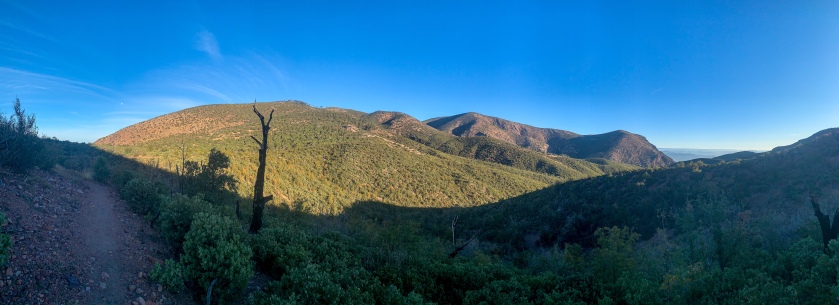
The Mazatzal Mountains themselves are an incredible place. Formed during an orogeny (a term referring to the process that creates mountains) when Arizona was a coastal region on the margin of what became North America, the Mazatzals gained their rugged nature as tectonic collisions compressed rock, lifting it and thrusting it above other rocks (overthrust). We’ll see the resulting folding in the next entry during a short side hike on the Barnhardt Trail. Mazatzal Peak, the highest point of the Northern Mazatzals, towers 1700 ft above the trail with a jagged west face that makes it appear as though half the mountain was simply cut away.
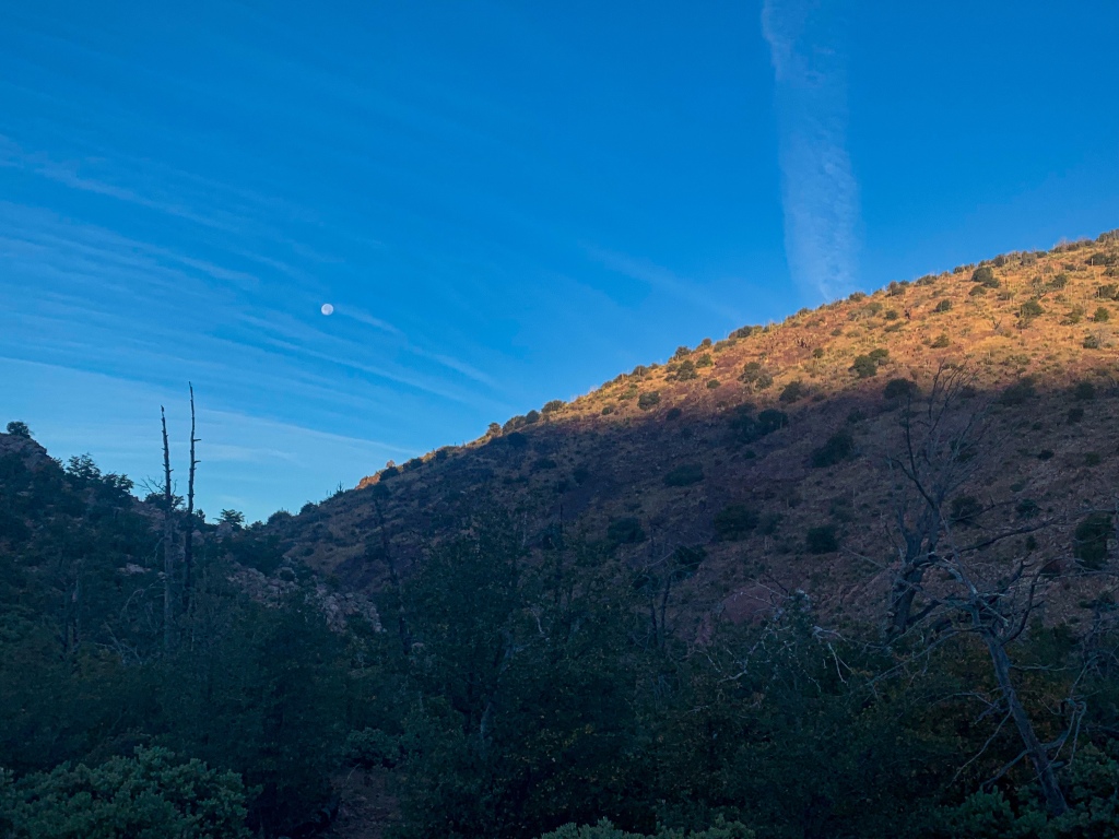
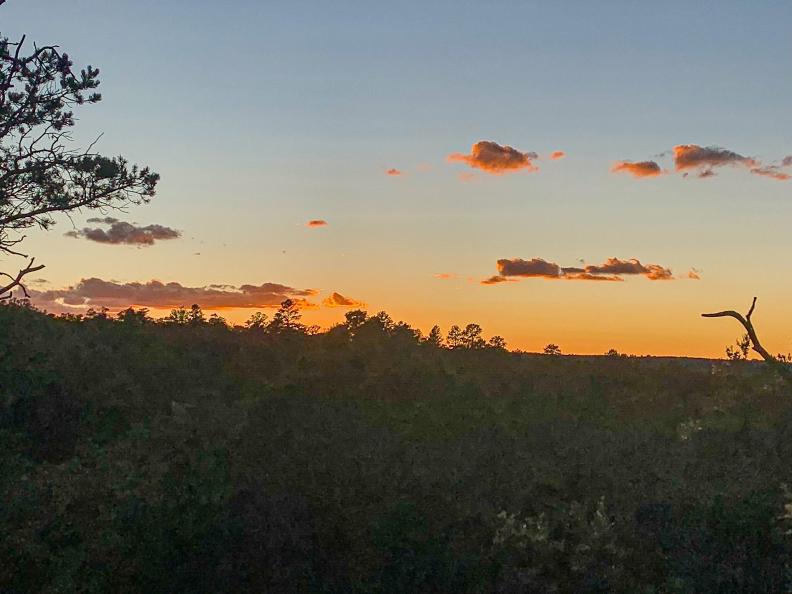
This passage passes through the northern half of the full range. Unfortunately the area was greatly impacted by the Willow & Sunflower Fires, which burned much (though not all, as we will see) of the old ponderosa forest that had made the mountains one of the most popular long-distance stretches of the Arizona Trail. Yet the incredible geology, solitude, sunsets, and views remain for the hardy and prepared souls who venture into this special place. Bagworms spin magnificent webs here, and temperatures are relatively tolerable outside of winter, when snow can make stretches impassable for those without adequate preparation.
Barnhardt Trail & Arizona Trail, Passage 23 (Mazatzal Divide)
Mazatzal Wilderness
Tonto National Forest
Barnhardt Trail Logistics
| Barnhardt Trail | |
| Trail Surface | Dirt trail |
| Length (Mi) | 6 one-way |
| Season | All year, but snow can make sections impassable in winter. |
| Potential Water Sources | Chilson Spring on upper end, short distance north along Arizona Trail (Mazatzal Divide Trail) Barnhardt Creek on lower end |
| Trailheads | Lower: Tonto Basin Upper: Arizona Trail (Mazatzal Divide Trail) near Chilson Spring |
| Trailhead Access | Lower: Vehicular. 4 mi dirt/rock road from AZ-188 to trailhead Upper: Foot access only |
| Wilderness | Yes |
| Possible Loop Combo? | Y Bar Trail |
| Special considerations | Manzanita present – wear pants & sleeves |
| Dog-friendly? | Yes |
| Ecosystems Traversed in area | Interior Chaparral Great Basin Conifer Woodland Rocky Mountain Montane Conifer Woodland Relict Conifer Woodland |
| Features | Geology Views Ecological diversity Waterfall, in wet months |
Barnhardt Trail Ecology
| Interior Chaparral | Great Basin Conifer Woodland | Rocky Mountain Montane Conifer Woodland | |
| Common Trees/Shrubs | * Birchleaf Mahogany * Ceanothus * Holly-leaf buckthorn * Manzanita * Shrub live oak * Silktassels * Stansbury cliffrose | * Arizona alder * Holly-leaf buckthorn * Junipers * Oaks, including Arizona oak, canyon live oak, Emory oak, Gambel oak, scrub-live oak * Piñon pine * Red barberry * Serviceberry * Silktassels * Skunkbush * sugar sumac | * Ponderosa Pine * Southwestern white pine * Subalpine fir * White fir * Rocky Mountain maple * Bigtooth maple * Grey alder * Red birch * Red osier dogwood * Cliffbush * Mallow ninebark * New Mexican locust * huckleberry * bilberries |
| Common herbaceous plants | * Buckwheats * Globemallows * Lupines * Penstemons * Sego-lily * Wormwood | * fringed brome * Geyer’s sedge/elk sedge * Ross’ sedge * Bronze sedge/dry land sedge/hillside sedge/hay sedge/Fernald’s hay sedge * screwleaf muhly * bluebunch wheatgrass * Spruce-fir fleabane * wild strawberry/Virginia strawberry * Small-flowered woodrush * mountain sweet Cicely * bittercress ragwort * western meadow-rue * Fendler’s meadow-rue | |
| Common succulents | * Agaves – golden flowered, Parry’s, Toumey’s * Banana & soap tree yucca * Barrel cactus * beargrass * beehive cactus * buckhorn cholla * Cane Cholla * hedgehog cacti * prickly pear cacti * Rock echeveria * Sotol * Whipple’s cholla | * beehive cactus * Claret cup hedgehog cacti * Golden-flowered agave * Parry’s agave * Prickly pear cacti * Whipple cholla * Tonto Basin agave |
4 thoughts on “Spectacular Barnhardt Trail, Mazatzal Wilderness: Amazing Arizona Hiking (Tonto NF)”