Arizona Trail Thruhiking, Passage 27: Highline
Backpacking the AZT, Days 40-41
Trans-Arizona/Utah Days 47-48
In the land of Arizona
Through desert heat or snow
Winds a trail for folks to follow
From Utah to Old Mexico
It’s the Arizona Trail
A pathway through the great Southwest
A diverse track through wood and stone
Your spirit it will test
Oh, sure you’ll sweat and blister
You’ll feel the miles every day
You’ll shiver at the loneliness
Your feet and seat will pay
But you’ll see moonlight on the borderlands
You’ll see stars on the Mogollon
You’ll feel the warmth of winter sun
And be thrilled straight through to bone
The aches and pains will fade away
You’ll feel renewed and whole
You’ll never be the same again
With Arizona in your soul
Along the Arizona Trail
A reverence and peace you’ll know
Through deserts, canyons, and mountains
From Utah to Old Mexico
-“The Arizona Trail,” Dale R. Shewalter
Well, I lost most of yesterday to a round of applications for work for the spring. I did get a beautiful sunset with the Mogollon Rim absorbing and radiating the color splendidly at the end of getting all my applications in, though.

Bray Creek-Geronimo Trailhead
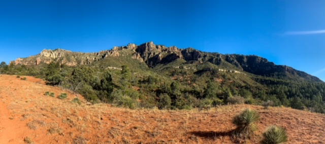
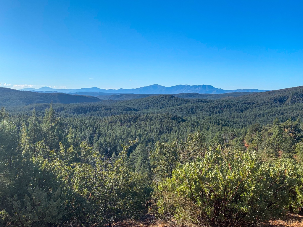
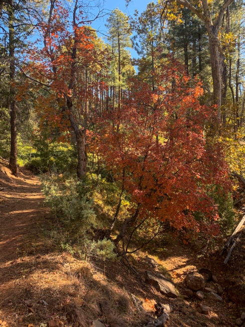
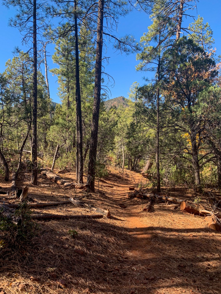
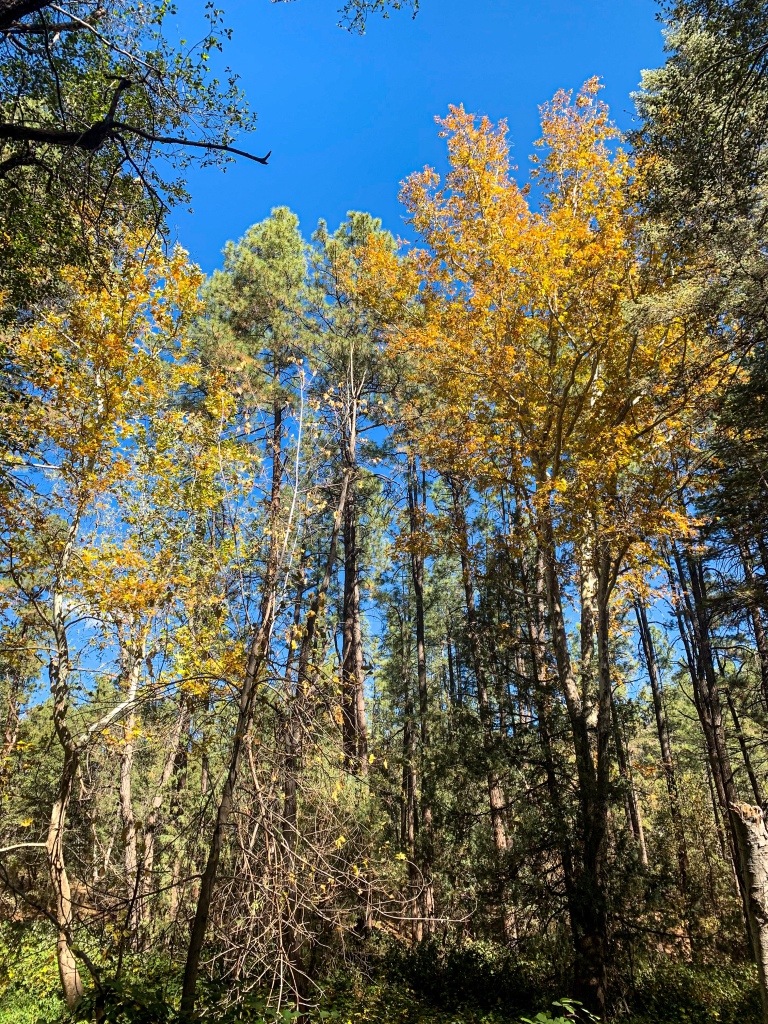
This morning, I pack up and continue south (in name; west in reality) along the AZT toward Pine. The trail continues to roll across the eroded foothills of the Mogollon Rim, the impressive and distinctive southern boundary of the Colorado Plateau, where the elevation jumps around 4000 ft in elevation. The Highline continues to define itself as a diverse landscape where the species of the desert below and the pine forests above mingle.
The Mazatzal Mountains – the next major hurdle once I make it to Pine – loom in the distance as well, and ironwood line the more open stretches of path across the Highline, where the Dude Fire burned the forest in 1990, affording more open areas and direct sunlight, shifting the plants that grow in those locations.

Arizona Trail, Passage 27 (Highline)
Tonto National Forest

Arizona Trail, Passage 27 (Highline)
Tonto National Forest
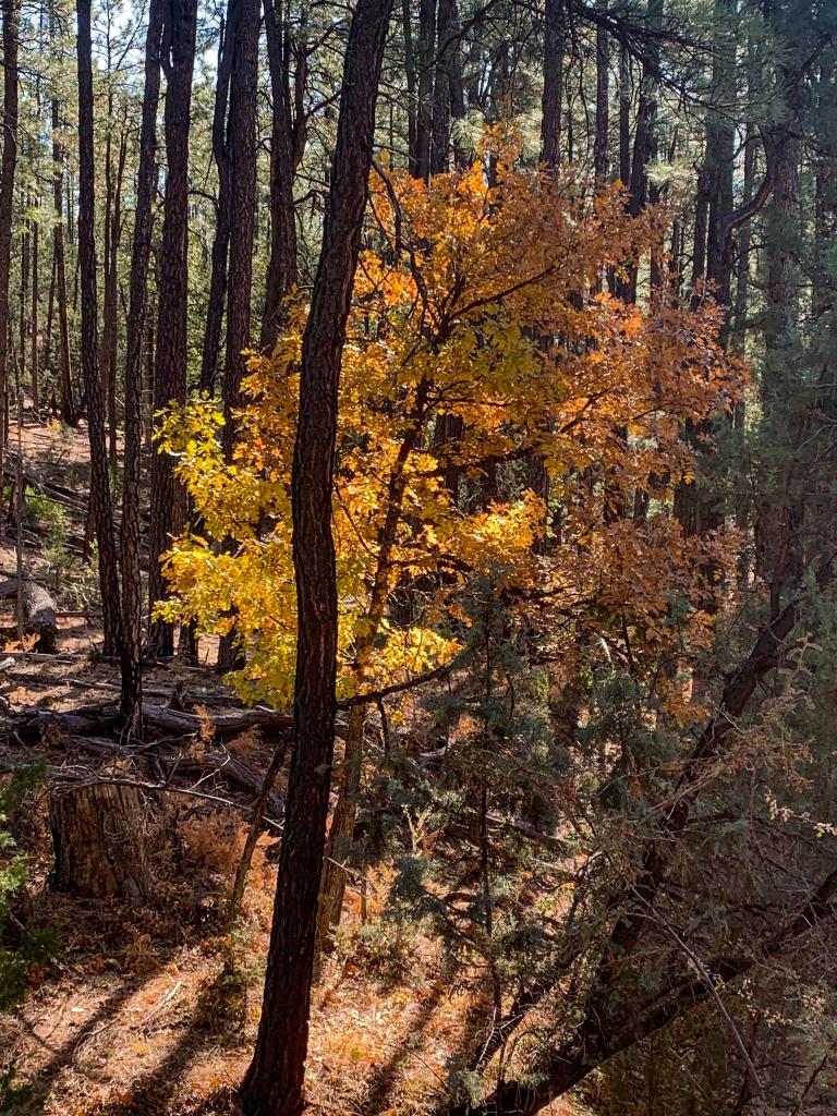
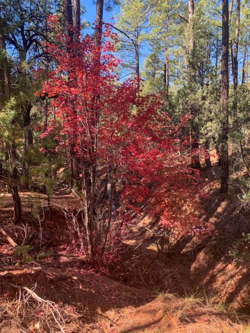
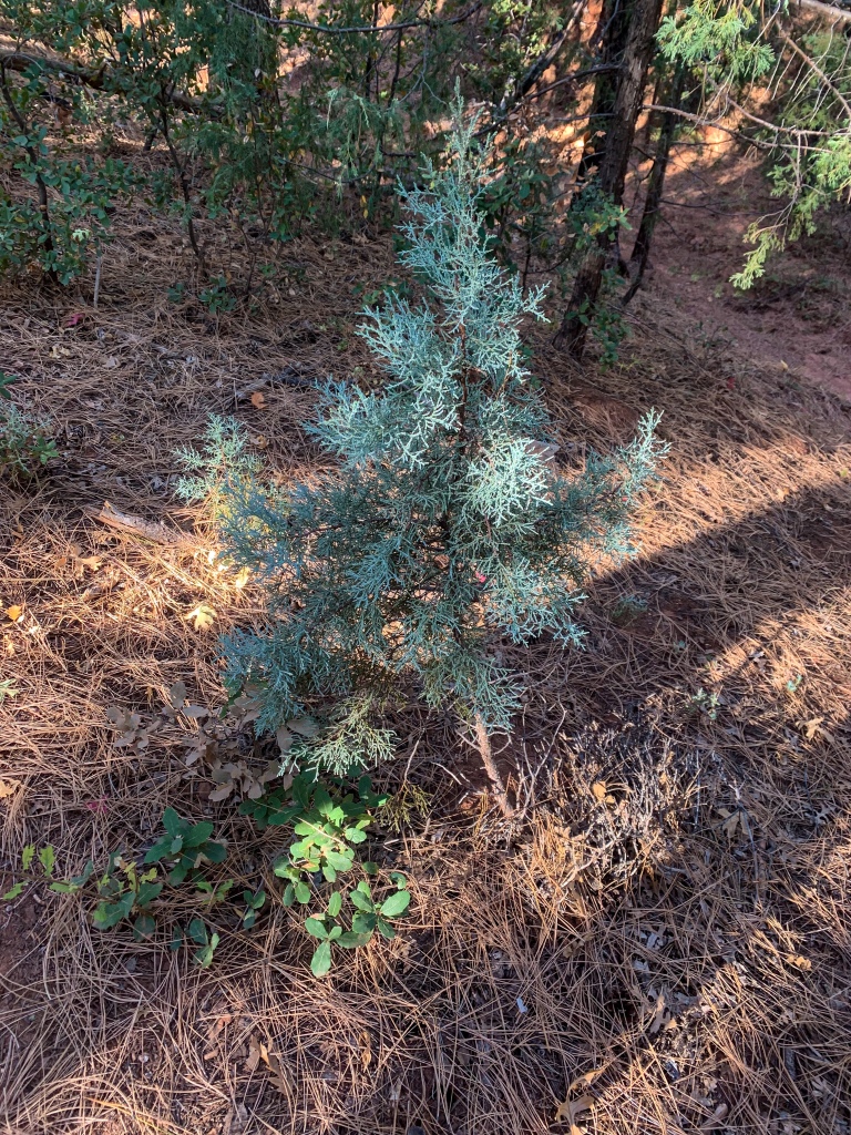
The Mogollon Rim continues to loom above as the trail heads toward Milk Ranch Point, which juts out from the rest of the Rim. In addition to the Dude Fire impacts – opening up clearings in the flora and affording different plants opportunities than they would have gotten or get today in the remnant forest- the impact of minor fluctuations in sun angle, water availability, shade, elevation, and other factors affecting microclimates continue to be quite evident.
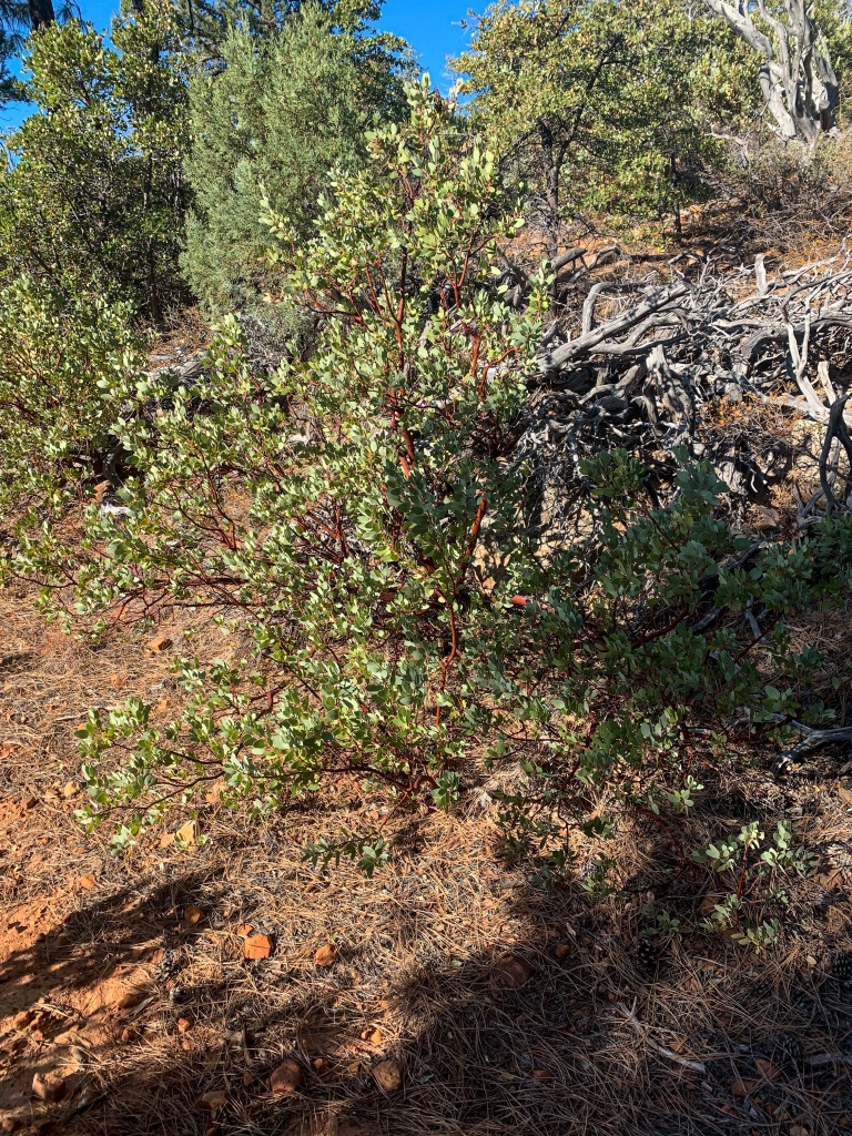
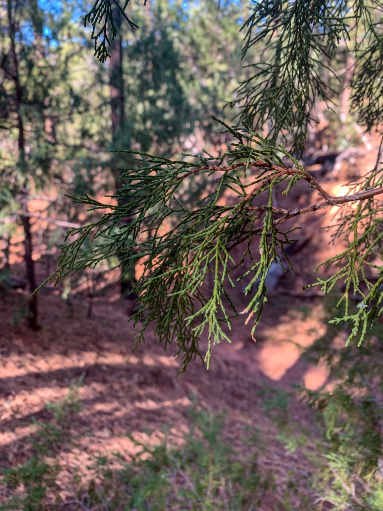
Ironwood dominates the more exposed sections. In the warmest and driest microclimates, succulents like yucca, agave, and prickly pear cactus can be found. In the draws, which are cooler and reduce sun angle, trees appear. Gamble oaks, ponderosa pines, and blue spruce all make appearances depending on the sun angle, moisture availability and apparent temperature.
Arizona Trail, Passage 27 (Highline)
Tonto National Forest
Arizona Trail, Passage 27 (Highline)
Tonto National Forest

Arizona Trail, Passage 27 (Highline)
Tonto National Forest
Arizona Trail, Passage 27 (Highline)
Tonto National Forest
Arizona Trail, Passage 27 (Highline)
Tonto National Forest
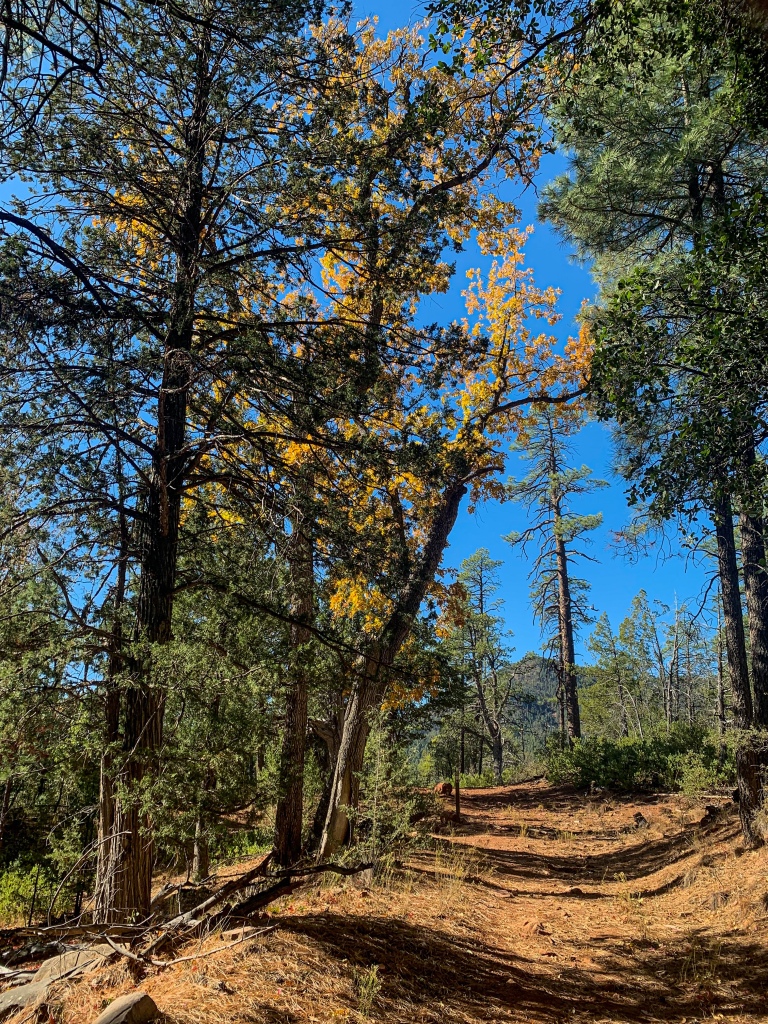
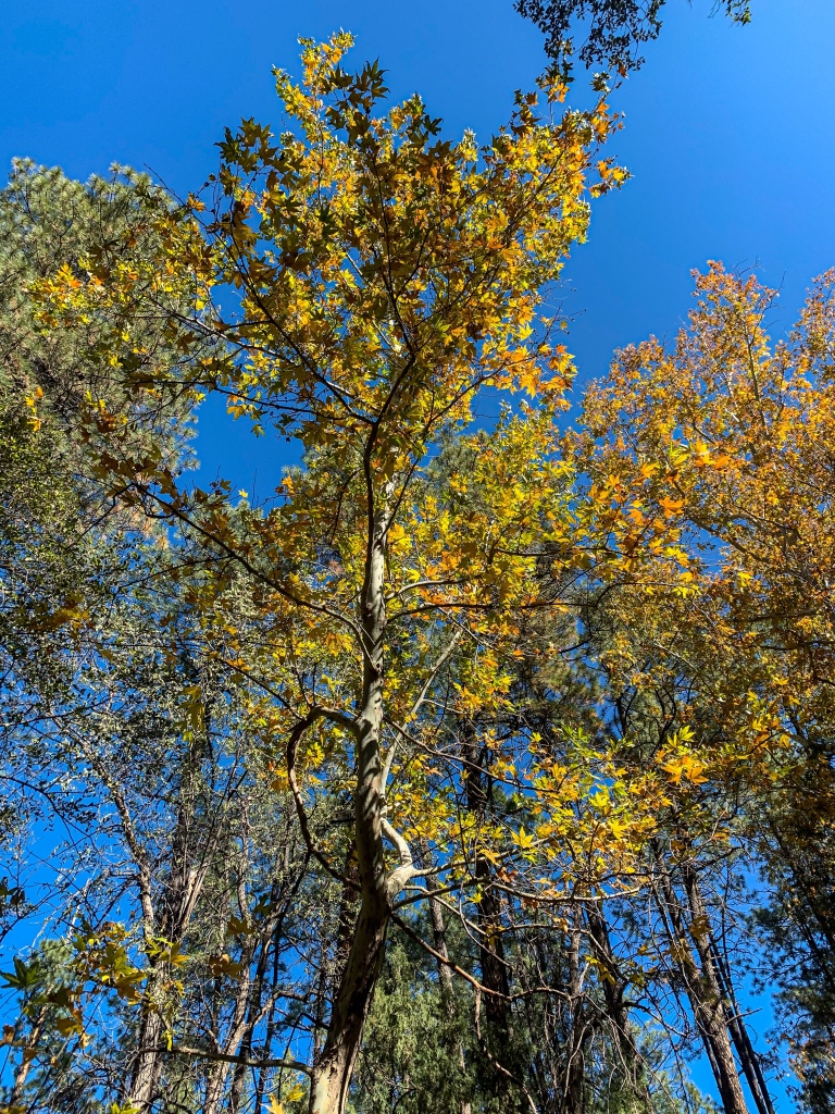
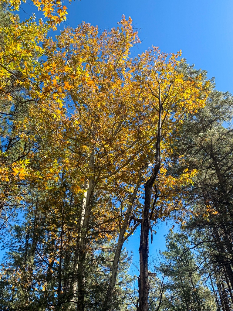
Fall foliage on AZT Highline segment
Arizona Trail, Passage 27 (Highline)
Tonto National Forest

Arizona Trail, Passage 27 (Highline)
Tonto National Forest
Arizona Trail, Passage 27 (Highline)
Tonto National Forest
Arizona Trail, Passage 27 (Highline)
Tonto National Forest
Arizona Trail Passage 27 (Highline)
Tonto National Forest
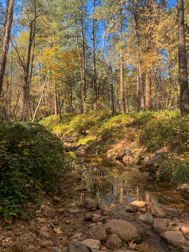
Arizona Trail: Geronimo Trailhead & West Webber Creek
Approaching the Geronimo Trailhead and West Webber Creek – probably the deepest draw encountered since the East Verde River – a new tree appears as well, the Arizona sycamore. I stop to have some food and refill my water here for the push around the Point to Pine. The reflection of the trees in the water of the Creek adds yet another dimension to the passage.
Arizona Trail, Passage 27 (Highline)
Tonto National Forest

Arizona Trail Passage 27 (Highline)
Tonto National Forest
Arizona Trail Passage 27 (Highline)
Tonto National Forest
Arizona Trail Passage 27 (Highline)
Tonto National Forest

Arizona Trail Passage 27 (Highline)
Tonto National Forest
Arizona Trail Passage 27 (Highline)
Tonto National Forest
Arizona Trail Passage 27 (Highline)
Tonto National Forest
| Passage 26 (Highline) | |
| Trail Surface | Dirt singletrack |
| Length (Mi) | 20.2 |
| Season | Spring-Fall |
| AZTA Passage Information | Passage 26 (Highline) |
| AZTA Passage Map | Passage 26 (Highline) Map |
| AZTA Elevation Profile | Passage 26 Elevation Profile |
| Potential Water Sources | East Verde River (mi 309.2 SOBO/479.6 NOBO) Creek (mi 311.9 SOBO/476.8 NOBO) Chase Creek (mi 312.6 SOBO/476.1 NOBO) North Sycamore Creek (314.1 SOBO/474.7 NOBO) Bray Creek (mi 315.4 SOBO/473.3 NOBO) Bear Spring (mi 316.8 SOBO/472.0 NOBO) Pine Spring (mi 322.1 SOBO/466.6 NOBO) Red Rock Spring (mi 323.2 SOBO/465.6 NOBO) |
| Trailheads | North: Mogollon Rim (mi 292.1 SOBO, 496.7 NOBO) South: AZ-87 near Pine (mi 328.1 SOBO, 460.6 NOBO) |
| Trailhead Access | North: Graded dirt road South: Paved road |
| Wilderness | No |
| Possible resupply points | Pine |
| Difficulty | Moderate |
| Potential campsites (mileages S to N) | Various LNT-compatible locations throughout |
| Threats | Heat – wear a cotton shirt so you can soak it. Synthetics aren’t great in the desert. Hypothermia – nights are generally about 30°F cooler than days in Arizona regardless of the time of year. Consider this in packing gear. Mornings can be cool year-round. Hyponatremia – “drunk on water.” To avoid, ensure adequate salt & electrolyte intake and ensure you eat as well as drink water. Symptoms are almost identical to dehydration, but drinking more makes it worse. Prevention is by far the best solution. Dehydration Lightning |
| Permits Required? | No |
| Cell service? | Limited |
| Ecosystems traversed | Rocky Mountain Montane Conifer Forest |
| Highlights | Mogollon Rim, southern boundary of Colorado Plateau Fall foliage Ecological diversity Extensive views |
| Weather | Current Passage 26 Weather (NWS) |
| Interior Chaparral | Great Basin Conifer Woodland | Rocky Mountain Montane Conifer Woodland | |
| Common Trees/Shrubs | * Birchleaf Mahogany * Ceanothus * Holly-leaf buckthorn * Manzanita * Shrub live oak * Silktassels * Stansbury cliffrose | * Arizona alder * Holly-leaf buckthorn * Junipers * Oaks, including Arizona oak, canyon live oak, Emory oak, Gambel oak, scrub-live oak * Piñon pine * Red barberry * Serviceberry * Silktassels * Skunkbush * sugar sumac | * Ponderosa Pine * Southwestern white pine * Subalpine fir * White fir * Rocky Mountain maple * Bigtooth maple * Grey alder * Red birch * Red osier dogwood * Cliffbush * Mallow ninebark * New Mexican locust * huckleberry * bilberries |
| Common herbaceous plants | * Buckwheats * Globemallows * Lupines * Penstemons * Sego-lily * Wormwood | * fringed brome * Geyer’s sedge/elk sedge * Ross’ sedge * Bronze sedge/dry land sedge/hillside sedge/hay sedge/Fernald’s hay sedge * screwleaf muhly * bluebunch wheatgrass * Spruce-fir fleabane * wild strawberry/Virginia strawberry * Small-flowered woodrush * mountain sweet Cicely * bittercress ragwort * western meadow-rue * Fendler’s meadow-rue | |
| Common succulents | * Agaves – golden flowered, Parry’s, Toumey’s * Banana & soap tree yucca * Barrel cactus * beargrass * beehive cactus * buckhorn cholla * Cane Cholla * hedgehog cacti * prickly pear cacti * Rock echeveria * Sotol * Whipple’s cholla | * beehive cactus * Claret cup hedgehog cacti * Golden-flowered agave * Parry’s agave * Prickly pear cacti * Whipple cholla * Tonto Basin agave |
One thought on “Amazing, Spectacular Arizona Trail Thruhiking: Bray Creek-Webber Creek”