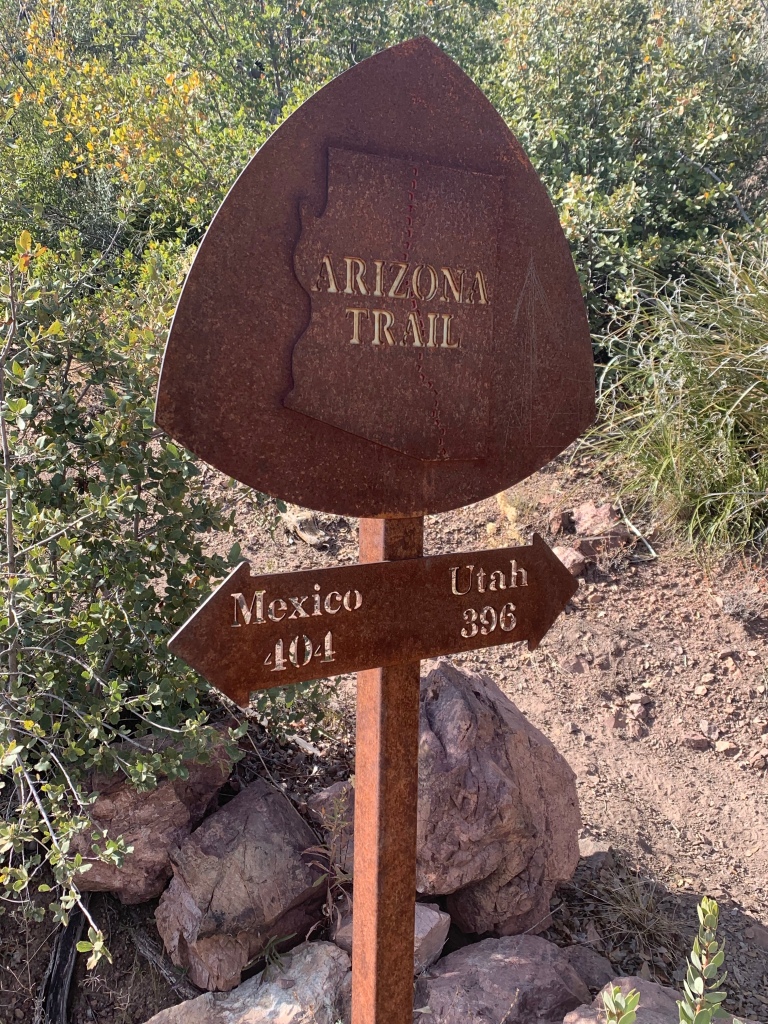
Arizona Trail, Passage 23: Mazatzal Divide (Part V)
AZT Backpacking Day 53
Trans-Arizona/Utah Day 60
Welcome back to Aspen’s Tracks, thruhiking the Arizona Trail southbound from Utah to Mexico. Today’s backpacking route takes me from the high ridge that I camped near last night through the end of the Mazatzal wilderness and on to the Mount Peeley Trailhead, the southern end of passage 23, the Mazatzal Divide. You can find today’s hiking logistics below the photo documentation and trail journal of the route.
If you missed my last entry covering the prior portion of the Mazatzal Divide passage, that can be found here. The next entry covers the northern portion of the Saddle Mountain passage, from Mt Peeley Trailhead through to McFarland Canyon. If you enjoy these accounts, please do subscribe to follow along to make sure that you don’t miss out on here or any future accounts to come!
In the land of Arizona
Through desert heat or snow
Winds a trail for folks to follow
From Utah to Old Mexico
It’s the Arizona Trail
A pathway through the great Southwest
A diverse track through wood and stone
Your spirit it will test
Oh, sure you’ll sweat and blister
You’ll feel the miles every day
You’ll shiver at the loneliness
Your feet and seat will pay
But you’ll see moonlight on the borderlands
You’ll see stars on the Mogollon
You’ll feel the warmth of winter sun
And be thrilled straight through to bone
The aches and pains will fade away
You’ll feel renewed and whole
You’ll never be the same again
With Arizona in your soul
Along the Arizona Trail
A reverence and peace you’ll know
Through deserts, canyons, and mountains
From Utah to Old Mexico
-“The Arizona Trail,” Dale R. Shewalter
Arizona Trail: Divide Highpoint-Mount Peeley Trailhead
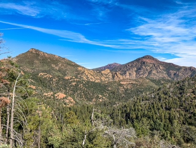
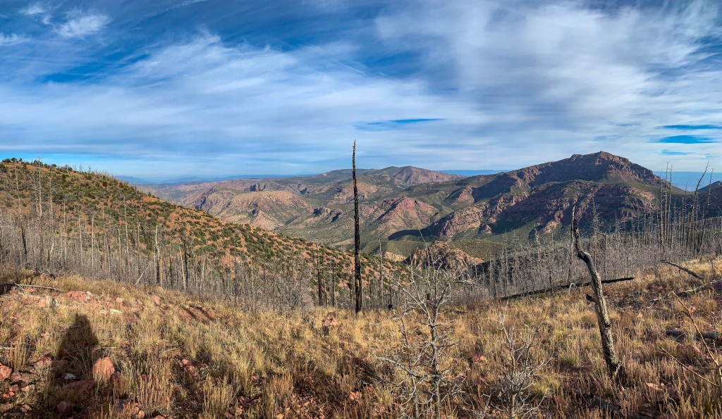
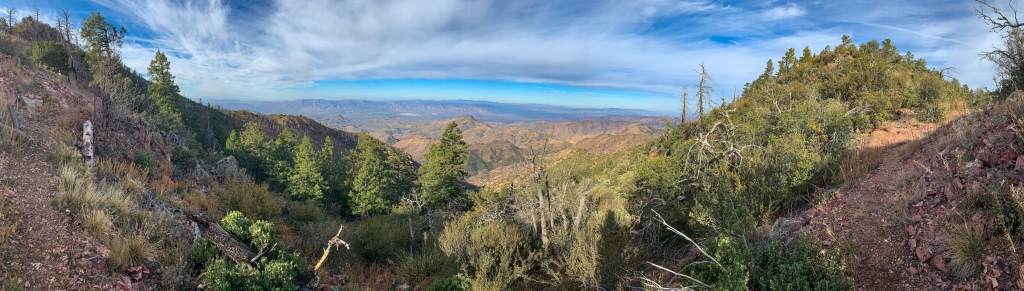
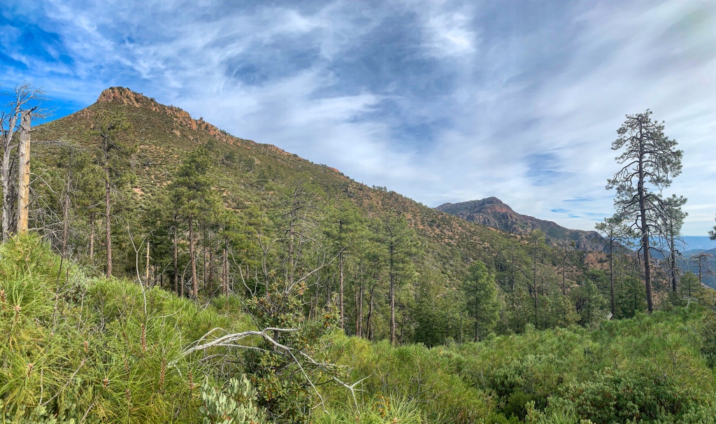
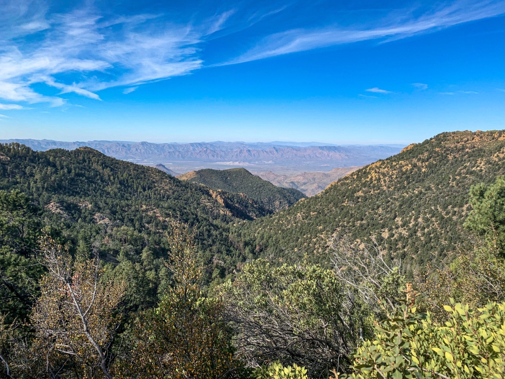
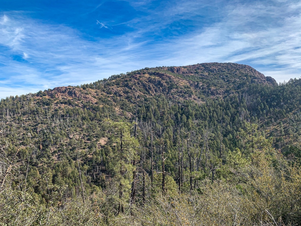
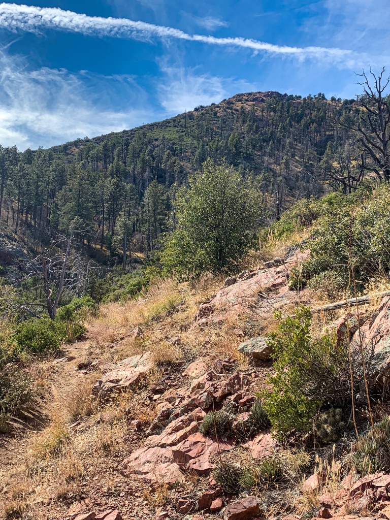
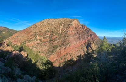
This stretch of the Divide was clearly less impacted than the areas farther north when it came to the Willow and Sunflower fires; it’s a noticeable difference here on the south side of the ridge. Mount Peeley and several other unnamed adjoining peaks tower over most of the passage, with framed views of Mazatzal Peak as well as views into the Verde Valley to the west.
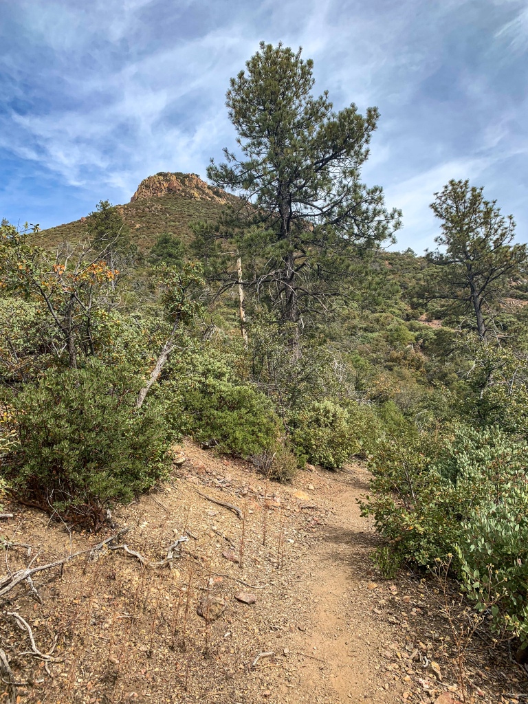
Arizona Trail, Passage 23 (Mazatzal Divide)
Mazatzal Wilderness
Tonto National Forest
Arizona Trail, Passage 23 (Mazatzal Divide)
Mazatzal Wilderness
Tonto National Forest
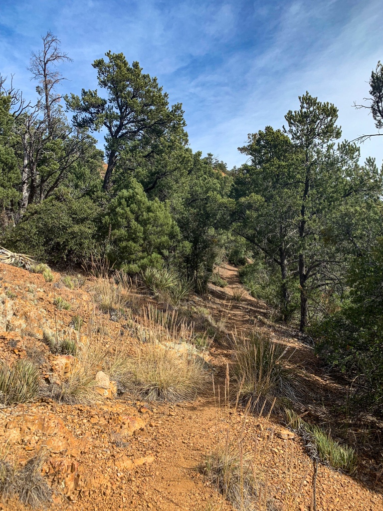
Arizona Trail, Passage 23 (Mazatzal Divide)
Mazatzal Wilderness
Tonto National Forest
Arizona Trail, Passage 23 (Mazatzal Divide)
Mazatzal Wilderness
Tonto National Forest

Mazatzal Wilderness
Tonto National Forest
Arizona Trail, Passage 23 (Mazatzal Divide)
Mazatzal Wilderness
Tonto National Forest
Arizona Trail, Passage 23 (Mazatzal Divide)
Mazatzal Wilderness
Tonto National Forest

Arizona Trail, Passage 23 (Mazatzal Divide)
Mazatzal Wilderness
Tonto National Forest
Arizona Trail, Passage 23 (Mazatzal Divide)
Mazatzal Wilderness
Tonto National Forest
Arizona Trail, Passage 23 (Mazatzal Divide)
Mazatzal Wilderness
Tonto National Forest
Arizona Trail, Passage 23 (Mazatzal Divide)
Mazatzal Wilderness
Tonto National Forest

Arizona Trail, Passage 23 (Mazatzal Divide)
Mazatzal Wilderness
Tonto National Forest
Arizona Trail, Passage 23 (Mazatzal Divide)
Mazatzal Wilderness
Tonto National Forest
Arizona Trail, Passage 23 (Mazatzal Divide)
Mazatzal Wilderness
Tonto National Forest
Arizona Trail, Passage 23 (Mazatzal Divide)
Mazatzal Wilderness
Tonto National Forest
Arizona Trail, Passage 23 (Mazatzal Divide)
Mazatzal Wilderness
Tonto National Forest

Arizona Trail, Passage 23 (Mazatzal Divide)
Mazatzal Wilderness
Tonto National Forest
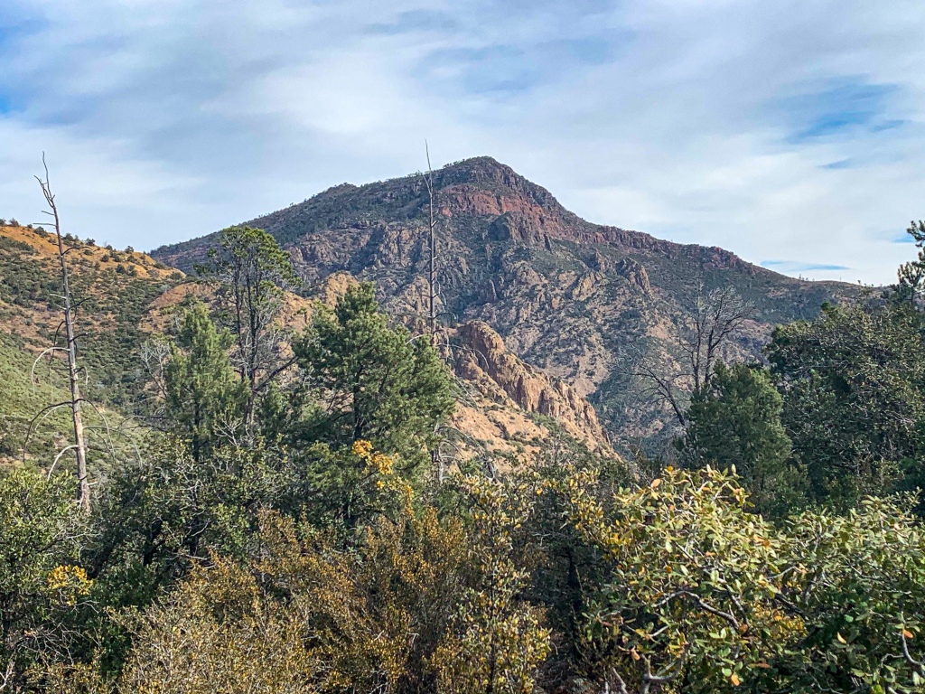
Arizona Trail: Mt Peeley-Mt Peeley Trailhead
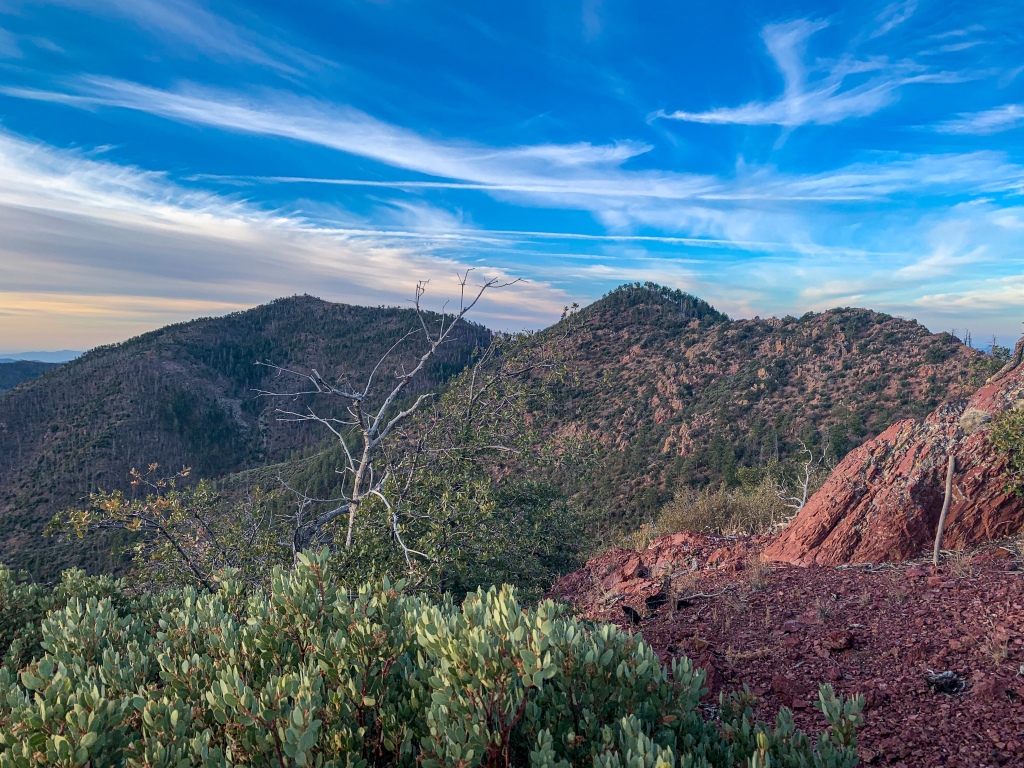
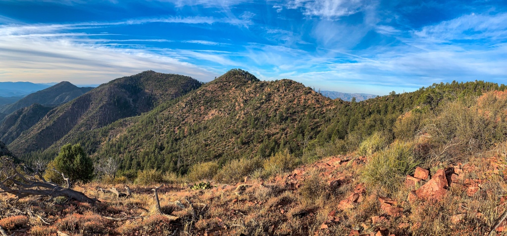
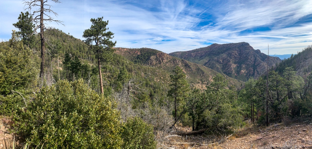
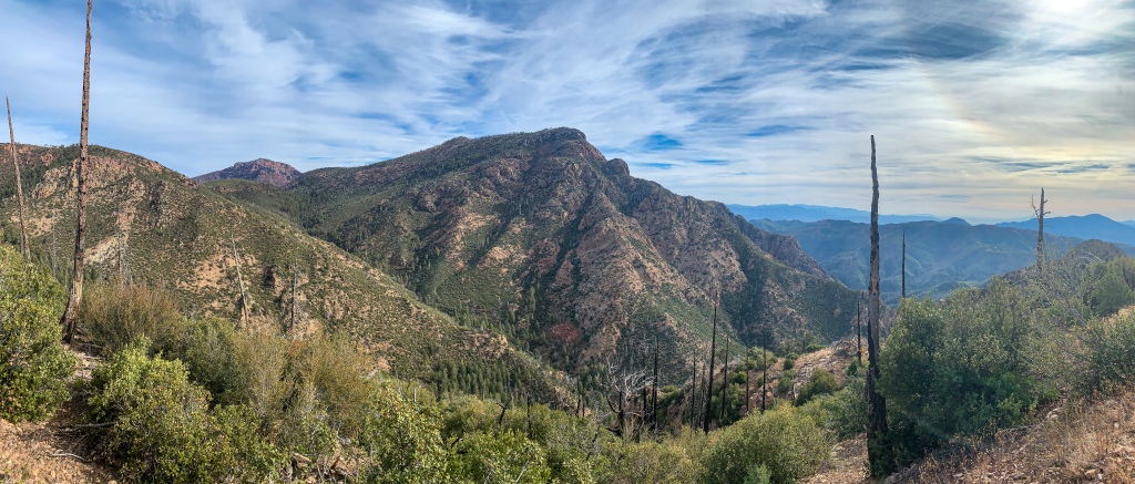
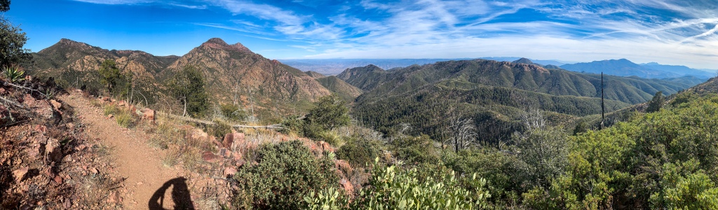
From the east slope of Mt Peeley, the view stretches clear down the Mazatzal spine to the Four Peaks and Superstition Mountains behind. While the trail briefly leaves designated wilderness for the first time in over 20 miles toward the end of the passage, the solitude does not diminish and it will shortly pass through another stretch of wilderness thereafter, the Saddle Mountain Wilderness en route to Sunflower and the AZ-87 crossing to the southern Mazatzals. (If you missed my description of the Mazatzal Mountains, you can find that as well as logistics and ecology reports for the passage after the photos.)
along the AZT
Arizona Trail, Passage 23 (Mazatzal Divide)
Mazatzal Wilderness
Tonto National Forest

Arizona Trail, Passage 23 (Mazatzal Divide)
Mazatzal Wilderness
Tonto National Forest


Arizona Trail, Passage 23 (Mazatzal Divide)
Mazatzal Wilderness
Tonto National Forest

Arizona Trail, Passage 23 (Mazatzal Divide)
Mazatzal Wilderness
Tonto National Forest

Arizona Trail, Passage 23 (Mazatzal Divide)

Arizona Trail, Passage 23 (Mazatzal Divide)
Mazatzal Wilderness
Tonto National Forest
Arizona Trail, Passage 23 (Mazatzal Divide)
Mazatzal Wilderness
Tonto National Forest
Arizona Trail, Passage 23 (Mazatzal Divide)
Mazatzal Wilderness
Tonto National Forest
The Mazatzal Mountains
This stretch of the Arizona Trail lies within the Mazatzal Wilderness in the Tonto National Forest. The origin of the name “Mazatzal” is unclear, though one possible meaning is a Nahuatl term meaning “place of the deer.” The Wilderness, which the trail will remain within now until just shy of Sunflower in the central Mazatzals, is about 390 square miles in size and surrounds the Mazatzal Mountains. It was one of the original Wilderness Areas designated upon the passage of the Wilderness Act in 1964.
The Mazatzal Mountains themselves are an incredible place. Formed during an orogeny (a term referring to the process that creates mountains) when Arizona was a coastal region on the margin of what became North America, the Mazatzals gained their rugged nature as tectonic collisions compressed rock, lifting it and thrusting it above other rocks (overthrust). We’ll see the resulting folding in the entry of a short side hike on the Barnhardt Trail. Mazatzal Peak, the highest point of the Northern Mazatzals, towers 1700 ft above the trail with a jagged west face that makes it appear as though half the mountain was simply cut away. This passage passes through the northern half of the full range.
Unfortunately the area was greatly impacted by the Willow & Sunflower Fires, which burned much (though not all, as we will see) of the old ponderosa forest that had made the mountains one of the most popular long-distance stretches of the Arizona Trail.
Yet the incredible geology, solitude, sunsets, and views remain for the hardy and prepared souls who venture into this special place. Bagworms spin magnificent webs here, and temperatures are relatively tolerable outside of winter, when snow can make stretches impassable for those without adequate preparation.
Trail Logistics and Ecology
| Passage 23 (Mazatzal Divide) | |
| AZTA Passage Information | Passage 23 (Mazatzal Divide) |
| AZTA Passage Map | Mazatzal Divide (Passage 23) |
| AZTA Elevation Profile | Mazatzal Divide Elevation Profile |
| Trail Surface | Dirt trail |
| Length (Mi) | 24.3 |
| Season | All year, but snow can make sections impassable in winter. |
| Potential Water Sources | Horse Camp Seep Hopi Spring Chilson Spring Bear Spring |
| Trailheads | North: Red Hills Trail Junction South: Mount Peeley Trailhead |
| Trailhead Access | North: Foot only. 5.75 mi from City Creek Trailhead South: Foot & 0.5 mi hike on Cornucopia Trail from trailhead. |
| Wilderness | Most |
| Possible resupply points | None |
| ATA-Rated Difficulty | Moderate |
| Potential campsites (mileages S to N) | 6.7, 9.4, 19.4, 22 |
| Ecosystems Traversed | Interior Chaparral Great Basin Conifer Woodland Rocky Mountain Montane Conifer Woodland Relict Conifer Woodland |
| Highlights | Mazatzal Mountains Geology Extensive views Diverse ecology Dramatic, rugged terrain Mazatzal Peak |
| Interior Chaparral | Great Basin Conifer Woodland | Rocky Mountain Montane Conifer Woodland | |
| Common Trees/Shrubs | * Birchleaf Mahogany * Ceanothus * Holly-leaf buckthorn * Manzanita * Shrub live oak * Silktassels * Stansbury cliffrose | * Arizona alder * Holly-leaf buckthorn * Junipers * Oaks, including Arizona oak, canyon live oak, Emory oak, Gambel oak, scrub-live oak * Piñon pine * Red barberry * Serviceberry * Silktassels * Skunkbush * sugar sumac | * Ponderosa Pine * Southwestern white pine * Subalpine fir * White fir * Rocky Mountain maple * Bigtooth maple * Grey alder * Red birch * Red osier dogwood * Cliffbush * Mallow ninebark * New Mexican locust * huckleberry * bilberries |
| Common herbaceous plants | * Buckwheats * Globemallows * Lupines * Penstemons * Sego-lily * Wormwood | * fringed brome * Geyer’s sedge/elk sedge * Ross’ sedge * Bronze sedge/dry land sedge/hillside sedge/hay sedge/Fernald’s hay sedge * screwleaf muhly * bluebunch wheatgrass * Spruce-fir fleabane * wild strawberry/Virginia strawberry * Small-flowered woodrush * mountain sweet Cicely * bittercress ragwort * western meadow-rue * Fendler’s meadow-rue | |
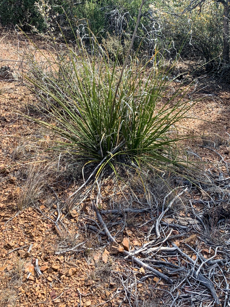
| Common succulents | * Agaves – golden flowered, Parry’s, Toumey’s * Banana & soap tree yucca * Barrel cactus * beargrass * beehive cactus * buckhorn cholla * Cane Cholla * hedgehog cacti * prickly pear cacti * Rock echeveria * Sotol * Whipple’s cholla | * beehive cactus * Claret cup hedgehog cacti * Golden-flowered agave * Parry’s agave * Prickly pear cacti * Whipple cholla * Tonto Basin agave |
find out here now
I enjoyed this and found it useful.
Click On this page
Just commenting to show my support. Your piece is well written Great job!