Backpacking the Arizona Trail: Day 45
AZT Passage 25, Whiterock Mesa
Utah-Arizona Day 52
Welcome back to Aspen’s Tracks, thruhiking the Arizona Trail southbound from Utah to Mexico. Today’s route covers backpacking the stretch of Passage 25, Whiterock Mesa, between FR 194 and Polk Spring. You can find today’s hiking logistics below the photo documentation and trail journal of the route.
If you missed my last entry covering the leg through the first portion of the Whiterock Mesa passage, from Pine to FR-194, that can be found here. The next entry will cover the stretch of the passage from Polk Spring onto Passage 24, the Red Hills, and the ascent into the Hills. If you enjoy these accounts, please do subscribe to follow along to make sure that you don’t miss out on here or any future accounts to come!
In the land of Arizona
Through desert heat or snow
Winds a trail for folks to follow
From Utah to Old Mexico
It’s the Arizona Trail
A pathway through the great Southwest
A diverse track through wood and stone
Your spirit it will test
Oh, sure you’ll sweat and blister
You’ll feel the miles every day
You’ll shiver at the loneliness
Your feet and seat will pay
But you’ll see moonlight on the borderlands
You’ll see stars on the Mogollon
You’ll feel the warmth of winter sun
And be thrilled straight through to bone
The aches and pains will fade away
You’ll feel renewed and whole
You’ll never be the same again
With Arizona in your soul
Along the Arizona Trail
A reverence and peace you’ll know
Through deserts, canyons, and mountains
From Utah to Old Mexico
-“The Arizona Trail,” Dale R. Shewalter
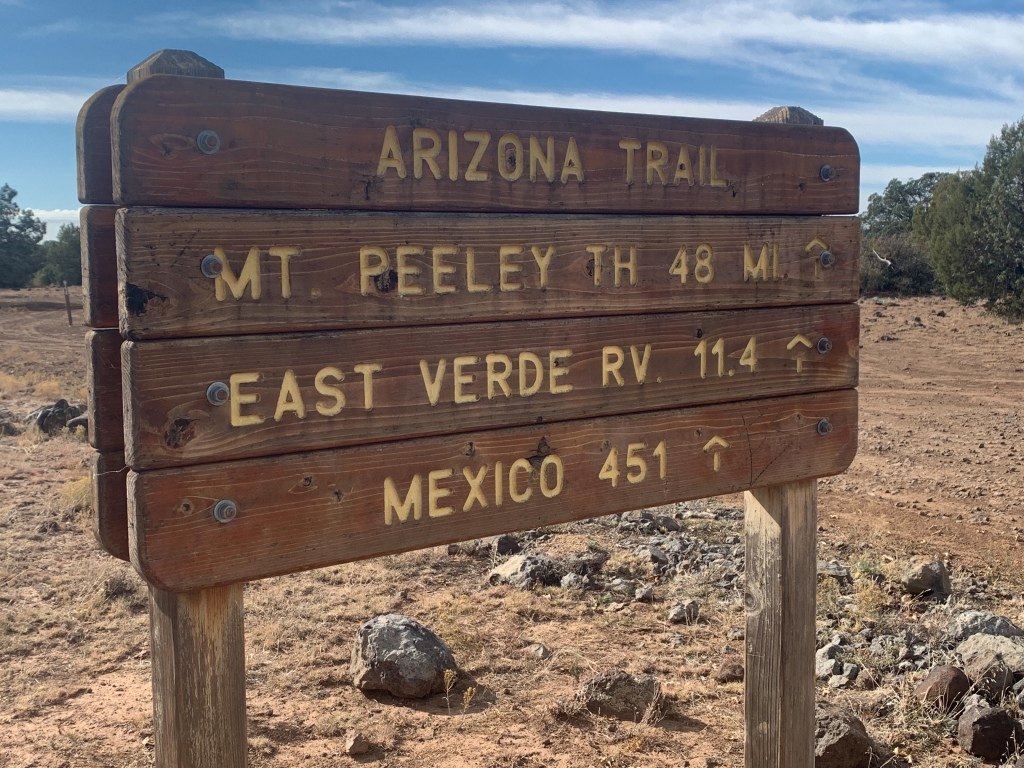
Arizona Trail: Polk Spring to Saddle Ridge
Day 45 thruhiking the AZT (46 south of the Utah line). Why do downhill grades never feel like such when hiking long distances? The elevation chart says almost all of today was downhill yet much felt level at best. It was warmer tonight near Polk Spring; I only have my shell layer on my sleeping bag.
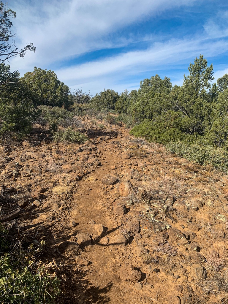
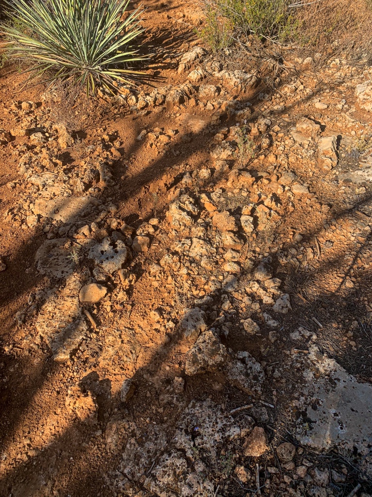
It’s been humid the last few days but I didn’t have to dry out my footprint this morning so it must not have been quite as humid as it has been. I got started around 10, heading down Passage 25 toward the East Verde River. The first few miles, the former end of Passage 26 and under the recent reorganization now the middle of Passage 25, were on a packed gravel road, then the trail headed onto older roads surfaced with large pieces of volcanic basalt and progress slowed. (Logistical data at the end).
Arizona Trail, Passage 26: Whiterock Mesa
Tonto National Forest

Arizona Trail, Passage 26: Whiterock Mesa
Tonto National Forest

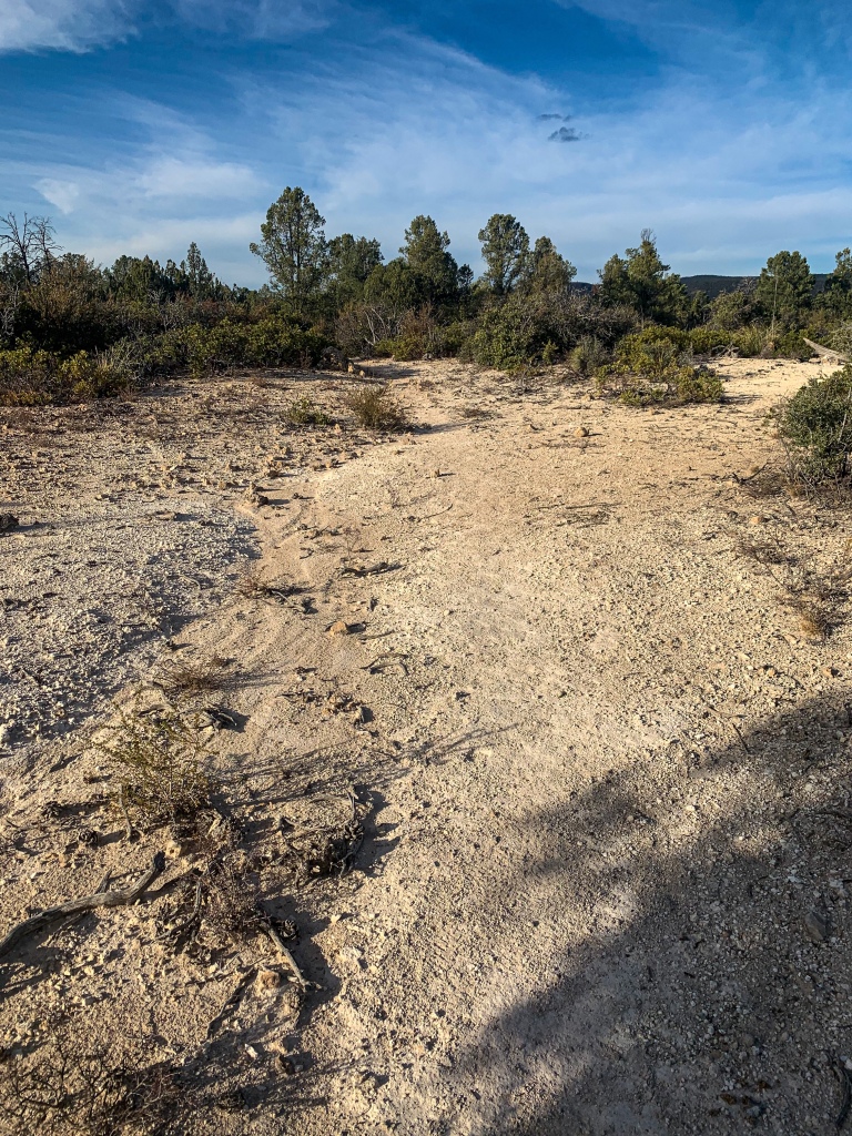
Arizona Trail, Passage 25: Whiterock Mesa
Tonto National Forest
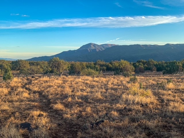
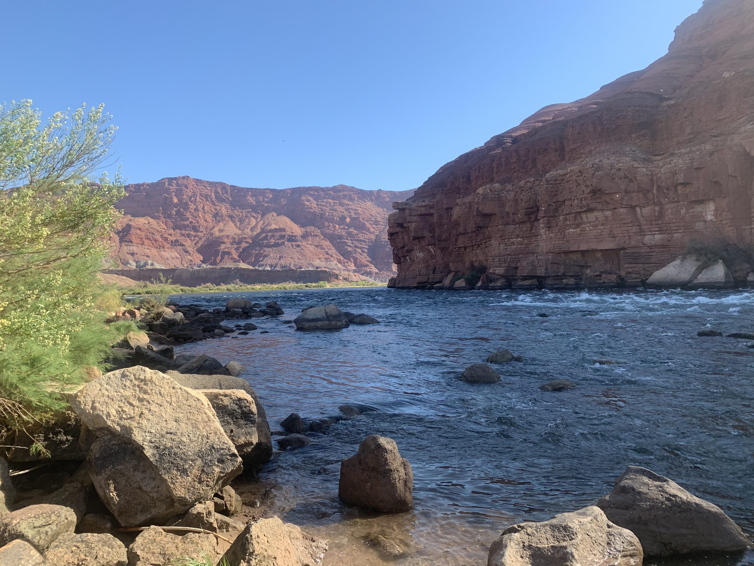
Once passing through a herd of cattle on the trail – carefully – I pass through a gate and enter the Mazatzal Wilderness. Following cairns, the surface alternates between the basalt and more dirt – like walking through a wash. As the trail skirts the rim briefly, a magnificent view of the Mazatzal Mountains and Red Hills opens up to the hiker. Shortly thereafter, the trail moves away from the rim again. The pinyon-juniper forest continues – a mental challenge to any backpacker on the trail since it offers no sign of a destination, although North Peak in the Mazatzals does occasionally poke above the trees.
Arizona Trail, Passage 25: Whiterock Mesa
Tonto National Forest

Arizona Trail, Passage 25: Whiterock Mesa
Tonto National Forest

Arizona Trail, Passage 25: Whiterock Mesa
Tonto National Forest

Arizona Trail, Passage 25: Whiterock Mesa
Tonto National Forest
Arizona Trail, Passage 25: Whiterock Mesa
Tonto National Forest
Arizona Trail, Passage 25: Whiterock Mesa
Tonto National Forest

Arizona Trail, Passage 25: Whiterock Mesa
Tonto National Forest
Arizona Trail: Saddle Ridge to Whiterock Spring
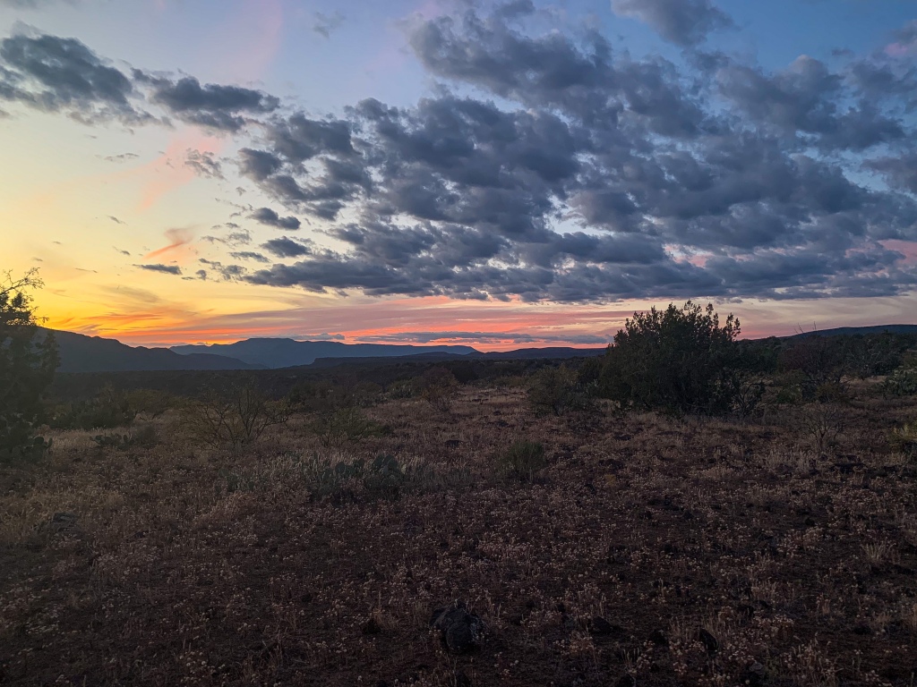
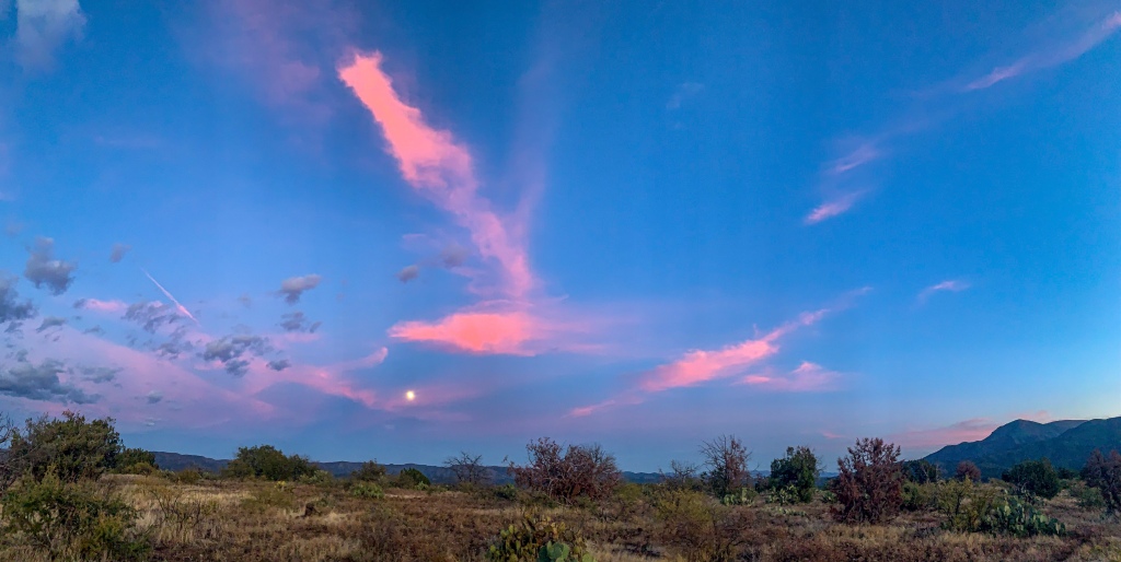
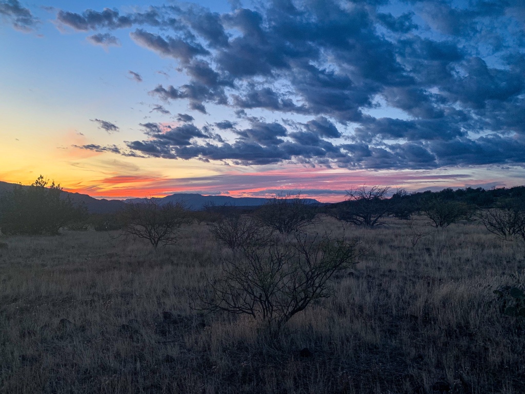
Upon hiking to the end of Saddle Ridge and descending to Whiterock Spring, an excellent panorama unfolds of the valleys of Rock Creek and the East Verde to the Mazatzals, Red Hills and Tonto Basin.

Arizona Trail, Passage 25: Whiterock Mesa
Tonto National Forest

Arizona Trail, Passage 25: Whiterock Mesa
Tonto National Forest

Arizona Trail, Passage 25: Whiterock Mesa
Tonto National Forest

Arizona Trail, Passage 25: Whiterock Mesa
Tonto National Forest

Arizona Trail, Passage 25: Whiterock Mesa
Tonto National Forest

Arizona Trail, Passage 25: Whiterock Mesa
Tonto National Forest
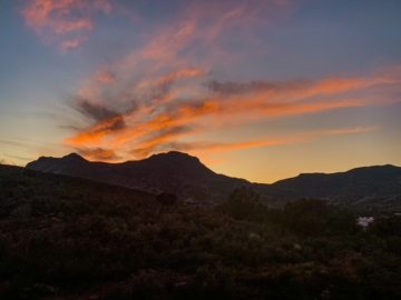
Another beautiful sunset and moonrise also await along the steep descent to Polk Spring, where I camp for the night and fill up on water – looks like there won’t be any for at least 20 miles. Tomorrow will see me on Passage 24, the Red Hills. It’s about to get geologically interesting again but a lot more strenuous. I did use as many water-thirsty foods and heavy foods as I could tonight in preparation.

Arizona Trail, Passage 25: Whiterock Mesa
Tonto National Forest

Arizona Trail, Passage 25: Whiterock Mesa
Tonto National Forest

Arizona Trail, Passage 25: Whiterock Mesa
Tonto National Forest

Arizona Trail, Passage 25: Whiterock Mesa
Tonto National Forest

Arizona Trail, Passage 25: Whiterock Mesa
Tonto National Forest
Arizona Trail, Passage 25: Whiterock Mesa
Tonto National Forest
Arizona Trail, Passage 25: Whiterock Mesa
Tonto National Forest
Arizona Trail, Passage 25: Whiterock Mesa
Tonto National Forest
Passage 25 Logistics
| Passage 25 (Whiterock Mesa) | |
| AZTA Passage Info and Map | Passage 25 (Whiterock Mesa) Passage 25 Map |
| Trail Surface | Varies Pine to Hardscrabble Mesa: Dirt singletrack Hardscrabble Mesa: Rocky FR 194: Packed gravel Whiterock Mesa to descent: Dirt singletrack |
| Length (mi) | 22.7 |
| Elevation Change (ft), north to south | Whiterock Mesa: 2661 up, 87 down Hardscrabble Mesa: 1745 up, 1263 down |
| Season | September-April |
| Potential Water Sources | Oak Canyon Spring Whiterock Spring Polk Spring |
| Trailheads | North: Pine Twin Buttes (FR 194) South: East Verde River (inaccessible by car) Doll Baby |
| Trailhead Access | North: Paved road (AZ-87) Middle: Graded dirt road (FR 194) South: Foot access only Doll Baby Trailhead accessible by car, 4 mi hike to East Verde River |
| Possible Resupply Points | Pine |
| ATA-Rated Difficulty | Whiterock Mesa: Easy Hardscrabble Mesa: Moderate |
| Threats | Heat – wear a cotton shirt so you can soak it. Synthetics aren’t great in the desert. Hypothermia – nights are generally about 30°F cooler than days in Arizona regardless of the time of year. Consider this in packing gear. Mornings can be cool year-round. Hyponatremia – “drunk on water.” To avoid, ensure adequate salt & electrolyte intake and ensure you eat as well as drink water. Symptoms are almost identical to dehydration, but drinking more makes it worse. Prevention is by far the best solution. Dehydration Lightning |
| Permits Required? | No |
| Cell Service? | Decent for area |
| Ecosystems Traversed | Rocky Mountain Montane Conifer Forest (north of Oak Spring Canyon) Great Basin Conifer Woodland |
| Highlights | Oak Spring Canyon Views of Mazatzal Mountains |
Passage 25 Ecology
| Interior Chaparral | Great Basin Conifer Woodland | Rocky Mountain Montane Conifer Woodland | |
| Common Trees/Shrubs | * Birchleaf Mahogany * Ceanothus * Holly-leaf buckthorn * Manzanita * Shrub live oak * Silktassels * Stansbury cliffrose | * Arizona alder * Holly-leaf buckthorn * Junipers * Oaks, including Arizona oak, canyon live oak, Emory oak, Gambel oak, scrub-live oak * Piñon pine * Red barberry * Serviceberry * Silktassels * Skunkbush * sugar sumac | * Ponderosa Pine * Southwestern white pine * Subalpine fir * White fir * Rocky Mountain maple * Bigtooth maple * Grey alder * Red birch * Red osier dogwood * Cliffbush * Mallow ninebark * New Mexican locust * huckleberry * bilberries |
| Common herbaceous plants | * Buckwheats * Globemallows * Lupines * Penstemons * Sego-lily * Wormwood | * fringed brome * Geyer’s sedge/elk sedge * Ross’ sedge * Bronze sedge/dry land sedge/hillside sedge/hay sedge/Fernald’s hay sedge * screwleaf muhly * bluebunch wheatgrass * Spruce-fir fleabane * wild strawberry/Virginia strawberry * Small-flowered woodrush * mountain sweet Cicely * bittercress ragwort * western meadow-rue * Fendler’s meadow-rue | |
| Common succulents | * Agaves – golden flowered, Parry’s, Toumey’s * Banana & soap tree yucca * Barrel cactus * beargrass * beehive cactus * buckhorn cholla * Cane Cholla * hedgehog cacti * prickly pear cacti * Rock echeveria * Sotol * Whipple’s cholla | * beehive cactus * Claret cup hedgehog cacti * Golden-flowered agave * Parry’s agave * Prickly pear cacti * Whipple cholla * Tonto Basin agave |
3 thoughts on “Amazing, Spectacular Arizona Trail – FR 194-Polk Spring (Day 45)”