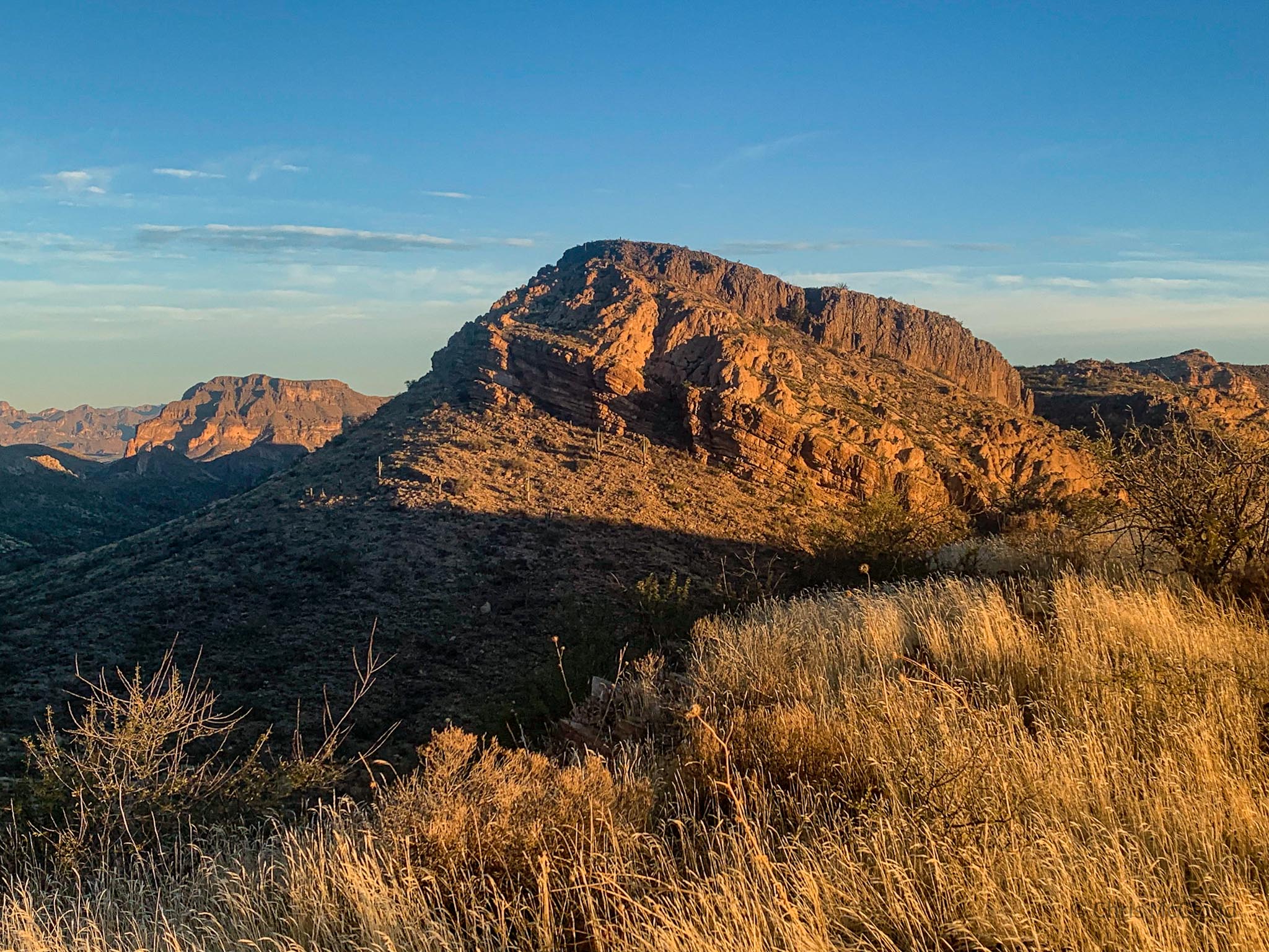
AZT Passage 17: Alamo Canyon
Alamo Canyon Overlook-Tonto National Forest Border
Arizona Trail Day 64, Part 1
Trans-Arizona/Utah Day 72, Part 1
Welcome back to Aspen’s Tracks, thruhiking the Arizona Trail from Utah to Mexico. Today, we’re continuing hiking along Passage 17. (If you missed my last entry covering the northern section of the Alamo Canyon leg, that can be found here.)
Starting with last night’s camp overlooking Alamo Canyon, this entry covers backpacking the final stretch through Alamo Canyon to the rainwater collector at the north end of the Gila River Canyons, while the next will cover the traverse through the mountains and canyons north of the Gila up to Martinez Canyon.
In the land of Arizona
“The Arizona Trail,” Dale R Shewalter
Through desert heat or snow
Winds a trail for folks to follow
From Utah to Old Mexico
It’s the Arizona Trail
A pathway through the great Southwest
A diverse track through wood and stone
Your spirit it will test
Some will push and pedal
And some will hike or run
Others will ride their horse or mule
What else could be more fun?
Oh, sure you’ll sweat and blister
You’ll feel the miles each day
You’ll shiver at the loneliness
Your feet and seat will pay
But you’ll see moonlight on the borderlands
You’ll see stars on the Mogollon
You’ll feel the warmth of winter sun
And be thrilled straight through to bone
The aches and pains will fade away
You’ll feel renewed and whole
You’ll never be the same again
With Arizona in your soul
Along the Arizona Trail
A reverence and peace you’ll know
Through deserts, canyons, and mountains
From Utah to Old Mexico
Arizona Trail: Picketpost Mountain Overlook-Rainwater Collector
After a relatively short day yesterday, I receive immediate motivation this morning. The sunrise decision last night most definitely paid off. It’s absolutely spectacular. After packing up, it’s southbound ho once again.

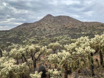
Arizona Trail, Passage 17: Alamo Canyon
Crossing through several drainages, the trail runs below rocky outcrops glowing in the morning light. It exits Tonto National Forest and crosses onto BLM land entering Alamo Canyon. It passes by the new rainwater collector that the Arizona Trail Association built shortly before my hike. After a brief moment of indecision, I drop my pack and return to fill up – this upcoming stretch is one of the driest of the entire trail under normal circumstances.

Arizona Trail, Passage 17: Alamo Canyon
Break: AZTA Rainwater Collector
Fortunately, the collector is completely full from the two recent storms, so water won’t be an issue at least at the start here today. I heard that a release was planned from dams upstream on the Gila River, so there should be water in the channel that the AZT follows, which is not always the case. Consequently, my hope is to carry enough, essentially, to get to the Gila, with perhaps some minor refills along the way if some of the side drainages are still flowing from the rain two days ago.

Arizona Trail, Passage 17: Alamo Canyon

Arizona Trail, Passage 17: Alamo Canyon
Tonto National Forest

Arizona Trail, Passage 17: Alamo Canyon
Tonto National Forest
More than that and I will probably be weighed down significantly, but this is probably the trickiest balance to weigh yet on the trail, and was a factor in my brief hesitation before setting out yesterday. The reputation of this passage precedes itself, without question.

Arizona Trail, Passage 17: Alamo Canyon
Tonto National Forest

Arizona Trail, Passage 17: Alamo Canyon
Tonto National Forest

Arizona Trail, Passage 17: Alamo Canyon
Tonto National Forest

Arizona Trail, Passage 17: Alamo Canyon
Tonto National Forest

Arizona Trail, Passage 17: Alamo Canyon
Tonto National Forest

Arizona Trail, Passage 17: Alamo Canyon
Tonto National Forest

Arizona Trail, Passage 17: Alamo Canyon
Tonto National Forest
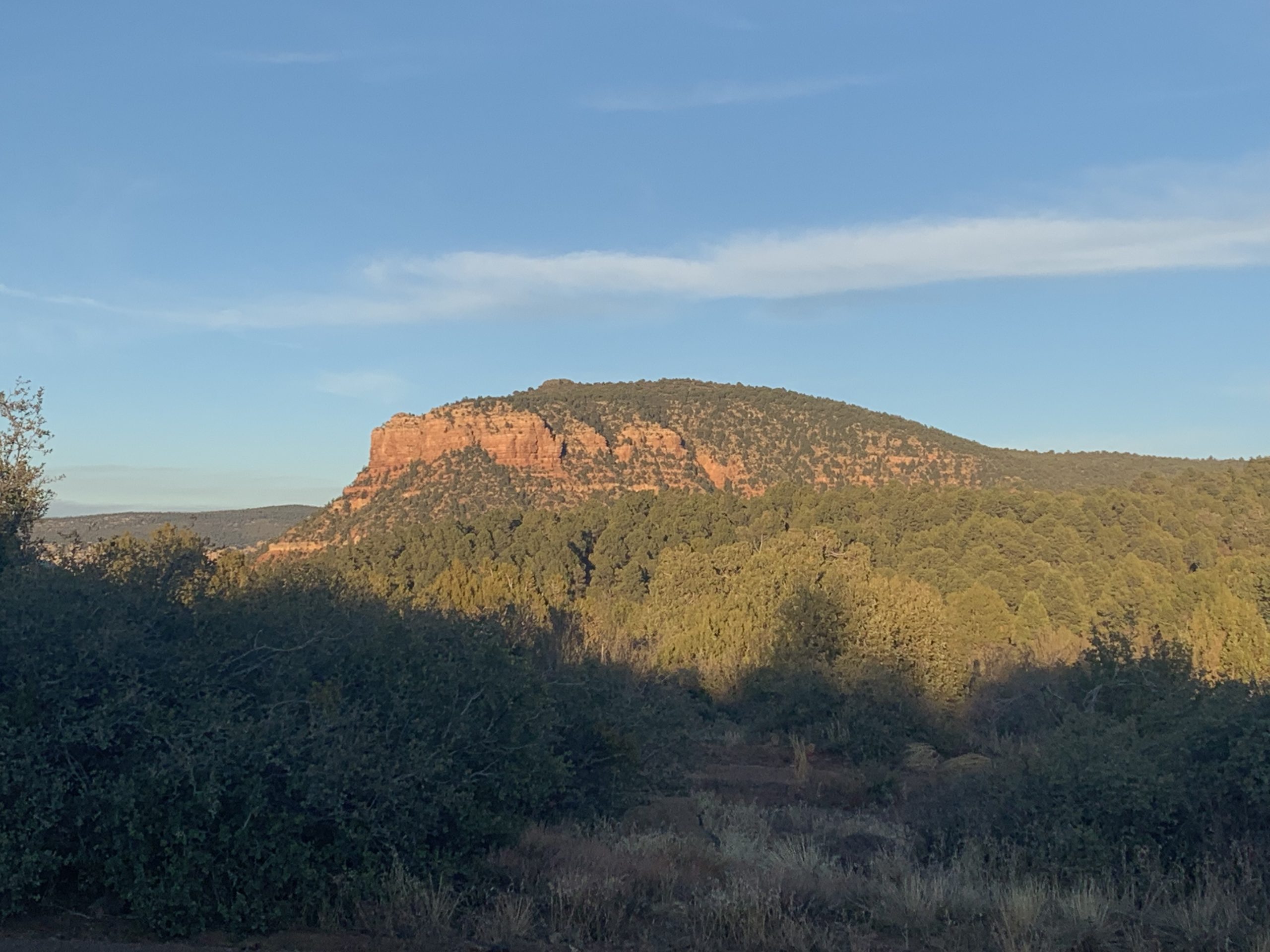
Arizona Trail: AZTA Rainwater Collector-Tonto NF Border & Passage 16 (Gila River Canyons)
Having wrapped up at the rainwater collector, I begin to descend slightly toward the canyon traverse through the mountains north of the Gila River. After about 20 minutes, I reach the gate marking the end of Passage 17 and the start of passage 17, the Gila River Canyons, one of the most remote stretches of the entire trail. I take a moment to soak in the solitude and remoteness of the setting, especially considering that this passage boundary is not accessible to motor vehicles, then pass through the gate and begin the traverse to the Gila River where I plan to make camp for the night.


Arizona Trail, Passage 17: Alamo Canyon
Tonto National Forest

Arizona Trail, Passage 17: Alamo Canyon
Tonto National Forest

Tonto National Forest

Kaibab National Forest

Arizona Trail, Passage 16: Gila River Canyons
Tonto National Forest Boundary
Passage 17 Logistics
| Passage 17 (Alamo Canyon) | |
| AZTA Page and Map | Passage 17 (Alamo Canyon) Passage 17 Map Passage 17 Elevation Profile |
| Weather | Passage 17 Weather |
| Trail Surface | Dirt Singletrack |
| Length (Mi) | 11.7 |
| Season | September-May |
| Potential Water Sources | Picketpost Trailhead Resupply Box (mi 300.6 NB, 487.9 SB) Arnett Canyon Trail Junction (mi 300.3 NB, 488.2 SB) Small Flow (mi 297.6 NB, 490.9 SB) Drainage & Water (mi 290.2 NB, 498.3 SB) Rainwater Collector (mi 289.1 NB, 499.3 SB) Full sources & Current Status: Arizona Trail Water Sources |
| Trailheads | North: Picketpost Trailhead South: Tonto National Forest boundary |
| Trailhead Access | North: Vehicular access; via paved road South: No vehicular access |
| Wilderness | No |
| Possible resupply points | Superior (north end) |
| ATA-Rated Difficulty | Moderate |
| Potential campsites | Terrain is pretty dry and rugged. Your best bet is to push through this passage in a day and camp near the rainwater collector on the south end or near one of the trailheads on the north end before ascending into the Superstitions, or just after ascending to the summit of Montana Mountain |
| Ecosystems Traversed | Arizona Upland, mostly |
| Highlights | Rugged canyon scenery Picketpost Mountain Views of Superstition Mountains and Apache Leap Desert flora & fauna diversity Solitude |
| Dog friendly? | Yes |
| Bike friendly? | Yes |
| Hazards | Arguably driest passage on trail. Unless recent storm, AZTA water collector is only reliable source north of Gila River on passage Extreme Heat in summer Flash flooding during monsoon (July-September) |
Passage 17 Ecology
| Arizona Upland | |
| Common Trees/Shrubs | * Fairy duster * Blue and littleleaf palo verde * Fremont wolfberry * Graythorn * Ocotillo * Red barberry * Scrub-live oak * Snapdragon-penstemon * Turpentine bush * Velvet mesquite * Whitethron acacia |
| Common herbaceous plants | * California flannelbush [rare in Arizona, Superstition Mountains included] * Bluedicks * Brittlebush * California poppies * Creamcups * Desert chicory * Desert rockpea * Desert windflower * Fringed red maids * Globemallows * Lupines * Sego-lily |
| Common succulents | * Arizona pencil cholla * Banana yucca * Soaptree yucca * Buckhorn cholla * Cane cholla * Chainfruit * Hedgehog cactus * Pencil cholla * Pincushion cactus * Prickly pears * Saguaro * Teddybear cholla |
Health
I’m so in love with this. You did a great job!!
I Fashion Styles
Its like you read my mind! You seem to know so much about this, like you wrote the book in it or something. I think that you can do with some pics to drive the message home a little bit, but other than that, this is wonderful blog. A fantastic read. I’ll definitely be back.
Aspen
Thanks! I have to admit, this is the first time I’ve ever heard that I could use some more pictures!
Franchesca Goloubev
Hello aspenstracks.com admin, Your posts are always informative and well-explained.