
St. George, Utah
In the magical, colorful outdoors wonderland that is southern Utah, it’s easy to rush between places like Zion National Park, Bryce Canyon, Capitol Reef, the Grand Staircase, Cedar Breaks, Arches, Canyonlands and more…and overlook some of the towns passed through on a road trip or hiking trip between these places. St. George is one, indeed the largest, and it shouldn’t be overlooked.
South Arrival (from Las Vegas)
Most people visiting southern Utah will approach St. George from the south, having flown into Las Vegas. The drive through southern Nevada along I-15, especially once north of the Lake Mead region, is arguably one of the least interesting in the United States. (This is not the case if you stop at various places off the interstate on the way, of course).
This all changes at the next state line. The short traverse through the Virgin River Gorge is one of the most spectacular stretches of interstate in the country, rivaling areas like the western legs of I-90 through the Rockies and Cascades. The degree of contrast is reminiscent of the crossing of the Columbia River lava flows on I-90 with the Rockies and Cascades crossings on either end.
Having passed through the Virgin River Gorge, the traveler crosses the Utah state line and almost immediately encounters the outskirts of St George, located mere miles north of the state line, another steep contrast – this time to the isolation and solitude of the Arizona Strip that has just been traversed.
As the largest town in southern Utah, St George offers a substantial range of amenities and access – a full service city, it offers major access to the Arizona Strip, containing Grand Canyon-Parashant National Monument, the Virgin River Gorge, the North Rim of Grand Canyon, and Vermilion Cliffs National Monument. It is also located in close proximity to such outdoor treasures as Red Cliffs NCA, Snow Canyon State Park, Zion National Park, Cedar Breaks National Monument, and Bryce Canyon National Park.

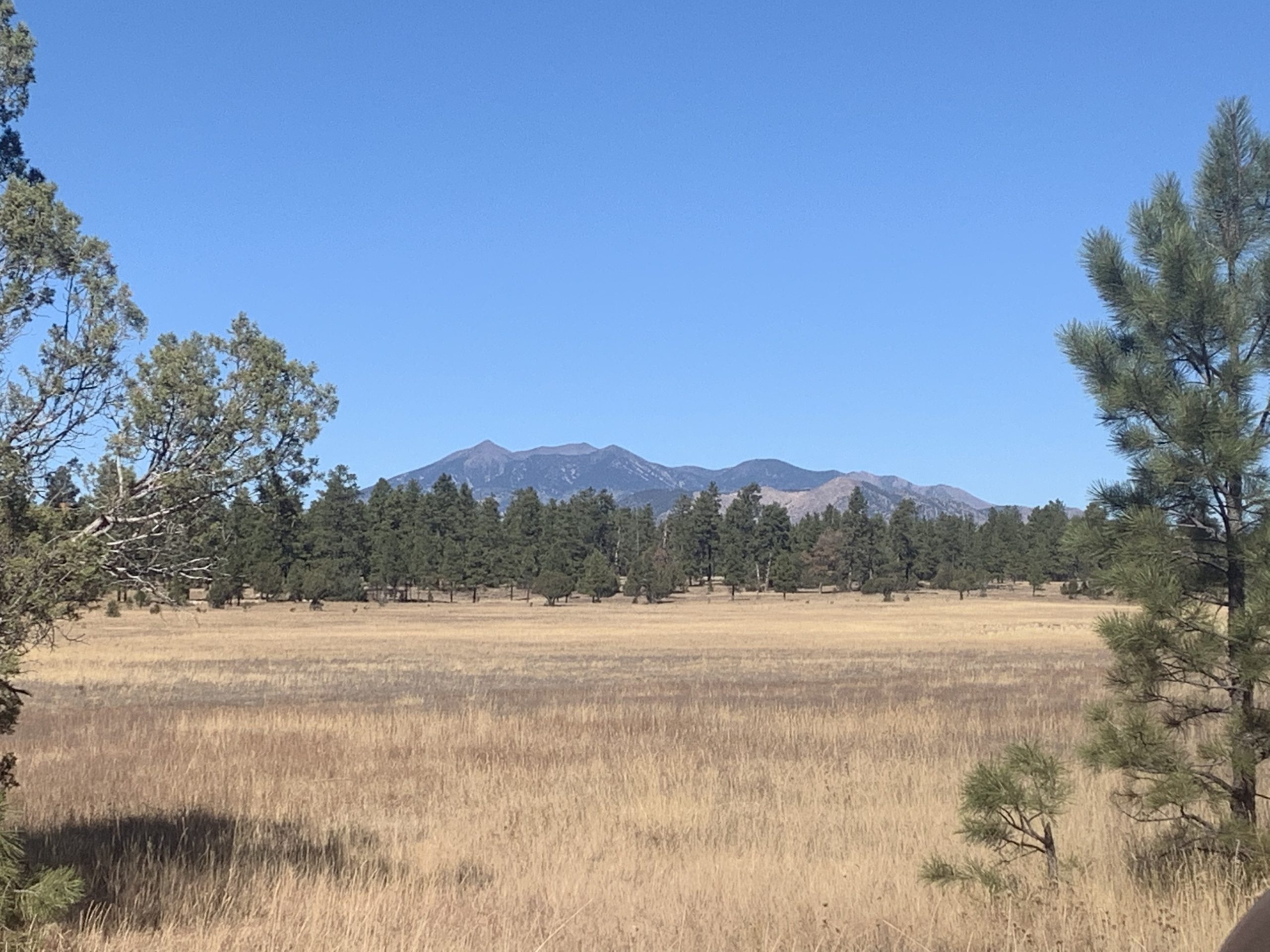
I-15, Arizona

I-15, Arizona

I-15, Arizona
St. George Food & Drink
Food
Bear Paw Cafe is a great local spot for breakfast. For the indecisive among us they have some great combo options that combine different parts of the menu (like eggs, crepes, protein, and potatoes). They have some great smoothies and tea options as well as waffles, pancakes, Belgian waffles, omelets and more. It’s also pretty much smack in the heart of downtown so easy to walk around town or head up to Pioneer Park or Snow Canyon from here afterwards.
Red Fort, an Indian restaurant in eastern St George, is a repeat winner of the Best of Southern Utah competition. The quality and authenticity are excellent. I highly recommend the tandoori chicken, and the mango ice cream – truly excellent! Banja Thai is a great Thai place in the historic downtown center of the city.
Dessert
Consider refreshing after a hot day hiking (or just rewarding yourself, in cooler weather) with ice cream from Handel’s – a regional chain in the southwest based in St George. Among the best ice creams I’ve ever had, Handel’s (like Hodgies in Newburyport) provides extremely generous portions – to the point where if you want two flavors, it is necessary to get at least 4 scoops!
If you’re in the mood for a more solid dessert, check out Mary’s Cheesecakes, which offers mini cheesecakes, cheesecake/cake combos, slices and whole cakes, as well as other innovations like Slicecream, a combination of cheesecake and ice cream. Fortunately there are spectacular trails on which to burn off these tasty treats, or to clear room for them in advance.
Drinks
You might be aware of Utah’s, historically, well, interesting alcohol laws, but there are still places to get a good drink. Utah recently loosened some of its more restrictive laws, and in 2019 Zion Brewery opened as the region’s first microbrewery. They sell food at their Springdale location and allow any food to be brought in at their St George location.
St. George: Outdoor Activities
This is where St. George really shines. If you check the even the self biographies of local leaders, you will note that many highlight their outdoor connections, especially hiking and/or cycling. Snow Canyon State Park, Red Cliffs National Conservation Area, Quail Creek State Park, Sand Hollow State Park, and more BLM, city, and state land around the city all provide a plethora of opportunities.
As always, if you go please remember to Leave No Trace and leave wherever you visit better than you found it. You can get maps, critical for the Arizona Strip in particular, from the interagency Bureau of Land Management/National Park Service/US Forest Service office at 345 Riverside Ave. Note that many of the locations listed below will eventually get their own more detailed posts as well.

St. George, Utah
Hiking
Snow Canyon State Park
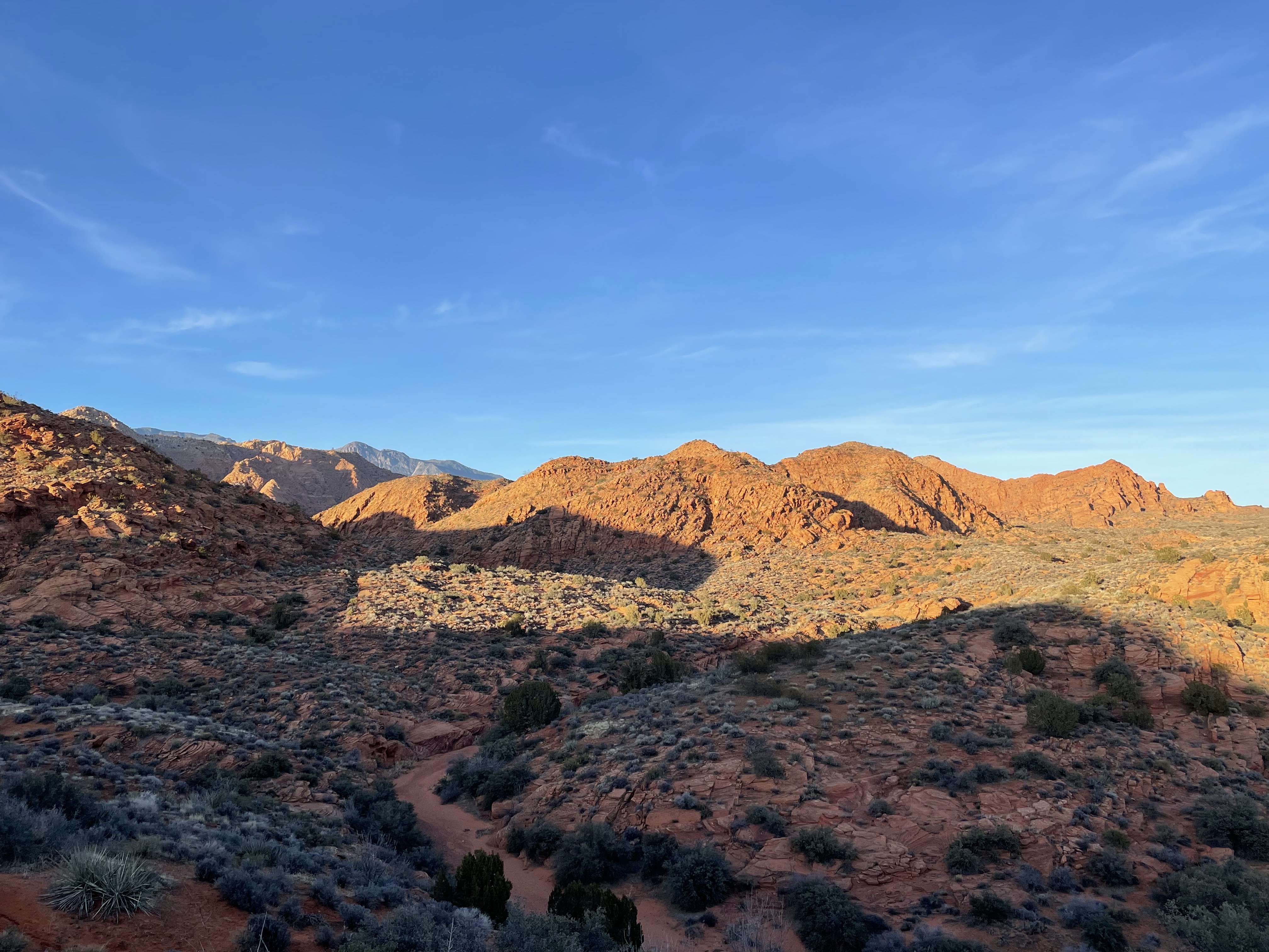
Snow Canyon lies to the northwest of St George and has miles of trails to explore, many relatively flat or gently sloping across the canyon floor. Be careful, cryptobiotic (living) soil grows in places on the canyon floor, so please do not step off the trails or past guardrails surrounding parking lots. Be particularly aware of any black crust or color on the surface of the soil. Stepping on such soil will kill it and negatively impact the park’s ecology, somewhat defeating one of the purposes for it. Snow Canyon is a geology and color nerd’s paradise, as it also includes petrified sand dunes, lava flows, pioneer names and more.

St. George, Utah

St. George, Utah

Snow Canyon State Park
St. George, Utah

Snow Canyon State Park
St. George, Utah

St. George, Utah

Snow Canyon State Park
St. George, Utah
Red Cliffs National Conservation Area
Red Cliffs lies to the north and has miles of trails leading through exposed red rock outcrops, washes, and slot canyons. You may encounter water and/or mud and some trails may require climbing around or going through water features. At times you may encounter a feature that is not passable at that time. Fortunately in such situations, there may be additional ways to cut off routes and avoid such obstacles, depending on where the obstacle occurs. Views in the area stretch to Zion National Park on the horizon. Areas like the Cottonwood Canyon Wilderness provide extensive opportunities for solitude for those who are able to reach it.


St. George, Utah


Hurricane Cliffs
Associated with the Hurricane Fault, the Hurricane Cliffs are a prominent landmark east of the city of Hurricane (pronounced hurri-can, not hurri-cane). They stretch into northwest Arizona, nearly to the Grand Canyon, and form part of the transition between the Colorado Plateau above and Great Basin below. Canyons stretch up into the cliffs and offer opportunities for exploration. If you are lucky and have had rain recently, you may have the opportunity to see some of the dry falls flowing, but please be aware of conditions and escape routes in the event of flash flooding.
Arizona Strip
Accessed directly through the Virgin River Gorge on I-15 as well as via UT-59 east, the Arizona Strip offers remote beauty, solitude, natural beauty, and history. On the eastern side lies places like Lee’s Ferry, Vermilion Cliffs, the North Rim of Grand Canyon and the Arizona Trail past Buckskin Mountain on BLM land. The trail continues through the Northern, Central and Southern sections of the Kaibab Plateau. To the west can be found remote stretches of Grand Canyon National Park as well as Grand Canyon-Parashant National Monument. Parashant has its own wilderness areas and overlooks of the Canyon.
Throughout, the Arizona Strip is an adventure in itself. Please note, four wheel drive vehicles are required for many of the roads on the Arizona Strip, and rain or snow can render many impassable during the summer monsoon or winter. Always check with the previously mentioned BLM office in St. George before attempting travel on the Strip, especially at Parashant.
Zion National Park
The South Gate of Zion is in the town of Springdale about an hour east of St. George. Zion is a hiking paradise with four season conditions depending on the time of year. Zion is the 5th most visited designated Park in the country, so make sure that you enter early or late (or ride the free Springdale shuttle) into the park to avoid traffic backups and parking limitations.
The lesser visited Kolob Canyons section offers a quieter side of Zion easily accessed off of I-15. Traction gear and/or wetsuits will be required for some hikes during the cooler months, while in the summer the water temperature is more pleasant relative to the air, but there is the potential for flash flooding that could close the parks iconic narrow canyons at any time. At any time of year, the colors and lighting of the eroded features of the park are worth the visit.

Zion National Park, Utah

Zion National Park, Utah
Cedar Breaks National Monument
Bryce Canyon without the crowds, Cedar Breaks hosts one of the best wildflower displays I’ve ever seen in midsummer. At over 10K ft in elevation, there are only two temperature seasons this high: cool, and cold. The bright colors and hoodoos of the Markagunt Plateau make for outstanding sunsets and stand out even on grey days. Bryce Canyon is a sunrise park; Cedar Breaks is a sunset park.

Cedar Breaks National Monument, Utah

Cedar Breaks National Monument, Utah
Bryce Canyon
One of the most iconic sunrise spots in North America, Bryce Canyon, at 10,000 ft elevation, is home to waterfalls, four season recreation, summer wildflowers, and it’s iconic hoodoos. The view from Bryce’s highest point stretches all the way to the Grand Canyon. Bryce is about 2.5 hours from St. George.

Bryce Canyon National Park
Boating
Sand Hollow State Park east of town offers boating on the Sand Hollow Reservoir. There’s also swimming and camping at this scenic blue water destination surrounded by orange dunes and red cliffs. Beware of swimmer’s itch here when the water is warmer, though.

St George, Utah
Camping
In terms of developed campgrounds, there are prominent ones at Snow Canyon, Sand Hollow, and Red Cliffs. There are also popular dispersed camping options on BLM lands around town, including the Beaver Dam Wash National Conservation Area off of UT-91 just west of town and on the Arizona Strip just south of town.
Cycling
St George has over 60 miles of bike trails in the immediate area and more in the greater region. Two of the longest are the Veyo Loop (43.5 miles) and the Virgin River Trail (17.6 miles). Another option is following the route of the Tour of St. George, which is ridden twice a year (spring and fall) in varying distance increments up to 100 miles and takes in many of the scenic spots around town, including Snow Canyon, the Red Cliffs, Quail Hollow State Park and Sand Hollow State Park.
Lodging and Camping in St. George
As the largest community in southern Utah, there are many lodging options in St. George, with just about every major hotel chain represented. Campgrounds are present at Snow Canyon State Park, Sand Hollow State Park, the Red Cliffs Campground at Red Cliffs NCA (the remainder of the area is closed to camping), the area around Sand Cove, and designated spots in the Pine Valley Ranger District of the Dixie National Forest. With adequate maps it is also possible to access BLM or state trust lands on the Arizona Strip for camping as well.
Please note that Arizona requires a permit to camp on state lands. BLM does not, but you must move every 14 days to a location at least 25 miles from your prior location (this means that every six weeks you can return to a prior location). BLM roads are not reliably maintained, stop by the BLM office above for information regarding current road conditions, which can vary significantly depending on the time of year, and to make sure you and your car are adequately prepared for the conditions you will encounter.
- Arizona
- Backpacking
- BLM Land
- Cottonwood Canyon Wilderness
- Day Hiking
- Glen Canyon NRA
- Grand Canyon National Park
- Hiking
- Kaibab National Forest
- National Conservation Areas & BLM National Monuments
- National Forest
- National Parks
- Paria Canyon-Vermilion Cliffs Wilderness
- Passage 40: Kaibab Plateau South
- Passage 41: Kaibab Plateau Central
- Passage 42: Kaibab Plateau North
- Passage 43: Buckskin Mountain
- photography
- public lands
- Red Cliffs NCA
- Road Trips
- Sand Hollow SP
- Snow Canyon SP
- State Parks
- The Arizona Trail
- Travel
- Utah
- Utah State Parks
- wilderness
- Zion NP
Hairstyles
Good website! I really love how it is simple on my eyes and the data are well written. I am wondering how I could be notified whenever a new post has been made. I’ve subscribed to your RSS feed which must do the trick! Have a nice day!