Fossil Springs Wilderness
Coconino National Forest
Fossil Springs Wilderness
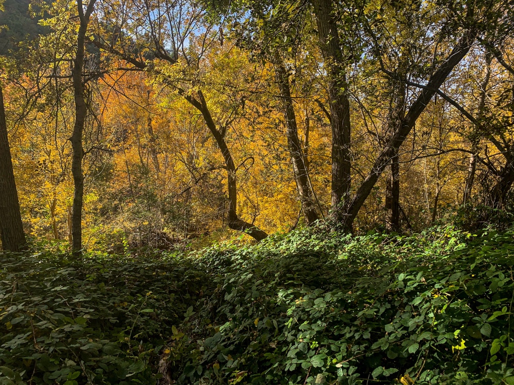
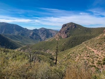
Fossil Springs Wilderness is one of the most spectacular areas in Arizona – so much so that permits are required from April 1-October 1. The Wilderness has 11,550 acres with 30 species of trees and shrubs and over 100 species of birds. Fossil Creek itself is one of two Wild & Scenic Rivers in Arizona as well, designated by Congress in 2009 after the Fossil Springs Dam was decommissioned by Arizona in 2005.
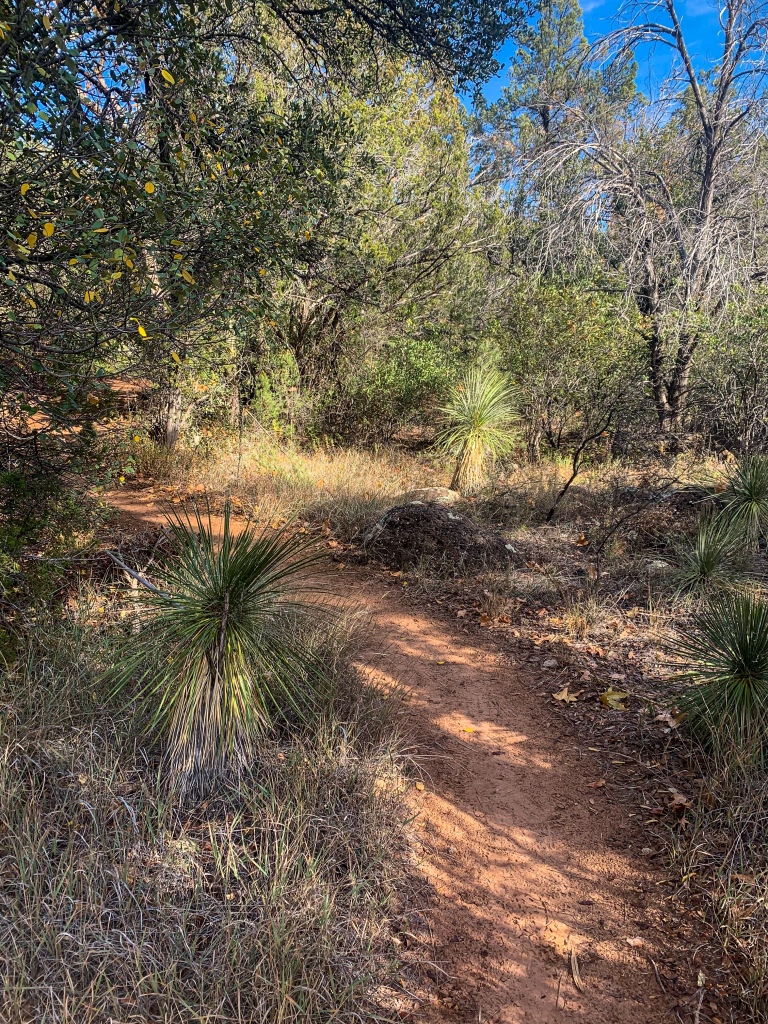
The next few entries will follow the loop from the eastern Fossil Springs Trailhead through Fossil Canyon, along the Flume Trail to the Fossil Creek Bridge, then returning to the start along Fossil Creek Road (FR 708) with a spur on the Waterfall Trail. I did the full loop in a day but one could easy split it into two and I’d recommend that for less experienced hikers or those who are just out for a weekend to give yourself a bit more time to soak it in. Today’s entry will cover the eastern segment of the loop, running along the Fossil Springs Trail from the Bob Bear (Fossil Springs) Trailhead 3 miles west of Strawberry to Fossil Creek Dam.
Important Notes
Two important things to recognize about the full loop: permits are required to park at the trailheads from April 1-October 30, and FR 708 (Fossil Creek Road) is closed from just below the Waterfall Trailhead to Just west of the Bob Bear Trailhead, so plan your starting point and route to get there in advance with that in mind and be aware it’s not easy to get from one side to the other by car.
You can, however, walk or bike the closed stretch of road. It is a long, sustained climb up the canyon wall, as we’ll see tomorrow – so consider that if doing the full loop as well. Some might prefer to go down the road first and up the shorter but steeper trail at the end. Or if you started at the bottom (Fossil Creek Bridge) you could go up the road or trail first, depending on your preferred method of ascent. Just remember, again – once you go to one of the two trailheads, that’s where you’ll be starting.
General things to know about this hike before we launch in:
| Fossil Springs Trail | Wilderness Loop | |
| Trail Surface | Dirt singletrack | Dirt (75% singletrack, 25% road) |
| Type of hike | Out & back | Loop |
| Length (mi) | 4.6 mi one-way | About 20 miles |
| Elevation Change (ft) | 1426 | 1625 |
| Season | All year | All year |
| Potential Water Sources | Fossil Springs Fossil Creek | Fossil Springs Fossil Creek |
| Trailheads | Bob Bear Trailhead, unless combined with Flume Trail | Bob Bear Trailhead Fossil Springs – Irving Trailhead |
| Permits required? | Yes, seasonally | Yes, seasonally |
Fossil Springs Wilderness: Fossil Springs Trail to Fossil Creek Dam
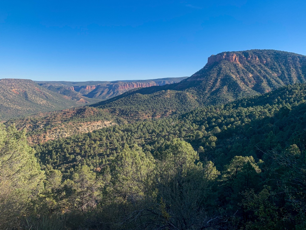
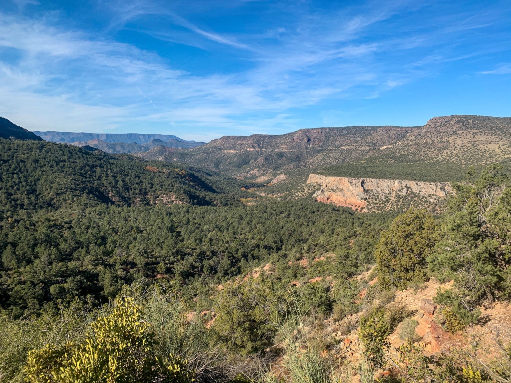
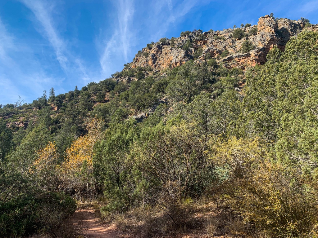
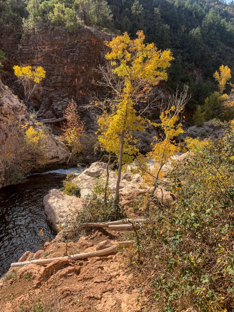
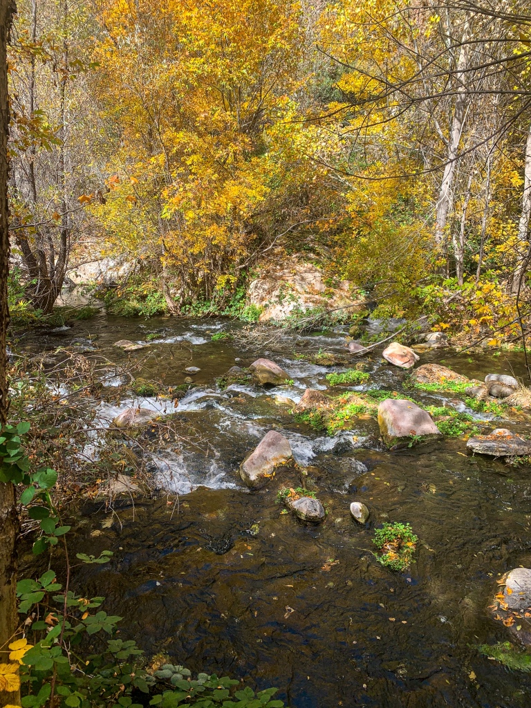
The trail descends from the Fossil Springs trailhead to the bottom of Fossil Canyon, a 1600 ft deep canyon carved over time into the Mogollon Rim. Upon reaching the canyon floor, it passes a junction with the Mail Trail, which ascends the Mogollon Rim (honestly, this would be a sweet potential alternate route for the AZT) and then traces the Canyon to reach Fossil Springs and the former site of the Fossil Springs Diversion Dam.
Fossil Springs Wilderness
Coconino National Forest

Fossil Springs Wilderness
Coconino National Forest

Fossil Springs Wilderness
Coconino National Forest
Fossil Springs Wilderness
Coconino National Forest
Fossil Springs Wilderness
Coconino National Forest
Fossil Springs Wilderness
Coconino National Forest

Fossil Springs Wilderness
Coconino National Forest
Fossil Springs Wilderness
Coconino National Forest

Fossil Springs Wilderness
Coconino National Forest
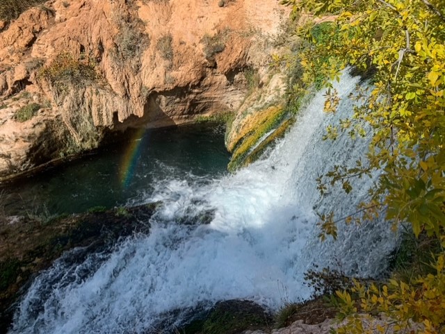
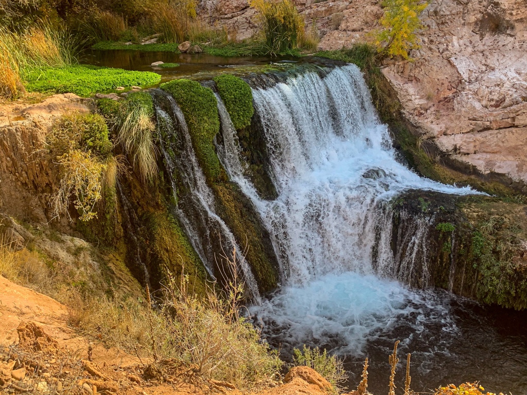
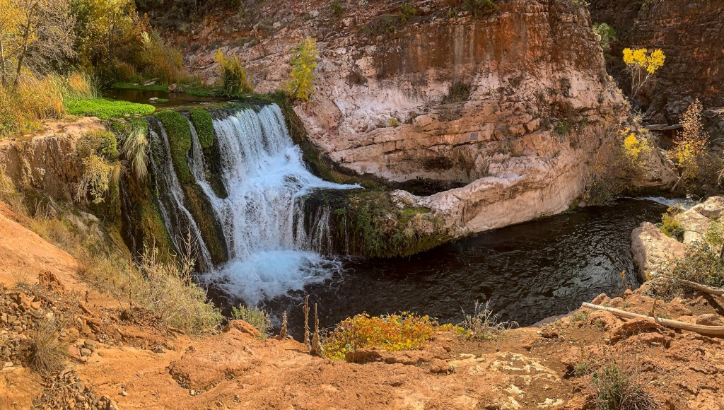
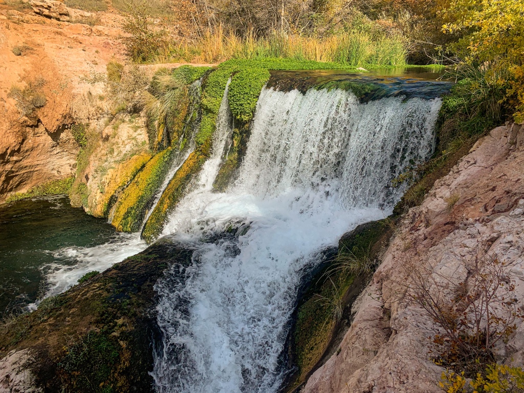
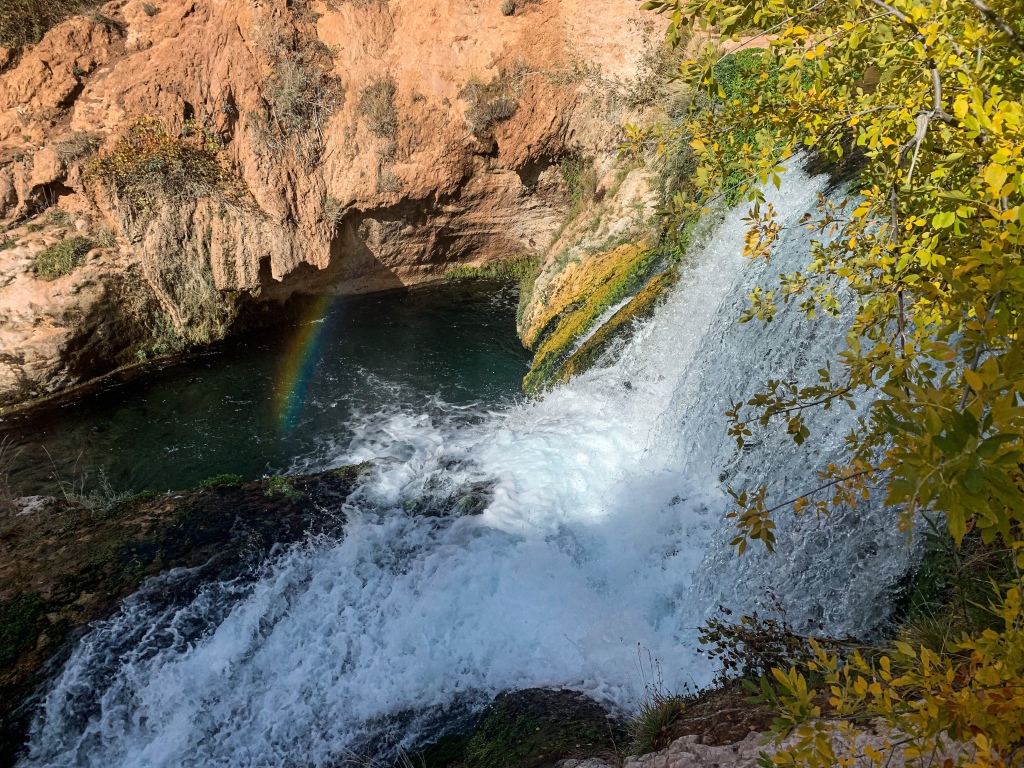
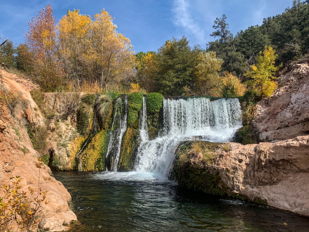
Fossil Creek Dam
The Diversion Dam, as the name suggests, diverted water from Fossil Creek into flumes that carried it four miles down Canyon to the Irving Powerhouse, built in a much more accessible spot; these flumes were calibrated to drop 1 ft of elevation for every 1000 ft in distance in order to develop the requisite hydraulic gradient for power generation. The dam was built in 1916, entirely by hand at 25 ft tall and 5 ft thick; it makes for a great waterfall today with the top 11 ft removed to allow the creek to flow freely again.
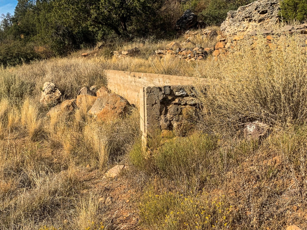
On the opposite bank from the trail, but accessible by a spur trail, is a natural feature called the Toilet Bowl, a rounded out area of the rocks separated by a rock wall from the main channel of the creek, but with an underground connection between the two – so in a sense, anything that ends up in the “bowl” winds up being “flushed” into the main channel. Swimming in the Bowl is not recommended. Foundations related to the flume or dam structures are nearby as well, and travertine formations abound, encasing fossils within – hence the name of the area.

Fossil Springs Wilderness
Coconino National Forest
Fossil Springs Wilderness
Coconino National Forest
Fossil Springs Wilderness
Coconino National Forest
Fossil Springs Wilderness
Coconino National Forest
Fossil Springs Wilderness
Coconino National Forest
Fossil Springs Wilderness
Coconino National Forest
Fossil Springs Wilderness
Coconino National Forest
Fossil Springs Wilderness
Coconino National Forest
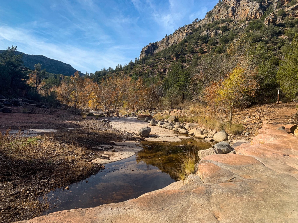
Fossil Springs
Just above the Fossil Creek Dam, the trail reaches its namesake. It (and the wilderness area) takes its name from Fossil Springs itself. Releasing 20,000 gallons/minute – or 30 million gallons daily – into the Canyon at 70°F, these springs are prolific and can be witnessed close to the main trail.

Fossil Springs Wilderness
Coconino National Forest
Fossil Springs Wilderness
Coconino National Forest
Fossil Springs Wilderness
Coconino National Forest
Fossil Springs Wilderness
Coconino National Forest

Fossil Springs Wilderness
Coconino National Forest
Fossil Springs Wilderness
Coconino National Forest

Fossil Springs Wilderness
Coconino National Forest
Fossil Springs Wilderness
Coconino National Forest
Fossil Springs Wilderness
Coconino National Forest

Fossil Springs Wilderness
Coconino National Forest

Fossil Springs Wilderness
Coconino National Forest
Fossil Springs Wilderness
Coconino National Forest

3 thoughts on “Fossil Springs Wilderness: Spectacular Fossil Springs Trail (Hiking Amazing Arizona)”