Backpacking the Arizona Trail: Passages 30 (Anderson Mesa) and 29 (Mormon Lake)
AZT Day 31
Trans-Arizona/Utah Day 38
In the land of Arizona
Through desert heat or snow
Winds a trail for folks to follow
From Utah to Old Mexico
It’s the Arizona Trail
A pathway through the great Southwest
A diverse track through wood and stone
Your spirit it will test
Oh, sure you’ll sweat and blister
You’ll feel the miles every day
You’ll shiver at the loneliness
Your feet and seat will pay
But you’ll see moonlight on the borderlands
You’ll see stars on the Mogollon
You’ll feel the warmth of winter sun
And be thrilled straight through to bone
The aches and pains will fade away
You’ll feel renewed and whole
You’ll never be the same again
With Arizona in your soul
Along the Arizona Trail
A reverence and peace you’ll know
Through deserts, canyons, and mountains
From Utah to Old Mexico
-“The Arizona Trail,” Dale R. Shewalter
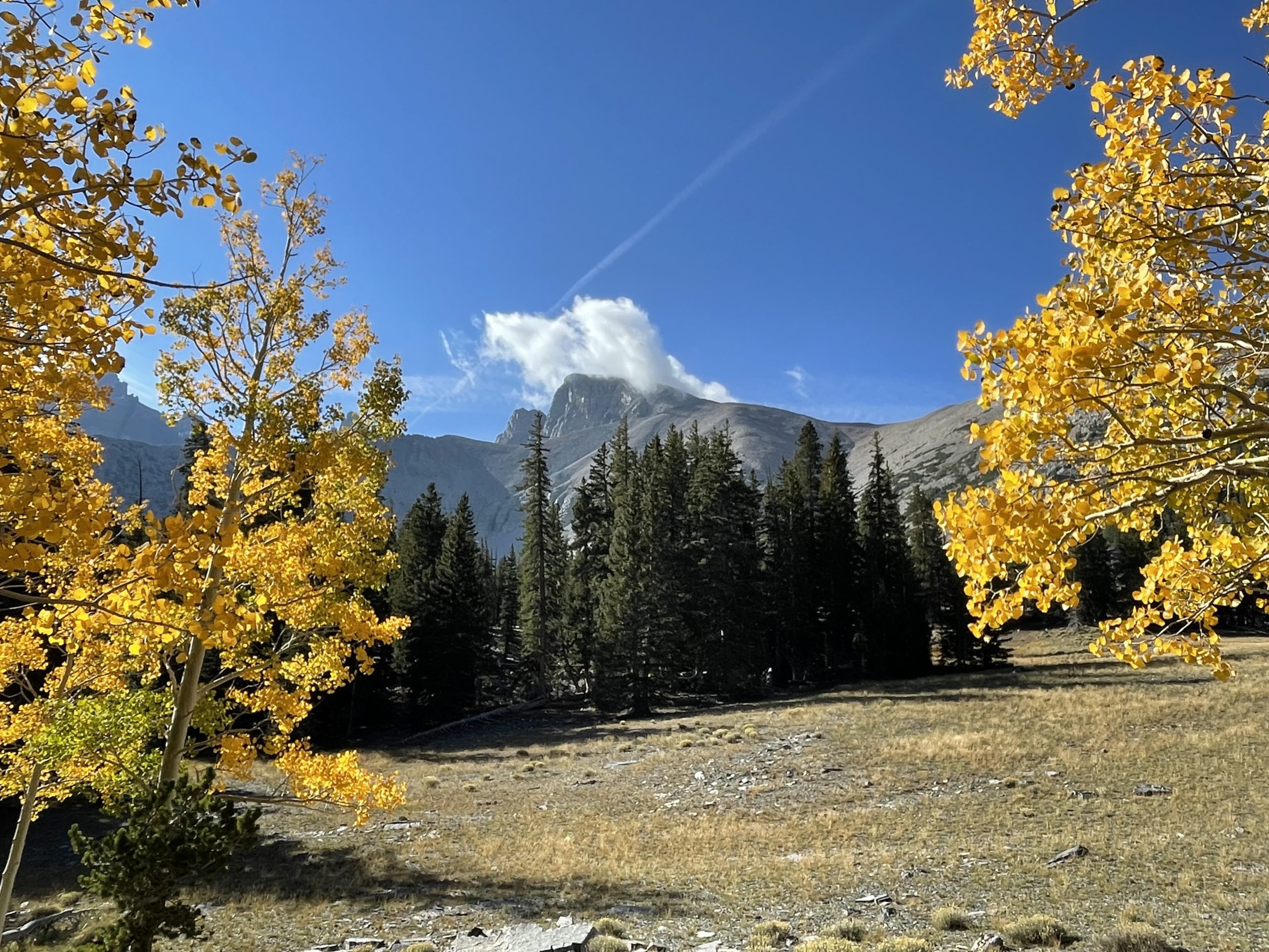
Arizona Trail Passage 30: Horse Lake-Lake Mary Road
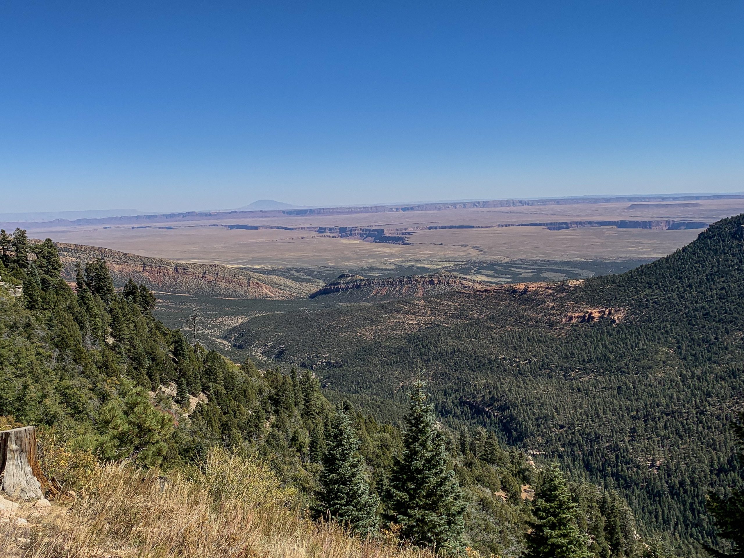
First order of business today is to fill up on water at Horse Lake, then pack up and head south. I run through a lot of water today, probably because of the exposed going. By the time I’ve descended off Anderson Mesa, crossed Lake Mary Road and reentered the ponderosa forest I’m on at least my third liter of water, so I’ve gone into rationing in the hopes of making it to Double Springs Campground, which it looks from Guthook is the next likely source of water. The trail becomes more dirt on the descent off Anderson Mesa, and this becomes more fixed west of Lake Mary Road.

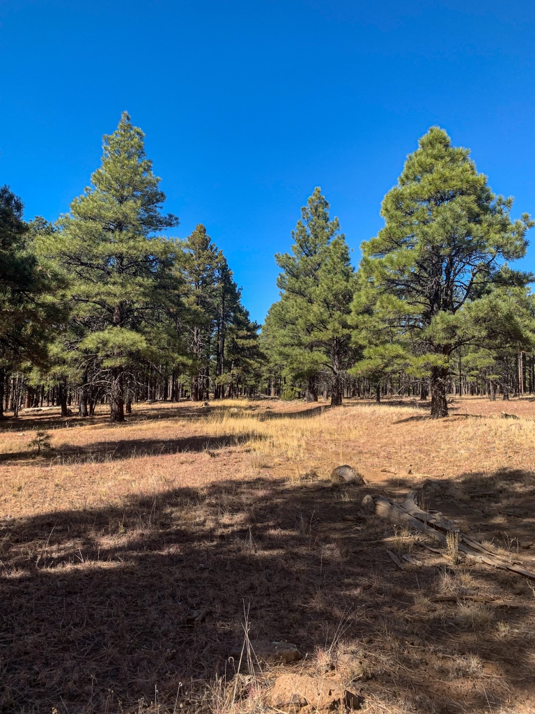
Arizona Trail, Passage 30 (Mormon Lake)
Coconino National Forest

Arizona Trail, Passage 30 (Mormon Lake)
Coconino National Forest

Arizona Trail, Passage 30 (Mormon Lake)
Coconino National Forest

Arizona Trail, Passage 30 (Mormon Lake)
Coconino National Forest
Arizona Trail, Passage 30 (Mormon Lake)
Coconino National Forest
Lake Mary Road-Double Springs (Passage 29: Mormon Lake)
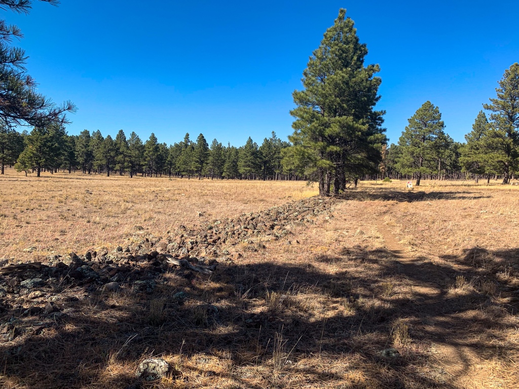
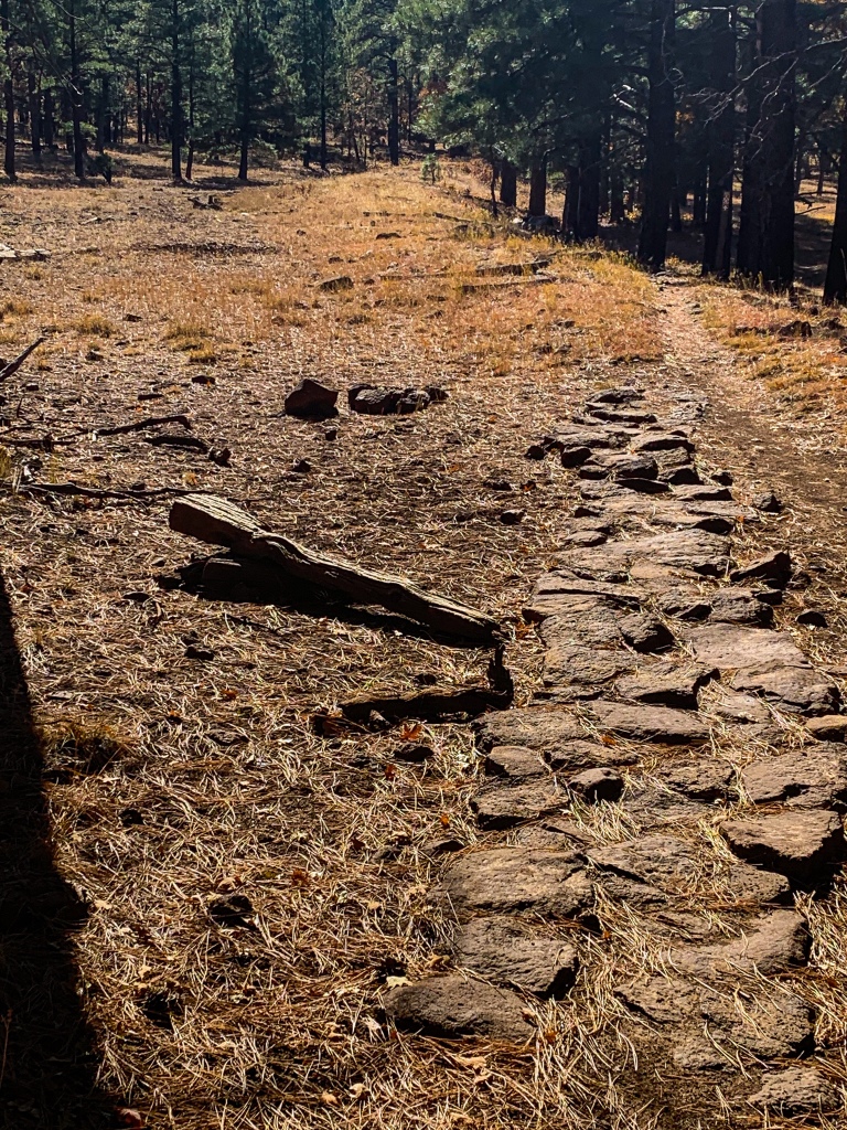
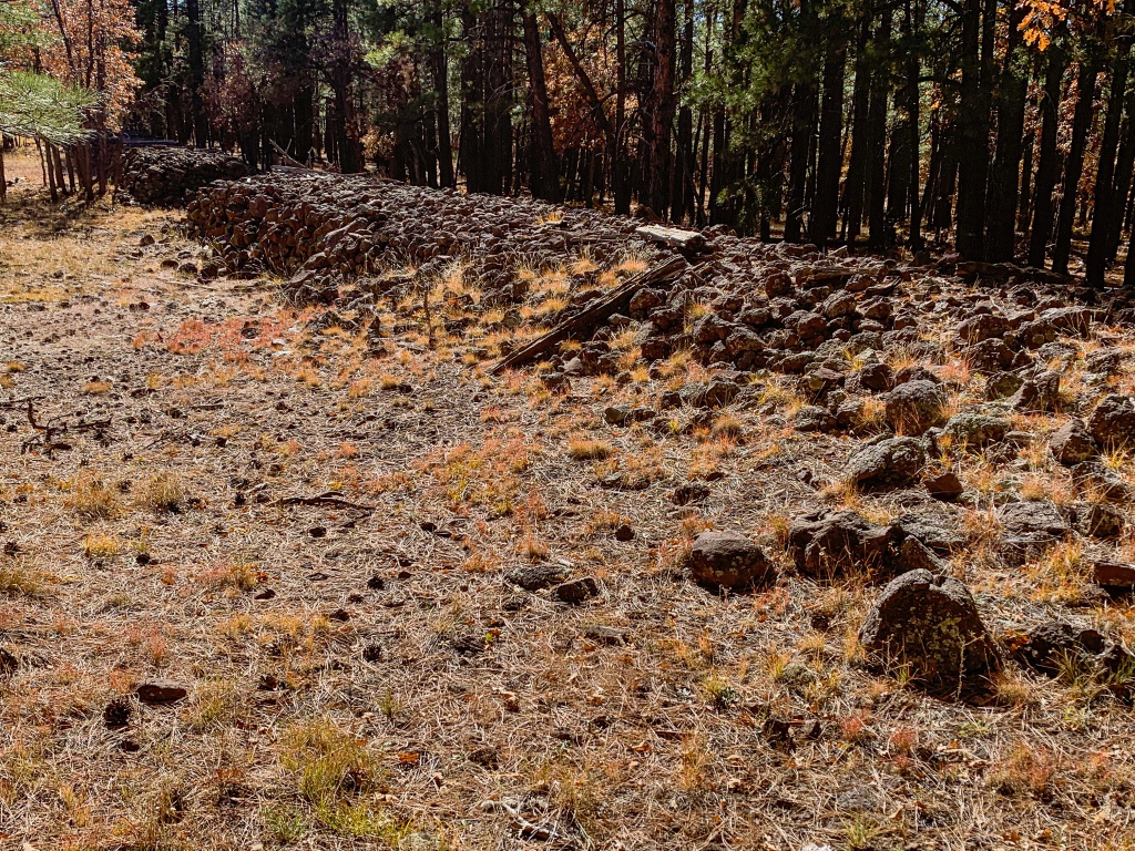
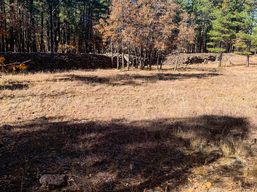
There is a lot of cool railroad history west of Lake Mary Road. The trail started following something that appeared to be a mass of stones in what seemed to be an unnatural line with a tendency to curve in places. Looked very much manmade and piled.
Arizona Trail, Passage 30 (Mormon Lake) west of Lake Mary Rd
Coconino National Forest

Arizona Trail, Passage 30 (Mormon Lake) west of Lake Mary Rd
Coconino National Forest
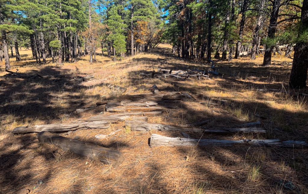
Eventually more of an obvious grade emerged, making the status of that particular feature an old railroad route quite obvious – particularly in the places where it was built above the level of the surrounding land. In some places you could even see where trestles would have been, and in others the ties were still visible. For someone like myself who is very much into railroad history – in this case, an old logging railroad, as confirmed by a nearby interpretive sign, it was really cool.
Arizona Trail, Passage 30 (Mormon Lake) west of Lake Mary Rd
Coconino National Forest

Arizona Trail, Passage 30 (Mormon Lake), west of Lake Mary Rd
Coconino National Forest
The sign nearby reads: “As you hike from Lake Mary toward Mormon Lake and south to Allan Lake on the Arizona Trail, you will pass and even follow the grades of many old logging railroads. The Flagstaff Lumber Company extended their old logging railroad from Lake Mary toward Mormon Lake and Mormon Mountain beginning in 1923. The railroad was constructed primarily to haul logs cut from the forest to sawmills in Flagstaff, Williams, and other areas. On weekends, the railroad would carry as many as 300 passengers to the Mormon Lake area.
The Flagstaff Lumber Company’s railroad ceased operations in 1927 due to a slump in timber prices and the high cost of operating a railroad up the seven mile grade to Mormon Mountain. Other logging railroads continued to operate in northern Arizona until 1966. Today these railroad grades provide a unique opportunity for the hiker to travel these traditional routes – under their own power rather than under steam power.”
Arizona Trail, Passage 30 (Mormon Lake), west of Lake Mary Rd
Coconino National Forest

Arizona Trail, Passage 30 (Mormon Lake)
Coconino National Forest

Arizona Trail, Passage 30 (Mormon Lake)
Coconino National Forest
Arizona Trail, Passage 30 (Mormon Lake)
Coconino National Forest
Arizona Trail, Passage 30 (Mormon Lake)
Coconino National Forest

Arizona Trail, Passage 30 (Mormon Lake)
Coconino National Forest

Arizona Trail, Passage 30 (Mormon Lake)
Coconino National Forest
The forest turns into a dense mixed conifer and I have a chance encounter with a mountain biker named Chris who recently moved here from Idaho. We talk about the trail ahead and some I’m looking at doing in Idaho. With the delay, I don’t quite make it to Double Springs, but I make it within about 1.5 miles of it.

Arizona Trail, Passage 30 (Mormon Lake)
Coconino National Forest

Arizona Trail, Passage 30 (Mormon Lake)
Coconino National Forest

Arizona Trail Passage Logistics & Ecology
| Passage 30: Anderson Mesa | Passage 29: Mormon Lake | |
| Trail Surface | Singletrack. Basalt lava with soil covering. | Dirt Singletrack |
| Length (Mi) | 17.8 | 14.8 |
| Season | April-October. Snow can be significant in winter. | Spring-fall |
| Potential Water Sources | Marshall Lake & Lower Tank (230.2 SOBO, 558.5 NOBO) Prime Lake (231.3 SOBO, 557.4 NOBO) Vail Lake (232.7 SOBO, 556.0 NOBO Lakeview Campground (mid-May to mid-October; 234.5 SOBO, 554.2 NOBO) Horse Lake Tank (237.1 SOBO, 551.6 NOBO) Pine Grove Campground (mid-May to mid-October; 241.3 SOBO, 547.4 NOBO) Railroad Tank (242.7 SOBO, 545.9 NOBO) Mayflower Spring (247.8 SOBO, 540.9 NOBO) | Mayflower Springs (mi 247.8 SOBO/540.9 NOBO) Dairy Springs (mi 248.9 SOBO/539.8 NOBO) Double Springs (mi 250.6 SOBO/538.1 NOBO) Wallace Spring (mi 252.3 SOBO/536.4 NOBO) Indian Springs (mi 255.0 SOBO/533.7 NOBO) Mormon Lake Village (mi 255.0 SOBO/533.7 NOBO) Spring/Tank (mi 257.6 SOBO/531.1 NOBO) Van Deren Spring (mi 261.3 SOBO/527.4 NOBO) Allan Lake Tank (mi 262 SOBO/526.7 NOBO) |
| Trailheads | North: Marshall Lake South: Mayflower Spring | North: Mayflower Spring (mi 247.8 SOBO/540.9 NOBO) South: Gooseberry Springs Trailhead (mi 10.6 SOBO/778.1 NOBO) |
| Trailhead Access | North: Graded dirt road South: Dirt road | North: Two track dirt road South: Graded dirt road |
| Wilderness | No | No |
| Possible resupply points | None | Mormon Lake Village |
| ATA-Rated Difficulty | Moderate (rugged trail surface) | Moderate |
| Potential campsites (mileages S to N) | Various LNT-compatible sites throughout, especially on Mesa top. Basalt can prove challenging in places to find smooth spot. Developed Lakeview Campground and Pine Grove Campground. | Dairy Springs Campground Double Springs Campground Indian Springs – excellent spot, wide flat camping area at the junction of the Indian Springs Trail to the village of Mormon Lake and the Arizona Trail Numerous spots south of Mormon Lake as terrain flattens |
| Ecosystems Traversed | Great Basin Conifer Woodland (Marshall Lake Trailhead to descent from Anderson Mesa just north of Lake Mary Road) Rocky Mountain Montane Conifer Woodland (just north of Lake Mary Road to Mayflower Spring) | Rocky Mountain Montane Conifer Woodland |
| Sites of Interest | Views of San Francisco Peaks & Mormon Mountain Lowell Observatory’s NPOI (Naval Precision Optical Intterferometer) | Mormon Lake Railroad history throughout in form of logging railroad routes that trail follows today – very evident. Please remember all artifacts are protected by the Antiquities Act and no artifact hunting is allowed on National Forest Land |
| Rocky Mountain Montane Conifer Woodland | |
| Common Trees/Shrubs | * Ponderosa Pine * Southwestern white pine * Subalpine fir * White fir * Rocky Mountain maple * Bigtooth maple * Grey alder * Red birch * Red osier dogwood * Cliffbush * Mallow ninebark * New Mexican locust * huckleberry * bilberries |
| Common herbaceous plants | * fringed brome * Geyer’s sedge/elk sedge * Ross’ sedge * Bronze sedge/dry land sedge/hillside sedge/hay sedge/Fernald’s hay sedge * screwleaf muhly * bluebunch wheatgrass * Spruce-fir fleabane * wild strawberry/Virginia strawberry * Small-flowered woodrush * mountain sweet Cicely * bittercress ragwort * western meadow-rue * Fendler’s meadow-rue |
שירותי ליווי בתל אביב
Greetings! Very useful advice in this particular article! It is the little changes that produce the greatest changes. Thanks a lot for sharing!