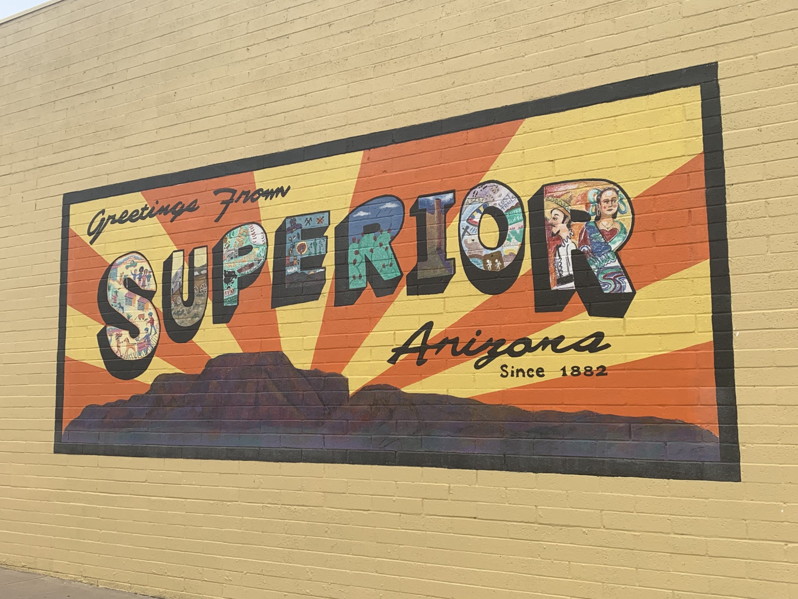

When I rolled into the town of Superior, Arizona, east of Phoenix on US-60 bordering the Superstition Mountains, I was facing a dire forecast. Three straight days there was virtually a 100% chance of precipitation, so I opted to stay with some trail angels in town. It didn’t do anything for two of the three days, then, on the third day, virtually everything came at once. I was called to the door by one of my hosts at one point and looked outside to see hail peppering the street. He turned to me and said, “I bet you’re glad you aren’t on the trail right now!”
Superior is a small town of 2837 in the Superstition foothills. Towering above the town is the formation called “Apache Leap,” a sheer cliff rising straight up. The town has one of the best trail angels on the entire Arizona Trail, Al Kaline, and also offers additional places to stay for those passing through on wheels instead of feet. There are a variety of places for people to resupply as well as several attractions worth checking out if you happen to be passing through.
Transportation to Superior
If you are an AZT hiker, there are trail angels in town who will pick you up at one of the AZT trailheads west of town and then drop you off there at the end of your stay. Alternatively, the Legends of Superior Trail (3.6 miles) connects the town to Picketpost Trailhead on the AZT and offers displays of local history on the way.
If you are roadtripping Arizona, you are probably going to arrive by car on US-60. 60 is a historic Arizona road that runs across the state. The modern incarnation originates at a junction with I-10 in western Arizona, starting with a northwest jog past the Harquahala Mountains, including the peak of the same name, the highest point in La Paz County and the former site of a Smithsonian Observatory that can still be seen today. Passing through Wickenburg it turns south to the state’s capital and largest city, Phoenix, before winding east through Tempe and around the Superstition Mountains to Superior. Continuing east to Globe, it begins one of its most scenic stretches. It passes the south end of Roosevelt Lake on the Salt River before turning northeast to Show Low, passing through the westernmost extent of the White Mountains foothills and ascending the Mogollon Rim, the southern boundary of the Colorado Plateau. Turning east past Springerville, 60 provides access to US-191, the Coronado Trail through the heart of the Whites, then enters New Mexico.
Services in Superior
There are two main stores in Superior, as well as a motel, a hiker hostel, and one of the best trail angels that you will find, on any trail, in my opinion. There is also a post office for those who have opted to mail themselves supplies, and a Chamber of Commerce office for additional local information.
Lodging
I highly recommend staying with Al Kaline (see below) if you can. Otherwise, there is a hiker hostel as well as a motel in town.
- 6 Bed Hostel
- Contact before arriving: 805-252-7973
- Services include showers and hand washing of clothes
- Located at Legends of Superior Trail trailhead in town
- Copper Mountain Motel
- 577 W Kiser Street, Superior AZ 85173
- Accepts hiker packages and has on-site hiker box
- 520-689-2886
- Co********************@***il.com
www.coppermountainmotelaz.com
Stores
- Family Dollar
- 580 US-60, Superior AZ 85173
- Save Money Market
- 420 Main St, Superior AZ 85173
As a reminder, you will need a photo ID in order to claim any packages sent to you via General Delivery. Al will also hold packages sent to you.
[Name]
General Delivery
25 North High School Ave
Superior, AZ 85173
Al Kaline
I don’t always single out particular individuals, but Al Kaline is one of the best trail angels on the entire Arizona Trail. He and his partner at the time hosted me over Thanksgiving and a friend over Christmas. Both times they had plans worked out in advance regarding who would attend to family obligations and who would assist the hikers staying with them. In addition to being extremely generous with food, he has a hiker box (an assortment of items that hikers may find useful), loaner clothes for use while washing trail clothes, and also shuttled me and other hikers both around town and to/from the Arizona Trail trailheads out at Rogers Trough and Picketpost.
Superior Points of Interest/Attractions
- Picketpost Mountain
- Site of an Arizona Trail trailhead, Picketpost is a prominent peak immediately south of US-60 just west of Superior. Picketpost is entirely volcanic, a mix of rhyolitic lava, water-laid and air-fall tuff, and lava flows and vent rocks. A 4.2 mile trail circles and ascends the mountain.
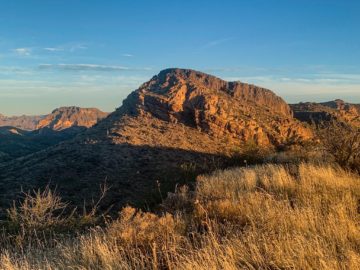
- Apache Leap
- Apache Leap towers over Superior to the east. The name comes from a conflict in the 1870s where the US military ambushed a group of Apache. Many were killed in the initial fighting; those that remained chose suicide and leapt over the cliff. Small stones of obsidian can be found in the area, said to contain the “tears of the Apache.”
- Superstition Mountains Wilderness
- Superior is near the southern gateway to the Superstitions at trailheads like Rogers Trough.
- Alamo Canyon
- Southbound from Picketpost, the Arizona Trail heads into Alamo Canyon, one of the most remote stretches of the AZT.


2 thoughts on “Superior, AZ: Towns Of The Amazing Arizona Trail & Roadtrips”