Arizona Trail Backpacking Passage 38, Grand Canyon Inner Gorge
AZT Day 9
Trans-Arizona/Utah Day 16
In the land of Arizona
Through desert heat or snow
Winds a trail for folks to follow
From Utah to Old Mexico
It’s the Arizona Trail
A pathway through the great Southwest
A diverse track through wood and stone
Your spirit it will test
Oh, sure you’ll sweat and blister
You’ll feel the miles every day
You’ll shiver at the loneliness
Your feet and seat will pay
But you’ll see moonlight on the borderlands
You’ll see stars on the Mogollon
You’ll feel the warmth of winter sun
And be thrilled straight through to bone
The aches and pains will fade away
You’ll feel renewed and whole
You’ll never be the same again
With Arizona in your soul
Along the Arizona Trail
A reverence and peace you’ll know
Through deserts, canyons, and mountains
From Utah to Old Mexico
-“The Arizona Trail,” Dale R. Shewalter
Arizona Trail: Bright Angel Campground to Kaibab Bridge
Took a rare opportunity to sleep in a bit this morning. I’m familiar with the hike out from Phantom Ranch to the South Rim, even along the steeper South Kaibab Trail, so I’m relatively confident in even getting a slower start and still making it out by early evening. (Note – If I had not spent 6 months working here and accustomed to hiking here, I would not do this, so for those of you who may be considering hiking at Grand Canyon, please allow yourself plenty of time to hike out to the South Rim – ideally twice the amount of time that it took you to reach the bottom if you start from the South Rim, or about the same amount of time it took you to reach Phantom from the North Rim.).
I get some breakfast at Phantom Ranch, the famous lodging within the Canyon designed by Mary Colter for the Fred Harvey Company and built at the bottom of Bright Angel Canyon just up from its junction with the Colorado River. Originally named Roosevelt Camp, Colter had the name changed to Phantom Ranch. All building materials other than rock (a prominent one, unsurprisingly) had to be hauled down by mule. Today, it is one of only two places in the United States where mail is still mailed by mule (and the cancellation stamps at the canteen proudly say so).
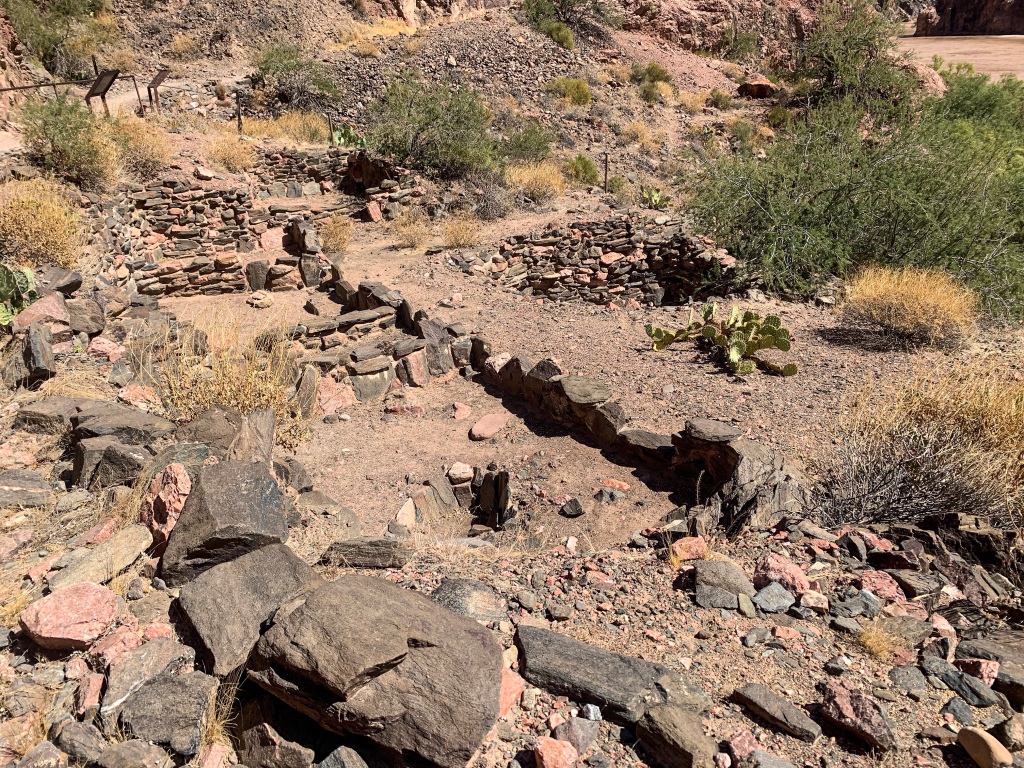
Around 11, I’m hiking out. The South Kaibab Trail turns east along the Colorado River from the mouth of Bright Angel Creek and passes Bright Angel Pueblo. The pueblo is 900-1000 years old, and was visited by John Wesley Powell’s 1869 Colorado River expedition, the first successful non-native attempt to raft the entire Grand Canyon.
Arizona Trail, Passage 38 (Grand Canyon Inner Canyon)
Grand Canyon National Park
Arizona Trail, Passage 38 (Grand Canyon Inner Canyon)
Grand Canyon National Park
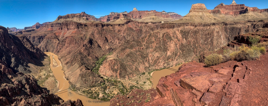
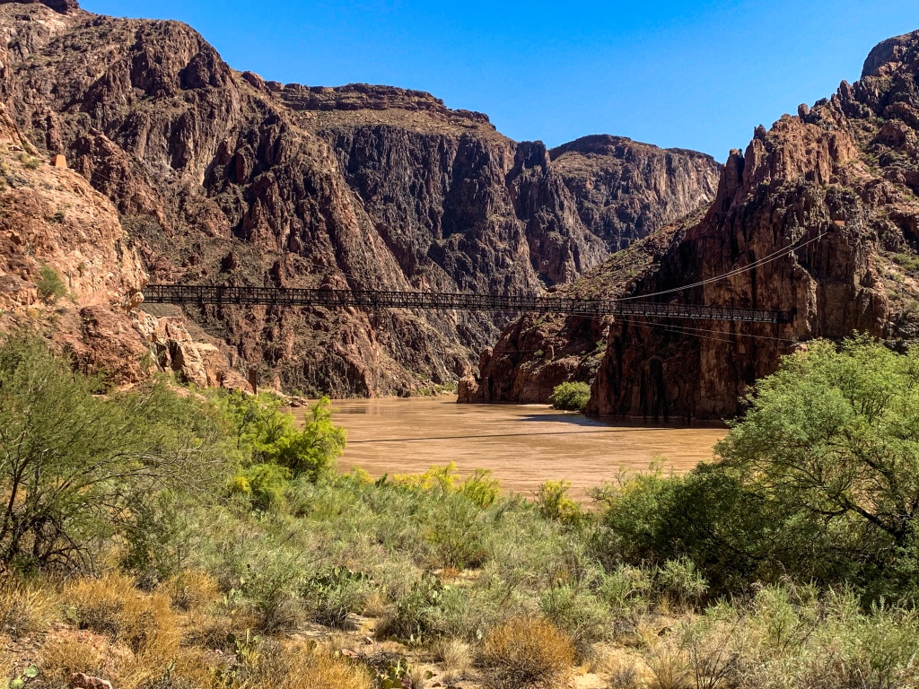
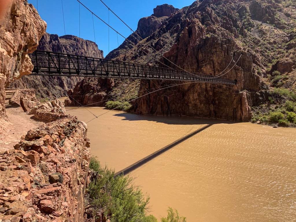
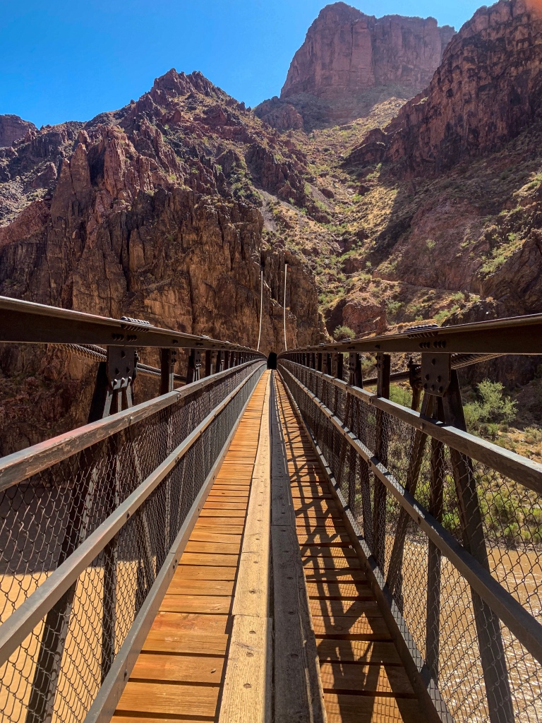
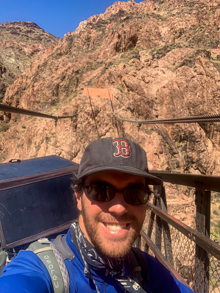
From the Pueblo, the trail reaches the Kaibab Bridge, or Black Bridge, over the Colorado River. A 440 ft suspension bridge, it is the crossing for all mule trips from the South Rim to Phantom Ranch, and along with the Silver Bridge downstream (visible from the Kaibab Bridge) it is one of only two crossings between the Navajo Bridge at Lee’s Ferry and Hoover Dam. The construction materials for the bridge were carried down the newly constructed South Kaibab Trail in 1928, with 42 Havasupai tribesmen carrying each 1 ton, 550 ft suspension cables down the trail. The materials weighed 122 tons in total. It is a major civil engineering landmark.
Kaibab Trail
Arizona Trail, Passage 38 (Grand Canyon Inner Canyon)
Grand Canyon National Park
Arizona Trail, Passage 38 (Grand Canyon Inner Canyon)
Grand Canyon National Park
Arizona Trail, Passage 38 (Grand Canyon Inner Canyon)
Grand Canyon National Park
Arizona Trail, Passage 38 (Grand Canyon Inner Canyon)
Grand Canyon National Park
Visible from the Kaibab Bridge are the Silver Bridge downstream, which the Bright Angel Trail uses to cross the river, as well as the cableway next to the bridge. The Black Bridge is the fourth crossing of the Colorado at the location. The first was a ferry, but this was extremely perilous. The second was the cableway, a 6×10 ft steel cage to carry passengers (mules and people) across the river. Theodore Roosevelt used it on a 1913 visit to then-Grand Canyon National Monument. A successor suspension bridge opened in 1920, to be succeeded by the Kaibab Bridge in 1928.
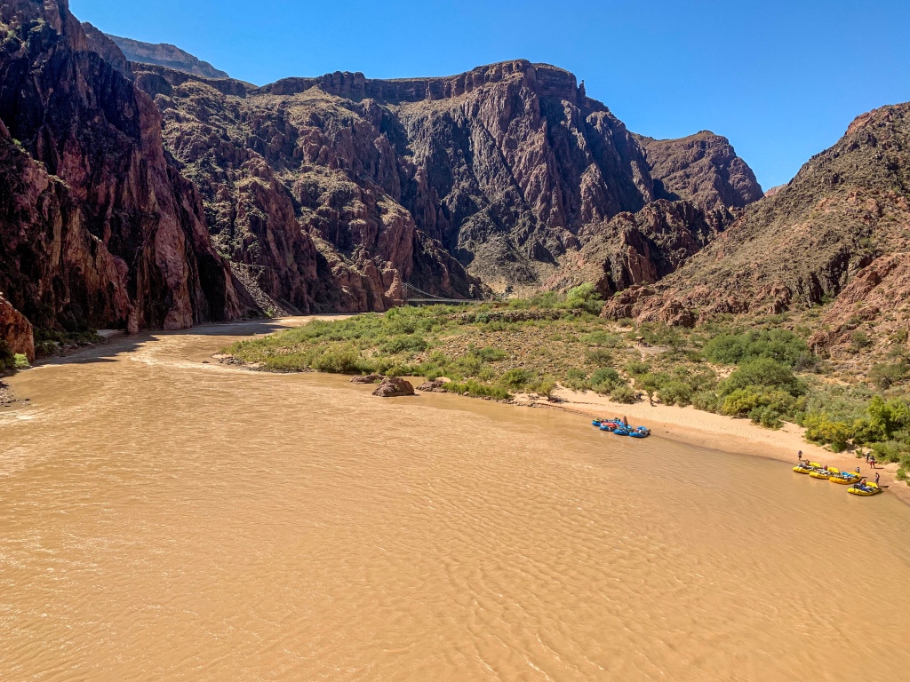
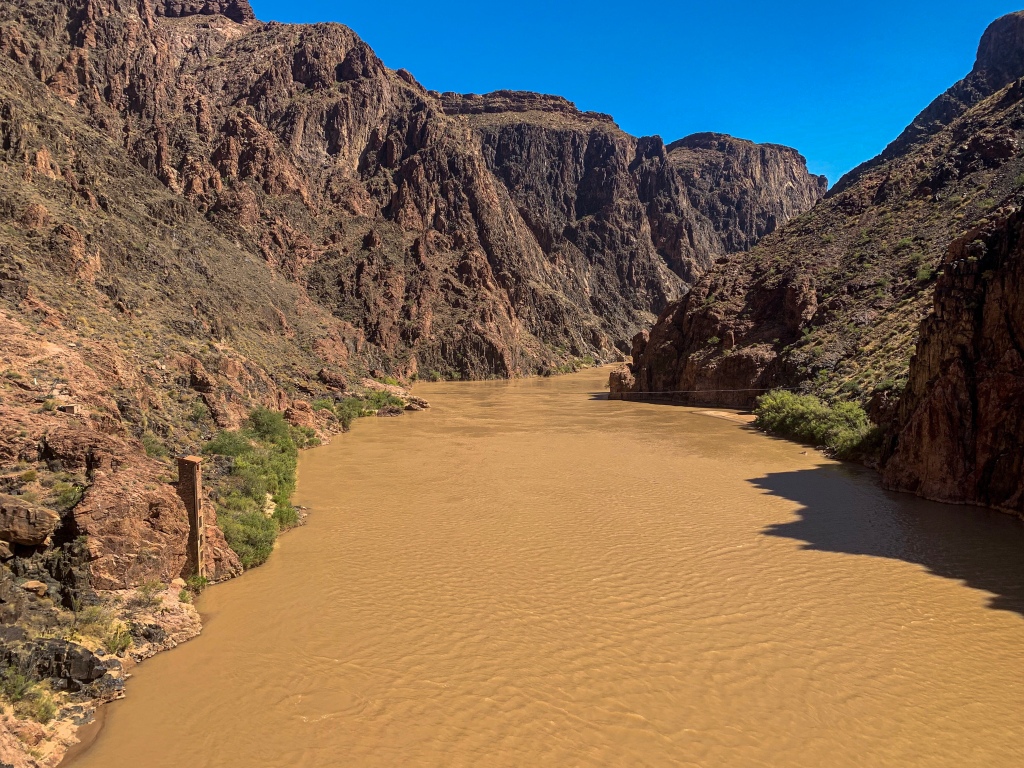
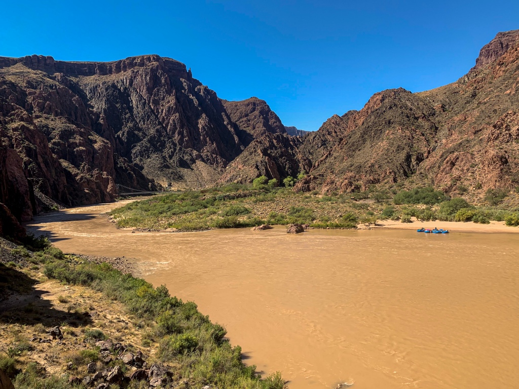
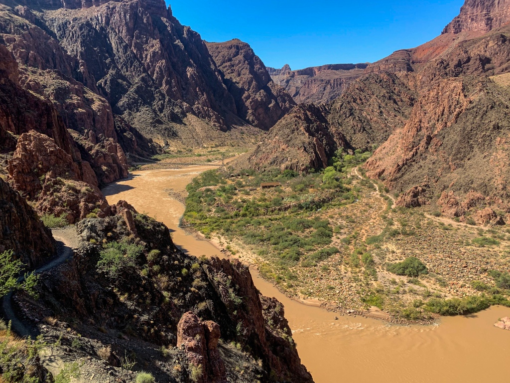
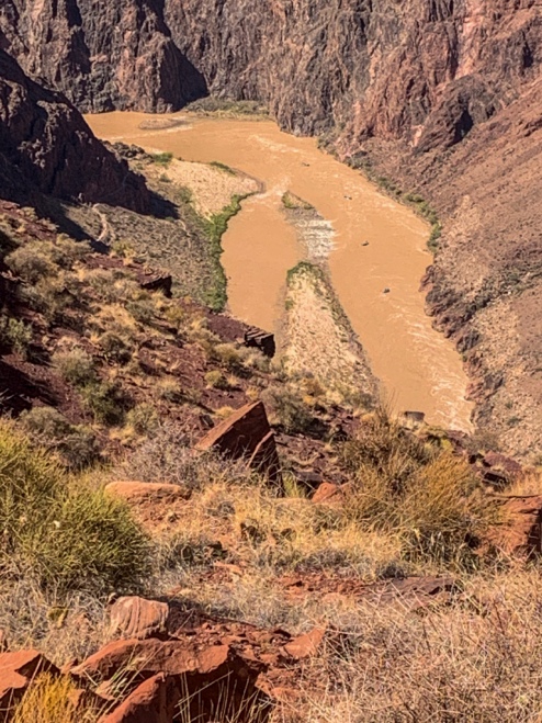
The river itself, unlike when I departed from Lee’s Ferry, is a deep brown today due to rain upstream. At such times, the river takes on its natural brown color, which in fact was what led to its name – “Rio Colorado,” meaning “colored river” or “red river” in Spanish. It’s refreshing to see it as it was seen for all of history before the construction of Glen Canyon Dam in the 1960s.
In stark contrast to the North Rim at around 8800 ft, the Colorado at Phantom is only around 2500 ft, or around the same elevation as Phoenix, so the weather it experiences is more akin to Central Arizona valleys than it is the rims of the Canyon. A hike through Grand Canyon crosses between 5-8 ecosystems, depending of where the precise boundaries are drawn, and can be like hiking from Mexico to Canada from an ecological perspective. Below the rim, one passes through the riparian zone along the river, the Lower Sonoran Desert, Upper Sonoran Desert. The North Rim features ponderosa pine and mixed conifer forests, and the South Rim ponderosa pine and pinyon-juniper forest.
Kaibab Bridge to Red & Whites Rescue
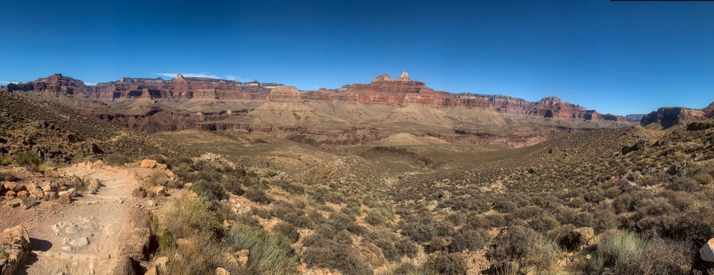
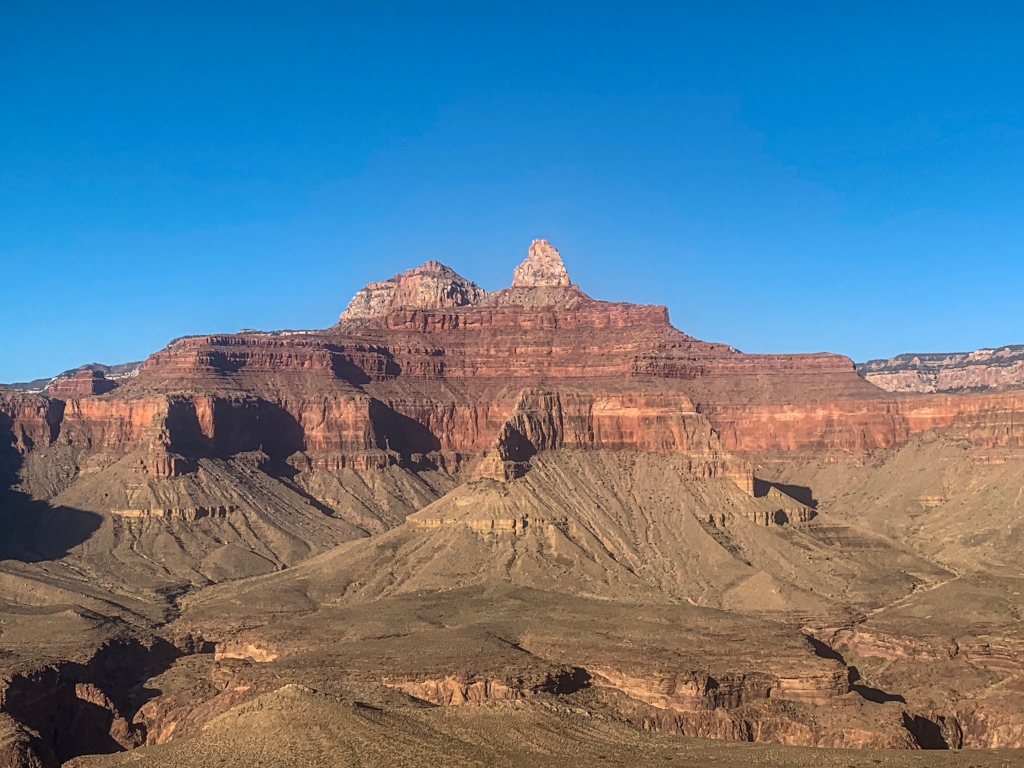
Passing through a brief tunnel on the south bank, the trail quickly ascends around 1500 ft to The Tipoff on the edge of the Tonto Platform, the rim of the Inner Canyon. During this climb, I am treated to some great views of river trips launching again after having lunch at Phantom Ranch. The trail crosses the Tonto Platform and begins to climb toward Skeleton Point, through sections of the South Kaibab with colorful names such as the “Red & Whites,” and with outstanding views of the formations and scale of the canyon.
Arizona Trail, Passage 38 (Grand Canyon Inner Canyon)
Grand Canyon National Park

Arizona Trail, Passage 38 (Grand Canyon Inner Canyon)
Grand Canyon National Park

Arizona Trail, Passage 38 (Grand Canyon Inner Canyon)
Grand Canyon National Park

Arizona Trail, Passage 38 (Grand Canyon Inner Canyon)
Grand Canyon National Park
Arizona Trail, Passage 38 (Grand Canyon Inner Canyon)
Grand Canyon National Park

Arizona Trail, Passage 38 (Grand Canyon Inner Canyon)
Grand Canyon National Park
Arizona Trail, Passage 38 (Grand Canyon Inner Canyon)
Grand Canyon National Park

Arizona Trail, Passage 38 (Grand Canyon Inner Canyon)
Grand Canyon National Park
Arizona Trail, Passage 38 (Grand Canyon Inner Canyon)
Grand Canyon National Park
Arizona Trail, Passage 38 (Grand Canyon Inner Canyon)
Grand Canyon National Park
Arizona Trail, Passage 38 (Grand Canyon Inner Canyon)
Grand Canyon National Park
Arizona Trail: Red & Whites Rescue to South Rim
And then everything changes.
I came around a corner below Skeleton Point, just below the Red & Whites to find someone sitting in the middle of the trail. Upon my asking if they were OK, they said no, they thought they had broken their ankle. When I asked why they thought that, they said that “I tried to stand up, and it just flops to the side.” Yes, that’s a break. I say that I can splint it, but other than that we’d have to get more help down to get her out. But I ask if they want me to use my new inReach to contact GRCA SAR and get it, which they accept. I hit the SOS button on my inReach, and a hiker behind me helps splint it using their poles and cord that I carried while I ran to Tipoff to call GRCA SAR directly.
Unfortunately it was too windy for a helicopter medivac at that time, so we had to wait about 2-3 hours for a medic to reach us on the trail. We got a firm splint on the ankle and lucked out – eventually they did get a helicopter window and managed to land and take the individual down a slope to where they had landed. Ended up hiking out with the husband of the individual in question; we topped around around 9-10. I have to say, given the wind we experienced on the upper South Kaibab, I’m shocked the helicopter managed to reach us at all. The backup plan was apparently to have them spend the night near Tipoff and launch in the morning.
So glad that I opted to carry an inReach for this trip, now. I didn’t expect it to pay off so soon, but, of course, that is the nature of an emergency.
Passage 38 (Grand Canyon) Logistics and Ecology Information
| Passage 38 (Grand Canyon Inner Canyon) | |
| Trail Surface | Dirt singletrack |
| Length (Mi) | 21.4 |
| Season | Fall-Spring (September-April). No vehicular access to North Kaibab Trailhead December-April. Feet of snow above Supai Tunnel on the North Kaibab Trail in winter. |
| Potential Water Sources | North Kaibab Trail Supai Tunnel Roaring Springs Manzanita Resthouse Bright Angel Creek Cottonwood Campground Phantom Ranch Bright Angel Campground |
| Trailheads | North: North Kaibab Trailhead South: South Kaibab Trailhead (Yaki Point) |
| Trailhead Access | North: Vehicular Access (paved) South: Foot and shuttle access |
| Wilderness | Yes |
| Possible resupply points | Grand Canyon North Rim Phantom Ranch Grand Canyon Village |
| ATA-Rated Difficulty | Strenuous |
| Potential campsites (mileages S to N) | Grand Canyon North Rim Campground Cottonwood Campground Bright Angel Campground Indian Garden Campground (slight detour required) Mather Campground Notem All camping within Grand Canyon National Park must take place in designated campsites. Walk-in reservations are available for AZT thruhikers. |
| Ecosystems Traversed | Great Basin Subalpine Conifer Forest Rocky Mountain Montane Conifer Forest Great Basin Desert Scrub Mojave Desert Scrub Riparian |
| Canyon Rim | Near river | Sonoran Desert | Riparian | Endemic | Near-endemic | |
| Common Trees/Shrubs | * rabbitbrush * Stansbury cliffrose * pinyon pine * Juniper | * Alkali goldenbush * Chuckwalla’s delight * longleaf brickellbush * Mojave brickellbush * Spearleaf brickellbush * Red barberry * Serviceberry * Silktassels * Skunkbush * sugar sumac | * brittlebush * odora * slender janusia | * Redbud | * Arizona turpentine bush | N/A |
| Common herbaceous plants | N/A | * Apache plume * Rabbitfoot * Sacred datura * Watson’s Dutchman-pipe * Western bernardia | * desert chicory | * maidenhair fern * Red monkeyflower | * Arizona prickle poppy * Glow willowweed | * giant hellebore orchid |
| Common succulents | * Banana yucca * Barrel cactus * claret cup hedgehog cacti | * Englemann hedgehog cactus * Pincushion cacti * Prickly pear cacti * Soaptree yucca | N/A | N/A | * Kaibab agave | * Barrel cactus * Grand Canyon beavertail cactus |
For my other entries on hiking the AZT in Grand Canyon, check out the following:
Amazing, Stunning Arizona Trail: Grand Canyon North Rim-Roaring Springs – Aspen’s Tracks (aspenstracks.com)
Amazing, Spectacular Arizona Trail: Grand Canyon, Roaring Springs-Ribbon Falls – (aspenstracks.com),
https://aspenstracks.com/arizona-trail-day-8-grand-canyon-ribbon-falls-to-bright-angel-campground/
Amazing, Spectacular Arizona Trail – Bright Angel CG (Colorado River)-South Rim – (aspenstracks.com)
For the National Park Service official advice on day hiking and backpacking below the rim at Grand Canyon, including on the AZT, check out the following:
Introduction to Backcountry Hiking (nps.gov)
Day Hiking – Grand Canyon National Park (U.S. National Park Service) (nps.gov)