Arizona Trail Backpacking Passage 38, Grand Canyon Inner Gorge (Rim to Rim)
AZT Day 8
Trans-Arizona/Utah Day 15
In the land of Arizona
Through desert heat or snow
Winds a trail for folks to follow
From Utah to Old Mexico
It’s the Arizona Trail
A pathway through the great Southwest
A diverse track through wood and stone
Your spirit it will test
Oh, sure you’ll sweat and blister
You’ll feel the miles every day
You’ll shiver at the loneliness
Your feet and seat will pay
But you’ll see moonlight on the borderlands
You’ll see stars on the Mogollon
You’ll feel the warmth of winter sun
And be thrilled straight through to bone
The aches and pains will fade away
You’ll feel renewed and whole
You’ll never be the same again
With Arizona in your soul
Along the Arizona Trail
A reverence and peace you’ll know
Through deserts, canyons, and mountains
From Utah to Old Mexico
-“The Arizona Trail,” Dale R. Shewalter
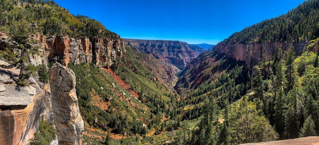
North Rim-Thompson Canyon
Grabbed a few things at the general store on the North Rim of Grand Canyon today, then packed up camp. The park has a number of special sites at the campground, available first-come, first-served, to those who hike or bike into the park. I then proceed over to the Backcountry Information Center, and get put on another thruhiker’s permit for Bright Angel Campground at the bottom, near the Colorado River.
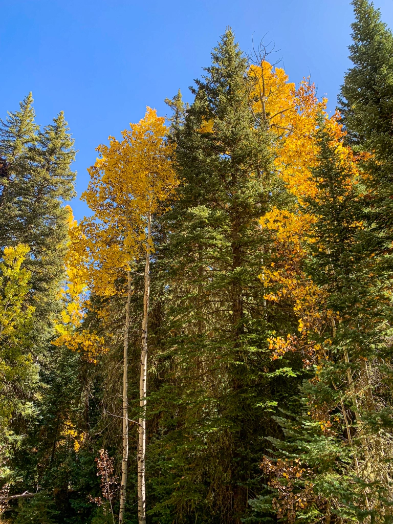
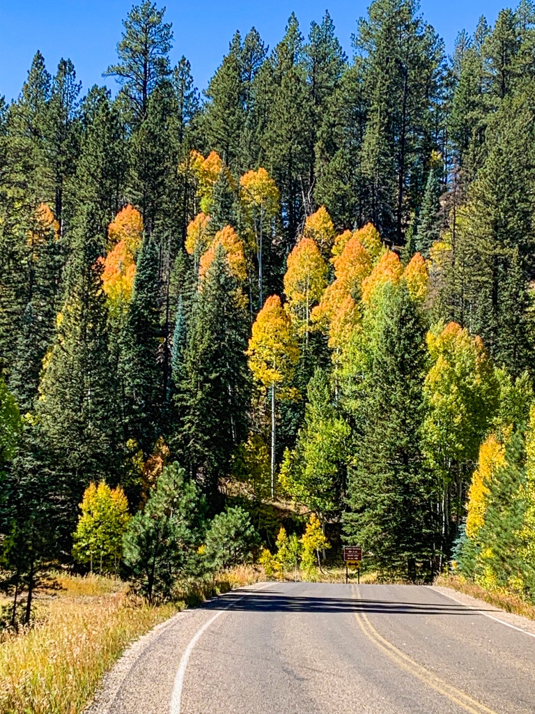
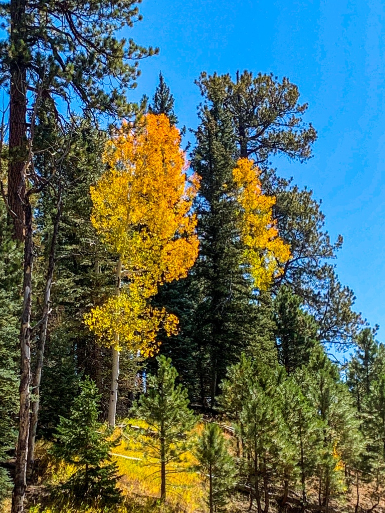
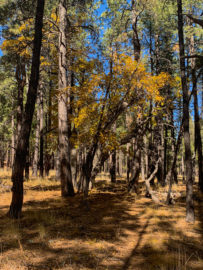
My pack weighs in at 46 pounds, not overly light but lighter than it has been. Obviously some of my efforts to cut weight before crossing the canyon paid off. After a side trip to see the aspens in Thompson Canyon, as recommended by the LE ranger that I spoke to yesterday, I head into the canyon.
Grand Canyon National Park North Rim, Arizona

Grand Canyon National Park North Rim, Arizona

Grand Canyon National Park North Rim, Arizona

Grand Canyon National Park North Rim, Arizona
Grand Canyon National Park North Rim, Arizona
Grand Canyon National Park North Rim, Arizona

Grand Canyon National Park North Rim, Arizona

Grand Canyon National Park North Rim, Arizona
Grand Canyon National Park North Rim, Arizona

Grand Canyon National Park North Rim, Arizona
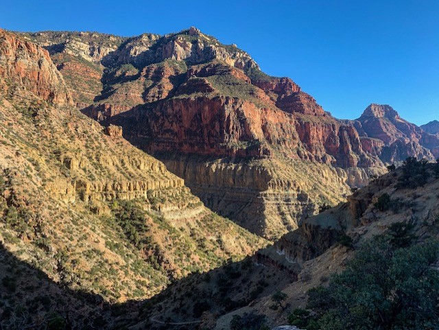
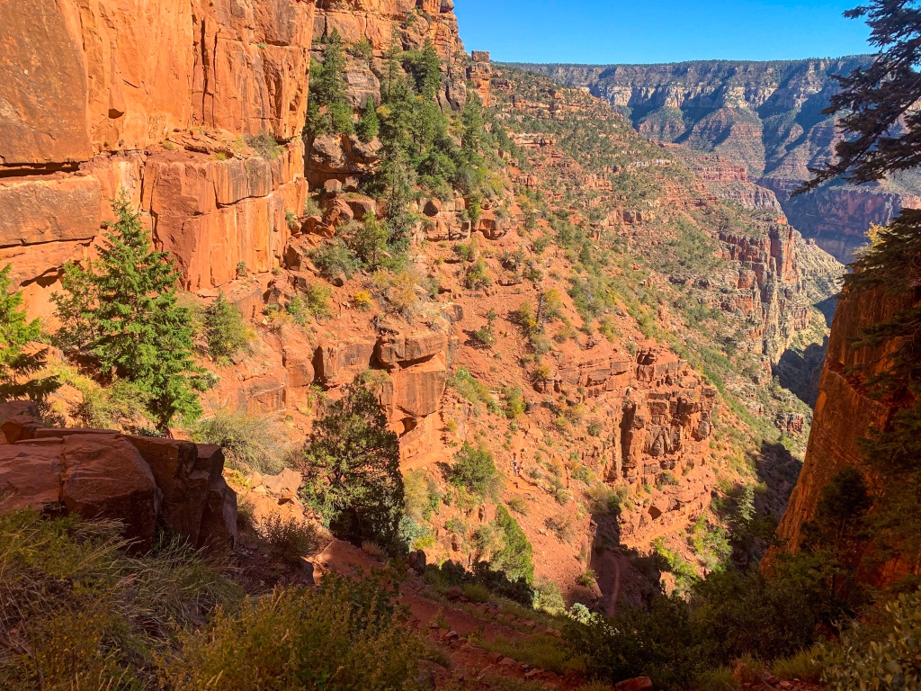
Arizona Trail: North Kaibab Trailhead to Supai Tunnel
This is the only part of the Arizona Trail that I have solid familiarity with, having hiked from the South Rim to the North Rim and back in May. If there’s anything I know, it’s to expect the unexpected. In May I ran into rain, hail, and snow between Cottonwood and the North Rim as elevations changed. I was also delayed heading back to the South Rim the following day by several hours due to a torrential rainstorm that blew through.
Fortunately, none of that materializes today. It’s still going to be warm at the bottom, but not as warm as it would have been had I started right when my season ended, and the warmth is a welcome change from the Kaibab cold of the past few nights. The trail starts at 8297 ft of elevation and drops to the Colorado River at 2480 ft.
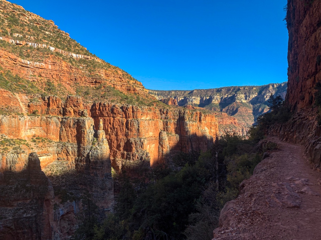
The route heads down the legendary North Kaibab Trail, past the Coconino Overlook, where I have a long conversation with a park PSAR volunteer hoping to do the trail themselves in the spring, to the Supai Tunnel, around which the grade peaks at 25%, one of the steepest on the entire AZT. Fortunately, I’m going down. By this point, I have descended through the Kaibab Limestone, Toroweap Formation, Coconino Sandstone, and into the Supai Group.

Arizona Trail, Passage 38 (Grand Canyon Inner Canyon)
Grand Canyon National Park
Arizona Trail Passage 38 (Grand Canyon Inner Canyon)
Grand Canyon National Park

Arizona Trail, Passage 38 (Grand Canyon, Inner Canyon)
Grand Canyon National Park

Arizona Trail Passage 38 (Grand Canyon Inner Canyon)
Grand Canyon National Park
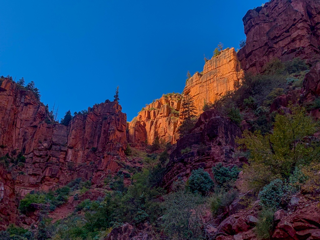
Arizona Trail: Supai Tunnel to Roaring Springs
Arizona Trail, Passage 38 (Grand Canyon, Inner Canyon)
Grand Canyon National Park

Arizona Trail, Passage 38 (Grand Canyon, Inner Canyon)
Grand Canyon National Park

Arizona Trail, Passage 38 (Grand Canyon, Inner Canyon)
Grand Canyon National Park
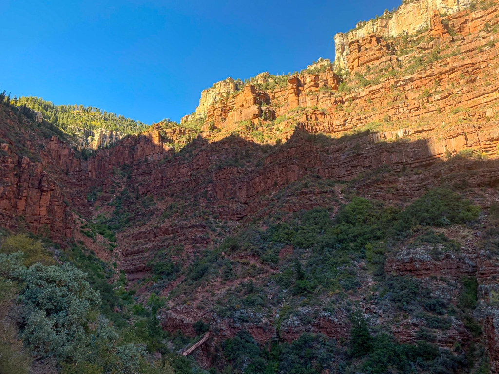
The trail continues to descend. It enters the Redwall Limestone and drops through a series of switchbacks to the Redwall Bridge before beginning a more gradual traverse through the layer, a stretch where the trail was literally blasted out of the cliff, almost forming a half-tunnel.
Arizona Trail, Passage 38 (Grand Canyon, Inner Canyon)
Grand Canyon National Park

Arizona Trail, Passage 38 (Grand Canyon, Inner Canyon)
Grand Canyon National Park
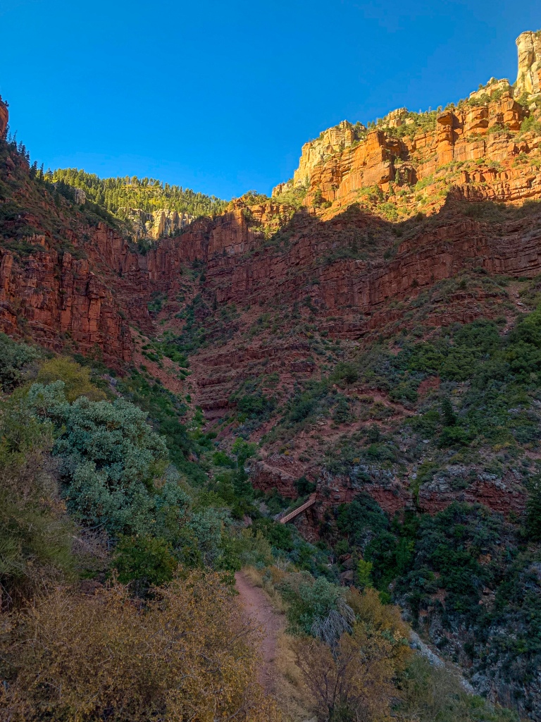
The trail continues through the Muav Limestone to Roaring Springs at the border with the Bright Angel Shale, the source of all of the drinking water for Grand Canyon National Park. The water from the springs is pumped to the North Rim and flows by gravity to Indian Gardens on the South Rim before being pumped to the rim itself from there. Entering Bright Angel Canyon, it passes through a segment of trail that was literally blown out of the side of the cliff by the Civilian Conservation Corps in the 1930s, the terrain was so rugged, forming a kind of half-tunnel above the trail in the side of the cliff.

Arizona Trail, Passage 38 (Grand Canyon, Inner Canyon)
Grand Canyon National Park
Arizona Trail, Passage 38 (Grand Canyon, Inner Canyon)
Grand Canyon National Park

Arizona Trail, Passage 38 (Grand Canyon, Inner Canyon)
Grand Canyon National Park
Arizona Trail, Passage 38 (Grand Canyon, Inner Canyon)
Grand Canyon National Park

Arizona Trail, Passage 38 (Grand Canyon, Inner Canyon)
Grand Canyon National Park
Arizona Trail, Passage 38 (Grand Canyon, Inner Canyon)
Grand Canyon National Park

Arizona Trail, Passage 38 (Grand Canyon, Inner Canyon)
Grand Canyon National Park
For my other entries on hiking the AZT in Grand Canyon, check out the following:
Amazing, Stunning Arizona Trail: Grand Canyon North Rim-Roaring Springs – Aspen’s Tracks (aspenstracks.com)
Amazing, Spectacular Arizona Trail: Grand Canyon, Roaring Springs-Ribbon Falls – (aspenstracks.com),
https://aspenstracks.com/arizona-trail-day-8-grand-canyon-ribbon-falls-to-bright-angel-campground/
Amazing, Spectacular Arizona Trail – Bright Angel CG (Colorado River)-South Rim – (aspenstracks.com)
For the National Park Service official advice on day hiking and backpacking below the rim at Grand Canyon, including on the AZT, check out the following:
Introduction to Backcountry Hiking (nps.gov)
Day Hiking – Grand Canyon National Park (U.S. National Park Service) (nps.gov)
Passage Logistics and Ecology Information
| Passage 38 (Grand Canyon Inner Canyon) | |
| Trail Surface | Dirt singletrack |
| Length (Mi) | 21.4 |
| Season | Fall-Spring (September-April). No vehicular access to North Kaibab Trailhead December-April. Feet of snow above Supai Tunnel on the North Kaibab Trail in winter. |
| Potential Water Sources | North Kaibab Trail Supai Tunnel Roaring Springs Manzanita Resthouse Bright Angel Creek Cottonwood Campground Phantom Ranch Bright Angel Campground |
| Trailheads | North: North Kaibab Trailhead South: South Kaibab Trailhead (Yaki Point) |
| Trailhead Access | North: Vehicular Access (paved) South: Foot and shuttle access |
| Wilderness | Yes |
| Possible resupply points | Grand Canyon North Rim Phantom Ranch Grand Canyon Village |
| ATA-Rated Difficulty | Strenuous |
| Potential campsites (mileages S to N) | Grand Canyon North Rim Campground Cottonwood Campground Bright Angel Campground Indian Garden Campground (slight detour required) Mather Campground Notem All camping within Grand Canyon National Park must take place in designated campsites. Walk-in reservations are available for AZT thruhikers. |
| Ecosystems Traversed | Great Basin Subalpine Conifer Forest Rocky Mountain Montane Conifer Forest Great Basin Desert Scrub Mojave Desert Scrub Riparian |
| Canyon Rim | Near river | Sonoran Desert | Riparian | Endemic | Near-endemic | |
| Common Trees/Shrubs | * rabbitbrush * Stansbury cliffrose * pinyon pine * Juniper | * Alkali goldenbush * Chuckwalla’s delight * longleaf brickellbush * Mojave brickellbush * Spearleaf brickellbush * Red barberry * Serviceberry * Silktassels * Skunkbush * sugar sumac | * brittlebush * odora * slender janusia | * Redbud | * Arizona turpentine bush | N/A |
| Common herbaceous plants | N/A | * Apache plume * Rabbitfoot * Sacred datura * Watson’s Dutchman-pipe * Western bernardia | * desert chicory | * maidenhair fern * Red monkeyflower | * Arizona prickle poppy * Glow willowweed | * giant hellebore orchid |
| Common succulents | * Banana yucca * Barrel cactus * claret cup hedgehog cacti | * Englemann hedgehog cactus * Pincushion cacti * Prickly pear cacti * Soaptree yucca | N/A | N/A | * Kaibab agave | * Barrel cactus * Grand Canyon beavertail cactus |
{карьера айтишника и ИИ
Greetings from Ohio! I’m bored to death at work so
I decided to browse your website on my iphone during lunch
break. I enjoy the knowledge you provide here and can’t wait to
take a look when I get home. I’m amazed at how fast your blog loaded on my cell phone ..
I’m not even using WIFI, just 3G .. Anyhow, excellent blog!