Backpacking the Arizona Trail: Passage 37, Grand Canyon South Rim
AZT Day 15
Trans-Arizona/Utah Day 22
In the land of Arizona
Through desert heat or snow
Winds a trail for folks to follow
From Utah to Old Mexico
It’s the Arizona Trail
A pathway through the great Southwest
A diverse track through wood and stone
Your spirit it will test
Oh, sure you’ll sweat and blister
You’ll feel the miles every day
You’ll shiver at the loneliness
Your feet and seat will pay
But you’ll see moonlight on the borderlands
You’ll see stars on the Mogollon
You’ll feel the warmth of winter sun
And be thrilled straight through to bone
The aches and pains will fade away
You’ll feel renewed and whole
You’ll never be the same again
With Arizona in your soul
Along the Arizona Trail
A reverence and peace you’ll know
Through deserts, canyons, and mountains
From Utah to Old Mexico
-“The Arizona Trail,” Dale R. Shewalter
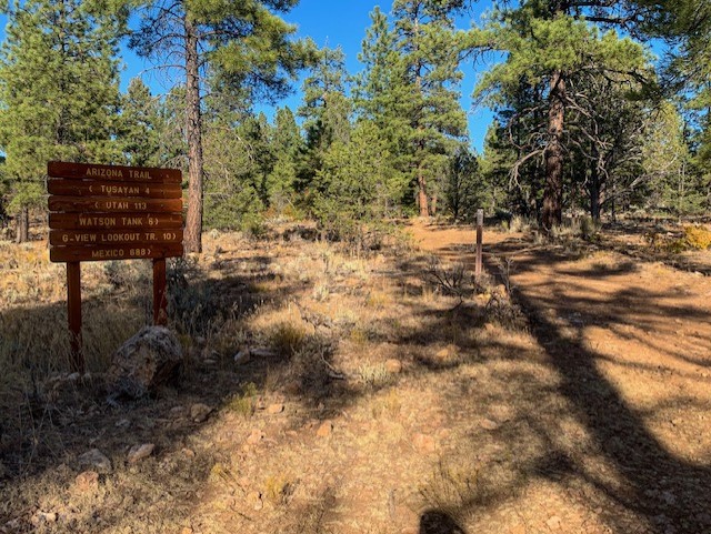
Unfortunately, I feel like the past few days off have broken my rhythm in terms of mileage. I spent last night with some friends on the South Rim before returning to camp for the night. Unfortunately, it seems I left my wallet at Maswik when I stopped there for dinner. So I’m up early, and head back to pick up my wallet at Maswick. I also grab some more cold weather gear at the Market before returning to the trail. I push through about 6 miles on the day across the Coconino Plateau, hiking across more limestone ridges, rice grass meadows, scrub, and pines with gambel oaks.

Arizona Trail, Passage 37 (Grand Canyon South Rim)
Kaibab National Forest

Arizona Trail, Passage 37 (Grand Canyon South Rim)
Kaibab National Forest

Arizona Trail, Passage 37 (Grand Canyon South Rim)
Kaibab National Forest

Arizona Trail, Passage 37 (Grand Canyon South Rim)
Kaibab National Forest

Arizona Trail, Passage 37 (Grand Canyon South Rim)
Kaibab National Forest
The trail ultimately passes through an area that seems the subject of a recent prescribed burn shortly before I call it for the night. The oaks aren’t quite the aspens but they are putting on a good show as well. Tonight is going to be a cold one; I set up the tent for the frst time on the trip to combat that. All clothes and electronics are in my sleeping bag tonight. The forecast is for the temperature to go down to 16ºF tonight, but unlike the Kaibab there’s no wind, so here’s hoping it’s a bit more manageable. Fingers crossed.

Arizona Trail, Passage 37 (Grand Canyon South Rim)
Kaibab National Forest

Arizona Trail, Passage 37 (Grand Canyon South Rim)
Kaibab National Forest
For my other entries on hiking the AZT in Grand Canyon, check out the following:
Amazing, Stunning Arizona Trail: Grand Canyon North Rim-Roaring Springs – Aspen’s Tracks (aspenstracks.com)
Amazing, Spectacular Arizona Trail: Grand Canyon, Roaring Springs-Ribbon Falls – (aspenstracks.com),
https://aspenstracks.com/arizona-trail-day-8-grand-canyon-ribbon-falls-to-bright-angel-campground/
Amazing, Spectacular Arizona Trail – Bright Angel CG (Colorado River)-South Rim – (aspenstracks.com)
For the National Park Service official advice on day hiking and backpacking below the rim at Grand Canyon, including on the AZT, check out the following:
Introduction to Backcountry Hiking (nps.gov)
Day Hiking – Grand Canyon National Park (U.S. National Park Service) (nps.gov)
Passage Logistics and Ecology Report
| Passage 37 (Grand Canyon South Rim) | |
| Trail Surface | Paved Dirt singletrack Forest road |
| Length (Mi) | 23.5 |
| Season | April-November |
| Potential Water Sources | Grand Canyon Village (99.9 SOBO, 688.8 NOBO) Tusayan (105.1 SOBO, 683.6 NOBO) Upper TenX Tank (113.4 SOBO, 675.3 NOBO) Watson Tank (116.3 SOBO, 672.4 NOBO) |
| Trailheads | North: South Kaibab Trailhead (Yaki Point) South: Grandview Lookout |
| Trailhead Access | North: Shuttle & foot access South: Vehicular access (graded dirt road) |
| Wilderness | No |
| Possible resupply points | Grand Canyon Village Tusayan |
| ATA-Rated Difficulty | Easy |
| Potential campsites (mileages S to N) | FR 328 south of Grand Canyon National Park boundary Area east of Tusayan has numerous options |
| Hazards | Heat – wear a cotton shirt so you can soak it. Synthetics aren’t great in the desert. Hyponatremia – “drunk on water.” To avoid, ensure adequate salt & electrolyte intake and ensure you eat as well as drink water. Symptoms are almost identical to dehydration, but drinking more makes it worse. Prevention is by far the best solution. Dehydration |
| Ecosystems Traversed | Great Basin Conifer Woodland (edge of Grand Canyon) Rocky Mountain Montane Conifer Woodland (remainder of passage) |
| Rocky Mountain Montane Conifer Woodland | Canyon Edge (Great Basin Conifer Woodland) | |
| Common Trees/Shrubs | * Ponderosa Pine * Southwestern white pine * Subalpine fir * White fir * Rocky Mountain maple * Bigtooth maple * Grey alder * Red birch * Red osier dogwood * Cliffbush * Mallow ninebark * New Mexican locust * huckleberry * bilberries * Gambel oaks | Pinyon Pine Juniper Gambel oaks |
| Common herbaceous plants | * fringed brome * Geyer’s sedge/elk sedge * Ross’ sedge * Bronze sedge/dry land sedge/hillside sedge/hay sedge/Fernald’s hay sedge * screwleaf muhly * bluebunch wheatgrass * Spruce-fir fleabane * wild strawberry/Virginia strawberry * Small-flowered woodrush * mountain sweet Cicely * bittercress ragwort * western meadow-rue * Fendler’s meadow-rue | Rabbitbrush Stansbury cliffrose |
| Common succulents | Banana yucca Claret cup hedgehog cacti |
